The best MTB trails around Langenhorn
4.6
(42)
139
riders
37
rides
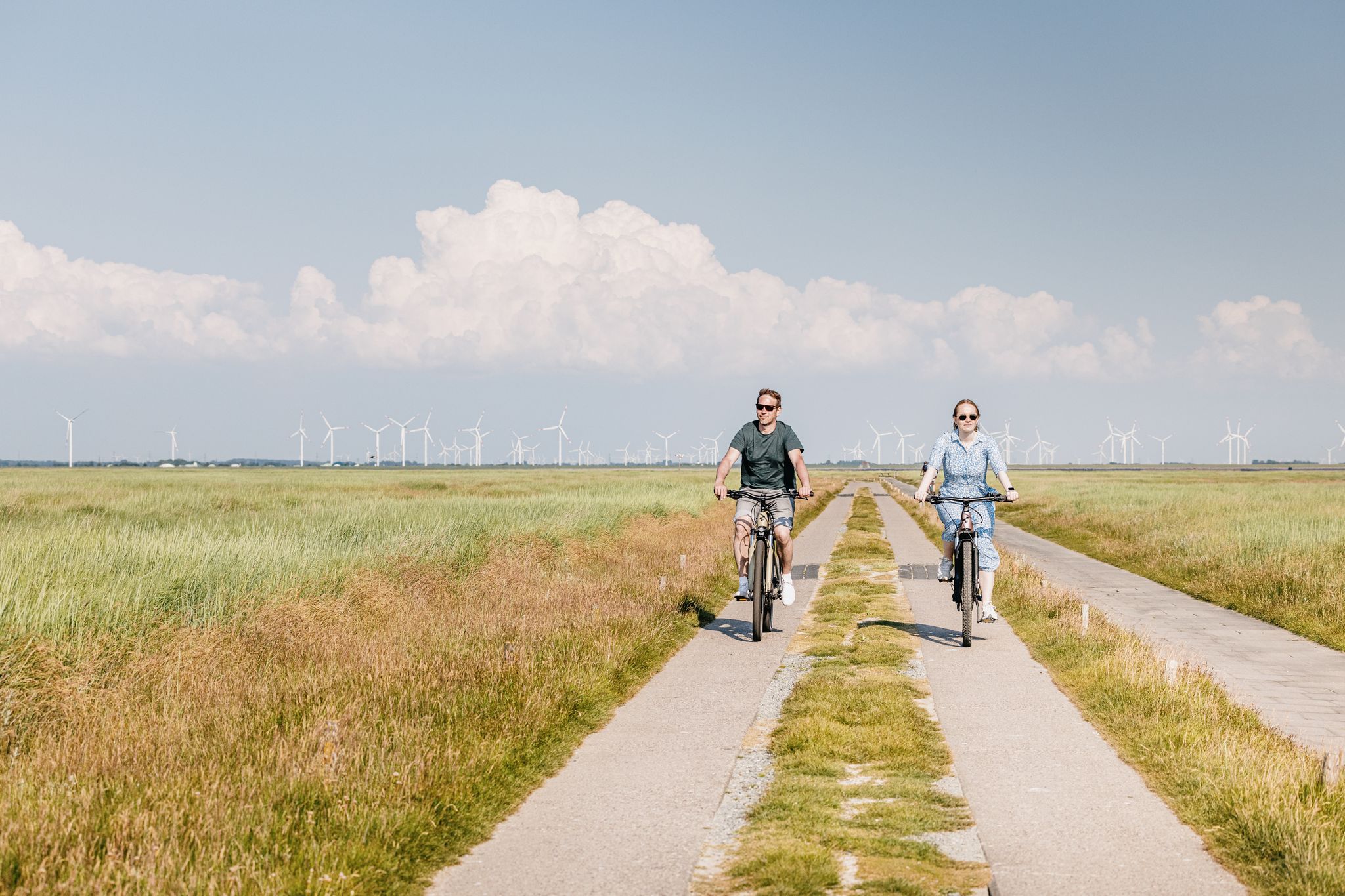
Mountain biking around Langenhorn offers diverse natural landscapes in the North Frisia region. The area features a blend of coastal influences, expansive marshlands, and a network of dykes. This varied terrain provides a range of environments for mountain bikers, from flat coastal paths to routes through more inland areas. The region's unique geography makes it suitable for different activity levels.
Best mountain bike trails around Langenhorn
- The most popular mountain bike trail is Heideberg Picnic Area – Lecker Au Bridge…
Last updated: July 23, 2026
4.9
(7)
27
riders
23.9km
01:52
100m
100m
Moderate mountain bike ride. Great for any fitness level. Advanced riding skills necessary.
4.8
(5)
25
riders
18.0km
01:26
90m
90m
Moderate mountain bike ride. Great for any fitness level. Advanced riding skills necessary.

Sign up for free
5.0
(3)
14
riders
Easy mountain bike ride. Great for any fitness level. Suitable for all skill levels.
5.0
(8)
10
riders
29.7km
02:05
120m
120m
Moderate mountain bike ride. Good fitness required. Advanced riding skills necessary.
5.0
(2)
5
riders
22.7km
01:14
20m
20m
Easy mountain bike ride. Great for any fitness level. Suitable for all skill levels.
Get access to more routes and recommendations from other explorers.
Sign up for free
Already have an account?
Our route recommendations are based on thousands of hikes, rides, and runs completed by other people on komoot.
Start today with a free account
Your next adventure awaits.
Login or Signup

Other adventures around Langenhorn

Tips from the Community


Optimal connection and not so expensive ✊
0
0

The Beltringharder Koog is an impressive nature reserve in North Friesland, Schleswig-Holstein. The Koog was embanked in 1987 and covers an area of 3,350 hectares, making it the largest nature reserve on the Schleswig-Holstein mainland. It was created in response to storm surges and today serves to protect the coast and promote biodiversity in the region. The Beltringharder Koog has a variety of habitats, including saltwater and freshwater lagoons, wet grassland and tidal floodplains. These diverse biotopes provide habitat for numerous species of birds that breed or rest here. Over 100,000 waders and water birds use the Koog throughout the year, making it a paradise for birdwatchers. Commonly seen species include greylag geese and black-necked grebes. For visitors, there are well-developed hiking and cycling trails that lead through the diverse landscape of the Koog. Tours that start at Lüttmoorsiel and lead along the dike to Lüttmoorsee and further are particularly recommended. Observation huts and viewing platforms on these routes offer excellent opportunities to observe wildlife in its natural environment. The Koog is also an example of successful cooperation between nature conservation organizations such as NABU, the Wadden Sea Conservation Station and the WWF. Together they ensure that this unique ecosystem is protected and cared for.
1
0
Hallig Nordstrandischmoor, often affectionately referred to as "Lüttmoor", is one of the smaller Hallig islands in the North Sea and is part of the Schleswig-Holstein Wadden Sea. This Hallig has an area of about 1.9 square kilometers and is home to around 22 residents who live on four terps: Neuwarft, Amalienwarft, Halberwegwarft and Norderwarft. Nordstrandischmoor is known for its unique connection to the mainland through the Lorenbahn, a narrow-gauge railway with a track width of 600 mm that runs from Lüttmoorsiel across the Beltringharder Koog. This railway is not only an important transport route for the islanders to obtain vital goods such as building materials and food, but also a tourist attraction. The history of the Hallig is closely linked to the great storm surge of 1634, in which the then island of Strand was almost completely destroyed. Nordstrandischmoor and other Hallig islands are the remnants of this former large island. The Hallig itself was only settled after the storm surge and was mainly used for peat mining.
0
0
The Sönke Nissen Koog is an impressive example of engineering and agricultural development in North Friesland. It is located northwest of Husum and covers about 1,200 hectares. The Koog was dyked in 1925 and completed in 1926, named after the engineer and diamond dealer Sönke Nissen, who played a key role in financing the project. Sönke Nissen, originally from Klockries near Niebüll, made his fortune through his work in German South West Africa, now Namibia, where he was involved in railway projects and diamond mining. After his death, the executors of his will used his fortune to build the Koog. The Koog comprises 28 farms, most of which are painted white and have green roofs. This uniform architecture was designed by the architect Heinrich Stav, who ensured that the buildings were built robustly and functionally, but also cost-effectively. The sluice in the Sönke-Nissen-Koog plays a central role in the drainage of the area and enables the marshland to be used for agricultural purposes. The fertile soils of the Koog are mainly used for growing winter wheat, winter barley and winter rapeseed, and some areas are also used to grow sugar beet, which is processed in biogas plants. In addition to agriculture, the Koog is also a location for renewable energies, including wind turbines and photovoltaic systems.
0
0
Pellworm is one of the North Frisian Islands in the Wadden Sea of Schleswig-Holstein. It is known for its tranquil, natural beauty and its importance in the field of sustainable energy. With an area of 37 square kilometers and a population of around 1,200 people, Pellworm offers an idyllic setting for nature lovers and those seeking peace and quiet. The island is characterized by its rich birdlife, including oystercatchers, shovelers and redshanks, making it a paradise for birdwatchers. Most notably, Pellworm is part of the UNESCO Wadden Sea World Heritage Site, one of the last large, largely undisturbed mudflat ecosystems in the world. Another highlight of the island is the Westerhever Lighthouse, which was built in 1906 and can be visited all year round. The lighthouse offers breathtaking views of the North Sea and the surrounding countryside . Pellworm is also known for its historic St. Salvator Church and numerous thatched-roof houses that retain the traditional North Frisian flair. Pellworm has also made a name for itself as a “green island” because it plays a leading role in the field of renewable energy. Germany’s first solar energy plant was put into operation here as early as 1983, and the island now uses a mixture of solar, wind and biogas plants to generate energy. Visitors can easily reach the island by ferry, which runs from Nordstrand. On Pellworm itself there are numerous opportunities for hikes, bike tours and mudflat hikes to the nearby Halligen.
0
0

Great trail route with mountains and valleys
0
0

Frequently Asked Questions
How many mountain bike trails are available around Langenhorn?
There are nearly 40 mountain bike trails around Langenhorn, offering a diverse range of experiences. These routes are highly rated by the komoot community, with an average score of 4.6 stars.
What kind of terrain can I expect on mountain bike trails in Langenhorn?
The region around Langenhorn offers a unique blend of coastal influences, marshlands, and dyke systems. You'll find varied terrain from flat coastal paths with views of the Wadden Sea to routes through more inland areas, including some with slight elevation changes like those near Rantzaushöhe.
Are there mountain bike trails suitable for beginners in Langenhorn?
Yes, Langenhorn has a good selection of trails suitable for beginners. Approximately half of the available routes are rated as 'easy', perfect for those new to mountain biking or looking for a relaxed ride. An example is the Nude Beach North Sea – View of Pellworm loop from Reußenköge, which is 31.4 km long and rated easy.
Can I find challenging mountain bike routes in Langenhorn?
While there are no routes explicitly rated as 'difficult', nearly half of the trails around Langenhorn are rated as 'moderate'. These routes, such as the Heideberg Picnic Area – Lecker Au Bridge loop from Leck, offer more varied terrain and longer distances, providing a good challenge for riders with some experience.
Are there any scenic viewpoints or landmarks along the mountain bike trails?
Yes, many routes offer scenic views, especially along the coast and dykes. You can enjoy breathtaking views of the Wadden Sea and salt marshes. Notable highlights include the Hauke-Haien-Koog Dike Cycle Path, the Lüttmoordamm Birdwatching Hide, and the Schlüttsiel Harbor. The Nude Beach North Sea – View of Pellworm loop from Reußenköge offers views of Pellworm island.
What is the best time of year for mountain biking in Langenhorn?
The North Frisia region, including Langenhorn, is enjoyable for mountain biking during most of the year. Spring and autumn offer pleasant temperatures and vibrant landscapes. Summer is also great, especially for coastal rides, but be mindful of potential wind. Winter rides are possible, but conditions can be wet, so check local weather forecasts.
Are there mountain bike trails that are loop routes?
Yes, many of the mountain bike trails around Langenhorn are designed as loops, making them convenient for starting and ending at the same point. Examples include the Grasnabenweg – Rantzaushöhe loop from Enge-Sande and the Dagebüll Lighthouse – Schlüttsiel Harbor loop from Broderswarft.
What are some interesting places to explore near the mountain bike trails?
Beyond the trails, you can explore the unique Wadden Sea environment. The Amsinck-Haus Visitor and Information Center focuses on the nature of the Wadden Sea and salt marshes. The Salt Marsh Trail to Hamburger Hallig offers a distinctive experience, and the Hauke-Haien-Koog is an important bird sanctuary.
Are there any mountain bike trails that pass by water features?
Absolutely. Given the region's coastal and marshland characteristics, many trails offer views of water. Routes along the dykes provide vistas of the Wadden Sea and salt marshes. The Lecker Au Bridge – Rantzaushöhe loop from Leck, for instance, passes by the Lecker Au river, and the Lüttmoorsee Saltwater Lagoon is another notable water feature in the area.
What do other mountain bikers say about the trails in Langenhorn?
The mountain bike trails in Langenhorn are highly regarded by the komoot community, holding an average rating of 4.6 out of 5 stars from over 40 reviews. Users often praise the diverse natural landscapes, the well-maintained dyke paths, and the unique coastal scenery that makes for a rewarding riding experience.
Are there any specific trails that offer views of the North Sea?
Yes, several trails provide direct views of the North Sea. The Nude Beach North Sea – View of Pellworm loop from Reußenköge is a prime example, offering expansive coastal vistas and views towards Pellworm island. Routes along the dykes, such as those near the Hauke-Haien-Koog, also provide excellent North Sea perspectives.
Most popular attractions around Langenhorn

Get inspired with the komoot mobile app


Explore more
Browse the best MTB trails in other regions.
