Top 15 Natural Monuments around Sant'Angelo D'Alife
Natural monuments around Sant'Angelo D'Alife are situated within the Matese massif, offering a blend of natural beauty and historical significance. The region is part of the Matese Regional Park, characterized by diverse landscapes including mountains, forests, and karst features. This area provides opportunities to explore geological formations and ancient sites. The natural environment is shaped by the Apennine mountains, with elevations reaching over 2,000 meters.
Best natural monuments around Sant'Angelo D'Alife
- The most popular natural monuments is Monte Miletto Summit…
Last updated: June 28, 2026
Monte Miletto Summit
Highlight • Summit
Translated by Google •
Tip by

Lete Waterfalls
Highlight • Waterfall
Translated by Google •
Tip by

Sign up now to discover places like this
Get recommendations on the best single tracks, peaks, & plenty of other exciting outdoor places.
Sign up for free
Fontegreca Cypress Grove
Highlight • Forest
Translated by Google •
Tip by

Campo Figliuolo Pond
Highlight • Lake
Translated by Google •
Tip by
Lake Matese
Highlight • Lake
Translated by Google •
Tip by

Sign up for free to discover even more natural monuments around Sant'Angelo D'Alife.
Sign up for free
Already have an account?
Start today with a free account
Your next adventure awaits.
Login or Signup

Tips from the Community

The Cipresseta di Fontegreca is one of the most well-equipped natural areas in the Matese: a forest of centuries-old cypress trees crisscrossed by streams, waterfalls, and shaded paths. There is a €3 entrance fee to the park, which allows for sustainable management of the area. Visitors have access to picnic tables, shaded areas for laying out a towel, public restrooms, and a seasonal shuttle service from the parking lot.
1
0

A short hike with no particular difficulties. The trailhead from Campitello Matese is unmarked and difficult to identify. The trail itself is poorly marked. For those like me who'd never done it, it's essential to follow the trail on an app or similar. The descent was made by descending from the chairlift side (which doesn't operate and doesn't appear to be in operation anymore), then descending along the ski slope, which halfway through features a barbed wire barrier (!) that I had to cross.
0
0

The cypress grove is accessible with the payment of 3 euros per person. It can be reached by shuttle, offered by a local association that takes care of it following the payment of 1 euro per person. It is an enchanting place to refresh and stop for a picnic. From there, several challenging and unmarked paths (mule tracks) wind towards the highest parts of the ridges where it stands, to be followed with caution.
0
0
The trail is not an official CAI trail and although the route suggested by koomot is intuitive, the deviation it proposes is risky. In fact, the undergrowth has almost reclaimed the trail, making it difficult and unpredictable. Access to the waterfalls is quite intuitive even if they are also not marked. On site you have to make do to find a location and bathing remains difficult. Exploring a bit you find several pools of freezing water. Despite the difficulty, it remains an enchanting place.
1
0

The Lete stream produces small waterfalls and natural pools where it is possible to swim.
0
0
The Bosco degli Zappini, better known as the "Cipresseta di Fontegreca", is one of the major symbols of the Matese Park. It is the subject of study because it is the only cypress forest of this size in Italy. Here there are also some fascinating waterfalls and natural pools.
1
0

Mount Miletto (2,050 meters above sea level) straddles Campania and Molise and offers a 360° view of the Apennines, Lake Matese and the Mediterranean Sea in the distance.
0
0
Frequently Asked Questions
What unique natural and historical sites can I explore near Sant'Angelo D'Alife?
One significant site is the Grotta di San Michele Arcangelo, a cave church steeped in history and local legend. Located between Sant'Angelo d'Alife and Raviscanina, this 60-meter long cave features ancient frescoes and a circular pool, believed to be a baptismal font. It has served as a sanctuary since Lombardian times, blending natural geology with centuries of religious devotion.
Are there any high-altitude natural monuments with panoramic views?
Yes, the Monte Miletto Summit is the highest point of the Matese Mountains, reaching 2,050 meters above sea level. From its challenging ascent, you can enjoy breathtaking 360° views, and on clear days, even spot the Adriatic and Tyrrhenian seas, Vesuvius, and the island of Capri.
What kind of natural features can I expect to see within the Matese Regional Park?
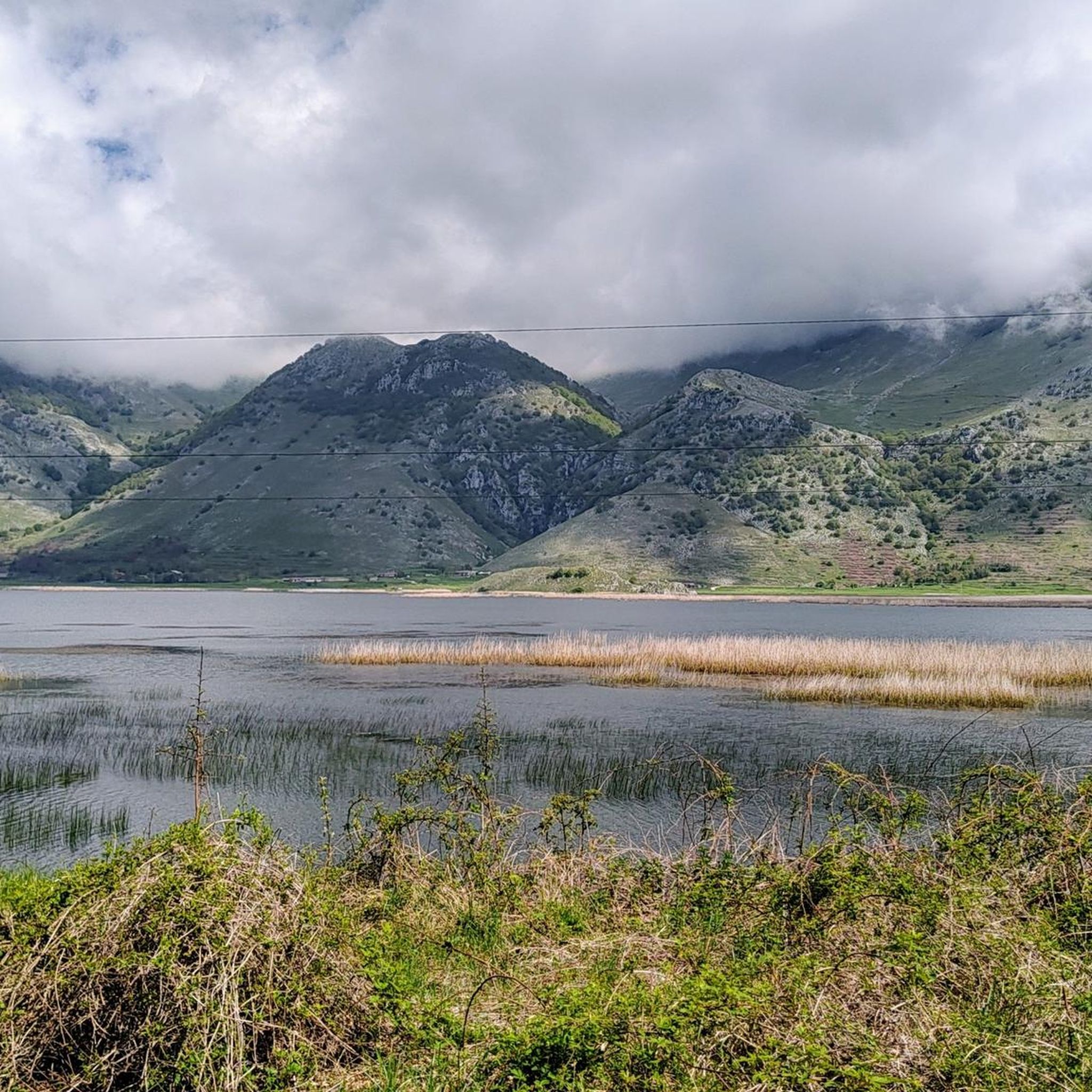
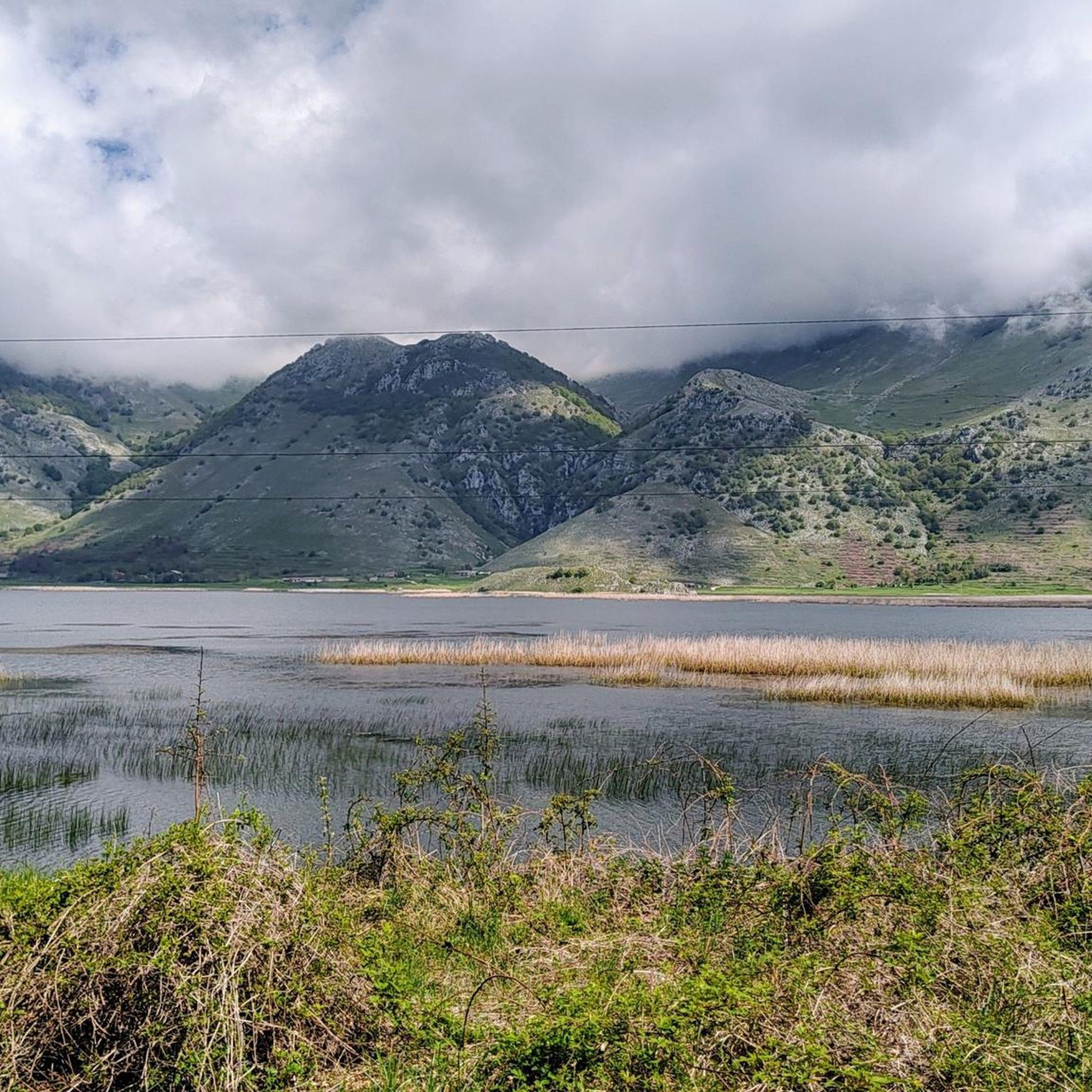
The Matese Regional Park, which encompasses Sant'Angelo D'Alife, is a 'biogeographical island' known for its wild landscapes, dolines (sinkholes), and extensive beech woods. You'll find rocky peaks, enchanting high-mountain forests, and serene lakes like Lake Matese, Italy's highest karst lake.
Are there any natural monuments suitable for families?
Absolutely. Lake Matese is considered family-friendly and offers a beautiful setting for a visit. It's a karst lake nestled in the Matese Regional Park, fed by snowmelt and perennial springs, providing a peaceful environment for all ages.
Where can I find waterfalls and natural pools for a refreshing experience?
The Lete Waterfalls offer small waterfalls and natural pools where you can find freezing cold water for a refreshing dip. Be aware that the trail to these waterfalls is not officially marked and can be challenging due to undergrowth, requiring careful navigation.
What outdoor activities are available near the natural monuments?
The Matese Regional Park offers a wide range of outdoor activities. You can enjoy trekking, mountain biking, horse riding, and canyoning. In winter, snowshoeing is also popular. For specific routes, you can explore options like hiking trails around Sant'Angelo D'Alife or MTB trails in the region.
Are there any natural monuments with historical significance beyond religious sites?
Yes, Campo Figliuolo Pond is not only surrounded by beautiful springs, valleys, and woods but also holds historical importance, particularly known for its connection to brigandage activities in the area.
What kind of hiking opportunities does Monte Cila offer?
Monte Cila, part of the Apennines, provides opportunities for trekking and experiencing the natural beauty of the region. There's a known hiking trail, 'Anello Piedimonte - Monte Cila - Castello M - Piedimonte M', leading to its 672-meter summit, which likely offers scenic vistas of the Volturno valley.
What are 'I Campanarielli' and what makes them unique?
I Campanarielli are two distinctive rock towers located in the middle of the Fondacone Valley. They are often compared to the Dolomite pinnacles due to their striking appearance. While the view from the path is suggestive, climbing to the top requires mountaineering skills and specialized equipment.
What is the best time of year to visit the natural monuments around Sant'Angelo D'Alife?
The Matese Regional Park offers diverse experiences throughout the year. Spring and autumn are ideal for trekking and enjoying the mild weather and vibrant colors. Summer allows for water activities and exploring higher altitudes, while winter provides opportunities for snowshoeing and experiencing the serene, snow-covered landscapes.
Can I find trails for running near these natural monuments?
Yes, there are several running trails in the vicinity. For example, you can find various running routes around Sant'Angelo D'Alife, ranging from moderate to difficult, allowing you to explore the natural surroundings while jogging.
Most popular routes around Sant'Angelo D'Alife
Most popular attractions around Sant'Angelo D'Alife

Get inspired with the komoot mobile app


Explore more
Extend your search for the best caves by checking out these guides of the top ones around Sant'Angelo D'Alife:
