The best cycling routes around Gusendos De Los Oteros
4.7
(4)
42
riders
2
rides
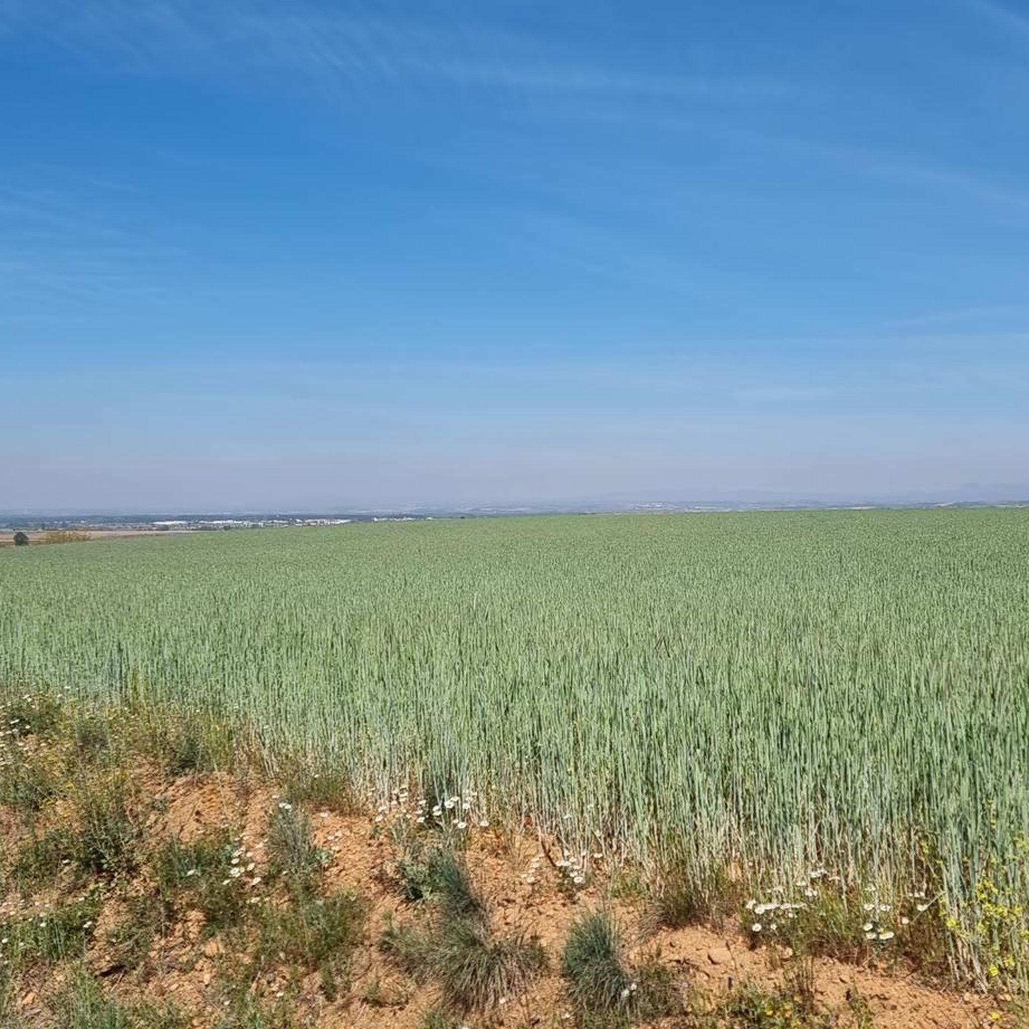
Touring cycling around Gusendos De Los Oteros features routes across a predominantly flat to gently rolling landscape, characteristic of agricultural plains. The region offers open vistas with minimal elevation changes, making it suitable for longer distance cycling. Routes often connect small villages and rural areas, providing a consistent terrain for touring cyclists. The area's topography supports accessible cycling for various skill levels.
Best touring cycling routes around Gusendos De Los Oteros
- The most popular touring cycling route is Los Oteros,…
Last updated: May 22, 2026
51.9km
03:06
140m
140m
Moderate bike ride. Good fitness required. Mostly paved surfaces. Suitable for all skill levels.
5.0
(1)
11
riders
163km
09:41
550m
550m
Hard bike ride. Very good fitness required. Mostly paved surfaces. Suitable for all skill levels.

Sign up for free
4.3
(3)
22
riders
116km
07:09
390m
390m
Hard bike ride. Very good fitness required. Mostly paved surfaces. Suitable for all skill levels.
7
riders
36.6km
02:11
120m
120m
Moderate bike ride. Good fitness required. Mostly paved surfaces. Suitable for all skill levels.
2
riders
15.7km
01:03
60m
60m
Easy bike ride. Great for any fitness level. Mostly paved surfaces. Suitable for all skill levels.
Our route recommendations are based on thousands of hikes, rides, and runs completed by other people on komoot.
Start today with a free account
Your next adventure awaits.
Login or Signup
Popular around Gusendos De Los Oteros
Tips from the Community


A beautiful, lively square right at the entrance to the old town of Leon.
4
0

The most famous monument is the church, recently the remains of an old hermitage were found. In the village there is a distillery where pomace and typical wines from the region are sold.
2
0
The Ermita de Nuestra Señora de Perales is a historic chapel located in Bercianos del Real Camino. The chapel was built in the 17th century. It was originally dependent on the Hospital del Cebreiro, which was founded in the 12th century. It is a simple brick building with a gable roof and a single tower. The interior is sober but charming, with a focus on devotion to Our Lady of Perales. Every year on September 8, a romería (pilgrimage) is held in her honor, during which the people of Bercianos del Real Camino visit the chapel and celebrate a party. The chapel is open from June 15 to September 30, from Monday to Sunday, between 11:00 and 13:00 and 18:00 and 20:00.
2
0
The Reliegos meteorite is a well-known meteorite fall in Spain, which occurred on December 28, 1947 near Reliegos, in the municipality of Santas Martas, province of León. It is an L5 chondrite, which means that it is an ordinary chondrite with a certain chemical composition and texture. The meteorite had a mass of 17.3 kg and consisted of a single stone. The meteorite is characterized by the presence of relatively indistinct chondrules in a finely ground and largely recrystallized matrix. The meteorite contains mainly olivine and orthopyroxene, as well as iron-nickel metal (mainly kamacite), troilite, plagioclase and accessory clinopyroxene. The Reliegos meteorite is one of the 80 confirmed witness accounts of meteorite falls classified as an L5 chondrite, and the only witness account of an L5 fall in Spain.
3
0
Frequently Asked Questions
What is the typical difficulty level for touring cycling routes in Gusendos De Los Oteros?
The routes around Gusendos De Los Oteros generally feature a predominantly flat to gently rolling landscape, characteristic of agricultural plains. This makes many routes suitable for various skill levels. You'll find options ranging from easy paths like the Bike loop from Fresno de la Vega, to moderate journeys, and even difficult routes with more significant elevation gain for experienced cyclists.
Are there any family-friendly touring cycling routes in Gusendos De Los Oteros?
Yes, the region's generally flat terrain makes it suitable for family cycling. Routes like the Bike loop from Fresno de la Vega are classified as easy, offering a shorter distance and minimal elevation, which can be ideal for families looking for a relaxed ride through rural landscapes.
What are the typical distances for touring cycling routes in this area?
Touring cycling routes in Gusendos De Los Oteros vary in length. You can find shorter loops, such as the Bike loop from Fresno de la Vega at about 9.8 miles (15.7 km), up to much longer and more challenging rides like the Pilgrim Cross Monument – El Burgo Ranero loop from Palanquinos, which spans over 101 miles (163 km).
Are there circular touring cycling routes available?
Yes, several routes in Gusendos De Los Oteros are designed as circular loops, allowing you to start and end at the same point. An example is the Los Oteros, Reliegos y Mansilla de las Mulas – circular from Palanquinos, which offers a comprehensive tour of the local countryside.
What kind of scenery can I expect while touring cycling in Gusendos De Los Oteros?
The region is characterized by open plains and extensive agricultural fields, offering wide, unobstructed vistas. You'll cycle through quiet village roads and rural landscapes, providing a consistent and accessible cycling experience with minimal elevation changes. The routes often connect small, traditional villages.
What do other touring cyclists enjoy most about cycling in Gusendos De Los Oteros?
The touring cycling routes in Gusendos De Los Oteros are highly rated by the komoot community, with an average score of 4.7 stars from over 4 reviews. Cyclists often appreciate the open plains, agricultural fields, and quiet village roads that define the area, providing a consistent and accessible cycling experience.
What are some interesting landmarks or attractions I can see along the routes?
While cycling, you might encounter various points of interest. Notable attractions include the Reliegos Meteorite Impact Site, which is a unique natural monument. You may also pass by the Camino de Santiago Distance Marker: 334.9 km to León, offering a glimpse into the historic pilgrimage route.
Are there places to stop for refreshments or food along the touring cycling routes?
While specific cafes are not always directly on every route, the routes often connect small villages. In these villages, you can typically find local establishments. For example, Bar Elvis is listed as a highlight in the area, providing a potential stop for refreshments.
When is the best time of year for touring cycling in Gusendos De Los Oteros?
Given the region's agricultural plains and open vistas, spring and autumn generally offer the most pleasant conditions for touring cycling. Temperatures are milder, and the landscape can be particularly scenic. Summer can be hot and exposed, while winter might bring colder temperatures and less predictable weather.
Where can I find parking for touring bike trails in Gusendos De Los Oteros?
As the routes often start from or pass through villages like Palanquinos or Fresno de la Vega, you can typically find public parking available within these settlements. It's advisable to look for designated parking areas or suitable street parking in the village centers near the route starting points.
Are there any advanced touring cycling routes for experienced riders?
Yes, for experienced riders seeking a greater challenge, routes like the Pilgrim Cross Monument – El Burgo Ranero loop from Palanquinos offer a difficult classification. This route covers a significant distance of over 101 miles (163 km) and includes more substantial elevation gain, making it suitable for advanced touring cyclists.
What is the longest touring cycling route available in Gusendos De Los Oteros?
The longest route listed is the Pilgrim Cross Monument – El Burgo Ranero loop from Palanquinos, which spans approximately 101.3 miles (163.1 km). This difficult route is designed for longer excursions and includes notable elevation changes.
Most popular routes around Gusendos De Los Oteros
Most popular attractions around Gusendos De Los Oteros

Get inspired with the komoot mobile app


Explore more
Browse the best Cycling routes in other regions.
