The 8 Most Amazing Peaks in the Philippines
Best mountain peaks in the Philippines offer a diverse range of landscapes, from high-altitude summits to active volcanoes. This archipelago nation features unique ecosystems and challenging trails across its many islands. The mountains are home to significant biodiversity, including endemic species of flora and fauna. Many peaks also hold cultural and spiritual importance for indigenous communities.
Best mountain peaks in the Philippines
- The most popular mountain peaks is Mt. Parawagan Peak, a summit that offers a 360-degree view of…
Last updated: May 16, 2026
Mayon Volcano
Highlight • Volcano
Tip by

Mt. Parawagan Peak
Highlight • Summit
Tip by

Sign up now to discover places like this
Get recommendations on the best single tracks, peaks, & plenty of other exciting outdoor places.
Sign up for free
Papaya River and Tarak Ridge Summit Hike
Highlight (Segment) • Trail
Tip by

Mount Batulao Summit
Highlight • Summit
Translated by Google •
Tip by

Mount Pulag Summit
Highlight • Summit
Tip by

Lower Summit of Mount Gulugod Baboy
Highlight • Summit
Tip by

Hapunang Banoy (Mascap Peak)
Highlight • Summit
Tip by
Highest Point of the DSB Highway (842 Meters)
Highlight • Summit
Tip by

View from Mount Canlandog
Highlight • Viewpoint
Tip by
Start today with a free account
Your next adventure awaits.
Login or Signup
Tips from the Community

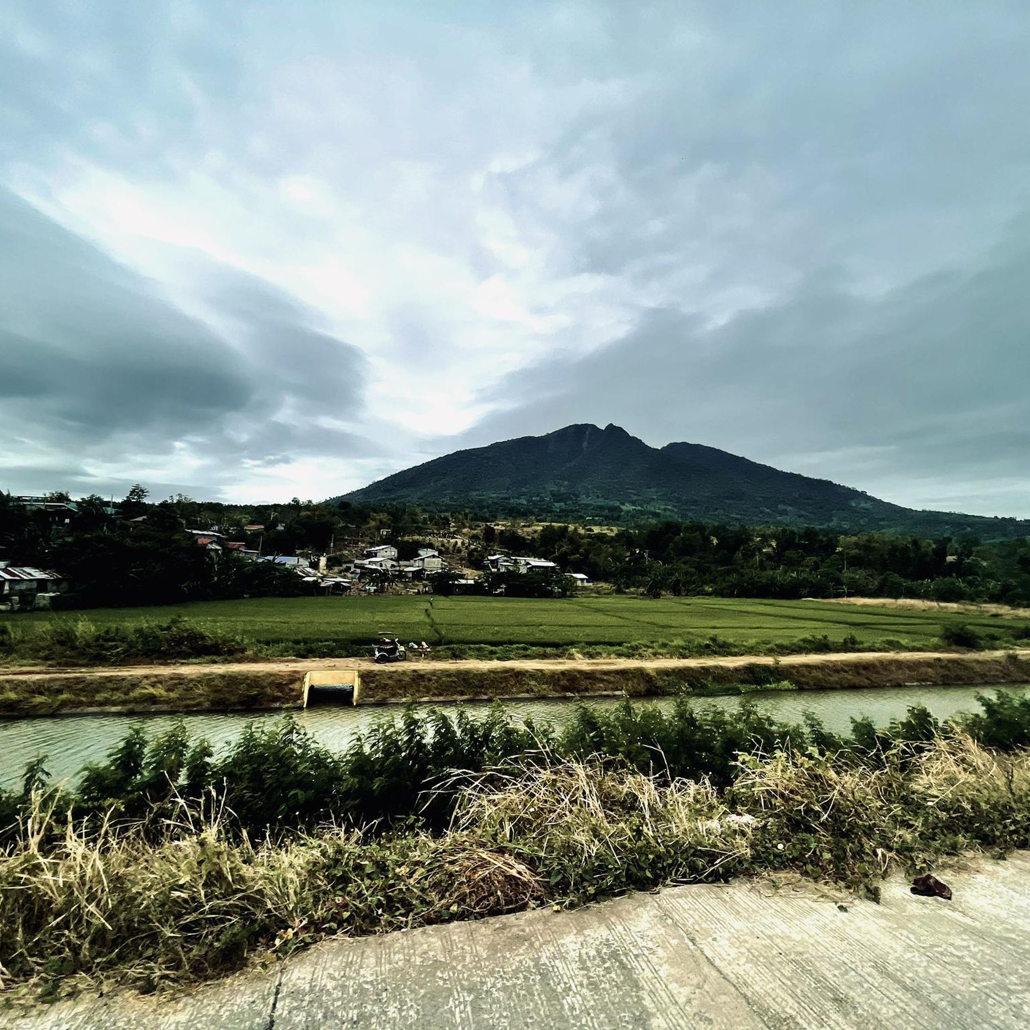
Mayon is a main landmark and highest point of the province of Albay and the whole „Bicol Region“ in Philippines. Rising 2460 meters from the shores of Albay Gulf (round about 10 km away). Mayon is a classic stratovolcano with a small central summit crater. Mayon is the most active volcano in the Philippines, erupting over 52 times in the past 500 years. Three telemetric units are installed on Mayon's slopes, which send information to the seven seismometers in different locations around the volcano. It is said that the volcano grew from the burial grounds of lovers Magayon and Panganoron. Thus, the ancient Bicolanos named it after the legendary princess-heroine Daragang Magayon (Beautiful Lady). After some time, the volcano was chosen as the abode of the supreme god of the Bicolano people, Gugurang, who also chose Mayon as the repository of the sacred fire of Ibalon. Numerous festivals and rituals are associated with the volcano and its landscape.
0
0

First you will pass the Malatan-og Viewing Deck and than at kilometer 49 you have reached the higest point of the DSB highway at 842 meters.
1
0
The last 7 kilometers are gravel road. The very last 2 kilometers are very steep (18-20%) and very bad road, so you may have to push your bike going up and down. The reward a fantastic view.
1
0

High-risk scrambles on sharp rocks, with a huge cliff fall on multiple sides. Gloves highly recommended.
0
0
Summit, great view of the sunrise and sea of clouds if weather permits. Best time to climb would be January to March). Cold temps (~10-15 degrees), bring enough layers for warmth.
0
0

The trail begins with a roughly 1km paved road leading to the trailhead. As you start hiking, you'll encounter a rocky terrain that quickly turns into a steep climb with a gradient of 14-16%. Be sure to watch out for tree roots and rocks along the way, including a particularly slippery tree with a sprawling, spiderweb-like root system. Once you reach a clearing, you'll come across a fenced area containing huts and totes belonging to a plantation company. From there, the trail becomes more challenging, with a "kiss-the-wall" situation that requires both your arms and legs to navigate the terrain. Throughout the hike, you'll encounter a diverse array of flora, including Amaciga, Narra, Banahaw trees, Pandan, various tree ferns, bamboo, mosses, and lichens. Keep an eye out for thorny plants along the trail, which can be hazardous. At Papaya River, you can refill your water from an aquifer before embarking on a continuous 2km ascent that will undoubtedly put your stamina to the test, with an average gradient of around 30%. After the steep climb, you'll enter a grassy area where you can camp out under the cover of trees. Beware of the abundant Cogon grass, which can cause cuts. You may also encounter Sampinit, a sour edible fruit. From there, the trail becomes rocky again, and you'll need to use plants, soil, and other materials to help you ascend and descend the steep sections. Finally, upon reaching the summit of Tarak Ridge, you'll find a small, tree-canopied area with a passage leading to a ledge for taking photos. Be sure to stop and take in the incredible views!
0
1

summit with an amazing view. On less crowded hours the trail can be riden down with enduro or downhill bike.
0
0
Frequently Asked Questions
What are some of the most popular mountain peaks for hiking in the Philippines?
Some of the most popular mountain peaks in the Philippines include Mt. Parawagan Peak, which offers a spectacular 360-degree view of the city and the Sierra mountains. Another favorite is Mount Pulag Summit, renowned for its potential for sunrise views and the 'sea of clouds' phenomenon. Visitors also enjoy Mount Batulao Summit, known for its interesting mountain range and varied terrain, which can include wet soil and mud, adding to the adventure.
When is the best time to climb mountains in the Philippines?
The best time to climb mountains in the Philippines generally aligns with the dry season. For instance, Mount Apo is best climbed from December to March, while Mount Pulag is ideal from November to February. These periods help avoid heavy rains and potential landslides, offering clearer views and safer trekking conditions.
What kind of natural features and wildlife can I expect to see on Philippine mountain trails?
Philippine mountain trails are rich in biodiversity. On Mount Apo, you might encounter the critically endangered Philippine Eagle, over 272 bird species, and diverse flora including rare orchids. Mount Pulag boasts mossy forests, grasslands, and endangered species like the Philippine brown deer. Mount Dulang-Dulang is a hotspot for endemic species, including flying lemurs and wild boars. Mount Kanlaon features lush forests, lagoons, and waterfalls, home to the Philippine spotted deer and Visayan Warty Pig.
Are there challenging mountain climbs in Mindanao?
Yes, Mindanao offers some of the most challenging mountain climbs in the Philippines. Mount Apo, the highest peak, is considered a difficulty level of 7/9. Mount Dulang-Dulang and Mount Kitanglad, both part of the Kitanglad Mountain Range, also offer challenging trails through ancient forests and rich biodiversity, rewarding mountaineers with breathtaking panoramic views.
What are the difficulty levels for hiking Mount Pulag and Mount Apo?
Mount Apo is considered a challenging climb with a difficulty level of 7/9. Mount Pulag, while popular, also presents a significant challenge. The Ambangeg Trail on Mount Pulag is considered the friendliest route, but other options like the Akiki and Trawangan trails are more demanding. Both mountains require good physical preparation and appropriate gear.
What outdoor activities can I do near these mountain peaks?
Beyond hiking, you can find various outdoor activities. For mountain biking enthusiasts, there are numerous MTB Trails in the Philippines, including challenging routes like the 'Timberland Heights – Little Baguio Road loop'. For those who enjoy running, there are Running Trails in the Philippines, such as the 'UP Sanctuary loop'. Additionally, there are many easy hikes in the Philippines, like the 'Osmeña Peak loop'.
Are there any beginner-friendly peaks in Luzon?
While many peaks in Luzon offer challenging climbs, Mount Maculot in Batangas is a popular destination for beginner hikers, offering scenic views of Taal Lake, Mount Makiling, and the Tagaytay highlands from its summit. For those seeking a less strenuous experience, the Ambangeg Trail on Mount Pulag is considered the most accessible route to experience its famous 'sea of clouds'.
What is the cultural significance of some Philippine mountain peaks?
Many Philippine mountain peaks hold deep cultural and spiritual importance for indigenous communities. Mount Apo is considered a sacred site by tribes like the Bagobo, Ubos, and Atas. Mount Pulag is regarded by indigenous peoples as the resting place of their ancestors. Mount Dulang-Dulang is sacred to the Talaandig tribe, who are its ancestral custodians. These mountains are not just natural wonders but also integral to the heritage and beliefs of local communities.
What should I wear when hiking in the Philippine mountains?
Given the varied terrain and weather conditions, it's advisable to wear sturdy shoes and clothes that can get dirty. For higher peaks like Mount Pulag, where temperatures can drop to 10-15 degrees Celsius, bringing enough layers for warmth is crucial. For trails with dense vegetation, like the Papaya River and Tarak Ridge Summit Hike, wearing long-sleeved shirts and pants is recommended to protect against thorny plants and insects.
What are some unique mountain peaks known for their specific features?
The Philippines has several peaks known for unique features. Mount Mayon is famous for its near-perfect cone shape. Mount Pulag is renowned for its 'sea of clouds' phenomenon. Mount Kanlaon is an active stratovolcano with an impressive lunar-shaped crater summit. Osmeña Peak in Cebu is known for its rugged hills reminiscent of Bohol's Chocolate Hills. Mount Halcon is considered one of the country's most strenuous hikes due to its steep slopes and dense jungle.
What do visitors enjoy most about the mountain peaks in the Philippines?
Visitors frequently praise the spectacular views and the sense of adventure. For instance, the view from Mt. Parawagan Peak is described as 'spectacular,' offering a 360-degree panorama. The potential for sunrise views and the 'sea of clouds' at Mount Pulag Summit is a major draw. The varied and sometimes muddy terrain of Mount Batulao Summit adds to the adventure for many hikers.
Are there any peaks that offer panoramic views of multiple provinces or islands?
Yes, several peaks offer extensive panoramic views. Mount Hibok-Hibok in Camiguin provides panoramic views of nearby provinces like Surigao, Siquijor, and Bohol from its summit. Mount Dulang-Dulang rewards mountaineers with breathtaking panoramic views of Mindanao, including Mount Apo and other peaks in the Kitanglad Range. Mount Tabayoc also offers panoramic views of the Cordillera Mountains.
Most popular routes in the Philippines
Most popular attractions in the Philippines

Get inspired with the komoot mobile app


Explore more
See even more amazing summits in the Philippines with these guides:
