The 9 Most Amazing Peaks around Weinbach
Best mountain peaks around Weinbach are found within the scenic Taunus low mountain range, characterized by rolling hills and verdant forests. The region offers numerous elevated points and hiking opportunities, with maximum elevations reaching approximately 370 meters. Visitors can explore an extensive network of hiking trails that traverse hilly terrain, providing views of the Lahn Valley. These trails often connect to historical sites and natural attractions in the vicinity.
Best mountain peaks around Weinbach
- The most popular mountain peaks is…
Last updated: May 14, 2026
Summit Cross Schinnkopf
Highlight • Monument
Translated by Google •
Tip by

Kuhbett Trail
Highlight • Trail
Translated by Google •
Tip by

Sign up now to discover places like this
Get recommendations on the best single tracks, peaks, & plenty of other exciting outdoor places.
Sign up for free
Suterkopf Summit
Highlight • Summit
Tip by

Eisenkopf Summit Cross
Highlight • Summit
Translated by Google •
Tip by

Heidenkopf
Highlight • Summit
Translated by Google •
Tip by

Sign up for free to discover even more peaks around Weinbach.
Sign up for free
Already have an account?
Start today with a free account
Your next adventure awaits.
Login or Signup



Tips from the Community

Very nice trail, in December 2025 everything was clear and one could enjoy it.
0
0


During the Second World War, there was an observation tower on the Suterkopf with a wide view of the surrounding area. From there there was a dedicated telephone line to Haintchen to report fires and smoke in the area. After the end of the war, the tower was dismantled for safety reasons.
2
0
The Schinnkopf was a place of execution in historical times. The place itself is not on any marked path. The cross is somewhat weathered and not directly accessible because it is fenced in with barbed wire.
1
0

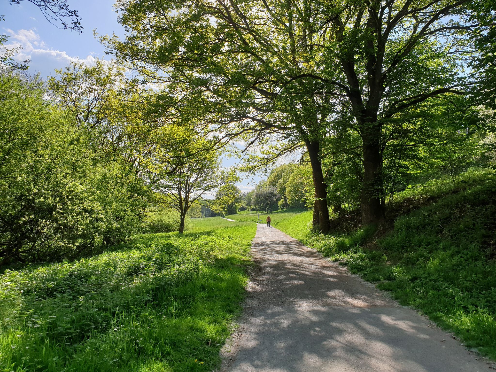
narrow path without roots or stones directly between the wind turbines.
1
0

It is a tedious and steep climb to the cow bed
0
0

Calm forest space, ideal to make a stop before descending to Haintchen or Hasselbach.
2
0
Frequently Asked Questions
What natural features can I expect to see on mountain peaks around Weinbach?
The elevated areas around Weinbach, part of the scenic Taunus low mountain range, are characterized by picturesque rolling hills and verdant forests. You'll find extensive networks of hiking trails winding through these natural landscapes. Many paths offer panoramic vistas of the meandering Lahn River and its picturesque valley. While exploring, you might encounter highlights like the Kuhbett Trail, which runs directly between wind turbines, or the tranquil forest setting of Suterkopf Summit.
Are there any challenging mountain hikes near Weinbach?
While Weinbach is known for its rolling hills rather than towering peaks, some trails offer more challenging sections. For instance, the Kuhbett Trail involves a tedious and steep climb to the Kuhbett. Additionally, the area around the Summit Cross Schinnkopf and Eisenkopf Summit Cross can present more demanding routes, often leading through forested terrain.
What are some of the best viewpoints around Weinbach's elevated areas?
Many elevated paths in the Weinbach area offer panoramic vistas, particularly of the Lahn River and its valley. Historically, Suterkopf Summit once hosted an observation tower with wide views. While the Summit Cross Schinnkopf is now forested, it remains an elevated point. The Heidenkopf also offers an elevated perspective within its forest setting.
What makes the Kuhbett Trail a popular spot?
The Kuhbett Trail is popular for its distinct experience, featuring a descent from Kuhbett to below the Krämerstein parking lot. This narrow path runs directly between wind turbines, offering a unique blend of nature and modern infrastructure. It's known for its short beginner trail section, though the climb to Kuhbett can be steep.
Are there any historical sites on or near the elevated points in Weinbach?
Yes, the region has historical connections. The Summit Cross Schinnkopf, for example, is a successor to a crucifix built in 1893, and the area was historically a place of execution with a gallows. Below the cross, there's a former quarry. The Suterkopf Summit once housed an observation tower during WWII. Beyond the immediate peaks, hikes in the Weinbach area can connect to or offer views of historical landmarks like the ruins of Freienfels Castle or the Ernst-Dienstbach footbridge.
Are there family-friendly mountain walks around Weinbach?
Weinbach's hilly terrain and extensive network of trails offer many options suitable for families. While specific 'family-friendly' categories aren't always assigned to individual peaks, the general nature of the Taunus low mountain range means many routes are accessible. For dedicated easy hikes, you can explore options like the 'Kubach Windmill – Kubach Water Wheel loop from Edelsberg' or the 'Freienfels Old Railway Station – Freienfels Railway Station loop from Freienfels', which are part of the Easy hikes around Weinbach guide.
What kind of outdoor activities can I do near the mountain peaks around Weinbach?
Beyond hiking the elevated points, Weinbach offers a variety of outdoor activities. You can enjoy road cycling on routes like the 'Runkel Town Mill Weir – Diez Old Town and Castle loop from Fürfurt' found in the Road Cycling Routes around Weinbach guide. Gravel biking is also popular, with routes such as the 'Old Lahn Bridge, Limburg – Lahn Riverside Path loop from Arfurt (Lahn)' available in the Gravel biking around Weinbach guide. The region's extensive trail network is perfect for exploring on foot or by bike.
Are there easy mountain hikes suitable for beginners in the Weinbach area?
Yes, the Weinbach area, with its rolling hills, provides numerous easy hiking opportunities suitable for beginners. Routes like the 'Kubach Windmill – Kubach Water Wheel loop from Edelsberg' and the 'Freienfels Old Railway Station – Freienfels Railway Station loop from Freienfels' are specifically categorized as easy. You can find more options in the Easy hikes around Weinbach guide, which offers trails with manageable distances and gentle inclines.
What is the best time to hike the mountain peaks near Weinbach?
The Weinbach region offers enjoyable hiking experiences throughout much of the year. Spring and autumn provide pleasant temperatures and beautiful scenery with blooming flora or vibrant fall foliage. Summer is also suitable, though it's advisable to hike in the mornings or late afternoons to avoid the midday heat. Winter hiking is possible, but trails might be covered in snow or ice, requiring appropriate gear and caution. The tranquil forest settings, like that of Suterkopf Summit, can be particularly serene in any season.
Are the mountain trails around Weinbach dog-friendly?
Generally, the extensive network of hiking and walking trails in the Weinbach region, which traverses forests and hills, is dog-friendly. Most natural trails in the Taunus low mountain range welcome dogs, provided they are kept on a leash and owners clean up after them. It's always a good idea to check local regulations or signage for specific areas, but you'll find plenty of opportunities to explore with your canine companion.
Where can I find parking for trails leading to Weinbach's elevated areas?
Parking is generally available at various trailheads and starting points for hikes in the Weinbach area. For example, the Kuhbett Trail has a parking lot at Krämerstein. Many villages and popular hiking spots in the region offer designated parking areas for visitors looking to explore the surrounding hills and forests. It's recommended to check specific route descriptions for detailed parking information.
Are there options for public transport to access the elevated areas near Weinbach?
While Weinbach is a municipality, public transport options to directly access specific remote trailheads for elevated areas might be limited. However, regional bus services connect Weinbach to larger towns in the Limburg-Weilburg district, from where you can often find local connections or start your hike. For detailed public transport information, it's best to consult local transport schedules or plan your route using a public transport app.
What should I wear for hiking in the Weinbach mountains?
Given the varied terrain of rolling hills and forests in the Taunus low mountain range, it's advisable to wear comfortable, layered clothing suitable for outdoor activity. Sturdy hiking shoes with good grip are essential, especially on potentially uneven or muddy paths. Depending on the season, bring rain gear, sun protection, and sufficient water. Even in summer, a light jacket can be useful for higher elevations or cooler forest sections.
Most popular routes around Weinbach
Most popular attractions around Weinbach

Get inspired with the komoot mobile app


Explore more
See even more amazing summits around Weinbach with these guides:
