The best walks and hikes in Rocks State Park Falling Branch Area
5.0
(5)
102
hikers
5
hikes
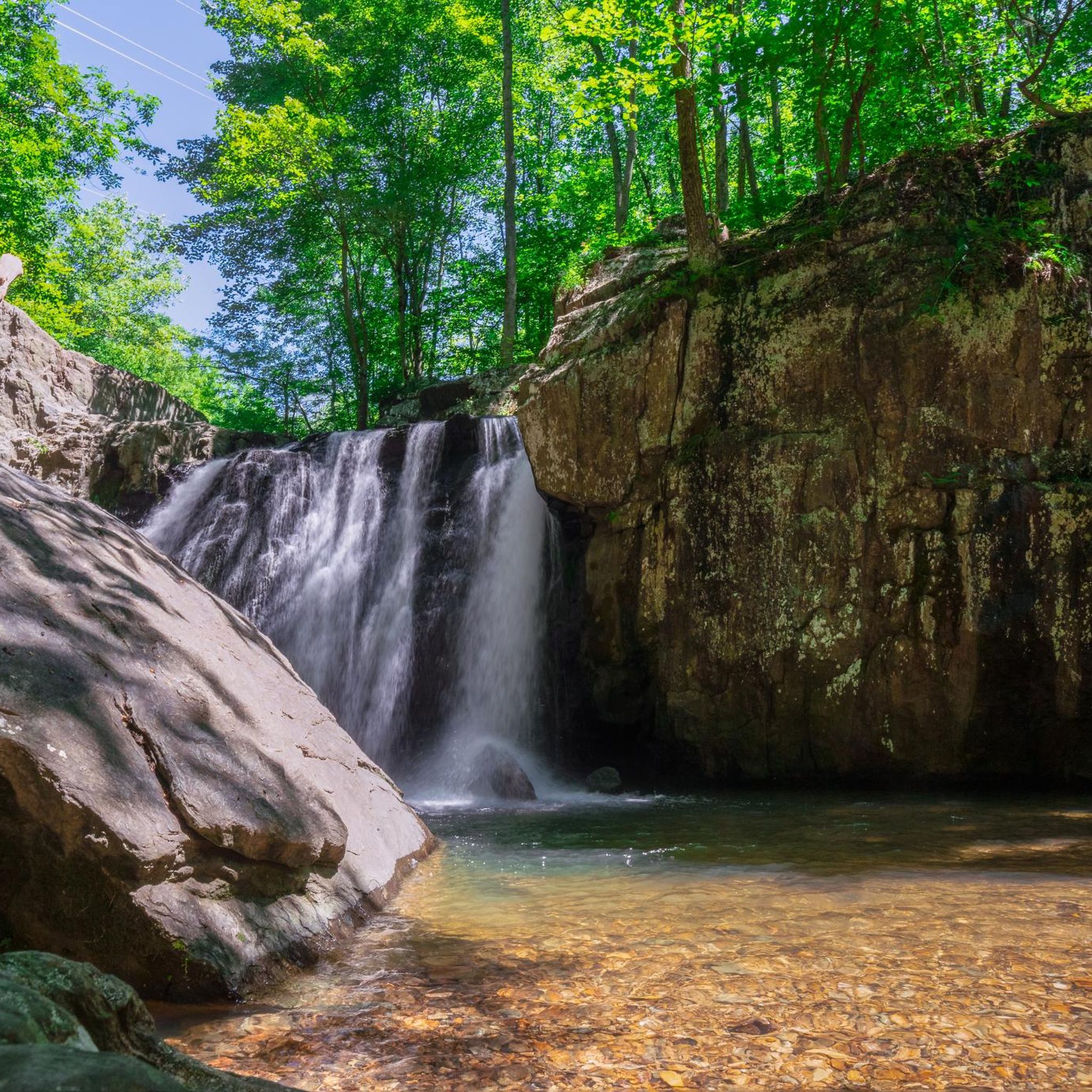
Hiking in Rocks State Park Falling Branch Area is characterized by its serene natural beauty, centered around Kilgore Falls, Maryland's second-highest vertical drop waterfall. The region features a non-developed, 67-acre parcel of land, emphasizing its pristine character. Trails often parallel the Falling Branch stream, winding through lush forests rich in biodiversity. The landscape offers a mix of easy paths and moderate ascents, with some sections near the falls being rocky.
Best hiking trails in Rocks State Park Falling Branch Area
- The most popular hiking route is White Trail Loop, a 2.7 miles (4.4 km) trail that takes 1 hour 21 minutes to complete, offering an easy journey through the park's forested areas.
- Another top favourite among local hikers is King and Queen Seat loop from Rocks State Park, an easy 2.5 miles (4.0 km) path. This route provides access to notable natural features within the broader park.
- Local hikers also love the Rock State Park loop from Deer Creek, a 4.9 miles (7.9 km) trail leading through varied terrain near Deer Creek, often completed in about 2 hours 15 minutes.
- Hiking in Rocks State Park Falling Branch Area is defined by its waterfalls, flowing streams, and dense woodlands. The network offers options for both easy family-friendly walks and more moderate trails.
- The routes in Rocks State Park Falling Branch Area are highly rated by the komoot community with an average score of 5.0 stars from 5 reviews. More than 100 hikers have used komoot to explore Rocks State Park Falling Branch Area's varied terrain.
Last updated: October 8, 2026
5.0
(2)
49
hikers
4.41km
01:21
150m
150m
The White Trail Loop offers a delightful journey through eastern deciduous forests, where you'll navigate rocky and rooted paths that add a touch of adventure to your steps. The true gem of this route is the King and Queen Seat, a striking 190-foot rock outcropping that provides expansive views over Deer Creek Gorge, making it a fantastic spot for sightseeing. It's a great way to experience Maryland's natural beauty without an overly strenuous effort.
Located in Rocks State Park in Jarrettsville, Maryland, this easy 2.7-mile (4.4 km) hiking route with 500 feet (152 metres) of elevation gain can be completed in about 1 hour and 20 minutes. While specific parking information isn't always readily available, arriving early at state parks is generally recommended to ensure a spot, especially during peak times. No permits are typically required for day hikes here, but always check the park's official site for any updates.
This trail is particularly notable for its connection to the King and Queen Seat, a popular destination for both hikers and rock climbers due to its unique geological formation and impressive vistas. The varied terrain, from forest paths to the dramatic rock outcrop, makes it a diverse and engaging experience for its relatively short length, appealing to those seeking a rewarding, family-friendly hike.
5.0
(2)
7
hikers
4.04km
01:10
100m
100m
Easy hike. Great for any fitness level. Easily-accessible paths. Suitable for all skill levels.

36
hikers
7.93km
02:15
180m
180m
Moderate hike. Good fitness required. Easily-accessible paths. Suitable for all skill levels.
5.0
(1)
5
hikers
2.67km
00:48
90m
90m
Easy hike. Great for any fitness level. Easily-accessible paths. Suitable for all skill levels.
3
hikers
2.13km
00:39
80m
80m
Easy hike. Great for any fitness level. Easily-accessible paths. Suitable for all skill levels.
Our route recommendations are based on thousands of hikes, rides, and runs completed by other people on komoot.
Start today with a free account
Your next adventure awaits.
Popular around Rocks State Park Falling Branch Area
Tips from the Community

the big picnic area has restrooms and water-fountains. most likely only on during summer.
0
0

Rocks State Park spans 855 acres in northern Harford County, offering rocky forest landscapes. Highlights include the King and Queen Seat, a natural rock outcrop, and Kilgore Falls, Maryland’s second-highest vertical waterfall. The park features three picnic areas and 3.5 miles of hiking trails, with Deer Creek providing opportunities for fishing, wading, and tubing. While biking isn't allowed on the trails, the park's picnic spots make it a pleasant rest area for bikers.
0
0

A very scenic place that can be reached by hiking the White Trail. Well worth the effort!
1
0
Frequently Asked Questions
How many hiking trails are there in Rocks State Park Falling Branch Area?
The Rocks State Park Falling Branch Area offers a selection of 5 hiking routes. Most of these, 4 to be exact, are considered easy, making them accessible for many visitors. There is also 1 moderate trail for those looking for a bit more challenge.
What is the main natural attraction in the Falling Branch Area?
The centerpiece of the Falling Branch Area is undoubtedly Kilgore Falls, Maryland's second-highest vertical drop waterfall. This picturesque 17-foot waterfall cascades into a pool, which is a popular spot for wading during warmer months. The area around the falls is framed by moss-covered rocks and hemlock branches, creating a tranquil setting. You can find more information about Kilgore Falls on Visit Harford's website.
Are there any family-friendly hikes in Rocks State Park Falling Branch Area?
Yes, the primary trail leading to Kilgore Falls is generally considered easy and suitable for families, though it can be rocky and slippery near the falls. Many of the routes in the area are rated as easy, such as the White Trail Loop, which is just over 4 km long with moderate elevation gain, making it a good option for families looking for a slightly longer walk.
What is the best time to visit Rocks State Park Falling Branch Area?
The Falling Branch Area is beautiful year-round, but it's particularly popular in warmer months when visitors can enjoy wading in the pool at Kilgore Falls. However, be aware that parking is limited, and reservations are required on weekends and holidays from Memorial Day weekend through Labor Day to manage crowds and protect the sensitive environment.
Are dogs allowed on the trails in Rocks State Park Falling Branch Area?
While the region research doesn't explicitly state dog policies for the Falling Branch Area, most Maryland State Parks allow leashed dogs on trails. It's always best to check the official Rocks State Park website or signage upon arrival for the most current regulations regarding pets.
Are there any circular routes in the Falling Branch Area?
Yes, several circular routes are available. For example, the White Trail Loop is an easy 4.4 km hike. Another option is the King and Queen Seat loop from Rocks State Park, which is about 4 km long and also rated easy.
What kind of terrain can I expect on the trails?
The trails in the Falling Branch Area, especially the path to Kilgore Falls, wind through lush forests and parallel the Falling Branch stream. While generally serene, the path can be rocky and slippery, particularly near the waterfall. Hikers will need to cross the stream, often by stone hopping, to reach the base of Kilgore Falls. The area is non-developed, emphasizing its natural character.
What wildlife might I encounter on the trails?
The surrounding forest is rich in biodiversity. Hikers often spot white-tailed deer, squirrels, and various bird species. The environmentally sensitive nature of the area means it's a great place to observe local fauna in their natural habitat.
What are the parking and permit requirements for the Falling Branch Area?
Parking at the Falling Branch Area is limited due to its environmentally sensitive nature. To ensure a less crowded experience, reservations are required for parking on weekends and holidays from Memorial Day weekend through Labor Day. It's advisable to plan ahead and secure your reservation if visiting during these peak times.
What do other hikers enjoy the most about hiking in Rocks State Park Falling Branch Area?
The Rocks State Park Falling Branch Area is highly rated by the komoot community, with an average score of 5.0 stars. Reviewers often praise the serene beauty of Kilgore Falls, the tranquil forest trails, and the opportunity to connect with nature in a pristine environment. The accessibility of the trails, especially for families, is also frequently highlighted.
Are there any longer or more challenging hikes in the vicinity?
While most routes directly within the Falling Branch Area are easy, you can find a moderate option like the Rock State Park loop from Deer Creek, which is nearly 8 km long with about 177 meters of elevation gain. This offers a more extended experience for those looking to explore further.
Most popular routes in Rocks State Park Falling Branch Area

Get inspired with the komoot mobile app


Explore more
Browse the best Hikes in other regions.
