RoutesPlannerFeaturesUpdates
App
Login or Signup
Get the App
Login or Signup
Routes
Cycling routes
Canada
British Columbia

Area A (Malaspina/Toba)

The best cycling routes around Area A (Malaspina/Toba)

24

riders

3

rides

Touring cycling around Area A (Malaspina/Toba) offers routes through diverse landscapes, characterized by coastal proximity and inland lakes. The region presents varied terrain, including forested sections and areas with notable elevation changes. These routes provide opportunities to explore the natural environment of the Malaspina/Toba area.

Best touring cycling routes around Area A (Malaspina/Toba)

  • The most popular touring cycling route is Totem Pole Viewpoint loop from Powell River, a 38.3 miles (61.6 km) trail that takes 4 hours 0 minutes…

Last updated: November 1, 2026

11

riders

#1.

Totem Pole Viewpoint loop from Powell River

61.6km

04:00

820m

820m

Hard bike ride. Very good fitness required. Mostly paved surfaces.

Navigate with deviceSend to Phone
Save
Hard

11

riders

Easy bike ride. Mostly paved surfaces.

Easy
guide_signup
Let us show you the way with the komoot mobile app
With a free komoot account, you can easily find, customize, and navigate endless outdoor adventures.
Sign up for free

Moderate bike ride. Good fitness required. Mostly paved surfaces.

Moderate

Our route recommendations are based on thousands of hikes, rides, and runs completed by other people on komoot.

Start today with a free account

Your next adventure awaits.

Login or Signup

Popular around Area A (Malaspina/Toba)
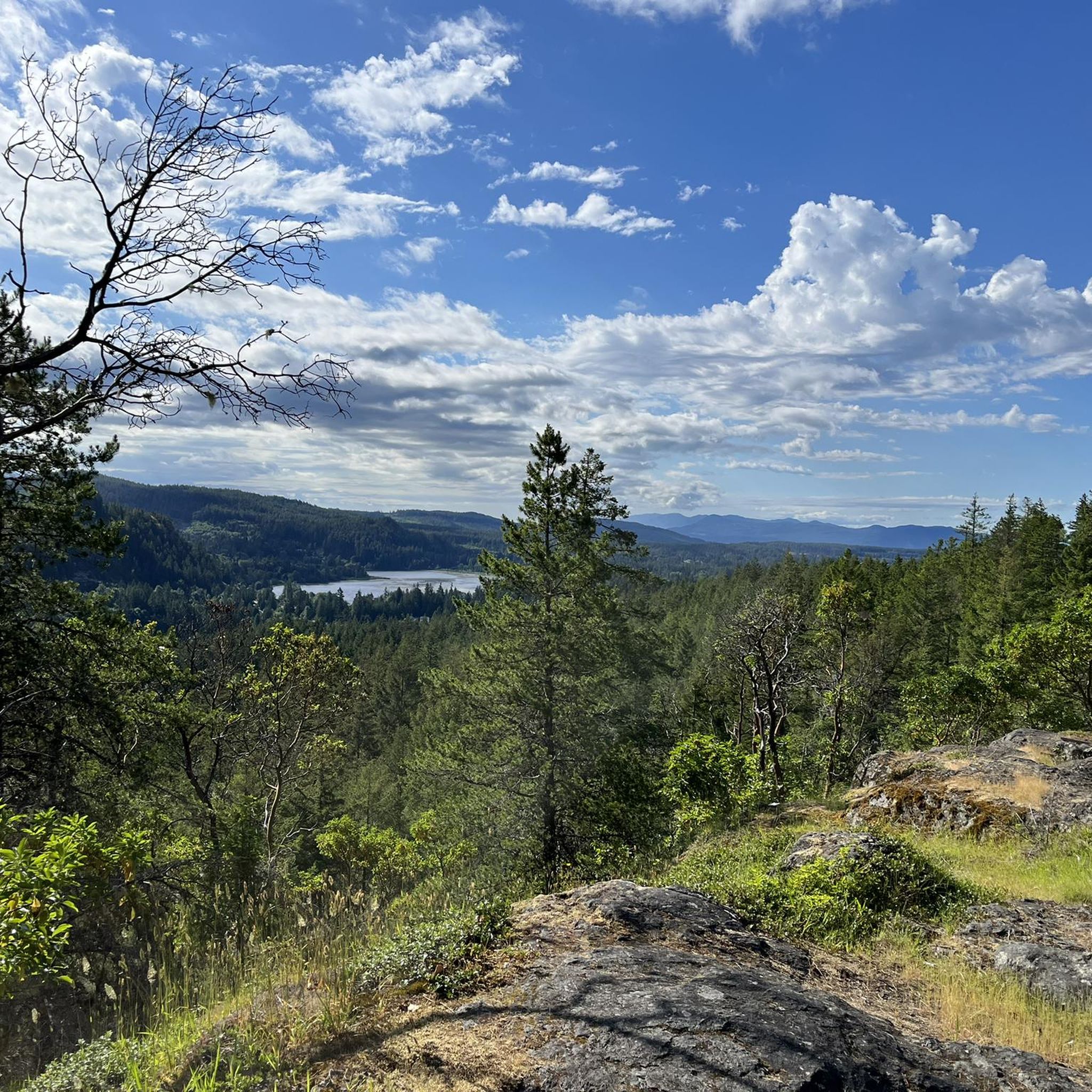
Hiking around Area A (Malaspina/Toba)

Tips from the Community

Lensdude
July 30, 2025, Totem Pole Viewpoint

Serious Coffee has great coffee and pastries at reasonable prices

0

0

Bus to Powell River. $3 Bicycles free of charge. Space for two bikes. Bus only runs twice a day! Note travel times

Translated by Google•

0

0

Frequently Asked Questions

How many touring cycling routes are available in Area A (Malaspina/Toba)?

Komoot features several touring cycling routes in Area A (Malaspina/Toba), offering diverse options for exploring the region's landscapes.

Are there touring cycling routes suitable for beginners in Area A (Malaspina/Toba)?

Yes, beginners can enjoy the easy Bike loop from Inland Lake Campground. This 8.0-mile (12.9 km) route is relatively flat, circling Inland Lake and taking about 1 hour 15 minutes to complete.

What options are available for experienced touring cyclists in Area A (Malaspina/Toba)?

Experienced cyclists looking for a challenge can tackle the difficult Totem Pole Viewpoint loop from Powell River. This route spans 38.3 miles (61.6 km) with significant elevation gain, typically requiring around 4 hours to complete.

Are there any circular touring cycling routes in Area A (Malaspina/Toba)?

Yes, the region offers several circular routes. The Bike loop from Inland Lake Campground and the Mud Lake – Deer Lake loop from Duck Lake Protected Area are both excellent options for loop rides.

What kind of scenery can I expect on touring cycling routes in Area A (Malaspina/Toba)?

The touring cycling routes in Area A (Malaspina/Toba) showcase diverse scenery, from coastal views and forested sections to serene inland lakes. You'll experience a mix of natural environments characteristic of the region.

Are there any interesting landmarks or points of interest along the touring cycling routes?

Yes, you can find several points of interest. For example, the Mud Lake – Deer Lake loop from Duck Lake Protected Area passes by multiple lakes. Other notable spots in the wider area include Manzanita Bluffs and Shelter and Wednesday Lake.

Can I find viewpoints or scenic spots on the touring routes in Area A (Malaspina/Toba)?

Absolutely. The Totem Pole Viewpoint loop from Powell River is specifically named for its scenic viewpoint. Many routes also offer glimpses of the coast and tranquil lake vistas.

What is the best time of year for touring cycling in Area A (Malaspina/Toba)?

The best time for touring cycling in Area A (Malaspina/Toba) is generally during the warmer, drier months, typically from late spring through early autumn. This period offers more predictable weather and comfortable temperatures for longer rides.

Are there any facilities or places to stop for refreshments near the touring cycling routes?

While specific cafes directly on the routes are not detailed, the region has amenities in towns like Powell River. For longer rides, it's advisable to carry sufficient water and snacks. Some routes pass near campsites like Anthony Island Campsite or Big Tla'amin Lake Campsite, which may offer basic facilities.

What should I pack for a touring cycling trip in Area A (Malaspina/Toba)?

Given the varied terrain and potential for elevation changes, it's wise to pack layers of clothing, rain gear, a repair kit, plenty of water, and snacks. A helmet is essential, and a map or GPS device is recommended, especially for longer or more remote routes.

What do other touring cyclists enjoy most about touring cycling in Area A (Malaspina/Toba)?

Over 20 touring cyclists have explored Area A (Malaspina/Toba) using komoot. They often praise the region's diverse terrain, from serene lake loops to challenging coastal climbs, and the opportunities to immerse themselves in the natural environment.

Are there any touring cycling routes suitable for families with children?

For families, the easy Bike loop from Inland Lake Campground is a great choice. Its manageable distance and minimal elevation make it suitable for a relaxed family outing.

Most popular routes around Area A (Malaspina/Toba)

Hiking around Area A (Malaspina/Toba)

Most popular attractions around Area A (Malaspina/Toba)

Places to see

Store rating

Get inspired with the komoot mobile app

With a free komoot account, you can easily find, customize, and navigate endless outdoor adventures.

or

Join komoot Now
Store rating

Explore more

Browse the best Cycling routes in other regions.

VancouverCoast MountainsRocky MountainsElectoral Area AStanley Park National Historic SiteVictoriaArea C (Pemberton Valley/Mount Currie/D'Arcy)Monashee MountainsVancouver IslandSaanichIona Beach Regional ParkVictoria Harbour Migratory Bird SanctuaryOkanagan-Similkameen DMetro Vancouver Regional ParksCypress Provincial ParkGaribaldi Provincial ParkGrouse Mountain Regional ParkColony Farm Regional ParkCapilano WatershedEast Central Okanagan Electoral AreaBurnabyCentral SaanichCoquitlam WatershedEagle Mountain Recreation SiteArea D (Elaho/Garibaldi)RichmondStawamus Chief Provincial ParkOkanagan LakeSurrey Bend Regional ParkShowh Lakes-Ancient Cedars Trail Recreation SiteArea E (Naramata/Greyback)Pacific Spirit Regional ParkNorth SaanichSelkirk MountainsDeas Island Regional ParkBuntzen Lake Recreation AreaBurnaby Lake Regional ParkWhistler Interpretive ForestMaple RidgeAlice Lake Provincial ParkBrohm Lake Day Use Recreation SiteBlackcomb Glacier Provincial ParkPitt MeadowsȽáu,Welṉew̱/John Dean Provincial ParkTantalus Provincial ParkCapilano River Regional ParkFraser Islands Regional Park ReserveTynehead Regional ParkBrackendale Eagles Provincial ParkCapital GCodd Wetland Ecological Conservancy AreaMinnekhada Regional ParkArea D (Trinity/West Creighton)Pitt LakeNorth Okanagan BBrohm Lake Interpretive Forest TrailsKalamalka Lake Provincial ParkDeltaPinecone Burke Provincial ParkSatellite Channel Ecological ReserveArea B (Shawnigan Lake)Oak Bay Islands Ecological ReserveCentral Okanagan JKanaka Creek Regional ParkCowichan Valley GFraser River Delta -- RamsarSurreyLangleyArea A (Upper Flathead/Elk Valley)Boundary Bay Regional ParkSea To Sea Regional ParkNorth CowichanSooke Hills Wilderness Regional ParkNanaimoGowlland Tod Provincial ParkSalt Spring Island Electoral AreaMount Tuam Ecological ReserveBurns Bog Ecological Conservancy AreaPurcell MountainsArea C (Moyie/Bull River)Burnaby Mountain Conservation AreaComox Valley B (Lazo North)Bear Creek Provincial ParkSkaha Bluffs Provincial ParkArea E (Chilliwack River Valley)Ayum Creek Regional Park ReserveLower Seymour Conservation ReserveK'Ómoks Royston LandsUpper Trent River WoodlandsArea C (Inkaneep/Willowbrook)Mount Maxwell Ecological ReserveArea G (Deroche/Dewdney/Sumas Mountain)Sooke Mountain Provincial ParkAbbotsfordLynn Headwaters Regional ParkCrown Land ReserveOkanagan Mountain Provincial ParkKoksilah River Provincial ParkMyra-Bellevue Provincial ParkMount Seymour Provincial ParkBlaney Bog Regional Park ReserveUbc Malcolm Knapp Research ForestMount Fernie Provincial ParkTəmtəmíxʷtən/Belcarra Regional ParkArea A (Baynes Sound)Nanaimo GArea B (Discovery Islands/Mainland Inlets)Mount Maxwell Provincial ParkSeal Bay Regional Nature ParkArea P (Rivers and the Peaks)Cowichan Valley FAlaksen National Wildlife AreaArea C (Arrowsmith-Benson)Burgoyne Bay Provincial ParkNanaimo EGoldstream Provincial ParkCougar Canyon Ecological ReserveGeorge C. Reifel Migratory Bird SanctuaryArea D (Oyster Bay/Buttle Lake)Robert'S Lake Regional ParkStephens Coyote Ridge Regional ParkVedder Mountain Interpretative ForestCultus Lake Provincial ParkNorth Cowichan Municipal Forest ReserveArea B (Lake Koocanusa)Rathtrevor Beach Provincial ParkArea C (Puntledge/Black Creek)Sumas Mountain Regional ParkArea F (Trout Creek Valley)Area F (Alberni Highway)Cowichan River Provincial ParkArea J (Copper Desert Country)Area A (Kicking Horse/Kinbasket Lake)Tsable Lakes WoodlandsHillkeep Regional ParkArea E (Saint Mary/Skookumchuck)Glen Valley Regional ParkFraser River Ecological ReserveArea F (Columbia Lake/Windermere Lake)Area G (Upper Similkameen/Hedley)Woodley Range Ecological ReserveEllison Provincial ParkMill Farm Regional Park ReserveFraser Valley DCrippen Regional ParkGolden Ears Provincial ParkBrandywine Falls Provincial ParkBeaver Lodge Forest LandsArea L (Grasslands)Ruckle Provincial ParkCowichan LakeArea I (Youbou / Meade Creek)Area G (Forster Creek/Mount Assiniboine)Area A (Osoyoos Lake)Kootenay Boundary EWindermere Lake Provincial ParkArea C (Sasquatch Country)Kootenay National ParkUpper Puntledge River WoodlandsArea H (Lighthouse Country)Read Island Provincial ParkColumbia National Wildlife AreaAlberni-ClayoquotArea F (Willow River/Upper Fraser)Area A (Kyuquot/Nootka/Sayward)Helliwell Provincial ParkBoyle Point Provincial ParkMount Geoffrey Escarpment Provincial ParkHarrison LakeArea B (Shelter Bay/Mica Creek)Mt. Macpherson Cross-Country Trails Recreation SiteMount Revelstoke National ParkMount Revelstoke National ParkArea B (Cawston/Lower Similkameen)Area E (Balfour/Cottonwood Lake)Area F (McConnell Creek/Hatzic Prairie)Pacific Rim National Park Reserve - Long Beach UnitSpallumcheenBodega Ridge Provincial ParkElk Falls Provincial ParkWidgeon Marsh Regional Park ReserveSilver Star Provincial ParkSunshine Coast Regional DistrictArea H (The Slocan Valley)Area C (Chilako River/Nechako)Area D (Tabor Lake/Stone Creek)West Arm Provincial ParkCampbell Valley Regional ParkMount Gardner Recreation SiteArea J (Lower Arrow/Columbia)Area G (Salmo Valley)Liumchen Ecological ReserveNairn Falls Provincial ParkTrinity Ricardo Trail Recreation SiteBeaufort East WoodlandsDenman Island Provincial ParkMt Begbie Area Recreation SiteMount Begbie Recreation SiteArea B (Lower Columbia/Old Glory)Blue Mountain Recreation SiteYoho National ParkArea C (Lois Lake/Saltery Bay)Area B (Paradise Valley)South Star Recreation TrailHazelton MountainsSkeena MountainsArea A (Hudson Bay Mountain)Mount Richardson Provincial Park

Nearby adventure guides

Things to Do around Powell Lake

background

Get ready to conquer new peaks

Sign up for Free
Explore
RoutesRoute plannerFeaturesRedeem a voucherHikesMTB TrailsRoad cycling routesBikepackingSitemap
Download the app
Follow Us on Socials

© komoot GmbH

Privacy Policy