The best walks and hikes in Zona 9
5.0
(4)
72
hikers
6
hikes
Hiking in Zona 9 offers accessible urban exploration within Guatemala City. The region is characterized by city monuments, urban green spaces, and well-defined loop trails. These routes provide opportunities for light exercise and cultural engagement within a city environment. The terrain is generally flat with minimal elevation changes, making it suitable for various activity levels.
Best hiking trails in Zona 9
- The most popular hiking route is David Vela Monument – Distrito Reforma loop from Zone 15, a 4.1…
Last updated: May 21, 2026
5.0
(2)
23
hikers
Moderate hike. Good fitness required. Easily-accessible paths. Suitable for all skill levels.
5.0
(2)
21
hikers
Moderate hike. Good fitness required. Easily-accessible paths. Suitable for all skill levels.

Sign up for free
15
hikers
Easy hike. Great for any fitness level. Easily-accessible paths. Suitable for all skill levels.
7
hikers
Easy hike. Great for any fitness level. Easily-accessible paths. Suitable for all skill levels.
4
hikers
Easy hike. Great for any fitness level. Easily-accessible paths. Suitable for all skill levels.
Our route recommendations are based on thousands of hikes, rides, and runs completed by other people on komoot.
Start today with a free account
Your next adventure awaits.
Login or Signup


Tips from the Community

here are the documents of independence of Central America. Signed on September 15, 1821. Unfortunately the hall was closed
1
0
The National Palace is in the center of Guatemala City, Zone 1. The Metropolitan Cathedral is next to it
0
0
Central square in Zone 1 in Guatemala City. Here is the Palacio nacional, the Metropolitan Cathedral.
1
0
Opened in 1871, architectural style: neoclassical architecture, architects: Marcos Ibanez, antonio Bernasconi, santiago marqui www.wikipedia.com
0
0
The Palacio Nacional is a museum. Central square in Zone 1 of Guatemala City. The Metropolitan Cathedral is next to it.
0
0
beautiful cycling and walking path on the median strip of Avenida Reforma and Avenida Americas Guatemala City, with some sculptures
3
0
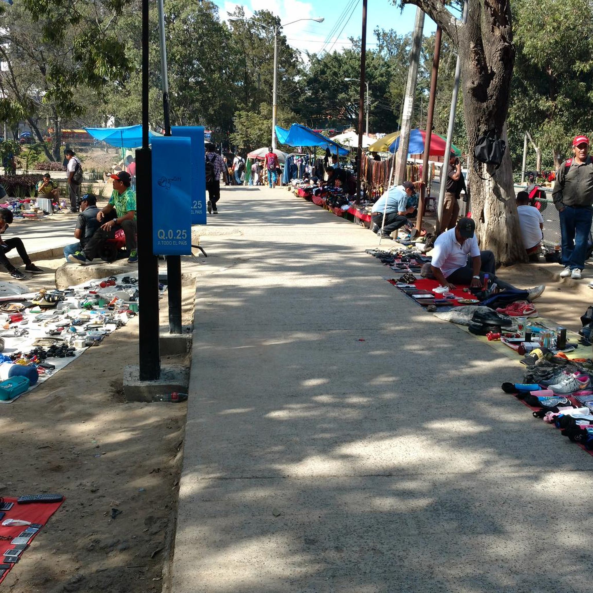
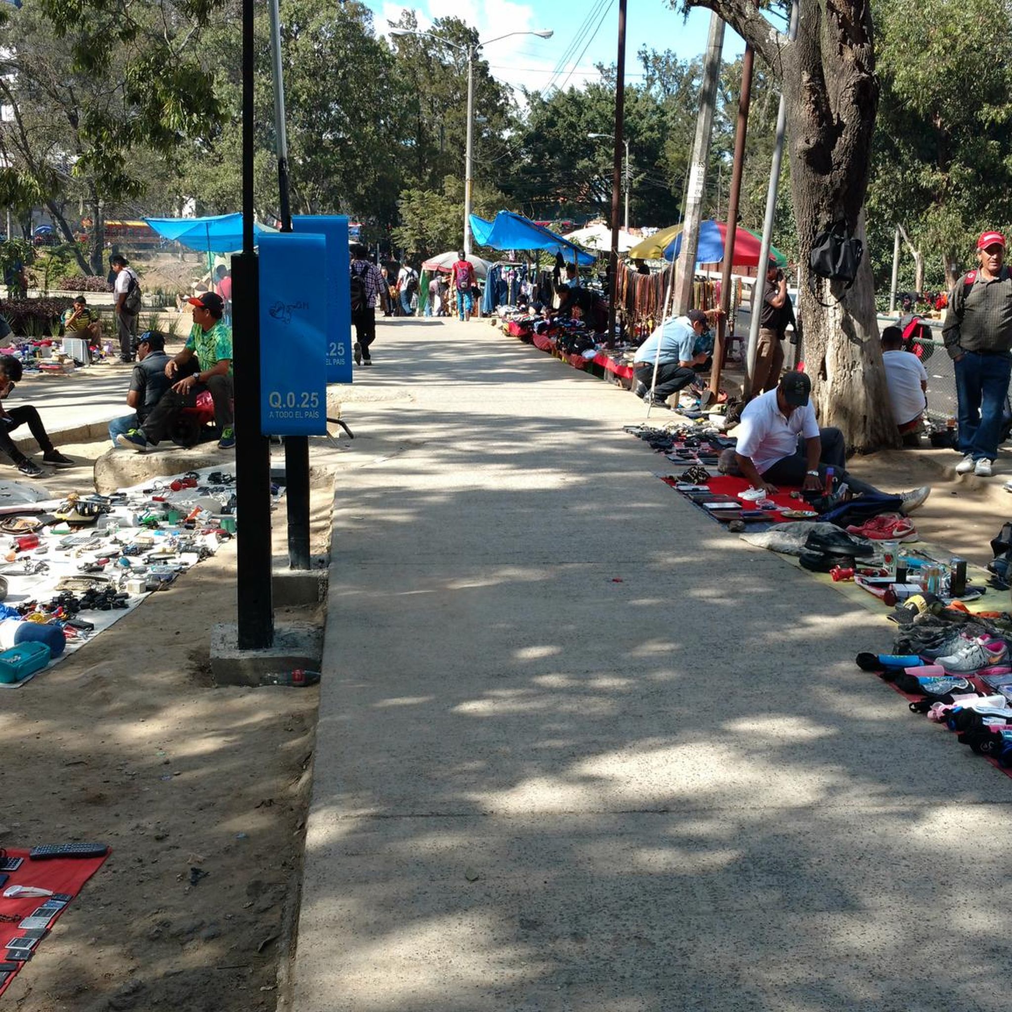
There are many shops, cafes. We found a second hand shop
1
0
Old Central Post Office building designed by Rafael Perez de Leon and Enrique Riera - passageway over 13a Calle, Guatemala City. www.istockphoto.com
0
0
Frequently Asked Questions
What kind of hiking trails can I expect in Zona 9?
Hiking in Zona 9 primarily features urban exploration routes, characterized by city monuments, green spaces, and accessible loop trails. The terrain is generally flat with minimal elevation changes, making it suitable for light exercise and cultural engagement within a city environment.
How long do hikes in Zona 9 typically take?
The hiking routes in Zona 9 vary in length and duration. You can find shorter walks, such as the Piscina Condominio Milenia loop from Oakland, which is about 1.9 miles (3.0 km) and takes around 47 minutes. Longer urban paths, like the David Vela Monument – Distrito Reforma loop from La Aurora International Airport, can be up to 5.6 miles (9.0 km) and take approximately 2 hours 19 minutes.
Are there any easy hiking trails suitable for beginners in Zona 9?
Yes, Zona 9 offers several easy hiking trails perfect for beginners. Most routes are designed for accessibility, with minimal elevation gain. An example is the David Vela Monument – Distrito Reforma loop from Zone 15, an easy 4.1-mile (6.6 km) trail connecting city landmarks and green areas.
Are the hiking trails in Zona 9 suitable for families with children?
Given their generally flat terrain, urban green spaces, and accessible loop formats, many trails in Zona 9 are well-suited for families. They offer opportunities for light exercise and exploring city sights without significant difficulty.
What are some notable landmarks or points of interest along the hiking routes in Zona 9?
Hiking routes in Zona 9 often pass by significant city landmarks. For instance, you can explore areas around the David Vela Monument and Distrito Reforma on several loops. Other routes might take you near the National Palace of Culture or through prominent avenues like 6a Avenida, Zona 1, offering a blend of urban scenery and historical context.
What is the best time of year to go hiking in Zona 9?
Guatemala City, including Zona 9, generally experiences a mild climate year-round. The dry season, from November to April, typically offers more consistent sunny weather, which is ideal for urban walks. The rainy season, from May to October, can bring afternoon showers, so it's advisable to check the forecast and plan accordingly.
Are there any challenging hikes in Zona 9 for experienced hikers?
Zona 9's hiking routes are predominantly easy, focusing on urban exploration and light exercise. There is one moderate route, the David Vela Monument – Distrito Reforma loop from La Aurora International Airport, which is 5.6 miles (9.0 km) long. However, for significantly challenging hikes with considerable elevation, you might need to explore areas outside Zona 9.
What do other hikers enjoy most about hiking in Zona 9?
The komoot community highly rates the hiking experience in Zona 9, with an average score of 5.0 stars. Hikers often praise the accessibility of the urban trails, the opportunity to combine exercise with cultural engagement, and the well-defined loop paths that make navigation straightforward.
Are there any loop trails available in Zona 9?
Yes, all the hiking routes in Zona 9 are loop trails. This design allows for convenient exploration, bringing you back to your starting point without needing to retrace your steps. Examples include the David Vela Monument – Distrito Reforma loop from Zone 8 and the National Palace of Culture – 6a Avenida, Zona 1 loop from Estadio Nacional Doroteo Guamuch Flores.
Is public transport accessible near the hiking trails in Zona 9?
As Zona 9 is an urban area within Guatemala City, public transport options are generally available and can provide access to various starting points for the hiking routes. It's advisable to check local bus routes or ride-sharing services for the most convenient access to your chosen trail.
What should I wear for hiking in Zona 9?
For urban hikes in Zona 9, comfortable walking shoes are essential. Light, breathable clothing is recommended due to the mild climate. Depending on the season, a light jacket or rain gear might be useful, especially during the rainy season (May to October).

Get inspired with the komoot mobile app


Explore more
Browse the best Hikes in other regions.
