The best cycling routes around Isporlatu/Esporlatu
11
riders
3
rides
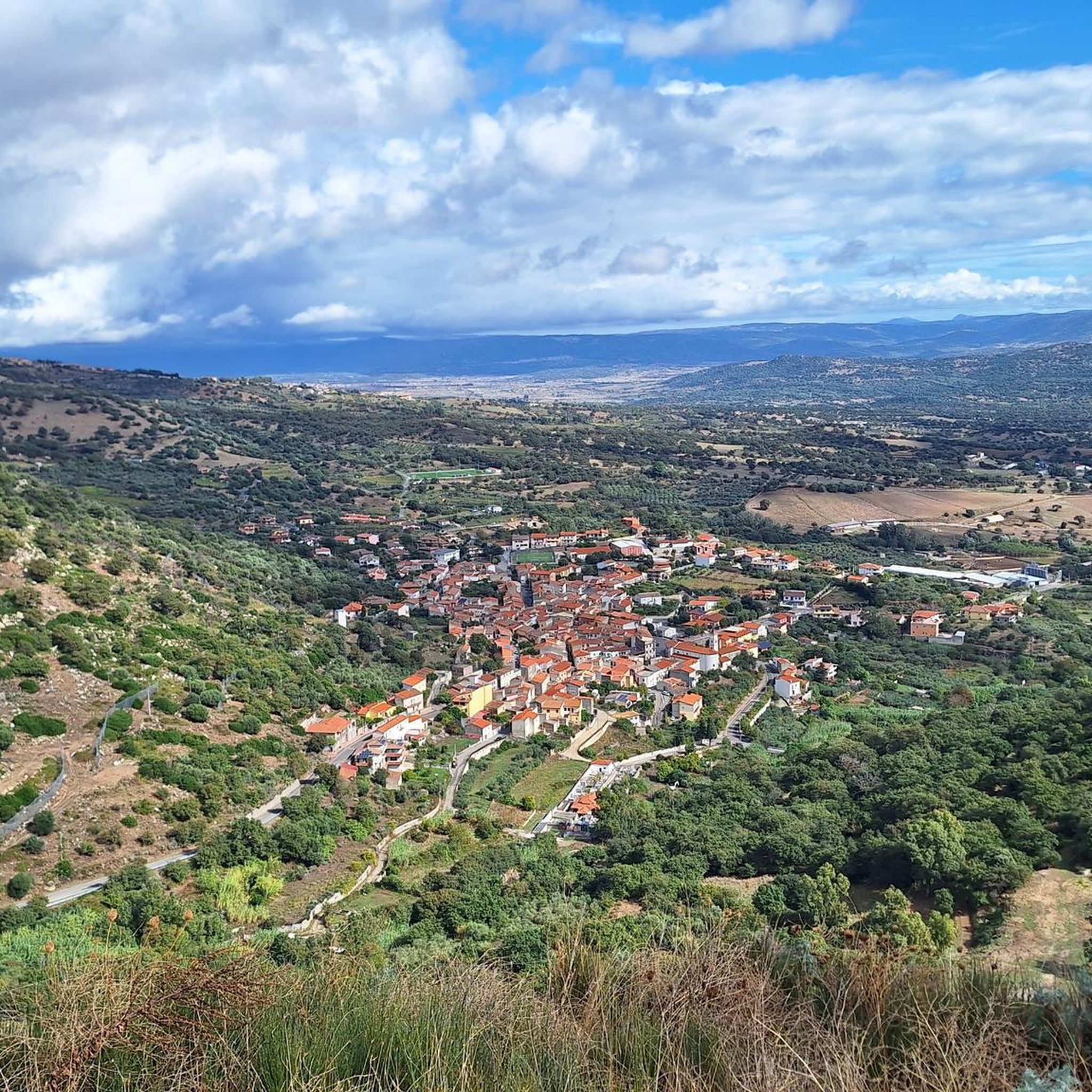
Touring cycling routes around Isporlatu/Esporlatu are situated in a valley at approximately 473 meters above sea level, characterized by significant altimetric variations. The terrain features irregular geometric profiles, with altitudes reaching up to 961 meters, indicating the presence of hills and climbs. Dense vegetation, including holm oaks, downy oaks, hollies, and maples, covers the surrounding areas, notably the Foresta di Burgos. The Rio Molinu traverses the municipal territory, contributing to the landscape.
Best touring cycling routes around Isporlatu/Esporlatu
- The most…
Last updated: May 18, 2026
1
riders
25.0km
01:55
670m
680m
Hard bike ride. Very good fitness required. Mostly paved surfaces. Suitable for all skill levels.
5
riders
26.1km
02:09
710m
710m
Hard bike ride. Very good fitness required. Mostly paved surfaces. Suitable for all skill levels.

Sign up for free
4
riders
71.4km
05:11
1,600m
1,600m
Hard bike ride. Very good fitness required. Mostly paved surfaces. Suitable for all skill levels.
1
riders
28.9km
02:12
740m
740m
Hard bike ride. Very good fitness required. Mostly paved surfaces. Suitable for all skill levels.
Our route recommendations are based on thousands of hikes, rides, and runs completed by other people on komoot.
Start today with a free account
Your next adventure awaits.
Login or Signup
Popular around Isporlatu/Esporlatu


Tips from the Community


More than the castle, which is very beautiful, the 360° panoramic view is worth the ticket price.
0
0

The Goceano castle (also called Burgos castle) is a very suggestive place. From the top of a granite cliff the castle dominates the nearby village and the valley behind it. It's worth getting up here to enjoy the view.
1
0

The climb is demanding, but the fantastic panorama manages to dampen the fatigue.
0
0


Well paved ascent with switchbacks and great views of the village of Bultei, on the horizon you can see the Gennargentu mountains and Monte Albo.
0
0

Tables and benches in the shade
0
0

I fantastic forest in the middle of Sardinia!
0
0
Frequently Asked Questions
How many touring cycling routes are available in Isporlatu/Esporlatu?
There are 4 touring cycling routes available around Isporlatu/Esporlatu on komoot. These routes are characterized by significant altimetric variations and dense forests, offering a challenging and rewarding experience for cyclists.
Are there any easy touring cycling routes suitable for beginners or families in the area?
The touring cycling routes around Isporlatu/Esporlatu are generally classified as difficult due to the significant altimetric variations and hilly terrain, with altitudes reaching up to 961 meters. There are no easy or moderate routes listed, making them more suitable for experienced touring cyclists looking for a challenge.
What kind of terrain can I expect on touring cycling routes around Isporlatu/Esporlatu?
You can expect varied and challenging terrain. The routes are situated in a valley with significant altimetric variations, featuring hills and climbs. The area is surrounded by dense vegetation, including holm oaks, downy oaks, hollies, and maples, particularly in the Foresta di Burgos. The Rio Molinu also traverses the municipal territory, adding to the natural landscape.
Are there any circular touring cycling routes available?
Yes, several routes are designed as loops. For example, you can explore the Towards the Passo S'Uccaidu and the Burgos forest - ring tour from Bono, or the longer Passo S'Uccaidu – Picnic Area with Tables loop from Anela. Another option is the Bike loop from Bolòtana/Bolotana, offering varied terrain and views.
What are some scenic viewpoints or natural features to look out for on the touring cycling routes?
The region offers several natural highlights. You might encounter the picturesque Passo S'Uccaidu and the dense Burgos forest. For specific natural features, consider visiting Punta Palai for summit views or the Riu Ilde Waterfall. The routes often traverse areas with holm oaks, downy oaks, and hollies, providing a lush green backdrop.
What historical or cultural attractions can I explore while cycling in Isporlatu/Esporlatu?
The area is rich in history. You can cycle past or near the medieval Burgos Castle, which offers panoramic views. Another significant historical site is the Pont’Ezzu Roman Bridge. The village itself has Nuragic remains, including the Erismanzanu nuraghe, and the parish church of San Gavino, built in the Middle Ages.
Are there any particularly long or challenging touring cycling routes for advanced cyclists?
Yes, for advanced cyclists seeking a significant challenge, the Goceano Forest Complex – Burgos Castle loop from Patada/Pattada is a demanding route spanning over 111 kilometers with substantial elevation gain. Another challenging option is the Passo S'Uccaidu – Picnic Area with Tables loop from Anela, which is over 71 kilometers long.
What is the best season for touring cycling in Isporlatu/Esporlatu?
While specific seasonal recommendations aren't provided, Sardinia generally offers good cycling conditions outside of the peak summer heat. Given the region's significant altimetric variations and dense forests, spring and autumn would likely provide the most comfortable temperatures and beautiful scenery for touring cycling, avoiding both extreme heat and potential winter chill at higher altitudes.
What do other touring cyclists enjoy most about cycling in Isporlatu/Esporlatu?
The komoot community appreciates the challenging nature of the routes and the varied topography. Cyclists often praise the dense forests and historical landscapes that define the touring experience around Isporlatu/Esporlatu, making it a rewarding destination for those seeking a demanding ride in a natural setting.
Are there opportunities to experience local culture or cuisine in Isporlatu/Esporlatu?
Absolutely. Esporlatu offers a chance to experience authentic Sardinian life. You can find traditional experiences like cheese-making workshops or sheep milking demonstrations. The village also celebrates its patron saint, San Gavino, with local festivals. For culinary delights, look for local specialties such as 'sa piscadura' (fava beans and lard), wild fennel sautéed in lard, and traditional pastries like 'sos papassinos'.
Can I find parking near the starting points of these cycling routes?
While specific parking locations are not detailed for each route, the routes often start from towns or villages such as Bono, Bolotana, Anela, or Pattada. It is generally advisable to look for public parking facilities within these communities when planning your ride.
How long do the touring cycling routes typically take to complete?
The duration varies significantly depending on the route's length and your cycling pace. For instance, the Towards the Passo S'Uccaidu and the Burgos forest - ring tour from Bono takes approximately 1 hour 55 minutes, while the much longer Goceano Forest Complex – Burgos Castle loop from Patada/Pattada can take around 7 hours 49 minutes.
Most popular routes around Isporlatu/Esporlatu
Most popular attractions around Isporlatu/Esporlatu

Get inspired with the komoot mobile app


Explore more
Browse the best Cycling routes in other regions.
