The best running trails around Twin Falls
102
runners
14
runs
Jogging around Twin Falls offers diverse routes set against the dramatic backdrop of the Snake River Canyon. The region is characterized by its deep canyon, impressive waterfalls, and extensive rim trails, providing varied terrain for runners. Numerous paths follow the canyon's edge, offering continuous views, while others explore parks and natural features. This landscape provides a mix of paved and natural surfaces suitable for different running preferences.
Best jogging routes around Twin Falls
- The most popular jogging route is Canyon Rim Trailhead – Morgensen Trailhead loop from Perrine Coulee Falls, a 5.0 miles (8.1 km) trail that takes about 53 minutes to complete. This moderate route offers views of the canyon and waterfalls.
- Another top favourite among local runners is Perrine Bridge - Twin Falls – Snake River - Canyon Rim Trail loop from Twin Falls Idaho Temple, a moderate 6.9 miles (11.1 km) path. This route provides expansive views of the Snake River and the iconic Perrine Bridge.
- Local runners also love the Canyon Rim Trailhead – Snake River - Canyon Rim Trail loop from Twin Falls Idaho Temple, a 3.3 miles (5.4 km) trail leading through the Snake River Canyon area, often completed in about 34 minutes.
- Jogging around Twin Falls is defined by the Snake River Canyon, impressive waterfalls, and well-maintained canyon rim trails. The network offers options for different ability levels, from easy loops to more challenging long-distance runs.
- The guide includes highly-rated routes that showcase the best of the region's landscape. More than 80 runners have used komoot to explore Twin Falls's varied terrain.
Last updated: August 5, 2026
18
runners
Moderate run. Good fitness required. Mostly paved surfaces. Suitable for all skill levels.
16
runners
The Snake River - Canyon Rim Trail – Perrine Bridge - Twin Falls loop offers a fantastic urban jogging experience, combining mostly paved paths with truly expansive views of the Snake River Canyon and the iconic Perrine Bridge. You'll feel the energy of the city while still being immersed in dramatic natural beauty. This moderate 4.4-mile (7.1 km) route involves 299 feet (91 metres) of elevation gain and typically takes around 44 minutes to complete, making it a high-reward, relatively quick workout.
This trail is easily accessible, particularly if you start from the Elevation 486 area, which provides a great initial viewpoint and convenient parking. You'll find restrooms and additional parking options conveniently located at various points along the wider Canyon Rim Trail system, including near the Twin Falls Visitor Center. It's a great option for a quick, invigorating run, especially if you're looking for a well-maintained path with stunning backdrops.
What makes this route truly stand out are the iconic landmarks you'll encounter. Not only do you get unparalleled views of the Perrine Bridge, a significant architectural wonder and a year-round BASE jumping site, but you're also jogging past the historic Evel Knievel Jump-site. The trail system is known for its accessibility and amenities, making it a popular choice for both locals and visitors to Twin Falls.

Sign up for free
8
runners
Moderate run. Good fitness required. Mostly paved surfaces. Suitable for all skill levels.
7
runners
Moderate run. Good fitness required. Mostly paved surfaces. Suitable for all skill levels.
3
runners
10.2km
01:05
50m
50m
The Running loop from Our Savior Lutheran Church is a practical choice for a local workout, offering a consistent path for your daily jog. This moderate route, spanning 6.3 miles (10.2 km) with a gentle 161 feet (49 metres) of elevation gain, provides a reliable way to get your miles in. You can expect a straightforward experience, likely on paved surfaces, making it ideal for those seeking a steady pace rather than rugged terrain.
To plan your visit, consider starting directly from the Our Savior Lutheran Church area in Twin Falls. Parking will likely be available nearby, either at the church itself or on adjacent streets. This route is accessible year-round, but for comfort, early mornings or evenings are often best to avoid the midday sun, especially during warmer months.
This loop serves as an excellent option for residents of Twin Falls looking for convenient running trails near Our Savior Lutheran Church. It's a solid choice for maintaining fitness, offering a predictable duration of about 1 hour and 4 minutes, and is suitable for beginner runners or anyone wanting a consistent, no-fuss exercise path in the area.
Get access to more routes and recommendations from other explorers.
Sign up for free
Already have an account?
Our route recommendations are based on thousands of hikes, rides, and runs completed by other people on komoot.
Start today with a free account
Your next adventure awaits.
Login or Signup
Popular around Twin Falls
Tips from the Community

The railroad bridge over the Snake River near Twin Falls was built in 1914. It was part of the Oregon Short Line Railroad and played a key role in connecting the region by rail during the early 20th century.
0
0

Fit for all ages. Dog walkers should know there is a set of metal grate steps your pooch may have trouble with.
0
0

There is a parking lot here with space for around ten cars. The trail leads you down along the Snake River, and is a perfect moderate out-and-back on dirt paths with great scenery.
1
0
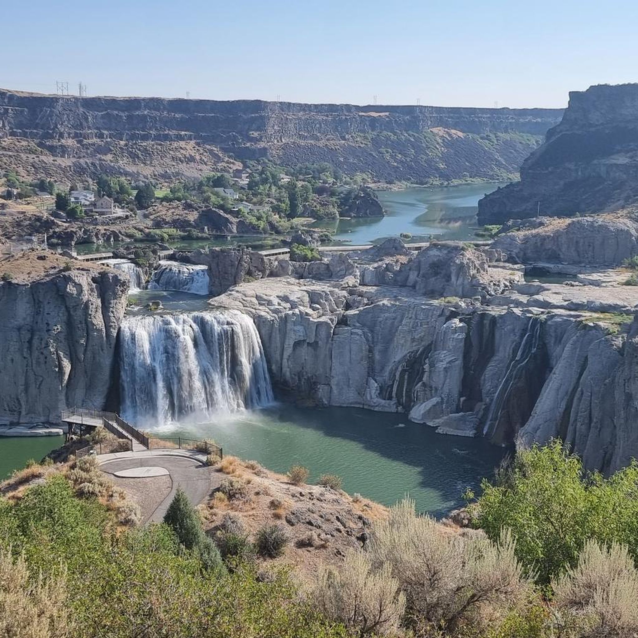
From here you can hike along the rim of the canyon to Shoshone Falls. The trail passes by Perrine Coulee Falls, the Perrine Memorial Bridge, and the spur trail into the canyon where you can hike alongside Pillar Falls.
0
0
Here you can see the ramp where Evel Knievel attempted to cross the canyon on a steam-powered rocket in 1974. The stunt failed due to a malfunctioning parachute, but Evel Knievel escaped with only a broken nose.
0
0

Excellent views from this level, smooth gravel trail with multiple overlooks into the impressive deep canyon
2
0
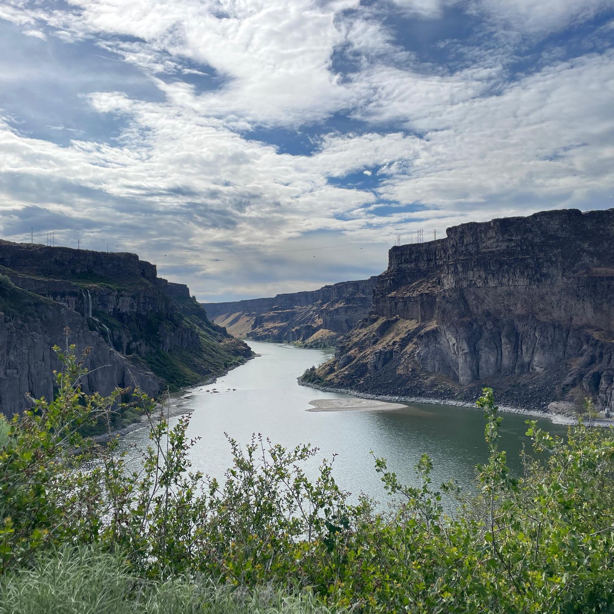
Engineering masterpiece in steel, providing stellar views up- and down-stream of the Snake River canyon far below.
2
0
Frequently Asked Questions
What types of running routes can I find in Twin Falls?
Twin Falls offers a diverse range of running routes, primarily characterized by the dramatic Snake River Canyon. You'll find extensive paved trails along the canyon rim, natural paths exploring parks like Auger Falls Heritage Park, and routes that lead to impressive waterfalls. The terrain varies from flat, accessible sections to more challenging paths with elevation changes, catering to different preferences and fitness levels.
Are there any easy or beginner-friendly jogging paths in Twin Falls?
Yes, Twin Falls has several easy running options suitable for beginners. The Canyon Rim Trailhead – Snake River - Canyon Rim Trail loop from Twin Falls Idaho Temple is a moderate 3.3-mile path that offers stunning views without significant elevation. The Snake River Canyon Rim Trail, in general, provides many accessible, paved sections perfect for a relaxed run or walk.
Can I bring my dog on the running trails in Twin Falls?
Many trails in Twin Falls are dog-friendly, provided your canine companion is kept on a leash. The popular Snake River Canyon Rim Trail is a great option for running with your dog, offering expansive views and a well-maintained surface. Always ensure to clean up after your pet to keep the trails enjoyable for everyone.
Are there any circular running routes available in the Twin Falls area?
Yes, many of the running routes in Twin Falls are designed as loops, offering varied scenery without retracing your steps. For example, the Canyon Rim Trailhead – Morgensen Trailhead loop from Perrine Coulee Falls is a moderate 5.0-mile circular route that provides excellent canyon and waterfall views.
What are some scenic viewpoints or attractions I can see while running in Twin Falls?
Twin Falls is renowned for its breathtaking natural attractions. While running, you can enjoy panoramic views of the Snake River Canyon, the iconic Perrine Bridge, and the majestic Shoshone Falls, often called the 'Niagara of the West'. You might also pass by Perrine Coulee Falls, where you can even walk behind the waterfall. The Snake River Viewpoint is another notable spot for stunning vistas.
Are there any challenging running routes for experienced runners in Twin Falls?
For experienced runners seeking a challenge, Twin Falls offers routes with longer distances and more varied terrain. The Snake River - Canyon Rim Trail – Perrine Bridge - Twin Falls loop from Eagle Hall Dormitory is a difficult 9.4-mile route that will test your endurance while providing continuous scenic rewards along the canyon rim.
Where can I find parking for the running trails in Twin Falls?
Parking is generally accessible at various points along the major running trails. For routes along the Snake River Canyon Rim Trail, you can often find parking at locations like the Twin Falls Visitor Center, Shoshone Falls Park, and Centennial Waterfront Park. Specific trailheads, such as the Morgensen Trailhead, also offer parking facilities.
What is the best time of year to go jogging in Twin Falls?
The best time to go jogging in Twin Falls is typically during the spring and fall months when the weather is mild and comfortable. Spring offers the added spectacle of Shoshone Falls at its most powerful due to snowmelt. Summer can be warm, so early morning or late evening runs are preferable. Winter running is possible, but some trails may be affected by snow or ice.
Are there any running routes that pass by the Perrine Bridge?
Absolutely! The Perrine Bridge is a central landmark for many running routes in Twin Falls. The Perrine Bridge - Twin Falls – Snake River - Canyon Rim Trail loop from Twin Falls Idaho Temple is a popular 6.9-mile route that offers expansive views of the Snake River and the iconic bridge, where you might even catch sight of BASE jumpers.
What do other runners enjoy most about jogging in Twin Falls?
Runners frequently praise the unparalleled scenic beauty of Twin Falls. The dramatic Snake River Canyon, the majestic Shoshone Falls, and the continuous canyon rim views are often highlighted. The variety of well-maintained trails, from paved paths to natural surfaces, also receives positive feedback, making it an exciting destination for outdoor enthusiasts.
Are there any running routes near Dierkes Lake?
Yes, Dierkes Lake, located near Shoshone Falls, offers a pleasant 1.7-mile loop trail. This route provides scenic views of the lake, the canyon, and the Snake River, making it an excellent spot for a refreshing run. It's a great option if you're looking for a slightly different landscape than the main canyon rim trails.
Can I find restrooms along the jogging trails in Twin Falls?
Restroom facilities are available at key access points and parks along the major jogging routes. You can typically find restrooms at locations such as the Twin Falls Visitor Center, Shoshone Falls Park, and Centennial Waterfront Park, which are common starting or stopping points for many runs along the Snake River Canyon Rim Trail.
Most popular attractions around Twin Falls

Get inspired with the komoot mobile app


Explore more
Browse the best Running Trails & Routes in other regions.
