The best gravel rides around Brouillet
4.5
(2)
13
riders
5
rides
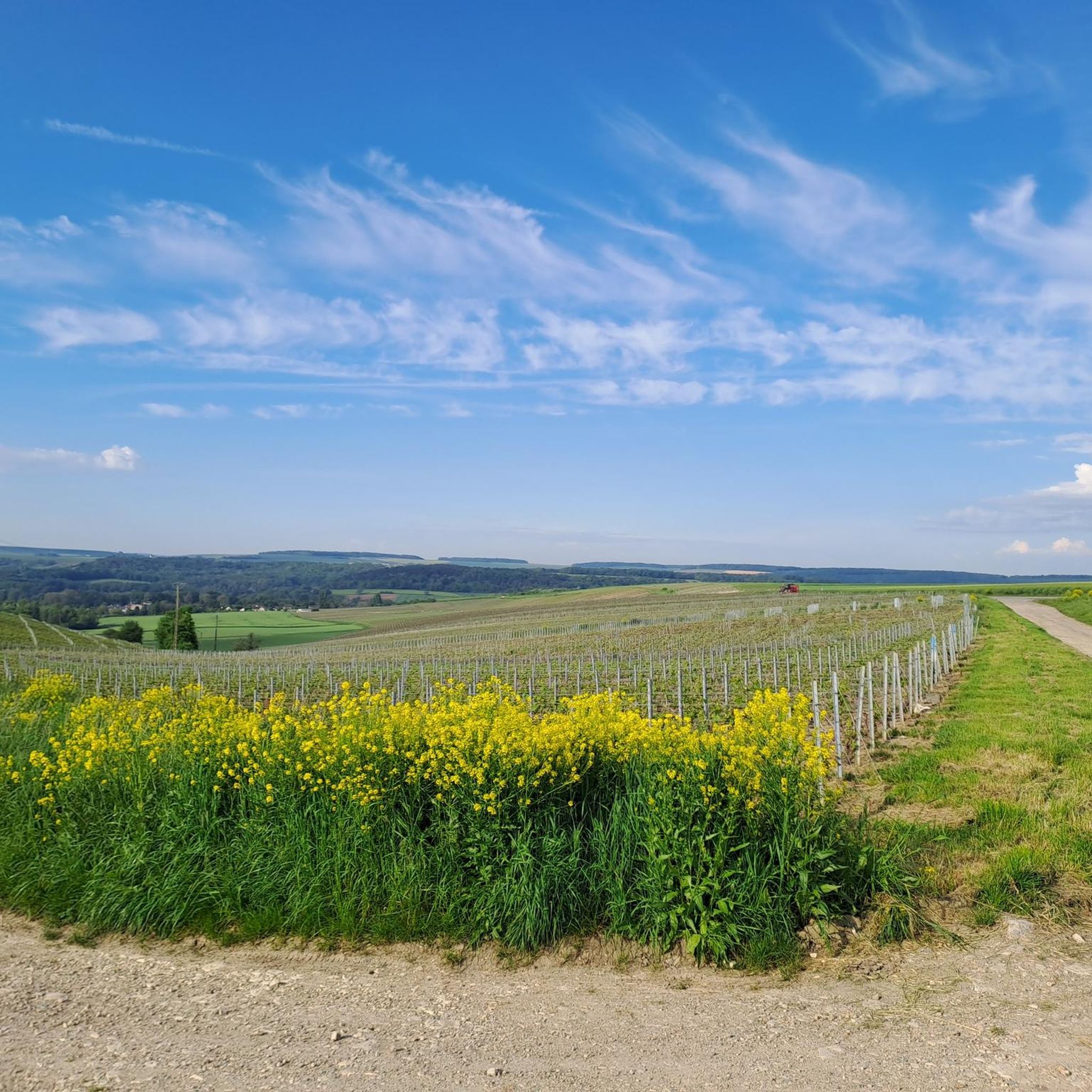
Gravel biking around Brouillet offers diverse terrain through agricultural plains, wooded environments, and scenic valleys. The region features a mix of paved roads, scenic gravel, and dirt stretches, providing an engaging experience for riders. Routes often incorporate quiet roads with minimal traffic, enhancing the serene riding experience. The landscape includes historical points of interest, such as Igny Abbey, nestled within a beautiful valley.
Best gravel bike trails around Brouillet
- The most popular gravel bike trail is Hardpacked Gravel Path –…
Last updated: August 3, 2026
5
riders
42.0km
03:10
400m
400m
Moderate gravel ride. Good fitness required. Mostly paved surfaces. Suitable for all skill levels.
5.0
(1)
1
riders
29.5km
02:09
430m
430m
Moderate gravel ride. Good fitness required. Mostly paved surfaces. Suitable for all skill levels.

Sign up for free
4.0
(1)
3
riders
61.5km
04:03
840m
840m
Hard gravel ride. Very good fitness required. Mostly paved surfaces. Suitable for all skill levels.
2
riders
47.2km
02:53
500m
500m
Hard gravel ride. Very good fitness required. Mostly paved surfaces. Suitable for all skill levels.
2
riders
55.8km
03:28
480m
480m
Hard gravel ride. Very good fitness required. Mostly paved surfaces. Suitable for all skill levels.
Our route recommendations are based on thousands of hikes, rides, and runs completed by other people on komoot.
Start today with a free account
Your next adventure awaits.
Login or Signup


Tips from the Community

Under the central arch is a calendar depicting the activities and tasks of agriculture and viticulture: grape pressing, harvesting, etc. A calendar can be seen here through the carved reliefs. Under the eastern arch, we can see a she-wolf suckling Romulus and Remus. According to legend, it was Remus who founded Reims. Finally, under the western arch, we can see Leda being seduced by Jupiter.
1
0
This ancient monument is one of the longest in the Roman world: it is approximately 32 meters long and 12 meters high! The Mars Gate was built towards the end of the 2nd century and is the only one of the four monumental arches providing access to the city of Durocortorum that has survived. It consists of three arcades. The central arch carried the city's major north-south axis, intended for the passage of carriages. The two side arcades were used by pedestrians.
1
0

This cemetery steeped in history is worth the detour
0
0

The monument survived destruction because it was walled up inside the Archbishop's castle in the 13th century, which inadvertently preserved it for future generations.
3
1
The Porte de Mars is a 3rd-century Roman monument in Reims, France, representing the widest arch in the entire Roman world at 33 meters long and 13 meters high. Originally built as one of four monumental arches at the cardinal entrances to ancient Durocortorum, it's the only surviving example of these grand structures. The arch features three decorated archways with intricate relief carvings, including scenes of Romulus and Remus with the she-wolf, agricultural calendars showing Gallic harvesters, and mythological figures like Leda and Zeus.
3
1
From its inauguration, residents criticized the fountain's weak water flow of only 12 liters per second, and the nude naiads representing the rivers caused public controversy. During World War II, German occupiers removed the bronze statue, but remarkably the fountain remained intact despite 60% of Reims being destroyed during the war.
4
3
The Subé Fountain stands in Place Drouet-d'Erlon in central Reims, funded by local benefactor Auguste Subé's donation of 200000 gold francs and inaugurated on July 15, 1906. The 17-meter tall column, made from Corgoloin and Chassignelles stone and decorated with vine motifs, represents the city of Reims and local industries including commerce, viticulture, industry, and agriculture. At its base, four naiads symbolize the rivers Suippe, Marne, Vesle, and Aisne that flow through the Marne department, while a golden Victory statue crowns the top.
4
2

This is a unique town hall, and one that's right in the city center. An impressive building, built in 1927.
0
0
Frequently Asked Questions
How many gravel bike trails are available in Brouillet?
There are at least 6 gravel bike trails around Brouillet documented on komoot, offering a variety of experiences for different skill levels.
What is the typical terrain like for gravel biking around Brouillet?
Gravel biking around Brouillet features diverse terrain, including agricultural plains, extensive wooded environments, and scenic valleys. You can expect a mix of paved roads, scenic gravel, and dirt stretches, often on quiet roads with minimal traffic.
What is the best time of year for gravel biking in Brouillet?
The region's varied terrain, including agricultural plains and wooded areas, suggests that spring and autumn would be ideal for gravel biking, offering pleasant temperatures and beautiful scenery. Summer can also be enjoyable, especially in wooded sections, while winter conditions might require checking local weather and trail status.
Are there any family-friendly gravel biking options in Brouillet?
While specific 'family-friendly' designations are not provided, many routes traverse quiet roads and less technical terrain. For a moderate ride through varied landscapes including fields and creeks, consider The Poor People's Hut – Pévy Horse Wash loop from Savigny-sur-Ardres, which is 18.3 miles (29.5 km) long.
What historical sites or landmarks can I see while gravel biking in Brouillet?
Several routes pass by historical points of interest. For example, the Igny Abbey – Parc des Bruyères loop from Vandeuil leads directly past Igny Abbey, a Cistercian monastery from 1127. You might also encounter The Lagery Market Hall, an impressive half-timbered building from 1543, in the broader region.
Are there any longer, more challenging gravel routes for experienced riders?
Yes, for experienced riders seeking a challenge, there are several difficult routes. The Hermonville – Saint-Hilaire Church loop from Jonchery-sur-Vesle is a demanding 46.5 miles (74.8 km) trail with significant elevation gain, offering a robust experience.
Are there any circular gravel bike routes in Brouillet?
All the gravel bike routes listed for Brouillet on komoot are designed as loops, allowing you to start and finish at the same point. This includes popular options like the Hardpacked Gravel Path – De Perles a Fismes loop from Faverolles-et-Coëmy.
What is the difficulty level of gravel bike trails in Brouillet?
The gravel bike trails in Brouillet cater to various ability levels. Out of the 6 available routes, 3 are rated as moderate and 3 are considered difficult, providing options for both intermediate and advanced riders.
Are there places to eat or drink along the gravel bike trails in Brouillet?
While specific cafes or pubs directly on the trails are not detailed, the region includes farming communities and small towns. It's advisable to carry sufficient water and snacks, and plan your route to pass through villages where you might find local establishments for refreshments.
Is there parking available for gravel bikers in Brouillet?
Information on specific parking areas for gravel bike trails in Brouillet is not explicitly provided. However, starting points for many routes are often in or near villages, where public parking might be available. It's recommended to check the starting location of your chosen route for local parking options.
What do other gravel bikers enjoy most about gravel biking in Brouillet?
The gravel biking routes in Brouillet are highly rated by the komoot community, with an average score of 5.0 stars. Riders often praise the diverse terrain, which includes agricultural plains and wooded environments, and the serene experience offered by quiet roads with minimal traffic.
Are there any routes that offer scenic viewpoints or natural features?
Yes, the region around Brouillet is known for its beautiful valleys and varied landscapes. Routes like the Saint-Hilaire Church – Subé fountain loop from Jonchery-sur-Vesle, which is 34.5 miles (55.5 km) long, will take you through picturesque areas with opportunities for scenic views.
Most popular attractions around Brouillet

Get inspired with the komoot mobile app


Explore more
Browse the best Gravel rides in other regions.
