The best gravel rides around Fortios
13
riders
8
rides
Gravel biking around Fortios is centered on the region's natural landscapes, particularly near the Parque Natural da Serra de São Mamede. This area is characterized by rolling hills, natural woodlands, and a network of rural roads and tracks. The terrain offers varied gradients, connecting historic towns such as Portalegre and Castelo de Vide. Riders can expect ascents and descents through a predominantly natural environment.
Best gravel bike trails around Fortios
- The most popular gravel bike trail is Loop tour from…
Last updated: October 28, 2026
3
riders
73.2km
06:34
1,600m
1,600m
Hard gravel ride. Very good fitness required. Mostly paved surfaces.
96.1km
08:37
1,690m
1,690m
Hard gravel ride. Very good fitness required. Mostly paved surfaces.

27.2km
02:03
380m
380m
Moderate gravel ride. Good fitness required. Mostly paved surfaces.
72.4km
07:07
1,860m
1,860m
Hard gravel ride. Very good fitness required. You may need to push your bike for some segments of this route.
6
riders
78.0km
06:00
1,380m
1,380m
Hard gravel ride. Very good fitness required. Mostly paved surfaces.
Get access to more routes and recommendations from other explorers.
Already have an account?
Our route recommendations are based on thousands of hikes, rides, and runs completed by other people on komoot.
Start today with a free account
Your next adventure awaits.
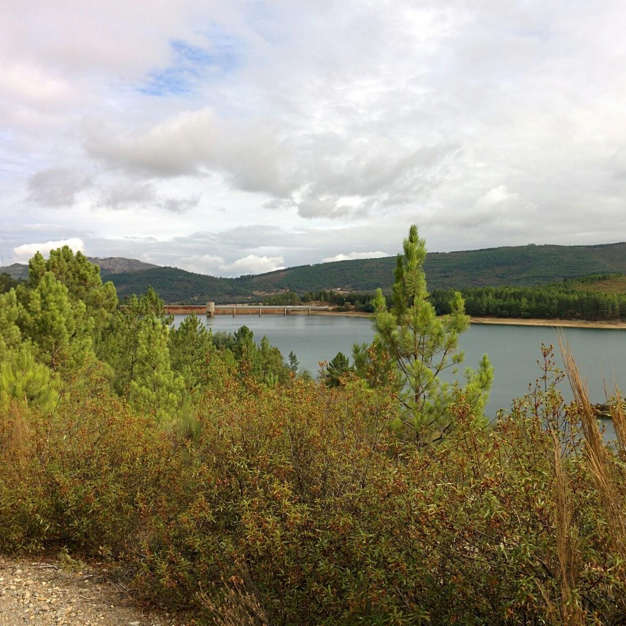
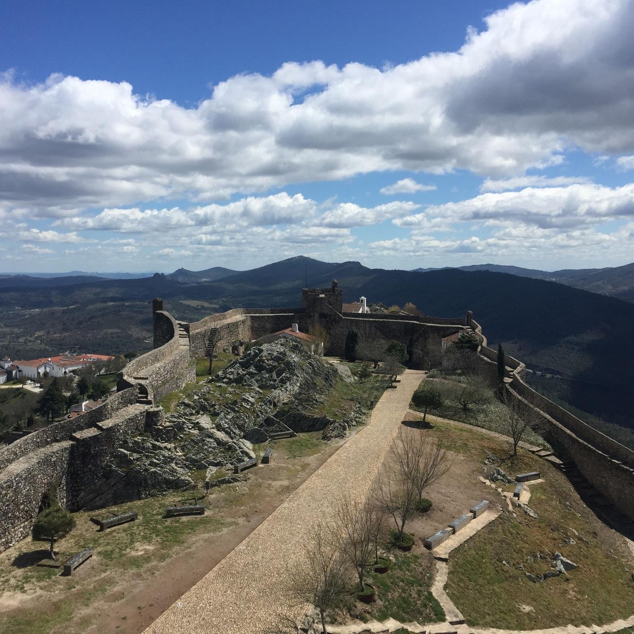

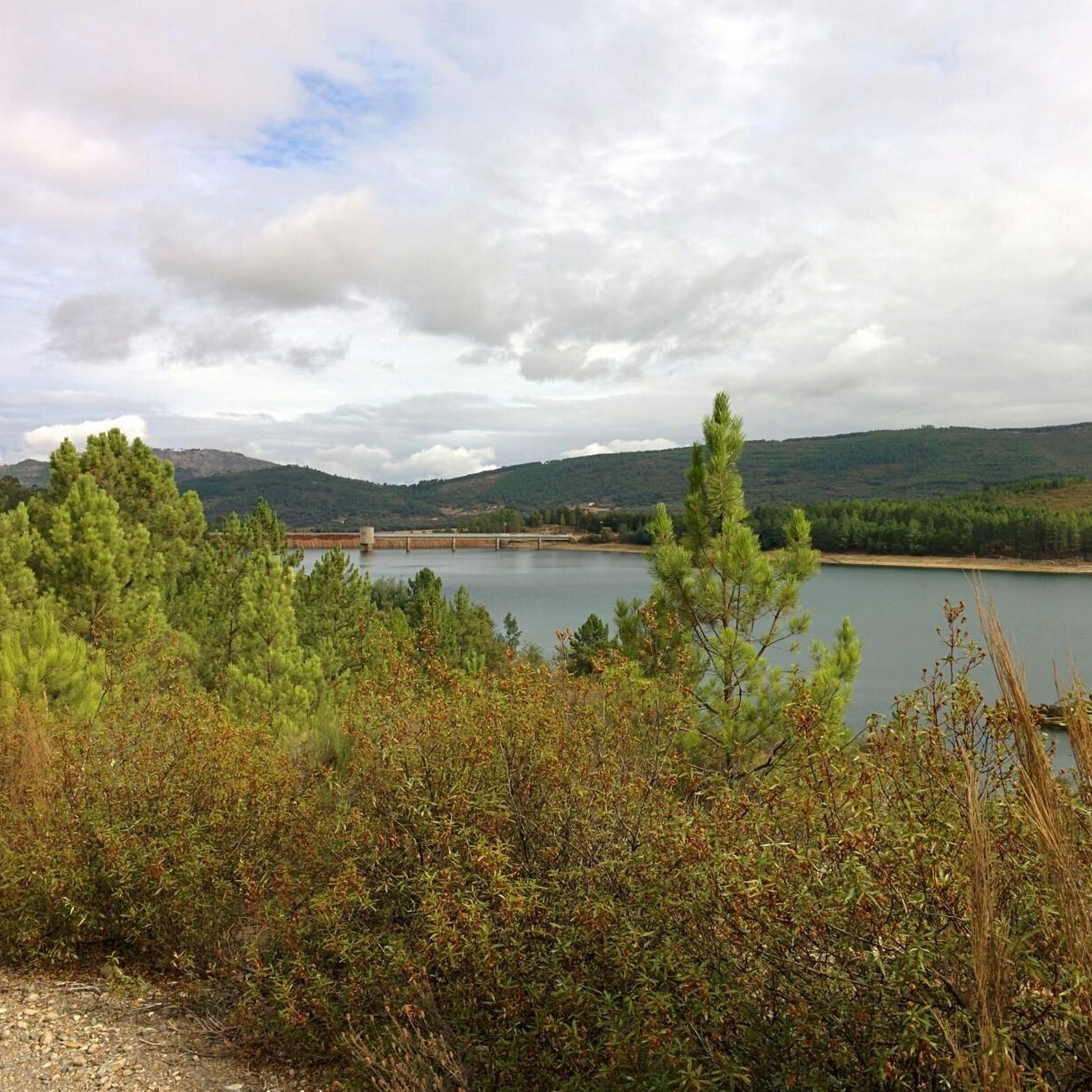

Tips from the Community

The Castelo de Portalegre is an important medieval fortress located at the highest point of the historic center of Portalegre, in the Alentejo region of Portugal. Originally built in the second half of the 13th century during the reign of Dom Afonso III and later rebuilt and expanded by King D. Dinis around 1290, the castle played a fundamental strategic role for centuries in the defense of the border with Castile
0
0
Marvão Castle and its fortified town are located on top of a rocky spur in the Serra de São Mamede (Serra do Sapoio), in the Alto Alentejo region of Portugal, at an altitude of about 843 meters. Nicknamed the "Eagle's Nest", the town offers a panoramic view as far as the eye can see, stretching to neighboring Spain
0
0

Located at the highest point of the historic center of Portalegre, enjoying strategic views over the city and the surrounding landscape, which so well characterizes the Alto-Alentejo region. Medieval castle, built during the reign of D. Dinis, around 1290. In this fortification, related to the defense of the Alto-Alentejo border, the Keep (Torre de Menagem) stands out, with interior floors covered by vaults and a regular quadrangular plan, well integrated into the characteristic wall of military Gothic architecture. There are still three towers, out of the twelve it initially had, one of which is the North Tower (Torre Norte) which, due to its height, currently constitutes the true scenic symbol of the city's medieval past. The castle has already undergone restoration work, and has also been intervened to house a museum inside, the Keep Museum Nucleus (Núcleo Museológico da Torre de Menagem), which is currently in operation.
3
0
Castelo de Vide is a charming Portuguese medieval village located in the district of Portalegre, in the Alentejo region, perched on the hills of the Serra de São Mamede Natural Park. Nicknamed the "Sintra of Alentejo" for its flowery alleys and lush landscapes, this town is famous for its healing thermal waters, its intact Gothic architecture, and one of the most important historical Jewish communities in the country.
0
0

For those planning to hike in the Alegrete area, the main reference route is the PR3 PTG – Percurso de Alegrete. This circular route offers a complete immersion in the Serra de São Mamede Natural Park, combining the medieval heritage of the village with montado landscapes and water lines. The Main Route (PR3 PTG) The PR3 PTG - Percurso de Alegrete is about 11.4 km long and is classified as medium/low difficulty. The recommended starting and ending point is near Fonte Nova, although many hikers start their journey in the village of Alegrete itself to explore the historic center right away. Castle and Village: The Castle of Alegrete is the (literal) highlight of the hike. Situated at about 500 meters above sea level, it offers a panoramic view of the Alentejo border region. Don't miss the Clock Tower (Torre do Relógio). Nature and Biodiversity: The trail crosses areas of cork oak montado, pine forests, and riparian areas. It is an excellent place for bird watching (such as the robin or the titmouse) and, near the water lines, you can find rare vegetation like the royal fern. Religious Heritage: During your passage through the village, you can also visit the small Chapel of Mercy (Capela da Misericórdia), which is part of the local historical complex. Practical Hiking Tips Time of Year: Avoid the months of July and August due to the extreme temperatures in the Alentejo. Autumn and spring are ideal for the colors of the vegetation and mild temperatures. In winter, be careful with the ground, which can become quite slippery on cobblestones and rocky trails. Equipment: Use footwear with good grip (the ascents and descents to the castle and river have sections of loose stones). Bring enough water, as outside the village, refueling points are scarce. Safety and Respect: Always follow the official signage (yellow and red marks).
0
0

Far in the northeast of Alentejo lies Castelo de Vide, just a few kilometers from the border with Spain. The town is often called Cidade branca (white city), which is primarily due to the pretty whitewashed houses of the town. The highlight of the town (besides its great location in the Parque Natural da Serra de São Mamede) is the 14th-century Castelo de São Roque. From the castle, you have a fantastic view of the old town. Other sights in Castelo de Vide include the old Jewish quarter with the oldest synagogue in Portugal and the numerous churches and chapels of the town.
3
0
Imposing building in which the Centro de Dia senior center is located
2
0

Beirã is a small, quiet town surrounded by rolling countryside, with cork oak forests, olive groves and a rural, peaceful atmosphere typical of the Alto Alentejo. This village is often associated with its historic train station, once an important hub on the line between Lisbon and Madrid, which still retains some of its old-world charm. Beirã is an ideal base for exploring the surrounding nature and the area's rich historical sites, such as the nearby, well-preserved medieval village of Marvão, perched on a hill, or the Roman city of Ammaia.
1
0
Frequently Asked Questions
What kind of terrain can I expect on gravel bike trails around Fortios?
Gravel biking around Fortios primarily features rolling hills, natural woodlands, and a network of rural roads and tracks. You'll encounter varied gradients, with ascents and descents through a predominantly natural environment, especially within the Parque Natural da Serra de São Mamede.
Are there gravel bike trails suitable for beginners in Fortios?
While many routes in the Fortios area are rated as difficult, there are also moderate options available. For example, the Portalegre and Reguengo Loop is a moderate 27.2 km trail that offers a good introduction to the region's varied rural landscapes without the extreme challenges of the longer routes.
What are some of the longer, more challenging gravel routes in the Fortios region?
For experienced riders seeking a challenge, the region offers several difficult, extensive loops. The Gravel loop from Castelo de Vide spans 96.1 km with significant climbs, while the Loop tour from Portalegre – Parque Natural da Serra de São Mamede covers 73.2 km, exploring diverse park landscapes.
Are there any circular gravel bike routes around Fortios?
Yes, many of the gravel bike routes in the Fortios area are designed as loops, allowing you to start and finish in the same location. Examples include the Loop tour from Portalegre – Parque Natural da Serra de São Mamede, the Gravel loop from Castelo de Vide, and the Serra de São Mamede Natural Park Loop.
What historical sites or natural monuments can I see while gravel biking near Fortios?
The region is rich in historical and natural attractions. You can encounter landmarks like the impressive Marvão Castle, the charming Historic Village of Marvão, or the ancient Nisa/Lage da Prata Plateau and Ancient Stone Structures. Natural features include the Alto de São Mamede Summit (1,025 m) and the scenic Vale Lourenço gorge.
Are there any routes that pass through towns or villages where I can stop for refreshments?
Yes, many routes connect historic towns like Portalegre and Castelo de Vide. For instance, the Castelo de Vide – Beirã Train Station loop from Castelo de Vide starts and ends in Castelo de Vide, offering opportunities to explore the town and find places for refreshments or meals.
What is the best time of year for gravel biking in Fortios?
Given the region's natural landscapes and varied gradients, spring and autumn generally offer the most pleasant conditions for gravel biking in Fortios, with milder temperatures and lush scenery. Summers can be hot, while winters might bring cooler, wetter weather, impacting trail conditions.
How many gravel bike trails are available in the Fortios area?
There are 6 gravel bike trails detailed for the Fortios area, offering a range of distances and difficulties to explore the region's natural beauty and rural landscapes.
What are the typical trail conditions for gravel biking around Fortios?
The trails primarily consist of rural roads and tracks, which can vary from well-maintained gravel to rougher, unpaved sections. Conditions can change with weather, so it's advisable to check local forecasts, especially after rain, as some sections might become muddy or slippery.
Can I access the gravel bike trails in Fortios using public transport?
While specific public transport links directly to trailheads might be limited, some routes, like the Castelo de Vide – Beirã Train Station loop, connect to train stations, potentially offering access points for those relying on public transport. It's recommended to research local bus or train services to towns like Portalegre or Castelo de Vide for the most up-to-date information.
Are there any family-friendly gravel biking options in Fortios?
While many routes are rated moderate to difficult, families with older children or those comfortable with longer distances might find the moderate Portalegre and Reguengo Loop suitable. It's a 27.2 km trail through varied rural landscapes, offering a less strenuous experience compared to the longer, more challenging loops.
Most popular attractions around Fortios

Get inspired with the komoot mobile app


Explore more
Browse the best Gravel rides in other regions.
