The best walks and hikes around Area C (Blind Bay/Sorrento)
4.8
(22)
155
hikers
16
hikes
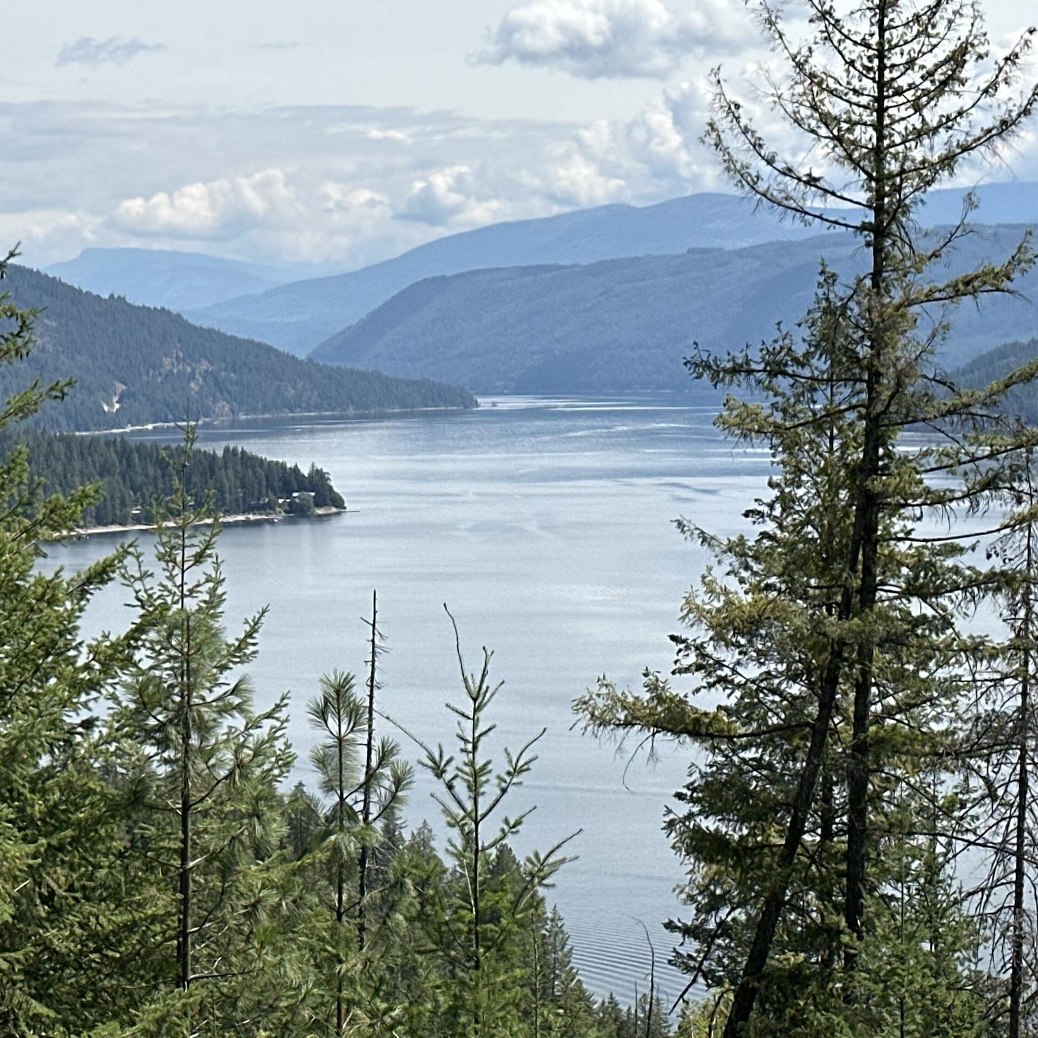
Hiking around Area C (Blind Bay/Sorrento) offers diverse landscapes on the southern shore of Shuswap Lake, characterized by forests, hills, and lake views. The region features a variety of trails, from easy walks to more challenging routes, catering to different fitness levels. Natural features include Shuswap Lake, various lookout points, and rivers. The terrain encompasses forested paths, some with moderate elevation changes, and trails leading to waterfalls.
Best hiking trails around Area C (Blind Bay/Sorrento)
- The most popular hiking route is Margaret Falls loop — Herald Provincial Park, a 3.2 miles (5.2 km) trail that takes 1 hour 41 minutes to complete. This easy route leads to the 90-foot Margaret Falls and offers views of Heralds Bay.
- Another top favourite among local hikers is Blind Bay Lookout loop from Loftus Lake, a moderate 7.1 miles (11.5 km) path. This trail provides extensive views west over Blind Bay, Shuswap Lake, and Copper Island.
- Local hikers also love the White Lake Lookout Trail, a 1.4 miles (2.3 km) trail leading through forested terrain, often completed in about 51 minutes. This easy route offers panoramic 360-degree views of White Lake and surrounding valleys.
- Hiking around Area C (Blind Bay/Sorrento) is defined by lake views, forested paths, and hills, with options for both easy family-friendly walks and more challenging routes. The network offers trails suitable for various ability levels.
- The routes in Area C (Blind Bay/Sorrento) are highly rated by the komoot community with an average score of 4.8 stars from more than 10 reviews. More than 60 hikers have used komoot to explore Area C (Blind Bay/Sorrento)'s varied terrain.
Last updated: August 10, 2026
4.9
(8)
44
hikers
5.18km
01:42
230m
220m
Easy hike. Great for any fitness level. Easily-accessible paths. Suitable for all skill levels.
11
hikers
3.65km
01:04
100m
100m
Easy hike. Great for any fitness level. Easily-accessible paths. Suitable for all skill levels.

Sign up for free
5.0
(1)
10
hikers
6.62km
02:11
300m
300m
Moderate hike. Good fitness required. Easily-accessible paths. Suitable for all skill levels.
5.0
(2)
6
hikers
926m
00:20
60m
60m
Easy hike. Great for any fitness level. Easily-accessible paths. Suitable for all skill levels.
4.0
(1)
1
hikers
2.34km
00:36
10m
10m
Easy hike. Great for any fitness level. Easily-accessible paths. Suitable for all skill levels.
Get access to more routes and recommendations from other explorers.
Sign up for free
Already have an account?
Our route recommendations are based on thousands of hikes, rides, and runs completed by other people on komoot.
Start today with a free account
Your next adventure awaits.
Login or Signup
Popular around Area C (Blind Bay/Sorrento)
Tips from the Community

The climb to Mount Baldy Lookout is rewarded with sweeping views across Shuswap Lake, Copper Island, and the surrounding forested hills. At 1,155 m (3,789 ft), it's one of the area's best viewpoints. However this trail to the summit was damaged by the 2023 wildfires and is currently closed. Repairs began in summer 2024 and are expected to continue until summer 2026.
0
0

A wonderful relatively easy hike, that's just one option amongst the extensive trail network through this forest. Keep an eye out for mountain bikers as these are multi-use trails.
0
0

Reinecker Creek tumbles through a narrow forested canyon on its way to Margaret Falls, carving through the rock that gives this trail its dramatic scenery. The creek flows year-round, with spring snowmelt and periods of heavy rain creating particularly impressive cascades and fast-moving water. Moss-covered boulders, cedar trees, and the constant sound of rushing water make the creek a defining feature of the Margaret Falls Trail.
0
0
This short forest trail follows Reinecker Creek through a lush canyon of moss-covered rock walls and towering cedars. Wooden bridges and boardwalks help navigate the damp terrain, while the sound of rushing water accompanies much of the walk. The route's most distinctive feature is a natural rock passage near the end of the trail, just before reaching Margaret Falls.
0
0

From a viewing platform at the end of the trail, you can take in the majesty of the 90-foot, two-step Margaret Falls.
0
0
You can see a portion of the Salmon Arm of Shuswap Lake from this spot in the trees along the trail.
0
0
This spot along the trail is where Reinecker Creek flows into Heralds Bay. You're treated to sweeping views of the bay and the end of the waterway that feeds the flow of Margaret Falls.
0
0

The small bridge over the river invites you to take a breather and cool off.
0
0
Frequently Asked Questions
How many hiking trails are available in Area C (Blind Bay/Sorrento)?
There are 8 hiking trails available in Area C (Blind Bay/Sorrento), offering a mix of easy and moderate options suitable for various fitness levels.
Are there any family-friendly hiking trails in Area C (Blind Bay/Sorrento)?
Yes, several trails are suitable for families. The Margaret Falls loop — Herald Provincial Park is an easy 5.2 km route leading to the impressive 90-foot Margaret Falls. Another great option is the Story Trail, which is a gentle walk, and the Sorrento/Blind Bay Park Loop is also known for being easy and suitable for all ages.
Which trails offer the best views of Shuswap Lake and the surrounding area?
For extensive views, consider the Blind Bay Lookout loop from Loftus Lake, which provides sweeping vistas west over Blind Bay, Shuswap Lake, and Copper Island. The White Lake Lookout Trail also offers panoramic 360-degree views of White Lake and the surrounding valleys.
Are there any hiking trails with waterfalls in Area C (Blind Bay/Sorrento)?
Absolutely. The Margaret Falls loop — Herald Provincial Park leads directly to the majestic 90-foot Margaret Falls, a prominent natural feature in the region. You can also find Syphon Falls nearby.
What kind of terrain can I expect on the hiking trails in this region?
The terrain in Area C (Blind Bay/Sorrento) is diverse, featuring forested paths, some with moderate elevation changes, and trails leading to lake views and waterfalls. You'll encounter a mix of gentle walks and more challenging routes with rocky switchbacks, particularly on trails like the Blind Bay Bluffs.
Are there any circular hiking routes in Area C (Blind Bay/Sorrento)?
Yes, several trails are designed as loops. The Margaret Falls loop — Herald Provincial Park is a popular circular route. Another option is the Blind Bay Lookout loop from Loftus Lake, which offers a longer, moderate circular experience.
What do other hikers enjoy most about hiking in Area C (Blind Bay/Sorrento)?
The trails in Area C (Blind Bay/Sorrento) are highly rated by the komoot community, with an average score of 4.8 stars from over 10 reviews. Hikers frequently praise the stunning lake views, diverse forested paths, and the variety of options for different skill levels, from easy walks to more challenging ascents.
Are there any specific landmarks or attractions to look out for while hiking?
Beyond the trails themselves, you can explore several natural attractions. Don't miss Margaret Falls and Syphon Falls. For panoramic vistas, the White Lake Lookout is a must-see. The region also features the iconic Copper Island, visible from many viewpoints, and the Story Trail itself is a unique attraction.
Is there parking available at the trailheads in Area C (Blind Bay/Sorrento)?
Most popular trailheads in the Area C (Blind Bay/Sorrento) region, including those for Herald Provincial Park and the Blind Bay Bluffs, typically offer designated parking areas. It's always advisable to check specific trail information for details on parking availability and any potential fees.
What is the best time of year to go hiking in Area C (Blind Bay/Sorrento)?
The region is beautiful year-round, but spring, summer, and fall offer the most ideal hiking conditions. Spring brings lush greenery and flowing waterfalls, summer provides warm weather for lake views, and fall showcases vibrant foliage. Some trails, like the Highlands Homestead Loop, are accessible year-round, but winter hiking may require appropriate gear for snow and ice.
Are dogs allowed on the hiking trails in Area C (Blind Bay/Sorrento)?
Many trails in the Area C (Blind Bay/Sorrento) region are dog-friendly, but regulations can vary by park or specific trail. It's generally recommended to keep dogs on a leash and to check local signage or park websites for the most current rules regarding pets before heading out.
Are there any easy, short hikes for a quick outdoor experience?
Yes, if you're looking for a quick and easy walk, the Story Trail is a short and gentle option. The White Lake Lookout Trail is also relatively short at 2.3 km, offering a rewarding view for a modest effort.
Most popular routes around Area C (Blind Bay/Sorrento)
Most popular attractions around Area C (Blind Bay/Sorrento)

Get inspired with the komoot mobile app


Explore more
Browse the best Hikes in other regions.
