The best running trails around Líjar
3.0
(1)
203
runners
32
runs
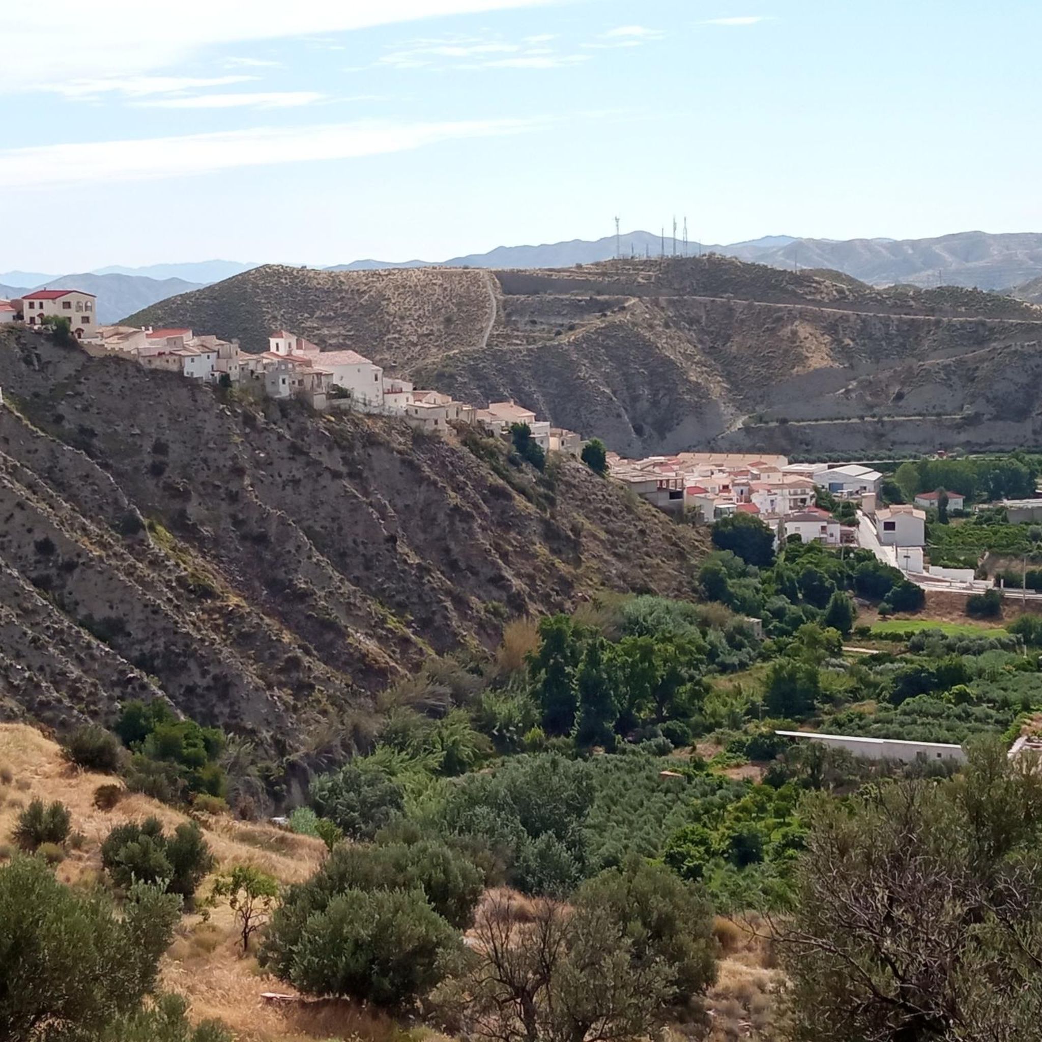
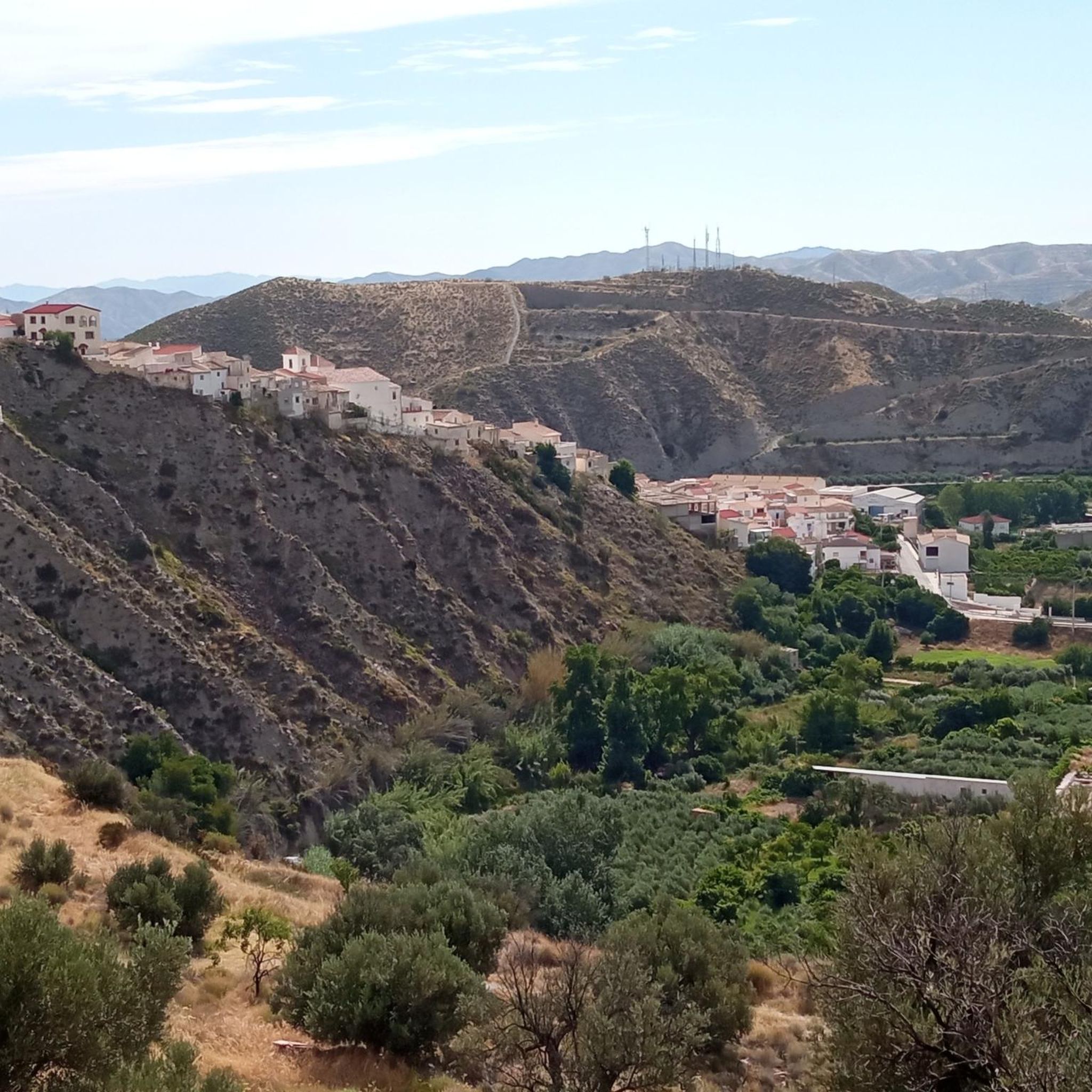
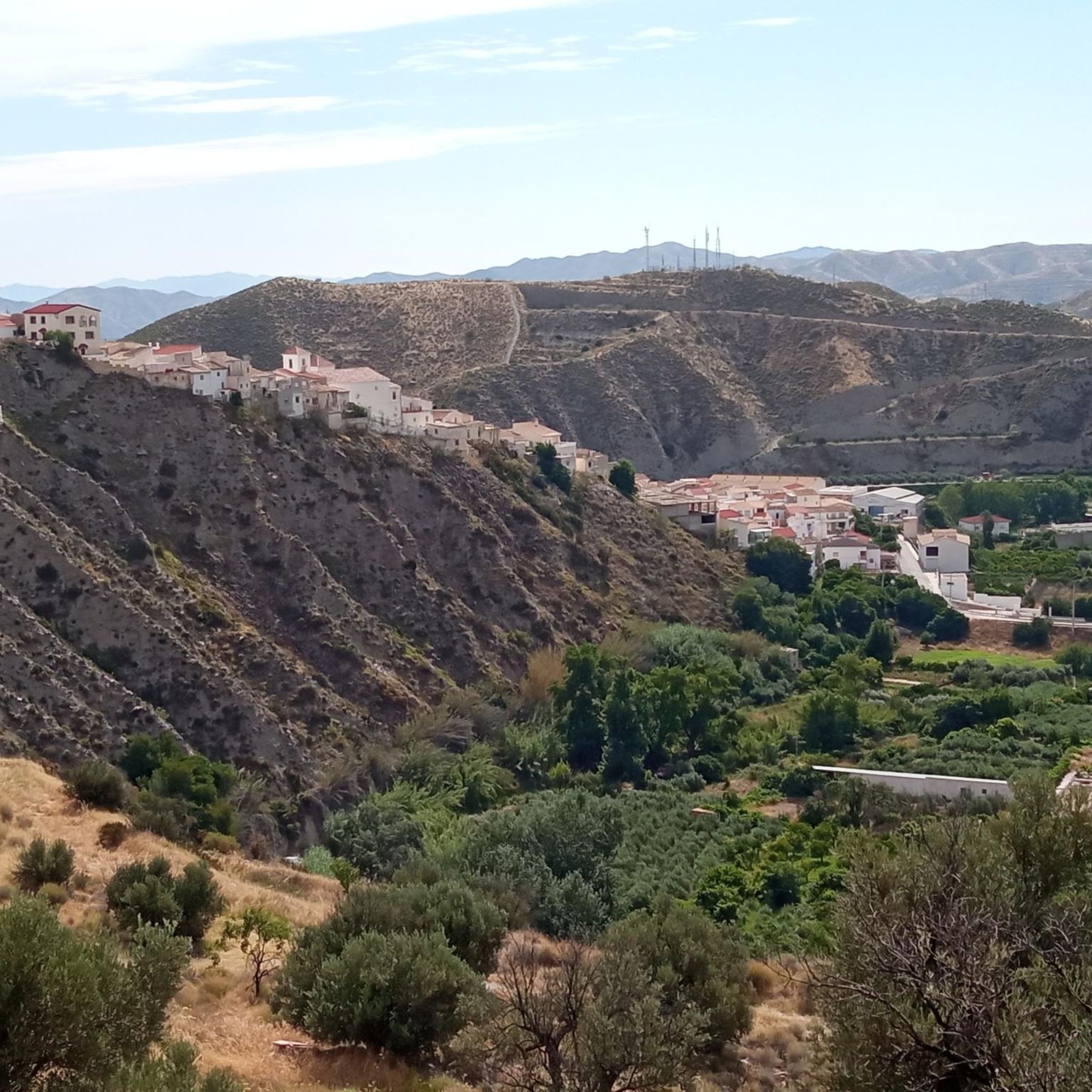
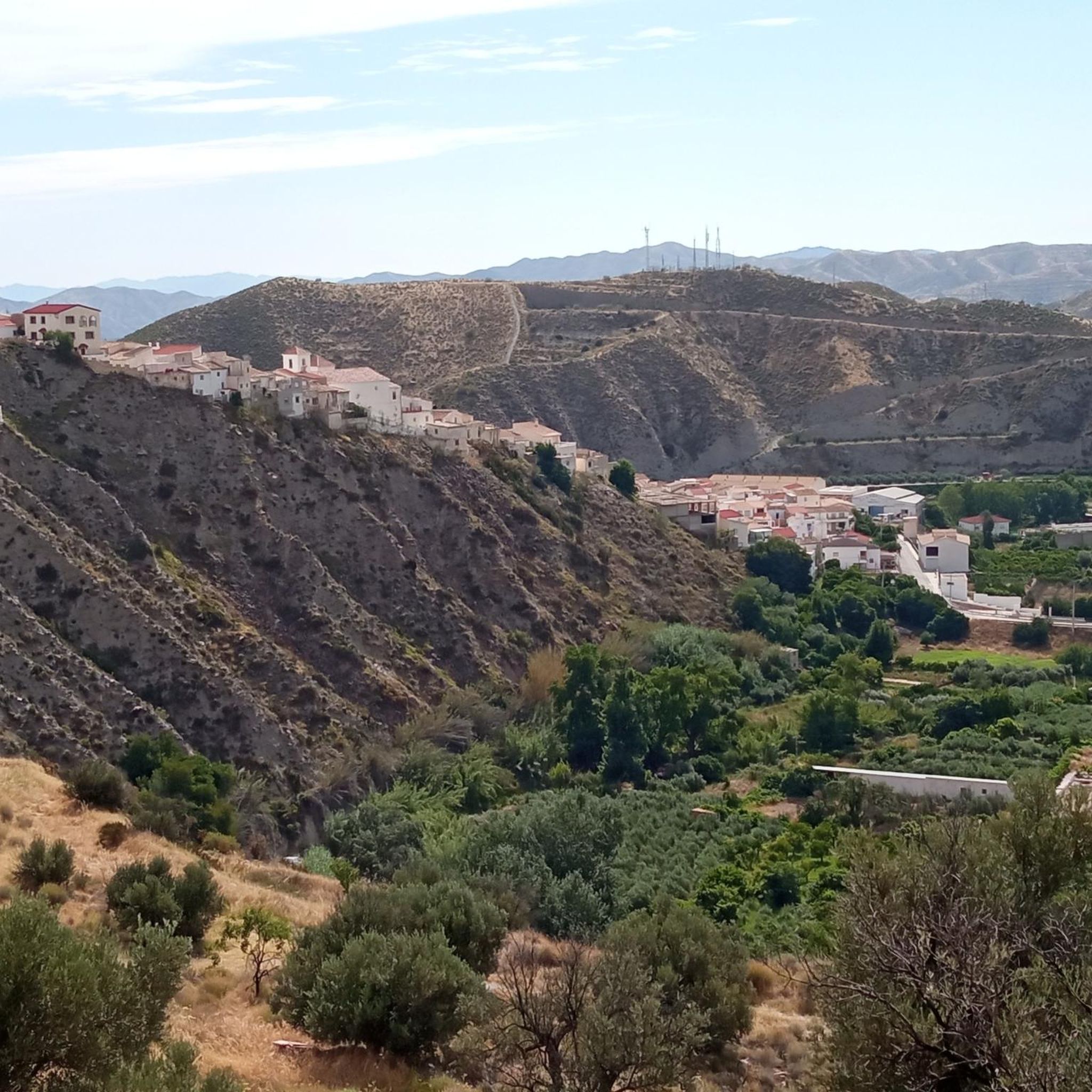
Jogging routes Líjar are set within the Sierra de los Filabres in Almería, offering a diverse landscape for runners. The region features varied topography with hills and gullies, providing natural inclines and descents. Runners can explore areas near the Tahalí River, which creates lush environments, or follow historical paths like the "Camino Empedrado." The surrounding natural environment includes a mix of arid and greener areas, ensuring varied scenery.
Best jogging routes around Líjar
- The most popular jogging route is Cerro…
Last updated: August 3, 2026
15
runners
9.16km
01:13
300m
300m
Moderate run. Good fitness required. Mostly paved surfaces. Suitable for all skill levels.
11
runners
7.57km
00:49
70m
70m
Moderate run. Good fitness required. Mostly paved surfaces. Suitable for all skill levels.

Sign up for free
6
runners
11.1km
01:09
70m
70m
Moderate run. Good fitness required. Mostly paved surfaces. Suitable for all skill levels.
3
runners
11.0km
01:19
190m
190m
Moderate run. Good fitness required. Mostly paved surfaces. Suitable for all skill levels.
4
runners
5.48km
00:35
60m
50m
Moderate run. Good fitness required. Mostly paved surfaces. Suitable for all skill levels.
Get access to more routes and recommendations from other explorers.
Sign up for free
Already have an account?
Our route recommendations are based on thousands of hikes, rides, and runs completed by other people on komoot.
Start today with a free account
Your next adventure awaits.
Login or Signup
Tips from the Community

The villa of Cantoria, in the heart of the Almanzora Valley, combines a tranquil atmosphere with several points of interest such as the Church of Nuestra Señora del Carmen. Cantoria is also known for its artisanal tradition and for the marble workshops scattered throughout the area. The Almanzora River and its surroundings offer gentle trails and open views of the valley. With local cafes, quiet squares, and a relaxed pace, it is a good starting point for discovering the villages and routes of this stretch of the Almanzora.
0
0
The Vía Verde del Valle del Almanzora, on the stretch between Almanzora and Cantoria, offers a very accessible walk on a very flat gravel path, ideal for families and those looking for a quiet route. Along the way, you will find several picnic areas perfect for taking a break, although it's good to know that there is very little shade, so it's advisable to bring water and sunscreen. The trail follows the old railway line and runs through orchards, semi-arid landscapes, and open views of the river and valley.
0
0


VIA VERDE DEL VALLE DE ALMONZORA is a spectacular route of a total of 98 km through the southeast of the peninsula between the highlands of Granada in the Baza area towards the district of Almendricos, already in the region of Murcia, and passes through the Almanzora Valley in Almería. A route that for decades crossed a railway line that transported tons of iron and other merchandise.
18
0

The towns of Fines and Olula del Río are an encounter with the culture of marble; figures and pieces of marble with inscriptions and inspiring phrases appear on the old railroad track. In Olula there is the famous giant head of a woman, on the other side of the road, you have to be careful not to pass it by. And nearby is the town of Macael for those interested in visiting the “white gold” quarries of the Almanzora Valley. Purchena is far from the road, it is a town with an Andalusian feel, with narrow streets with whitewashed facades at the foot of the remains of an old Muslim fortress from the Nasrid era. The railway continues to trace the slopes of the valley and cross seasonal boulevards over imposing stone bridges to the Tíjola station, which preserves a train engine from the glorious era of the mining railway and the railway buildings. The station is a bar with food service and a terrace on one of the platforms. In Los Canos there are remains of the old iron ore loading dock. The carts arrived loaded with material by aerial cables from the mining sites and by simple gravity they filled the train cars that were in the tunnels located under the loading dock.
0
0

It is a pity that this station, which was once one of the most important on the line, has not been maintained and restored. Even so, pedaling through here evokes the importance that the railway once had in the entire area.
0
0

80 m long tunnel which currently has lighting, is part of the itinerary of two trails.
1
0
Frequently Asked Questions
How many running routes are available around Líjar, and what are their difficulty levels?
There are over 10 running routes available around Líjar. Most of these, specifically 10, are classified as moderate, offering a good balance for various fitness levels. For those seeking a greater challenge, there are also 3 difficult routes.
Are there many circular running routes in the Líjar area?
Yes, many of the running routes around Líjar are circular, allowing you to start and finish in the same location. An excellent example is the Running loop from Cerros de Maripérez, which navigates through the area's characteristic hills.
What kind of terrain can I expect on the jogging trails near Líjar?
The jogging trails near Líjar offer a diverse landscape. You'll encounter mountainous terrain with natural inclines and descents, historical cobbled paths like the "Camino Empedrado" winding through ravines, and refreshing sections near the Tahalí River with lush vegetation. The Sierra de los Filabres provides a mix of arid and greener areas, ensuring varied scenery.
Are there any running routes that offer panoramic views?
Yes, Líjar is known for its stunning viewpoints. A rewarding jog can lead you to Líjar's viewpoint, offering magnificent panoramic views of the town and its surroundings. While not explicitly listed as a viewpoint route, the Cerro del Castillo loop from Fines provides views of the historic castle hill, which is often a high point.
What historical or cultural landmarks can I see while running in Líjar?
Líjar's routes are rich in history. You can jog through the narrow streets of the Barrio del Castillo (Castle Quarter) near the Castillo de Líjar, explore the old public wash house (Lavadero de Líjar), and pass by the 16th-century Church of Santa Maria. The ancient "Camino Empedrado" also offers a unique historical running surface.
Are there any longer, more challenging running routes for experienced runners?
Yes, for experienced runners seeking a challenge, Líjar offers more difficult routes. The Peña Felipe loop from Laroya is a difficult route spanning nearly 13 km with significant elevation gain, perfect for pushing your limits.
What do other runners enjoy most about jogging in Líjar?
The running routes in Líjar are highly rated by the komoot community, with an average score of 3.0 stars. Runners often praise the varied terrain, the opportunity to explore historic paths, and the scenic beauty of the Sierra de los Filabres. Over 60 runners have used komoot to discover the area's diverse trails.
Are there any running routes that follow a river or offer a waterside experience?
Yes, the Tahalí River (or Líjar River) flows near the town and creates wetlands and lush areas. While often hidden, its presence offers opportunities for riverside jogging, providing a refreshing and natural environment. You can explore up to 500 meters along the riverbed, enjoying the trees and dense shrubs.
Can I find routes that are suitable for a quicker run, perhaps under an hour?
Absolutely. If you're looking for a quicker run, the Running loop from Olula del Río is a moderate 7.4 km trail that can often be completed in about 48 minutes, making it ideal for a shorter, invigorating jog.
What are some other interesting places to explore near the running trails?
Beyond the immediate trails, you can explore nearby attractions such as the Fines-Olula Station, the Cantoria Tunnel, or the historic Aqueduct near Purchena. These offer additional points of interest to combine with your running adventures.
Are there any routes that connect to broader regional trails?
Yes, Líjar serves as a starting point for several routes, including the "Sendero del Poyo PR-A 257," an 11.7 km circular route. The broader region also features the "Vía Verde del Valle de Almanzora," a 98 km route built on an old railway line, offering extensive opportunities for longer runs and exploration.
Most popular attractions around Líjar

Get inspired with the komoot mobile app


Explore more
Browse the best Running Trails & Routes in other regions.
