The best cycling routes in Parque Estatal Monte Alto
70
riders
9
rides
Touring cycling in Parque Estatal Monte Alto offers routes through a landscape shaped by three inactive volcanoes, featuring varied slopes and impressive panoramic views. The terrain includes steep gradients on the northern, southern, and western flanks, while the eastern side gently descends towards the Acatitlán valley. The park is characterized by extensive pine and oak forests, providing ample shade and a rich ecosystem. Elevation gains can be significant, with some routes climbing over 3,000 feet.
Best touring cycling routes in…
Last updated: July 25, 2026
10
riders
62.7km
04:39
1,310m
1,310m
Hard bike ride. Very good fitness required. Mostly paved surfaces. Suitable for all skill levels.
11
riders
146km
10:42
3,360m
3,360m
Hard bike ride. Very good fitness required. Mostly paved surfaces. Suitable for all skill levels.

Sign up for free
9
riders
73.1km
05:07
1,370m
1,370m
Hard bike ride. Very good fitness required. Mostly paved surfaces. Suitable for all skill levels.
8
riders
121km
08:54
2,650m
2,650m
Hard bike ride. Very good fitness required. Mostly paved surfaces. Suitable for all skill levels.
6
riders
17.9km
01:32
410m
410m
Hard bike ride. Good fitness required. You may need to push your bike for some segments of this route.
Get access to more routes and recommendations from other explorers.
Sign up for free
Already have an account?
Our route recommendations are based on thousands of hikes, rides, and runs completed by other people on komoot.
Start today with a free account
Your next adventure awaits.
Login or Signup


Frequently Asked Questions
How many touring cycling routes are available in Parque Estatal Monte Alto?
Parque Estatal Monte Alto offers a selection of 9 touring cycling routes. These routes cater to various skill levels, with 1 moderate and 8 difficult options, providing diverse challenges across the park's volcanic terrain.
What kind of terrain can I expect on touring cycling routes in Parque Estatal Monte Alto?
The terrain in Parque Estatal Monte Alto is shaped by three inactive volcanoes, resulting in varied slopes. You'll encounter steep gradients on the northern, southern, and western flanks, while the eastern side gently descends towards the Acatitlán valley. The routes predominantly traverse extensive pine and oak forests, offering ample shade and a picturesque environment. Expect significant elevation gains, with some routes climbing over 3,000 feet.
Are there any circular touring cycling routes in Parque Estatal Monte Alto?
Yes, many touring cycling routes in Parque Estatal Monte Alto are circular. For example, you can explore the challenging Amanalco Central Park loop from Mesa de Jaimes, which covers 38.9 miles (62.7 km), or the extensive El Mapa loop from Valle de Bravo, a 90.6-mile (145.8 km) path with substantial elevation gain. Another option is the shorter Monte Alto loop from Mesa de Jaimes, an 11.1-mile (17.9 km) trail through forests.
What are some notable landmarks or viewpoints I can see while cycling in Parque Estatal Monte Alto?
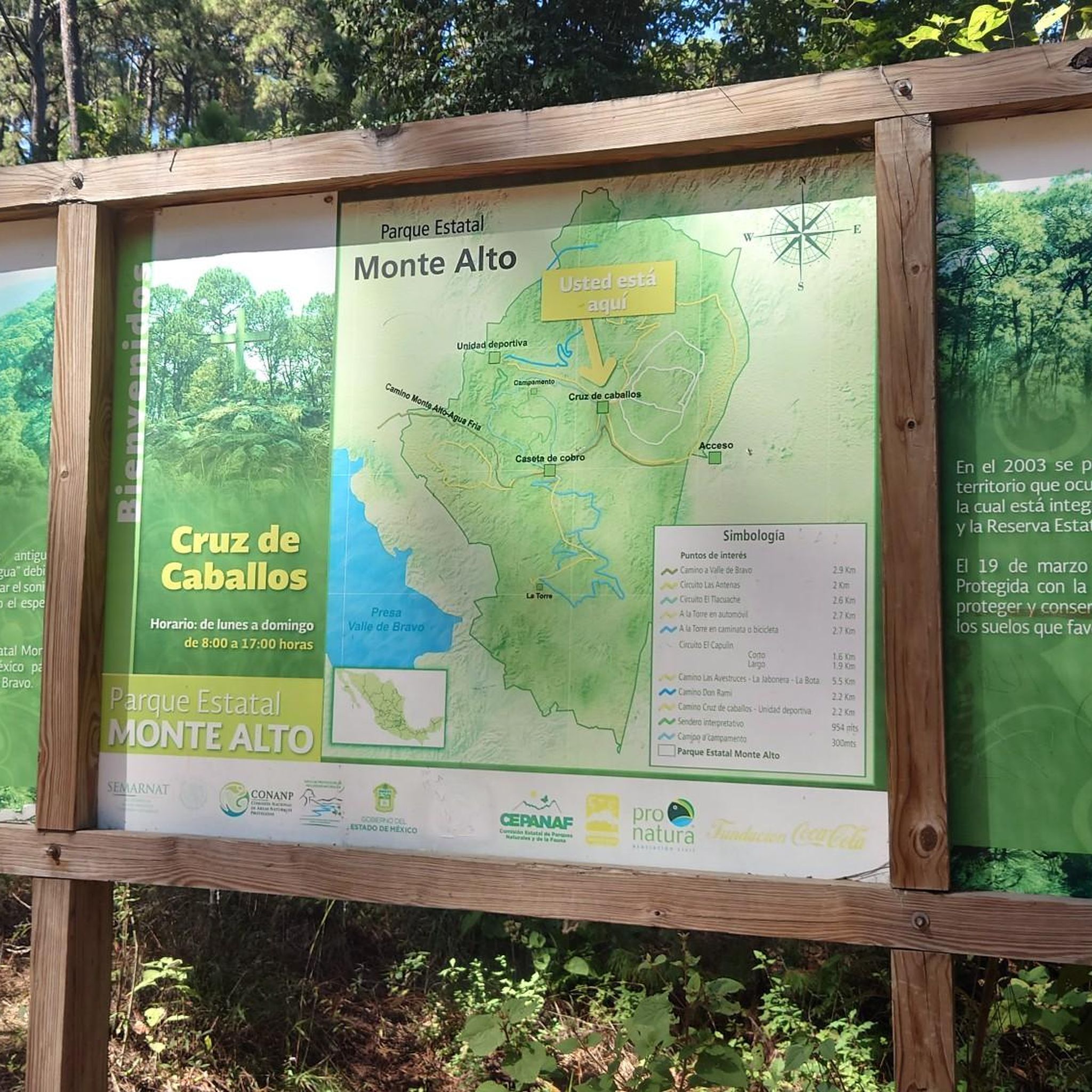
While cycling in Parque Estatal Monte Alto, you'll be treated to impressive panoramic views, especially from higher elevations. The park is renowned for its paragliding launch point, "La Torre," which offers spectacular vistas of Valle de Bravo and its lake. The extensive pine and oak forests themselves are a natural highlight, providing a beautiful backdrop for your ride.
Are there any touring cycling routes suitable for beginners in Parque Estatal Monte Alto?
The majority of touring cycling routes in Parque Estatal Monte Alto are rated as difficult due to significant elevation changes and varied terrain. There is one moderate route available, but generally, the park is better suited for cyclists with good fitness and experience. For a less strenuous option, consider exploring the park's extensive network of trails for hiking and mountain biking, which include tracks categorized for beginners in other cycling disciplines.
What is the best time of year to go touring cycling in Parque Estatal Monte Alto?
Parque Estatal Monte Alto offers a pleasant environment for cycling throughout much of the year. The dominant pine and oak forests provide ample shade, which can be particularly welcome during warmer months. The rainy season brings vibrant ecosystems, including abundant orchids and mushrooms, but also potentially wetter trail conditions. For optimal riding, consider visiting during drier periods to enjoy the well-maintained facilities and diverse landscapes.
Is there parking available for touring cyclists at Parque Estatal Monte Alto?
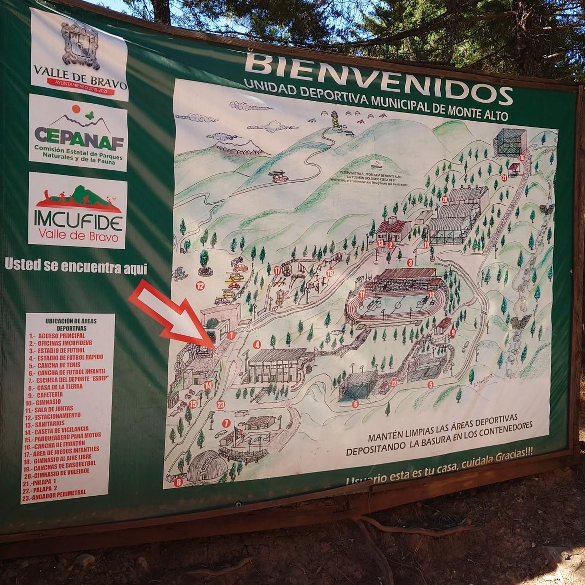
Yes, Parque Estatal Monte Alto is equipped with facilities for visitors. While specific parking areas for cyclists are not detailed, the park offers designated camping areas and picnic spots, indicating infrastructure for visitor access. It is advisable to check local park information for precise parking locations near trailheads.
Can I bring my dog on the touring cycling routes in Parque Estatal Monte Alto?
The provided information does not explicitly state whether dogs are permitted on the touring cycling routes. Parque Estatal Monte Alto is a natural reserve with diverse flora and fauna, including various birds and small mammals. It is recommended to check with park authorities directly regarding their pet policies to ensure a safe and compliant visit for you and your dog.
What are the longest touring cycling routes in Parque Estatal Monte Alto?
For those seeking a significant challenge, the El Mapa loop from Valle de Bravo is one of the longest touring cycling routes, spanning 90.6 miles (145.8 km) with substantial elevation gain. Another extensive option is the San Antonio loop from Valle de Bravo, which covers 121.1 km (75.2 miles) and features significant climbing.
Are there any facilities like cafes or accommodation near the touring cycling routes?
Parque Estatal Monte Alto is located near the Magical Town of Valle de Bravo, which is a popular tourist destination. While the park itself offers designated camping areas with platforms and cabins, Valle de Bravo provides a wider range of services, including cafes, restaurants, and various accommodation options. These can serve as convenient bases for exploring the park's cycling routes.
What kind of wildlife might I encounter while touring cycling in Parque Estatal Monte Alto?
Parque Estatal Monte Alto is home to a vibrant ecosystem. While cycling through the pine and oak forests, you might spot a variety of birds such as hawks, owls, vultures, and hummingbirds. Smaller mammals like rabbits, cacomixtles, squirrels, tlacuaches, and armadillos also inhabit the park. Observing wildlife adds another dimension to the natural beauty of your ride.
How long do the touring cycling routes typically take to complete?
The duration of touring cycling routes in Parque Estatal Monte Alto varies significantly based on distance, elevation, and your pace. For instance, the challenging Amanalco Central Park loop from Mesa de Jaimes (62.7 km) typically takes around 4 hours and 40 minutes. A shorter route like the Monte Alto loop from Mesa de Jaimes (17.9 km) can be completed in about 1 hour and 30 minutes. Longer routes, such as the Presa Ixtapantongo loop from Mesa de Jaimes (73.1 km), might take over 5 hours.
Most popular routes in Parque Estatal Monte Alto

Get inspired with the komoot mobile app


