The best walks and hikes in Mcdonalds Point Conservation Area
4.8
(10)
113
hikers
9
hikes
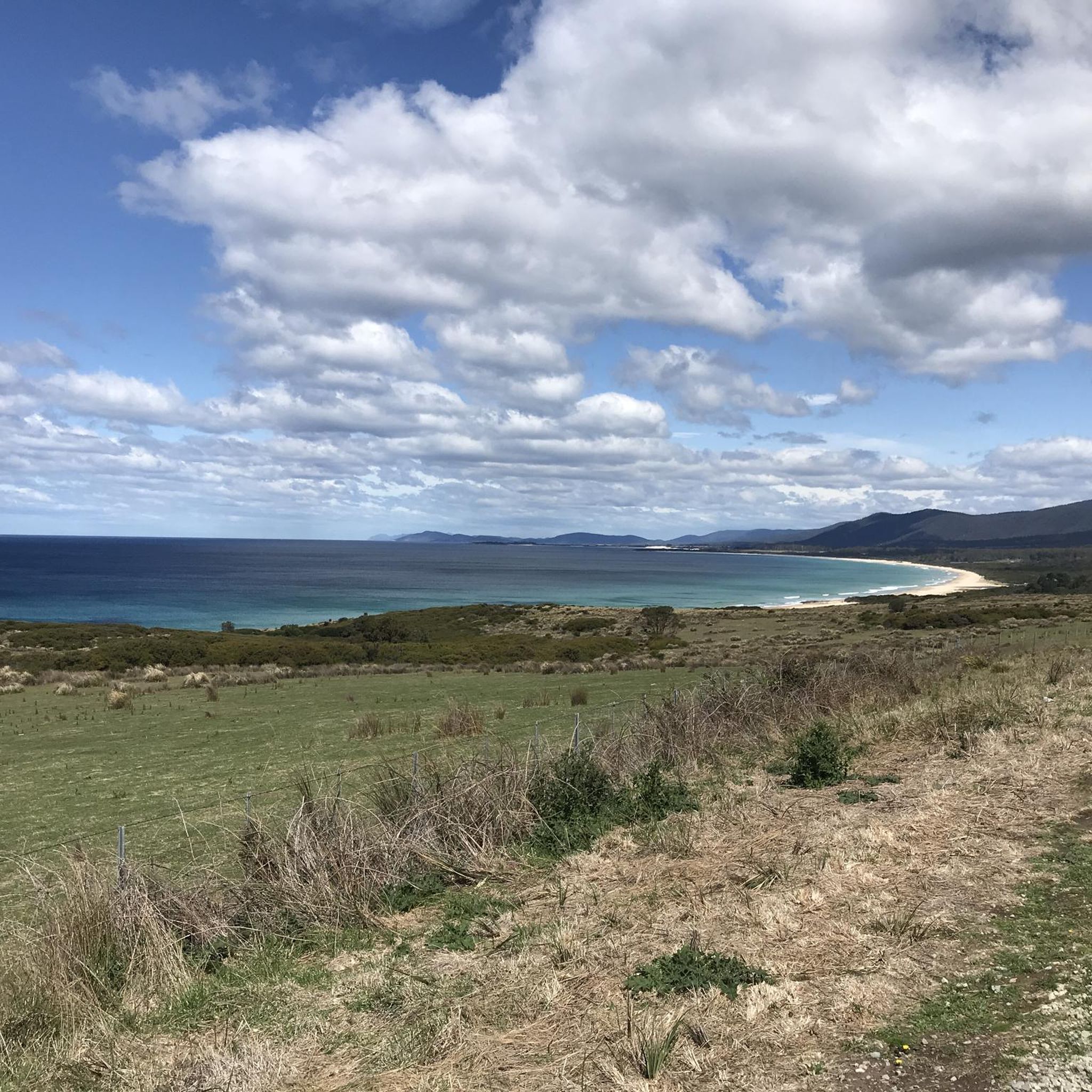
Hiking in Mcdonalds Point Conservation Area offers trails primarily along the Tasmanian coastline. The region is characterized by its white sand beaches, granite rock formations, and coastal vegetation. Elevation changes are generally moderate, with some routes providing lookout points over the ocean. The terrain includes sandy paths and sections through conservation land.
Best hiking trails in Mcdonalds Point Conservation Area
- The most popular hiking route is Skeleton Bay Lookout – Binalong Bay Beach loop from Trefula Conservation Covenant, a…
Last updated: October 30, 2026
4.0
(2)
7
hikers
Moderate hike. Good fitness required. Easily walkable paths.
5.0
(1)
3
hikers
Moderate hike. Good fitness required. Easily walkable paths.

25
hikers
3.76km
00:58
10m
10m
Easy hike. Easily walkable paths.
4.7
(3)
16
hikers
12.2km
03:11
80m
80m
Moderate hike. Good fitness required. Easily walkable paths.
6
hikers
Hard hike. Good fitness required. Sure-footedness, sturdy shoes and alpine experience required.
Get access to more routes and recommendations from other explorers.
Already have an account?
Our route recommendations are based on thousands of hikes, rides, and runs completed by other people on komoot.
Start today with a free account
Your next adventure awaits.
Popular around Mcdonalds Point Conservation Area


Tips from the Community

Rocks coloured by lichen to an amazing orange
0
0

5 minute return path off the hiking trail to Skeleton Bay Lookout. you may spot a whale if you're lucky 🐳
0
0
Frequently Asked Questions
How many hiking trails are available in Mcdonalds Point Conservation Area?
Mcdonalds Point Conservation Area offers a selection of 9 hiking routes. These trails primarily explore the Tasmanian coastline, featuring white sand beaches and granite rock formations.
What kind of terrain can I expect on hikes in Mcdonalds Point Conservation Area?
The terrain in Mcdonalds Point Conservation Area is characterized by coastal paths, pristine white sand beaches, and distinctive granite rock formations. You'll find sandy sections and paths winding through conservation land. Elevation changes are generally moderate, with some routes offering lookout points over the ocean.
Are there any easy hiking options suitable for beginners or families?
Yes, Mcdonalds Point Conservation Area has 4 easy hiking routes. A great option for families or beginners is the Binalong Bay Beach – Bay of Fires loop from Binalong Bay, which is 2.3 miles (3.8 km) long and takes about 1 hour to complete, showcasing iconic beaches and boulders.
Can I bring my dog on the trails in Mcdonalds Point Conservation Area?
While many conservation areas have specific rules regarding pets, it's generally best to check local signage or the official Mcdonalds Point Conservation Area website for the most current regulations on bringing dogs, especially to protect local wildlife and sensitive coastal ecosystems.
What are the typical lengths and durations of hikes in the area?
Hikes in Mcdonalds Point Conservation Area vary in length and duration. You can find shorter walks like the Hiking loop from Binalong Bay, which is 1.9 miles (3 km) and takes about 1 hour. Longer routes, such as the Skeleton Bay Lookout – Binalong Bay Beach loop from Trefula Conservation Covenant, span 9.0 miles (14.5 km) and typically require around 4 hours to complete.
Are there any circular hiking routes in Mcdonalds Point Conservation Area?
Yes, many of the trails in Mcdonalds Point Conservation Area are designed as loops, allowing you to start and end at the same point. Examples include the Skeleton Bay Lookout – Binalong Bay Beach loop from Trefula Conservation Covenant and the East Coast Whale Trail Lookout – Binalong Bay Beach loop from Binalong Bay.
What natural features or viewpoints can I expect to see?
Hikers in Mcdonalds Point Conservation Area will encounter stunning coastal scenery, including expansive white sand beaches and unique granite rock formations. Many routes offer lookout points with panoramic ocean views, such as those found on the Skeleton Bay Lookout – Binalong Bay Beach loop.
Is Mcdonalds Point Conservation Area suitable for wildlife spotting?
Given its coastal location, Mcdonalds Point Conservation Area offers potential for wildlife spotting, particularly marine birds and possibly other coastal creatures. Routes like the East Coast Whale Trail Lookout – Binalong Bay Beach loop are noted for potential wildlife encounters along their coastal paths.
What is the best time of year to go hiking in Mcdonalds Point Conservation Area?
The Tasmanian coastline generally offers pleasant hiking conditions during the warmer months, from spring through autumn (September to May). These seasons provide more stable weather for enjoying the beaches and coastal views. Winter hiking is possible, but conditions can be cooler and windier.
Where can I park when visiting Mcdonalds Point Conservation Area?
Specific parking information for Mcdonalds Point Conservation Area is usually available at trailheads or on local government websites. Given the starting points mentioned for routes like those from Binalong Bay or Trefula Conservation Covenant, it's likely that designated parking areas are available near these access points.
Are there any challenging hikes for experienced hikers?
While the area's elevation changes are generally moderate, there are 2 routes classified as difficult. These longer trails, such as the 9.0 miles (14.5 km) Skeleton Bay Lookout – Binalong Bay Beach loop from Trefula Conservation Covenant, offer more extensive distances and varied coastal terrain that can provide a good challenge for experienced hikers.
What do other hikers say about the trails in Mcdonalds Point Conservation Area?
The trails in Mcdonalds Point Conservation Area are highly rated by the komoot community, with an average score of 4.8 stars from over 7 reviews. Hikers often praise the pristine coastal scenery, the unique granite formations, and the well-maintained paths that offer diverse experiences from easy beach walks to more extensive coastal loops.
Are there any facilities or cafes near the hiking trails?
Mcdonalds Point Conservation Area is located near Binalong Bay, which is a small coastal town. While specific facilities directly on the trails may be limited, you can typically find amenities like cafes and basic services in nearby towns to support your hiking trip.
Most popular routes in Mcdonalds Point Conservation Area

Get inspired with the komoot mobile app


Explore more
Browse the best Hikes in other regions.
