The best walks and hikes around Brieulles-Sur-Meuse
4.6
(37)
118
hikers
26
hikes
Hiking around Brieulles-Sur-Meuse offers diverse terrain within France's Grand Est region, characterized by the Meuse River, extensive forests, and rolling agricultural lands. The landscape transitions from tranquil riverside paths to dense woodlands and open fields, providing varied scenery. Elevations are generally moderate, with some routes featuring gentle climbs through forested areas and along riverbanks. This mix of natural features creates a varied environment for outdoor activities.
Best hiking trails around Brieulles-Sur-Meuse
- The most popular hiking route is Hiking loop from…
Last updated: November 4, 2026
4.2
(9)
20
hikers
10.9km
02:57
130m
130m
Moderate hike. Good fitness required. Easily walkable paths.
4.5
(2)
11
hikers
4.28km
01:18
150m
150m
Easy hike. Easily walkable paths.

4.4
(9)
17
hikers
10.5km
02:50
140m
140m
Moderate hike. Good fitness required. Easily walkable paths.
5.0
(1)
6
hikers
6.27km
01:44
110m
110m
Easy hike. Easily walkable paths.
7
hikers
5.23km
01:22
40m
40m
Easy hike. Easily walkable paths.
Get access to more routes and recommendations from other explorers.
Already have an account?
Our route recommendations are based on thousands of hikes, rides, and runs completed by other people on komoot.
Start today with a free account
Your next adventure awaits.



Tips from the Community

This impressive American WWI memorial was dedicated in 1937 to commemorate the victory of the American First Army during the Meuse-Argonne Offensive (26 September – 11 November 1918). The 54-metre-high Doric granite column, designed by John Russell Pope, is topped by a statue symbolising liberty. The monument stands on the hill of Montfaucon, where a medieval monastery once stood and where the Americans achieved a strategic victory in 1918.
9
0

Follow the marking tapes if no signpost is visible.
0
0
Tips: Climb the 234 steps to the viewing platform for a panoramic view of the former battlefield. Read the inscriptions at the foot of the monument with the names of the participating divisions.
1
0
This impressive American WWI memorial was dedicated in 1937 to commemorate the victory of the American First Army during the Meuse-Argonne Offensive (26 September – 11 November 1918). The 54-metre-high Doric granite column, designed by John Russell Pope, is topped by a statue symbolising liberty 1 2. The monument stands on the hill of Montfaucon, where a medieval monastery once stood and where the Americans achieved a strategic victory in 1918.
1
0

To get up here you have to master a very steep climb. With the bike, full saddlebags and at the end of the day not without. But the view of the city and the surrounding area is worth the effort.
0
0
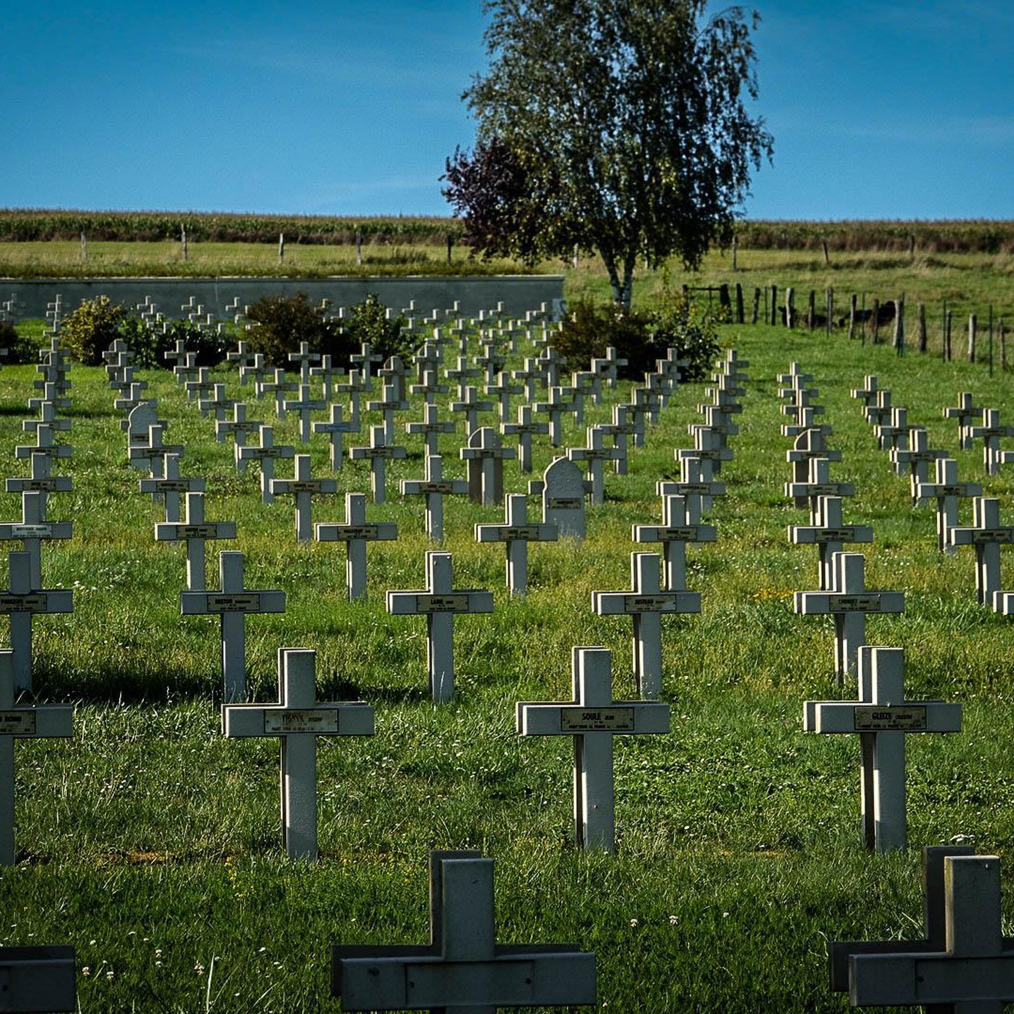
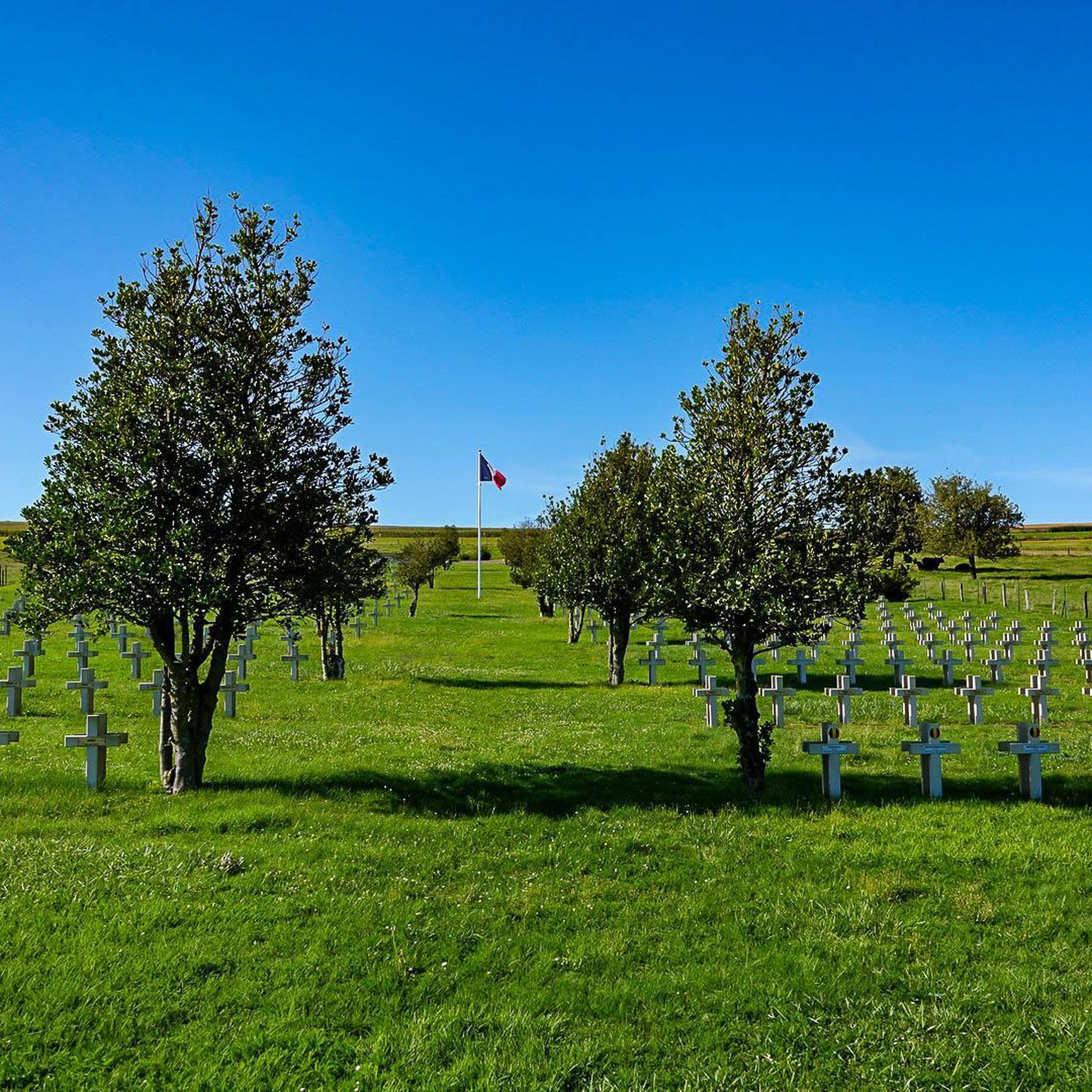
The American military cemetery in Romagne-sous-Montfaucon contains the graves of 14,246 soldiers who died during the First World War in northwest France. It is the largest American military cemetery in Europe. The cemetery site is located in the old front line of the Meuse-Argonne offensive that took place between September 26 and November 11, 1918. The plot of land was used as a cemetery on October 14, 1918 after it had been occupied by the American forces just before. 32nd Infantry Division. The site was given on permanent loan to the US by the French government. The 14,246 graves are spread over eight fields. There are lime trees surrounding the fields, the fields themselves are covered with grass. Each grave has its own stone. For Jewish graves, the top of the stone is shaped like a Star of David. The text on each stone states the soldier's name, rank, division, state and date of death. Of the 14,246 graves, 486 soldiers have not been identified. The stones of the unidentified soldiers bear the text: Here rests in honored glory an American soldier known but to god. On the south side of the cemetery is a memorial building, designed by the architectural firm York and Sawyer from New York. The center of the memorial gives access to a chapel containing the flags of the US and the other allied countries. The stained glass windows show the insignia of the various divisions that operated in the region. The two loggias outside the chapel display the names of 954 missing soldiers. The visitors building is located on the north side of the cemetery. There is a book here in which a visit can be registered. The entrance to the cemetery, both on the west and east sides, is 'guarded' by two white towers with the American eagle on top. There is a large pond in the middle of the site. The maintenance and management of the cemetery is the responsibility of the American Battle Monuments Commission.
6
0
Romagne-sous-Montfaucon was heavily fought over in the First World War. The small museum is definitely worth it. Owner and driving force is the Dutchman Jean-Paul de Vries
7
0
Frequently Asked Questions
How many hiking trails are available around Brieulles-sur-Meuse?
There are approximately 15 hiking routes available around Brieulles-sur-Meuse. These trails offer a mix of easy, moderate, and difficult options, catering to various fitness levels.
What types of terrain can I expect on hikes near Brieulles-sur-Meuse?
The terrain around Brieulles-sur-Meuse is quite varied. You'll find tranquil paths along the Meuse River, extensive forested areas, and rolling agricultural lands. This mosaic of landscapes provides diverse scenery, from shaded woodlands to open fields with panoramic views.
Are there any easy or family-friendly hiking options?
Yes, Brieulles-sur-Meuse offers several easy routes suitable for families or those seeking a relaxed walk. For example, the Lac Vert loop from Dun-sur-Meuse is an easy 3.3-mile (5.3 km) trail around a tranquil lake, often completed in about 1 hour 21 minutes.
What historical landmarks can I see while hiking in the area?
The region is rich in history, particularly related to World War I. You can visit the Meuse-Argonne American Cemetery near Romagne-sous-Montfaucon, which is the largest American military cemetery in Europe. Another notable site is the Pershing Bridge of Dun-sur-Meuse, known for its historical significance and scenic views over the river.
Are there any circular hiking routes?
Yes, many of the trails around Brieulles-sur-Meuse are designed as loops. A popular option is the Hiking loop from Dun-sur-Meuse, a moderate 7.5-mile (12.1 km) route offering views of the Meuse River and countryside.
What do other hikers enjoy most about hiking in Brieulles-sur-Meuse?
The hiking routes in Brieulles-sur-Meuse are highly rated by the komoot community, with an average score of 4.7 stars from around 20 reviews. Hikers often praise the varied terrain, from peaceful riverside paths to immersive forest trails, and the opportunities to explore historical sites.
Are there any challenging hikes for experienced hikers?
Yes, for those seeking a more demanding experience, there are difficult routes available. An example is the Saint-Germain Hill loop from Dun-sur-Meuse, which is an 11.7-mile (18.8 km) trail with significant elevation gain, taking approximately 5 hours 28 minutes to complete.
Can I find trails that combine natural beauty with historical sites?
Absolutely. The region uniquely blends natural landscapes with historical significance. The Hindenburg Line – Romagne-sous-Montfaucon loop from Romagne-sous-Montfaucon is a moderate 6.4-mile (10.3 km) path that explores both forested areas and historical sites near Romagne-sous-Montfaucon.
What is the best time of year to go hiking in Brieulles-sur-Meuse?
The diverse landscape of Brieulles-sur-Meuse makes it enjoyable throughout much of the year. Spring and autumn offer pleasant temperatures and beautiful scenery with blooming flowers or vibrant fall foliage. Summer is also popular, especially for shaded forest walks, while riverside paths can be enjoyed in milder weather.
Are there any specific natural features to look out for on the trails?
The Meuse River is a central natural feature, offering picturesque routes along its banks. You'll also encounter extensive forests, covering a significant portion of the land, providing shaded walks and opportunities to observe local wildlife. The varied agricultural lands and prairies offer open views and a rich biodiversity.
Is there parking available at trailheads?
While specific parking details for every trailhead are not listed, hiking routes in the region typically have designated parking areas near their starting points, especially in villages like Dun-sur-Meuse or Romagne-sous-Montfaucon, which serve as common access points for trails.
Are there any villages or points of interest to explore near the hiking routes?
Yes, the small village of Murvaux, with its 12th-century Romanesque church, offers a cultural point of interest for hikers in the vicinity. Dun-sur-Meuse also serves as a starting point for several routes and provides amenities.
Most popular routes around Brieulles-Sur-Meuse
Most popular attractions around Brieulles-Sur-Meuse

Get inspired with the komoot mobile app


Explore more
Browse the best Hikes in other regions.
