The best running trails around Reichenburg
4.5
(126)
5,040
runners
20
runs
Jogging routes around Reichenburg offer a diverse landscape characterized by lush forests, panoramic mountain views, and proximity to the Linth River. The region, nestled in the canton of Schwyz, features varied terrain from flat paths along waterways to routes with gentle ascents. Joggers can explore trails that wind through verdant areas, providing views of the Swiss Prealps and the Glarner Alps. This area provides a mix of natural features suitable for different running preferences.
Best jogging routes around Reichenburg
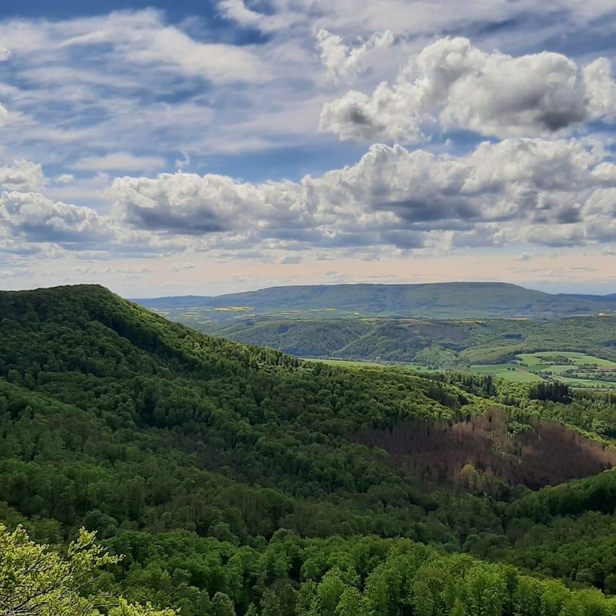
- The most popular jogging route is View of Mount Federispitz – View of the Glarus Alps loop from Reichenburg, an 8.6 miles (13.8 km) trail that takes 1 hour 25 minutes to complete. This route offers expansive views of Mount Federispitz and the Glarus Alps.
- Another top favourite among local runners is Gravel Path in Niderriet loop from Reichenburg, a moderate 3.6 miles (5.8 km) path. This trail leads through the Niderriet area, offering a serene gravel path experience.
- Local runners also love the Gravel Path in Niderriet – Hirschlensee loop from Reichenburg, a 5.5 miles (8.8 km) trail leading through the Niderriet and past Hirschlensee, often completed in about 55 minutes.
- Jogging around Reichenburg is defined by lush forests, the Linth River, and views of the Glarner Alps. The network offers options for different ability levels, from gentle riverside paths to routes with moderate elevation changes.
- The routes in Reichenburg are highly rated by the komoot community with an average score of 4.5 stars from over 90 reviews. Nearly 5,000 runners have used komoot to explore Reichenburg's varied terrain.
Last updated: September 28, 2026
18
runners
Moderate run. Good fitness required. Mostly paved surfaces. Suitable for all skill levels.
3.0
(2)
20
runners
5.85km
00:36
20m
20m
Moderate run. Good fitness required. Mostly paved surfaces. Suitable for all skill levels.

7
runners
5.16km
00:33
30m
30m
Moderate run. Good fitness required. Mostly paved surfaces. Suitable for all skill levels.
6
runners
8.83km
00:55
20m
20m
Moderate run. Good fitness required. Mostly paved surfaces. Suitable for all skill levels.
5
runners
11.6km
01:12
50m
50m
Moderate run. Good fitness required. Mostly paved surfaces. Suitable for all skill levels.
Get access to more routes and recommendations from other explorers.
Already have an account?
Our route recommendations are based on thousands of hikes, rides, and runs completed by other people on komoot.
Start today with a free account
Your next adventure awaits.
Tips from the Community

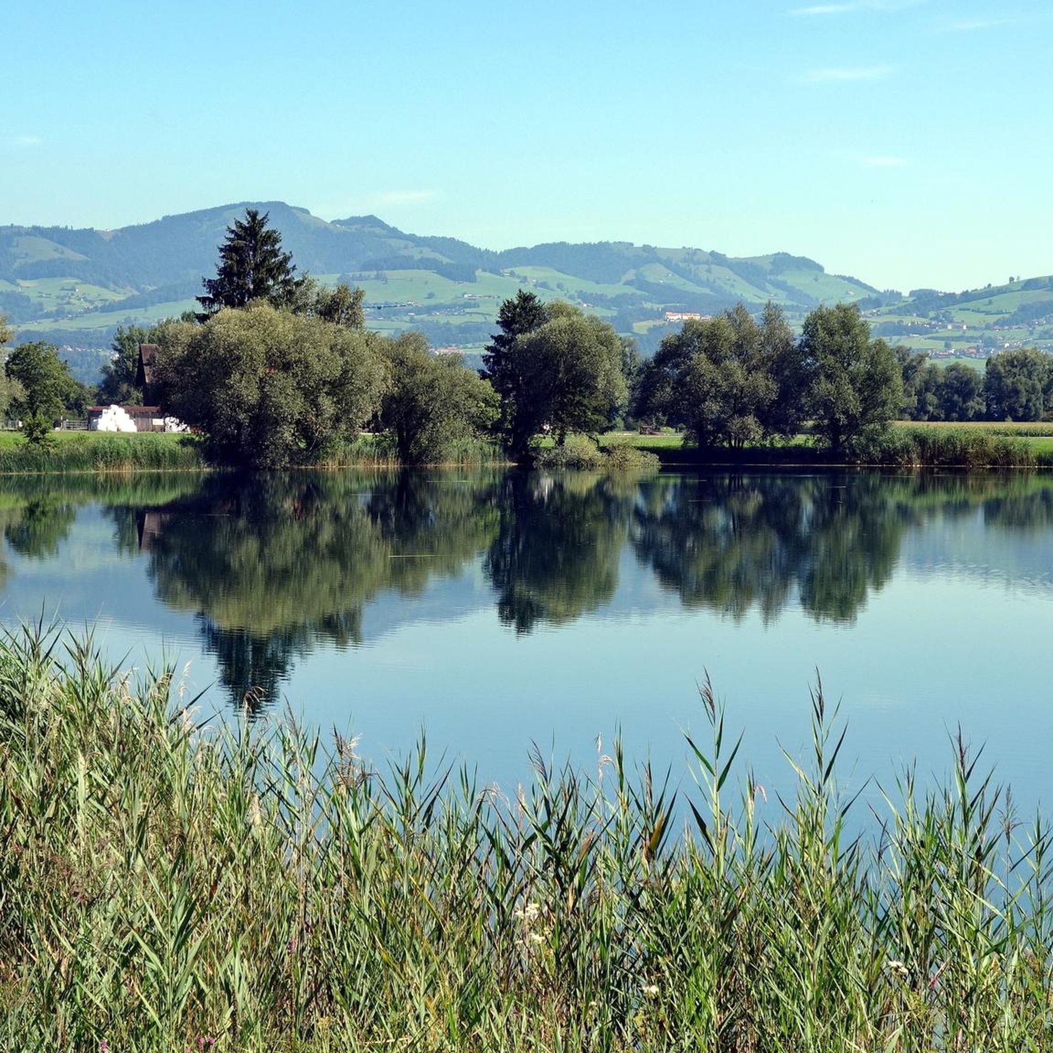
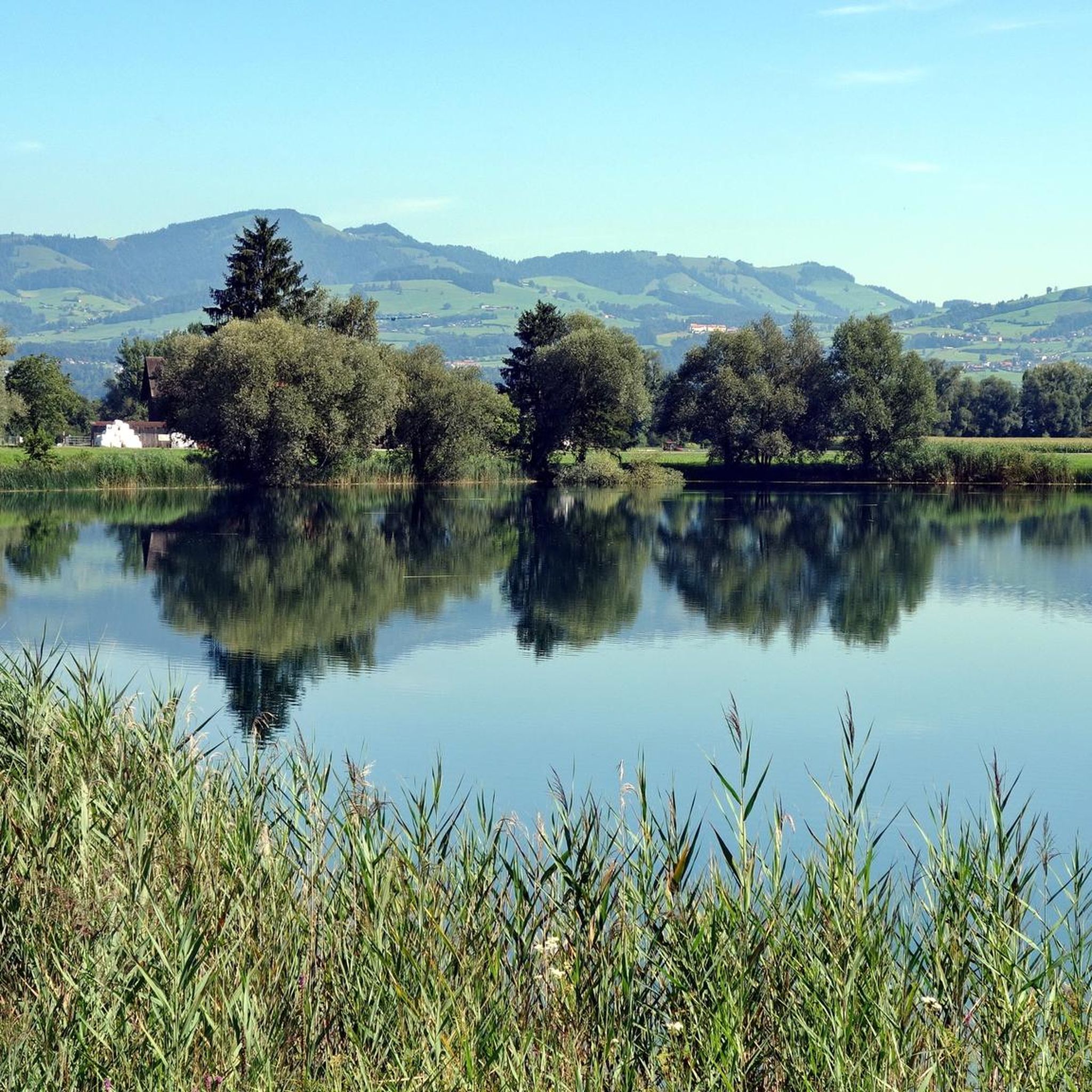
The pond was created during gravel mining and is therefore considered a so-called quarry pond. The lake is a good 300 meters long and 250 meters wide. Although swimming is prohibited, it is still a popular spot.
3
0

Beautiful lake surrounded by greenery. You can enjoy the sun in the meadows or look for a small bench. There is a fence around the Hirschlensee, access is via a small parking lot southeast of the lake.
0
0

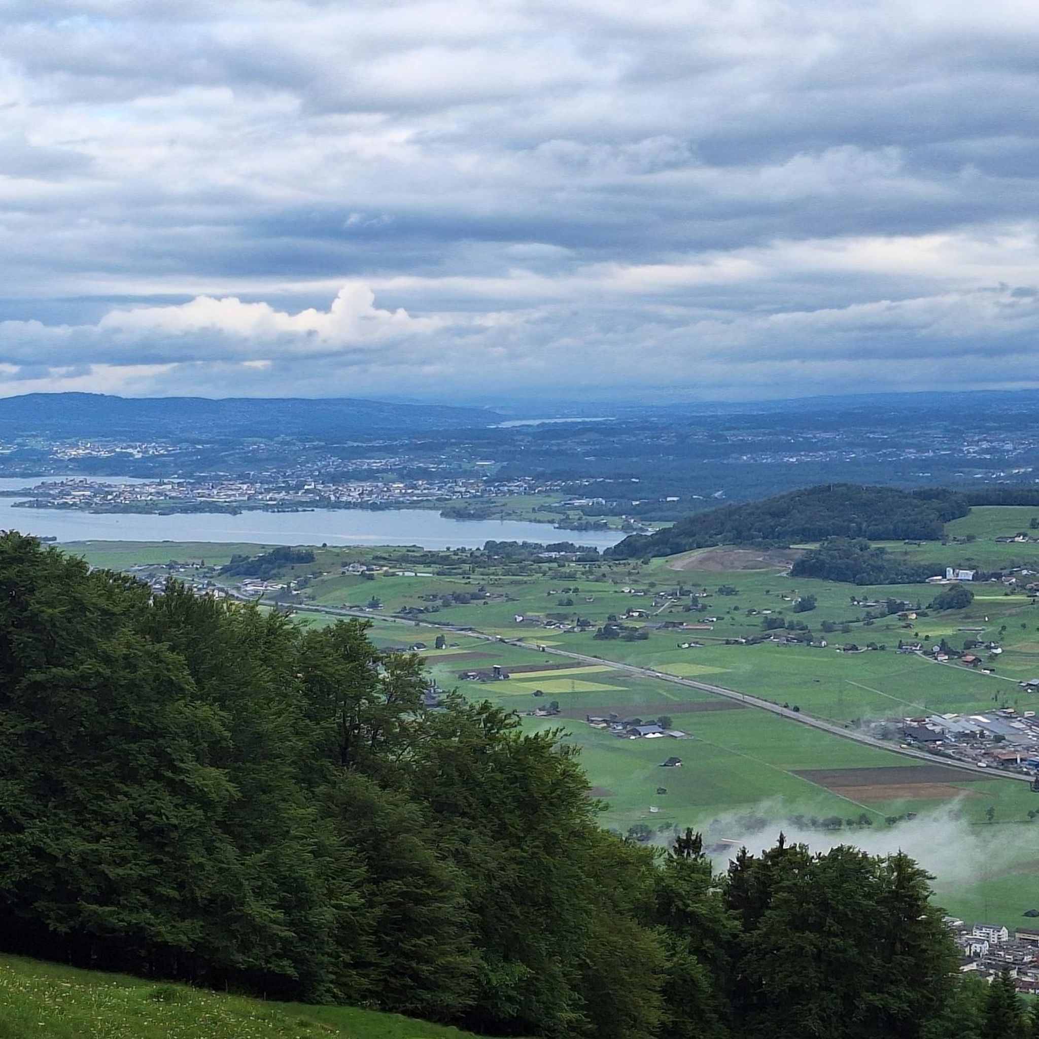
Between Lake Zurich and the Walensee lies the Linthebene, a piece of former lake and marshland, which has been redesigned by comprehensive drainage projects. On the right side of the Linth lie the Gaster and See regions of the canton St. Gallen and on the left side the March region of the canton of Schwyz.
0
0
In hanging casting, the Linth can leave its narrow bed in the channel cut and form a river-typical habitat in the expansion, before it is led between dams in the lake of Zurich.
0
0
Good starting point for a short round. Also there is a nice swimming spot on the Linth! In hanging casting, the Linth can leave its narrow bed in the channel cut and form a river-typical habitat in the expansion, before it is led between dams in the lake of Zurich.
0
0
Frequently Asked Questions
How many running routes are available around Reichenburg?
Reichenburg offers a diverse selection of over 20 running routes, catering to various fitness levels. These trails wind through lush forests, along the Linth River, and provide panoramic views of the surrounding mountains.
Are there any easy or beginner-friendly jogging routes in Reichenburg?
Yes, Reichenburg has several routes suitable for beginners. For instance, the Gravel Path in Niderriet loop from Reichenburg is a moderate 3.6-mile (5.8 km) path that offers a serene experience through the Niderriet area, perfect for a relaxed run.
What kind of scenery can I expect on the running trails in Reichenburg?
Jogging routes in Reichenburg are known for their stunning natural beauty. You can expect to run through verdant forests, along the picturesque Linth River, and enjoy breathtaking panoramic views of the Swiss Prealps and the Glarner Alps. Some routes, like the View of Mount Federispitz – View of the Glarus Alps loop from Reichenburg, specifically highlight these expansive mountain vistas.
Are there any circular running routes in the Reichenburg area?
Yes, many of the running routes around Reichenburg are designed as loops, offering convenient circular paths. Examples include the Gravel Path in Niderriet – Hirschlensee loop from Reichenburg, which takes you past the beautiful Hirschlensee, and the Burgstelle Mülenen loop from Reichenburg.
What are some interesting landmarks or natural attractions I might see while running?
While jogging, you can encounter several natural highlights. The Gravel Path in Niderriet – Hirschlensee loop from Reichenburg passes by Hirschlensee, a serene former quarry pond. Other notable natural features in the broader region include the Federispitz and the Lake Wägital, offering impressive backdrops to your run.
Are there any running routes suitable for families with children?
For families, routes with gentler terrain and shorter distances are ideal. The Gravel Path in Niderriet loop from Reichenburg is a moderate 3.6-mile (5.8 km) path that is relatively flat and offers a pleasant experience for all ages. The paths along the Linth River also provide safe and scenic options for family runs.
What do other runners say about the trails in Reichenburg?
The running trails in Reichenburg are highly regarded by the komoot community, boasting an average rating of 4.5 stars from over 90 reviews. Runners frequently praise the varied terrain, from peaceful riverside paths to routes with stunning mountain views, and the overall natural beauty of the region.
Are there options for longer or more challenging runs in Reichenburg?
Yes, for those seeking a greater challenge, Reichenburg offers routes with moderate elevation changes and longer distances. The View of Mount Federispitz – View of the Glarus Alps loop from Reichenburg is an 8.6-mile (13.8 km) trail that provides a good workout with rewarding panoramic views.
Can I find running routes that are accessible by public transport in Reichenburg?
Reichenburg is well-connected, and many running routes are accessible from the town center, which is served by public transport. You can often start your run directly from the village or a short walk from a bus stop, making it convenient to explore the trails without a car.
Are there any running routes that pass by lakes or rivers?
Absolutely. The region is characterized by its proximity to water features. You can find beautiful running paths along the Linth River, offering flat and scenic routes. Additionally, the Gravel Path in Niderriet – Hirschlensee loop from Reichenburg takes you past the tranquil Hirschlensee, a lovely spot for a run.
What is the typical duration for a running route in Reichenburg?
The duration of running routes in Reichenburg varies depending on the distance and your pace. Shorter routes, like the 3.6-mile (5.8 km) Gravel Path in Niderriet loop from Reichenburg, can be completed in about 35-40 minutes. Longer trails, such as the 8.6-mile (13.8 km) View of Mount Federispitz – View of the Glarus Alps loop from Reichenburg, typically take around 1 hour 25 minutes.
Are there specific trails that offer views of the Glarner Alps?
Yes, several trails provide stunning vistas of the Glarner Alps. The View of Mount Federispitz – View of the Glarus Alps loop from Reichenburg is specifically highlighted for its expansive views of both Mount Federispitz and the majestic Glarner Alps, making it a popular choice for scenic runs.
Most popular routes around Reichenburg
Most popular attractions around Reichenburg

Get inspired with the komoot mobile app


Explore more
Browse the best Running Trails & Routes in other regions.
