The best waterfall hikes and walks around Mittweida
4.6
(16000)
52,237
hikers
7
hikes
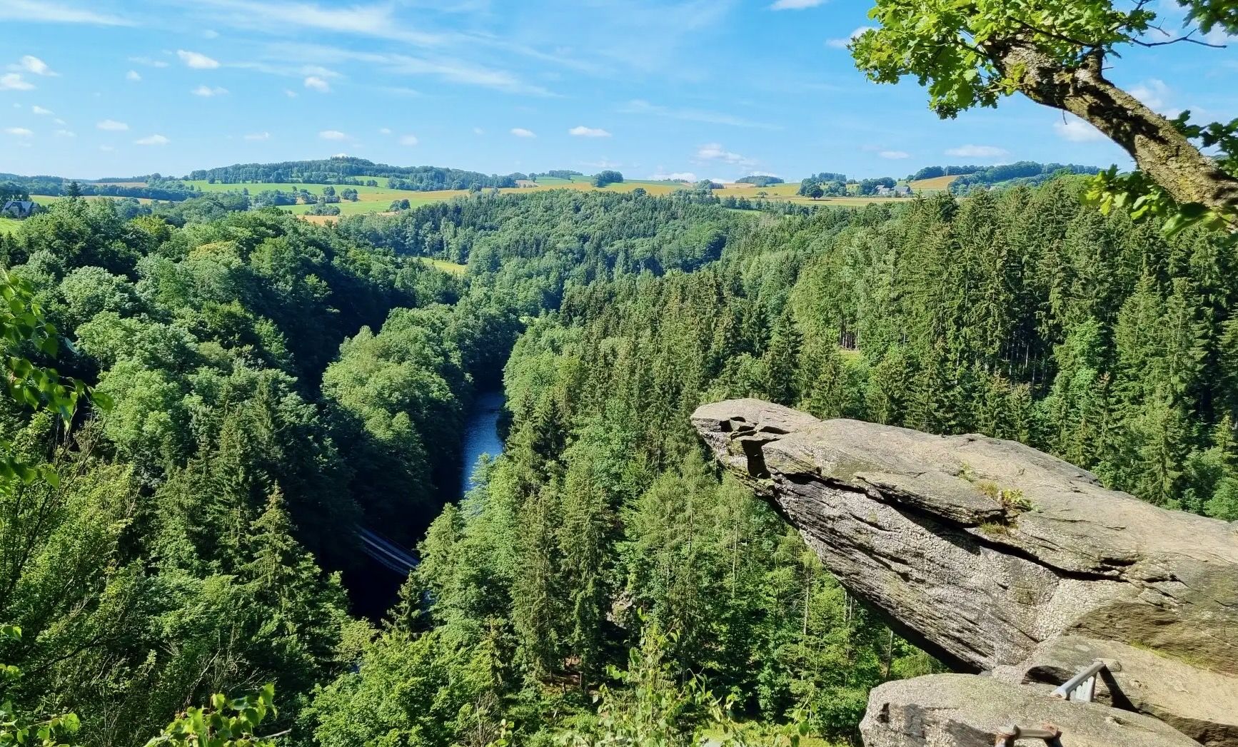
Waterfall hiking trails around Mittweida traverse a landscape characterized by idyllic forests, rolling hills, and the meandering Zschopau River. The region, part of the Saxon Castle Country, offers diverse natural features suitable for outdoor exploration. Hikers can expect routes that follow river valleys and pass through serene woodlands, providing varied terrain. This area in Central Saxony presents a mix of natural beauty and historical relevance.
Best waterfall hiking trails around Mittweida
- The most popular waterfall hiking route is Ringethal Tree…
Last updated: July 23, 2026
4.9
(28)
113
hikers
3.90km
01:03
40m
40m
Easy hike. Great for any fitness level. Easily-accessible paths. Suitable for all skill levels.
4.7
(144)
393
hikers
11.7km
03:09
150m
150m
Moderate hike. Good fitness required. Easily-accessible paths. Suitable for all skill levels.

Sign up for free
4.6
(30)
76
hikers
9.94km
02:39
110m
110m
Moderate hike. Good fitness required. Easily-accessible paths. Suitable for all skill levels.
5.0
(5)
21
hikers
12.4km
03:18
140m
140m
Moderate hike. Good fitness required. Easily-accessible paths. Suitable for all skill levels.
4.3
(3)
6
hikers
20.1km
05:37
350m
340m
Hard hike. Very good fitness required. Easily-accessible paths. Suitable for all skill levels.
Get access to more routes and recommendations from other explorers.
Sign up for free
Already have an account?
Our route recommendations are based on thousands of hikes, rides, and runs completed by other people on komoot.
Start today with a free account
Your next adventure awaits.
Login or Signup
Popular around Mittweida


Tips from the Community

The Dreiwerdener Bridge, an attractive stone structure that was rebuilt after the flood damage of 2002. You should walk to the middle of the bridge to enjoy the beautiful view of the river valley and the Dreiwerdener weir and to convince yourself that the Zschopau is rich in fish. https://www.mittweida.de/fileadmin/Tourismus/Wandern/schweizerwald.pdf
0
0
Behind the inscription stone from 1880, a wooden sign with a „romantic“ poem and the picture of a blackbird rises. But this bird did not give the place its name. Below the bank rock, there was once a ford and a ferry point, where logs were pulled from the river on a rope - from this came „Amsel“ - and loaded onto carts. Next to the rock, the old haulage road can still be recognized. Recently, a covered rest area has invited visitors to linger here. View overgrown, from the rest area you don't see much of the Zschopau. https://www.mittweida.de/fileadmin/Tourismus/Wandern/schweizerwald.pdf
0
0
The Zschopautal Viaduct was built in 1905/06. The railway bridge over the Zschopau and the road from Neudörfchen to Dreiwerden is a steel truss bridge with a solid web girder segment, which has been preserved to this day. The bridge has a length of 133.6 m, a height of 11.1 m, and a width of 3 m. The tracks were removed after the line was closed. https://de.wikipedia.org/wiki/Bahnstrecke_Mittweida%E2%80%93Dreiwerden/Ringethal
0
0

The City Church of Our Lady is not a unified building but a conglomerate of different architectural styles from the 14th century to the present day.
0
0

Liebenhainer Mühle first mentioned in 1378
0
0

It's just incredibly beautiful here 😊.
0
0

Frequently Asked Questions
How many waterfall hiking trails are there around Mittweida?
There are currently 9 dedicated waterfall hiking trails around Mittweida featured on komoot. These routes offer a variety of experiences, from easy strolls to more challenging excursions through the region's scenic landscapes.
What is the best time of year to go waterfall hiking near Mittweida?
The best seasons for hiking around Mittweida, especially to enjoy the natural scenery, are generally spring and autumn. During these times, the weather is mild, and the landscape is particularly vibrant with blooming flora or colorful foliage. Waterfalls tend to be more impressive after periods of rain or during spring snowmelt.
Are there any easy waterfall hikes suitable for beginners or families?
Yes, there are several easy waterfall hikes around Mittweida. For instance, the Liebenhain Mill – Liebenhain Suspension Bridge loop from Mittweida is an easy 6.9 km path that features riverside sections and the scenic Liebenhain Suspension Bridge. Another accessible option is the Zschopautal River Meadow – Liebenhain Mill loop from Mittweida, a shorter 3.9 km trail through river meadows.
Can I find circular waterfall walks in the Mittweida area?
Absolutely. Many of the waterfall trails around Mittweida are designed as circular routes, allowing you to start and end at the same point. A popular moderate circular route is the Ringethal Tree Park – Liebenhain Mill loop from Rößgen, which is about 15.3 km long and explores the Ringethal Tree Park.
What kind of terrain can I expect on waterfall hikes around Mittweida?
The terrain on waterfall hikes around Mittweida is diverse, characterized by idyllic forests, rolling hills, and the meandering Zschopau River Valley. You can expect well-maintained paths, some riverside sections, and occasional gentle ascents and descents. The region is part of the Saxon Castle Country, offering a blend of natural beauty and historical elements.
Are there any interesting landmarks or attractions near the waterfall trails?
Yes, the region offers several interesting landmarks. Along some routes, you might encounter historical sites like the Berbersdorf Lime Quarries or the Alte Hoffnung Erbstolln Silver Mine. You could also visit the impressive Kriebstein Castle, which offers breathtaking panoramic views, or cross the scenic Auerswalde Suspension Bridge.
What do other hikers say about the waterfall trails in Mittweida?
The waterfall trails and general hiking routes in Mittweida are highly rated by the komoot community, with an average score of 4.5 stars from over 1800 reviews. Hikers often praise the quiet woodlands, the picturesque river valleys, and the well-marked paths that make exploring the region a delightful experience.
Are there any moderate waterfall hikes for those looking for a bit more challenge?
For hikers seeking a moderate challenge, the Liebenhain Suspension Bridge – Liebenhain Mill loop from Mittweida is a great option. This 10.1 km route offers varied terrain and takes approximately 2 hours and 43 minutes to complete. Another moderate choice is the Ringethal Tree Park – Liebenhain Mill loop from Ringethal, spanning about 12.9 km.
Are the waterfall hiking trails around Mittweida dog-friendly?
Many hiking trails in the Mittweida region, including those leading to waterfalls, are generally dog-friendly. However, it's always recommended to keep your dog on a leash, especially in nature reserves or areas with wildlife, and to be mindful of other hikers. Always carry water for your dog and clean up after them.
Is there parking available near the starting points of these waterfall hikes?
While specific parking details vary by trail, many popular hiking areas and trailheads around Mittweida, especially those leading to attractions like the Ringethal Tree Park or Liebenhain Mill, typically offer designated parking facilities. It's advisable to check the individual tour details on komoot for the most accurate parking information for your chosen route.
Are there any cafes or places to eat near the waterfall trails?
The Mittweida region, being a popular outdoor destination, often has cafes, restaurants, or traditional inns in nearby towns and villages. While specific establishments directly at every waterfall might be rare, you can usually find places to refresh and eat in Mittweida itself or in charming localities like Ringethal or around Liebenhain Mill, which are often integrated into hiking routes.
What is the longest waterfall hike available around Mittweida?
The longest waterfall hike currently featured is the Ringethal Tree Park – Liebenhain Mill loop from Rößgen. This moderate trail covers approximately 15.3 km and typically takes around 4 hours and 10 minutes to complete, offering an extensive exploration of the area's natural beauty.
Most popular routes around Mittweida
Most popular attractions around Mittweida

Get inspired with the komoot mobile app


Explore more
Browse the best Hikes in other regions.
