The best walks and hikes in Skibergfjell Naturreservat
4.7
(6)
39
hikers
8
hikes
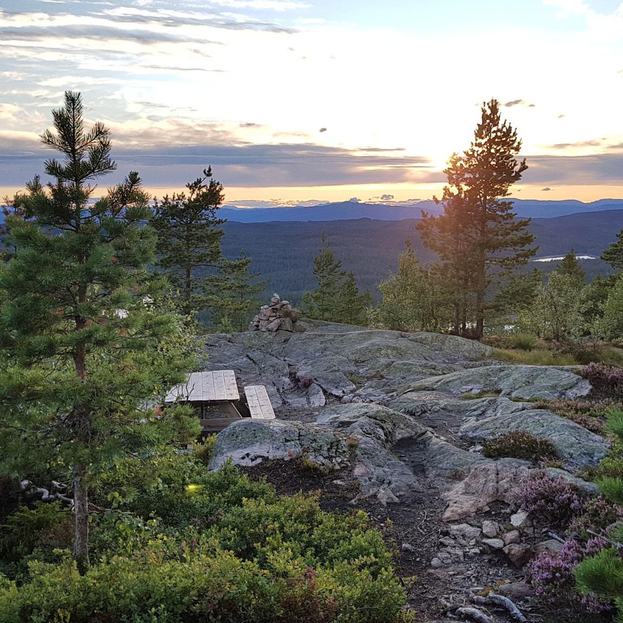
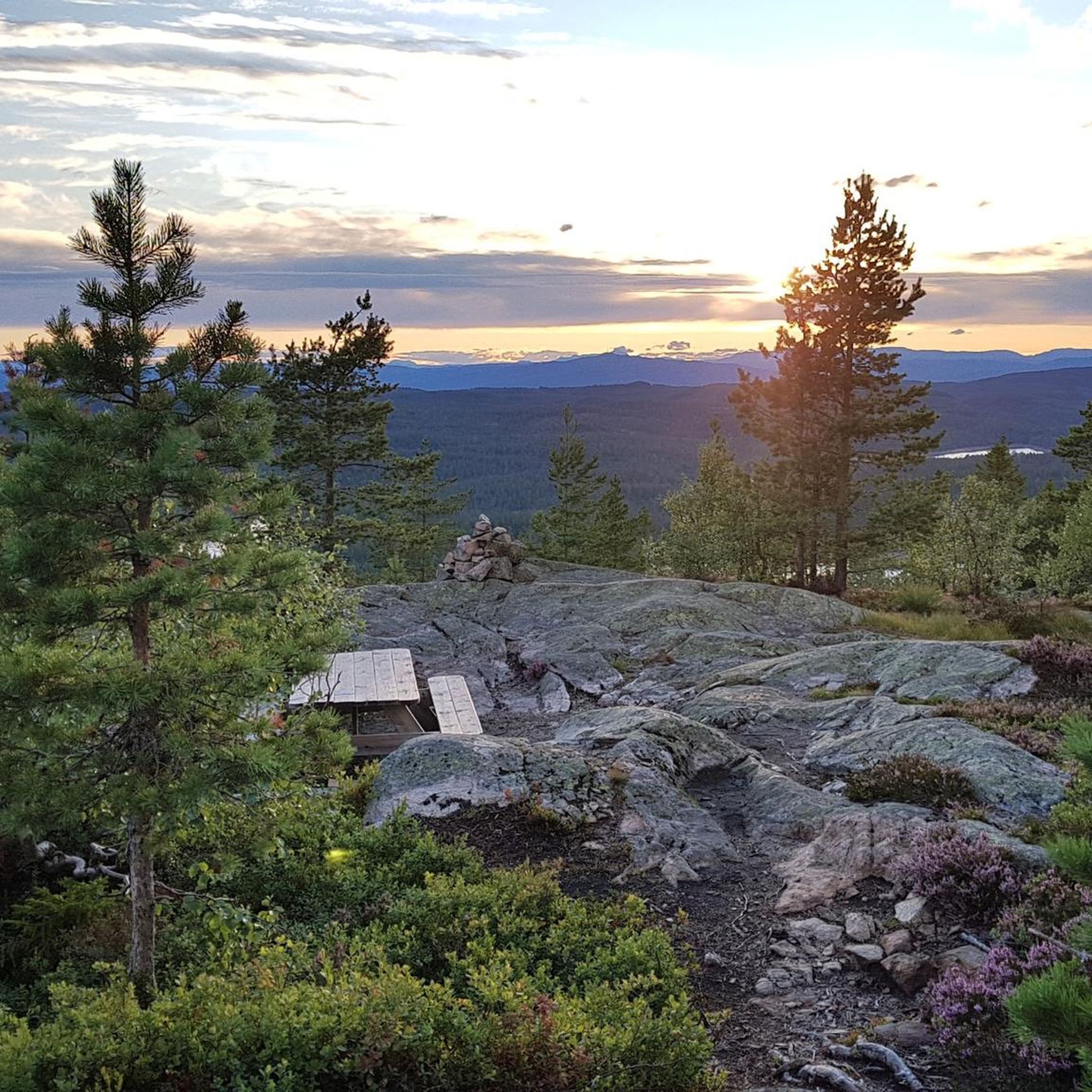
Hiking in Skibergfjell Naturreservat offers diverse landscapes within Vestfold's second-largest protected area. The terrain features significant geological contrasts, ranging from nutrient-rich rhomb porphyry in the east to nutrient-poor ekerite in the west. This geological diversity supports varied vegetation, including noble deciduous forests, herb-rich spruce forests, and expansive old-growth coniferous forests. Topography includes steep cliffs, gentle slopes, and defined stream gorges, with high points like Skibergfjell (632 meters) and Vestfjellet (634 meters) providing extensive views.
Best hiking trails in Skibergfjell Naturreservat
…Last updated: May 24, 2026
2
hikers
3.07km
01:02
150m
150m
Easy hike. Great for any fitness level. Easily-accessible paths. Suitable for all skill levels.
5.0
(3)
9
hikers
7.49km
02:14
230m
230m
Moderate hike. Good fitness required. Easily-accessible paths. Suitable for all skill levels.

Sign up for free
5
hikers
5.20km
01:28
110m
110m
Easy hike. Great for any fitness level. Easily-accessible paths. Suitable for all skill levels.
5.0
(2)
5
hikers
8.03km
02:19
200m
200m
Moderate hike. Good fitness required. Easily-accessible paths. Suitable for all skill levels.
2
hikers
Easy hike. Great for any fitness level. Easily-accessible paths. Suitable for all skill levels.
Get access to more routes and recommendations from other explorers.
Sign up for free
Already have an account?
Our route recommendations are based on thousands of hikes, rides, and runs completed by other people on komoot.
Start today with a free account
Your next adventure awaits.
Login or Signup
Popular around Skibergfjell Naturreservat
Tips from the Community

The route runs along 2 lakes, hidden in the forest. You can't get close to them.
0
0
From this point there is a nice view over the lake at Eidsfoss
0
0

With the possibility of swimming
0
0

The point is 632m above sea level and thus only 2m lower than the highest point in Vestfold. A nice trail takes you to Vestfjellet (634m) with a slightly better view of forest and lakes.
0
0
Frequently Asked Questions
What kind of terrain can I expect when hiking in Skibergfjell Naturreservat?
Skibergfjell Naturreservat offers a diverse landscape with significant geological contrasts. You'll find everything from steep cliffs and gentle slopes to broad plateaus and picturesque stream gorges. The eastern parts feature nutrient-rich rhomb porphyry supporting rich deciduous forests, while the western areas have nutrient-poor ekerite with blueberry spruce forests and pine bogs. The reserve is also known for its large, unbroken expanses of ancient coniferous forests.
Are there any easy hiking trails suitable for beginners or families?
Yes, Skibergfjell Naturreservat has several easy trails. For a pleasant forest walk, consider the Gauseseterskarva – Ramskollen loop from Gausesetra, which is just over 3 km. Another accessible option is the Trail Signpost in the Forest – Picnic Table by the Lake loop from Eidsfoss, offering a gentle 4 km path.
Where can I find panoramic views in Skibergfjell Naturreservat?
For breathtaking panoramic views, head to the higher points of the reserve. Vestfjellet (634 meters) and Skibergfjell (632 meters) offer extensive vistas across the Oslo Fjord to the Færder lighthouse, and on clear days, even as far as Sweden. The Skibergfjell Summit – View from Vestfjell loop from Grønntjernveien is a moderate route that takes you to these elevated positions.
Are there any historical landmarks or points of interest in the reserve?
Yes, Skibergfjell holds historical significance related to geographical surveying. At the peak of Skibergfjell, you can find an octagonal granite monument installed in 1877, which served as a trigonometric point for measurements, including calculations related to the Earth's circumference. Nearby, a concrete column marks a remnant of Norway's first-order foundation network, crucial for 20th-century map-making.
What is the best time of year to visit Skibergfjell Naturreservat for hiking?
Skibergfjell Naturreservat is a popular spot for outdoor enthusiasts throughout the year. While hiking is possible in most seasons, the forest road (Brekkeveien) leading to many trailheads is subject to a toll and closed during the winter months. Spring, summer, and autumn offer the most accessible conditions for exploring the trails and enjoying the diverse vegetation and views.
Are there any circular hiking routes available?
Yes, many of the trails in Skibergfjell Naturreservat are designed as loops. For example, the View from Vestfjell – Skibergfjell Summit loop from Dovrehallen provides a circular route that takes you through varied terrain. Another option is the moderate Red Cabin on the Hill – View of Lake at Eidsfoss loop from Eidsfoss.
What do other hikers say about the trails in Skibergfjell Naturreservat?
The trails in Skibergfjell Naturreservat are highly rated by the komoot community, with an average score of 4.7 stars from numerous reviews. Hikers often praise the diverse geology, the presence of old-growth coniferous forests, and the rewarding panoramic views from the high points.
Is there parking available for hikers?
Access to many trailheads is via Brekkeveien, a forest road originating from Eidsfoss. This road leads to a parking area situated 410 meters above sea level. Please note that this road is subject to a toll and is closed during the winter months.
What kind of vegetation and wildlife can I expect to see?
The reserve's varied geology supports distinct vegetation types. In the east, you'll find rich deciduous forests with species like elm, ash, lime, maple, hazel, and oak, alongside flourishing bogs. The western areas host more sparse vegetation of blueberry spruce forests, heather, cranberry forests, and pine bogs. The ancient coniferous forests are crucial habitats, providing diverse microenvironments for fungi, lichens, and insects.
How many hiking routes are there in Skibergfjell Naturreservat?
There are 8 hiking routes documented in Skibergfjell Naturreservat, catering to various fitness levels. This includes 5 easy trails and 3 moderate trails, ensuring options for both casual walkers and more experienced hikers.
Are there any challenging routes for experienced hikers?
While there are no routes classified as 'difficult' in our current selection, some of the moderate trails, such as the 7.7 km Skibergfjell Summit – View from Vestfjell loop from Grønntjernveien, require good physical condition and sure-footedness, especially when ascending to the highest points for panoramic views. The Norwegian Tourist Association (DNT) also marks more demanding routes in the area that may require sturdy footwear and alpine experience.

Get inspired with the komoot mobile app


Explore more
Browse the best Hikes in other regions.
