RoutesPlannerFeaturesUpdates
App
Login or Signup
Get the App
Login or Signup
Routes
Hikes
Canada
British Columbia

West Arm Provincial Park

Routes
Hikes
Canada
British Columbia

West Arm Provincial Park

The best walks and hikes in West Arm Provincial Park

4.6

(20)

327

hikers

10

hikes

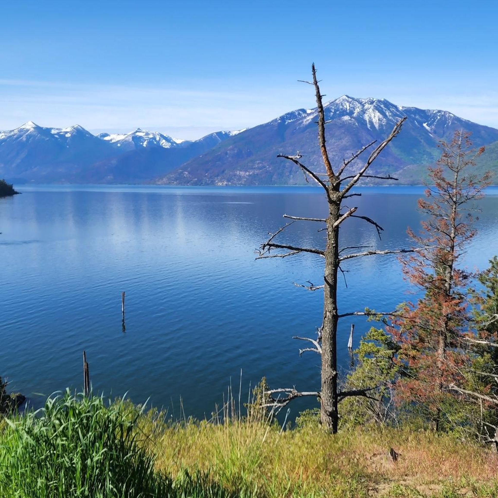
Hiking in West Arm Provincial Park offers diverse landscapes, stretching from the shores of Kootenay Lake through old-growth forests to high-elevation areas. The park protects significant watersheds and varied ecosystems, providing habitat for numerous species. Its topography includes creek fans, pocket beaches, and subalpine regions, with peaks offering expansive views of the surrounding wilderness. The largely undeveloped nature of the park ensures a genuine wilderness experience.

Best hiking trails in West Arm Provincial Park

  • The most popular hiking route is…

Last updated: November 4, 2026

4

hikers

#1.

Kokanee Creek Provincial Park loop via Canyon Trail

3.49km

00:59

70m

70m

Easy hike. Easily walkable paths.

Navigate with deviceSend to Phone
Save
Easy

4.5

(2)

42

hikers

Easy hike. Easily walkable paths.

Easy
guide_signup
Let us show you the way with the komoot mobile app
With a free komoot account, you can easily find, customize, and navigate endless outdoor adventures.
Sign up for free

Easy hike. Easily walkable paths.

Easy

Easy hike. Easily walkable paths.

Easy

5.0

(2)

22

hikers

Moderate hike. Good fitness required. Easily walkable paths.

Moderate
Sign up for free to see 6 more hikes in West Arm Provincial Park.

Get access to more routes and recommendations from other explorers.

Sign up for free

Already have an account?

Our route recommendations are based on thousands of hikes, rides, and runs completed by other people on komoot.

Start today with a free account

Your next adventure awaits.

Login or Signup

Popular around West Arm Provincial Park
Road Cycling Routes in West Arm Provincial Park

Running Trails in West Arm Provincial Park

Cycling in West Arm Provincial Park

Tips from the Community

Alice Baddeley
July 27, 2026, Hall Street Pier

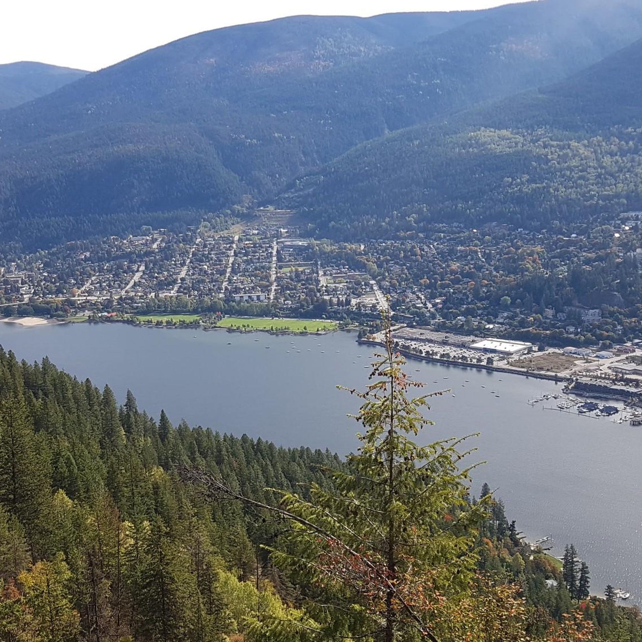
Hall Street Pier sits on Nelson’s waterfront, linking Hall Street and the downtown area with Kootenay Lake. It includes seating, a covered bandshell, swimming access and views across the water. It also displays the restored Ladybird speedboat, built on Kootenay Lake in 1922.

0

0

Take a moment to admire the views across the West Arm of Kootenay Lake from the southern end of Lakeside Park. Framed by the Selkirk Mountains, this glacier-carved lake is one of British Columbia's largest and most scenic waterways.

0

0

Relax on the long sandy beach and enjoy views across the West Arm of Kootenay Lake towards the surrounding mountains. The beach is popular for swimming, paddling and picnics, while the adjoining park has gardens, a playground, playing fields and a broad waterfront promenade. You’ll also find a public wharf, boat launch and seasonal café nearby.

0

0

Created in 1955 this provincial park sits Kokanee Creek meets Kootenay Lake. It covers 260 hectares of forest, beaches, and deltas. You'll find a nice network of trails, a visitor centre, campgrounds, boat launch, and more.

0

0

Andrus
July 6, 2026, Canyon Trail

The Canyon Trail follows the path of Kokanee Creek as it makes it's final run into Kootenay Lake. Along the way you'll be surrounded by lush forest with the creek always at your side. If you time it right you can even see the salmon as they make their way upstream to spawn.

0

0

Canyon Lookout is a spectacular viewpoint over Kokanee Creek. It's accessible from a short trail off of Kokanee Glacier Road, or by a longer hike along the Canyon Trail from the Sandspit Campground.

0

0

take me back to nelson please and thank you

1

0

Last climb

Translated by Google•

0

0

Frequently Asked Questions

What kind of hiking experience can I expect in West Arm Provincial Park?

West Arm Provincial Park offers a genuine wilderness experience with diverse landscapes, from the tranquil shores of Kootenay Lake through ancient old-growth forests to high-elevation areas. You'll find opportunities for everything from lakeside strolls to more challenging ascents with expansive views, all within a largely undeveloped natural environment.

Are there easy hiking trails suitable for beginners or families?

Yes, the park offers several easy trails. For a gentle walk with minimal elevation gain, consider the Hall Street Pier loop from Nelson, which is 4.4 km long and takes about 1 hour 8 minutes. This route offers a pleasant experience near the lake.

What are some trails with good viewpoints or scenic features?

While many trails offer natural beauty, the park's high-elevation areas provide expansive views. For a moderate challenge leading to scenic vistas, the Pull Pit Rock loop from North Shore offers varied terrain and takes you through areas with potential viewpoints over the lake and surrounding wilderness.

Are there any circular hiking routes in West Arm Provincial Park?

Yes, many of the trails in West Arm Provincial Park are designed as loops, allowing you to start and end at the same point. Examples include the Hall Street Pier loop from Nelson and the Lyon's Bluff loop from Lyon's Bluff, providing convenient options for exploration.

What is the best time of year to go hiking in West Arm Provincial Park?

The best time to hike generally depends on the elevation. Lower elevation trails along Kootenay Lake and through old-growth forests are accessible for much of the year. For high-elevation routes and alpine areas, late spring through early fall typically offers the most favorable conditions, avoiding snow and ice.

Is West Arm Provincial Park dog-friendly?

West Arm Provincial Park is a wilderness area, and while dogs are generally permitted on trails, it's crucial to keep them on a leash to protect wildlife, especially given the presence of species like grizzly bears and mountain caribou. Always practice responsible pet ownership and pack out all waste.

Are there any long-distance or more challenging hikes available?

For a longer, more challenging hike, consider the Hall Street Pier – Pull Pit Rock loop from Nelson. This moderate route spans nearly 14.5 km with over 400 meters of elevation gain, typically taking around 4 hours 22 minutes to complete, offering a more extensive exploration of the park's varied terrain.

What natural features are prominent in West Arm Provincial Park?

The park is characterized by its diverse natural features, including the picturesque Kootenay Lake shoreline with creek fans and pocket beaches, extensive old-growth forests, and high-elevation subalpine and alpine regions. It also plays a crucial role in protecting important watersheds and is recognized for its significant biodiversity.

What do other hikers say about the trails in West Arm Provincial Park?

The trails in West Arm Provincial Park are highly regarded by the komoot community, with an average rating of 4.7 stars from over 10 reviews. Hikers often praise the park's natural beauty, the sense of wilderness, and the diverse landscapes encountered on the routes.

Are there any historical or cultural points of interest within the park?

Yes, West Arm Provincial Park protects important First Nations cultural values, including archaeological sites along the lakeshore. It also holds heritage values associated with railway development and sternwheeler ships, adding a historical dimension to the natural exploration for those interested in the region's past.

Is public transport available to access West Arm Provincial Park trailheads?

Access to West Arm Provincial Park is primarily by car, as it is a largely undeveloped wilderness area. While some routes, like those starting from Nelson, might be accessible via local transit to the town, direct public transport to specific trailheads within the park is generally limited. Planning for private vehicle access is recommended.

Are there designated parking areas for hikers?

Given the park's undeveloped nature, designated parking areas might be limited. For trails closer to urban centers like Nelson, such as the Hall Street Pier loop from Nelson, you may find more established parking options. For more remote trailheads, roadside parking might be the only option, so always park responsibly and respect local regulations.

Most popular routes in West Arm Provincial Park

Easy hikes in West Arm Provincial Park

Store rating

Get inspired with the komoot mobile app

With a free komoot account, you can easily find, customize, and navigate endless outdoor adventures.

or

Join komoot Now
Store rating

Explore more

Browse the best Hikes in other regions.

Rocky MountainsSelkirk MountainsMonashee MountainsElectoral Area AAlberni-ClayoquotVancouver IslandVancouverArea C (Pemberton Valley/Mount Currie/D'Arcy)Metro Vancouver Regional ParksArea A (Kicking Horse/Kinbasket Lake)Area D (Oyster Bay/Buttle Lake)Area D (Elaho/Garibaldi)Yoho National ParkBurnabyBeaver Lodge Forest LandsSaanichNanaimoEast Central Okanagan Electoral AreaColony Farm Regional ParkCentral Okanagan JFraser River Delta -- RamsarCowichan Valley GArea G (Forster Creek/Mount Assiniboine)Okanagan LakeArea B (South Fraser Canyon/Sunshine Valley)Area A (Baynes Sound)Purcell MountainsSunshine Coast Regional DistrictArea E (Chilliwack River Valley)SurreyArea P (Rivers and the Peaks)Area F (McConnell Creek/Hatzic Prairie)Area F (Columbia Lake/Windermere Lake)Hazelton MountainsArea B (Shelter Bay/Mica Creek)Area D (Falkland/Silver Creek)Stave West Forest & Recreation AreaSpallumcheenNorth Okanagan BArea L (Grasslands)North CowichanAbbotsfordArea A (Upper Flathead/Elk Valley)Kanaka Creek Regional ParkBurns Bog Ecological Conservancy AreaFraser Islands Regional Park ReserveNanaimo GTynehead Regional ParkLangleyArea C (Arrowsmith-Benson)Surrey Bend Regional ParkUpper Trent River WoodlandsArea C (Moyie/Bull River)Coquitlam WatershedArea F (Grindrod/Ashton Creek/Mabel Lake)Maple RidgeStephens Coyote Ridge Regional ParkKootenay National ParkOkanagan Mountain Provincial ParkArea C (Puntledge/Black Creek)Woodley Range Ecological ReserveCariboo MountainsRichmondBeaufort East WoodlandsArea H (Lighthouse Country)Area G (Deroche/Dewdney/Sumas Mountain)K'Ómoks Royston LandsArea A (Kyuquot/Nootka/Sayward)Tsable Lakes WoodlandsRobert'S Lake Regional ParkGlen Valley Regional ParkAkamina-Kishinena Provincial ParkArea A (Wells Gray Country)Upper Puntledge River WoodlandsArea C (Sasquatch Country)Central SaanichUpper Qualicum River WoodlandsStave LakePacific Rim National Park Reserve - Long Beach UnitStrathcona Provincial ParkCypress Provincial ParkArea H (The Slocan Valley)Fraser Valley DCrown Land ReservePacific Rim National Park Reserve - West Coast Trail UnitStikine RegionUpper Little Qualicum River WoodlandsShuswap LakeOkanagan-Similkameen DWells Gray Provincial ParkBurnaby Lake Regional ParkVictoriaEagle Mountain Recreation SiteSumas Mountain Regional ParkDawley Passage Provincial ParkIona Beach Regional ParkArea N (Beautiful Nicola Valley - South)Area E (Moberly Lake/Sukunka Valley)Blackcomb Glacier Provincial ParkArea C (Chilako River/Nechako)DeltaStanley Park National Historic SiteAyum Creek Regional Park ReservePowell LakeArea E (Eagle River Valley)Callaghan ConservancyElk Falls Provincial ParkTantalus Provincial ParkMount Geoffrey Escarpment Provincial ParkGaribaldi Provincial ParkBoyle Point Provincial ParkBlaney Bog Regional Park ReserveCapital GArea H (Robson Valley/Canoe)Gowlland Tod Provincial ParkArea B (Shawnigan Lake)Blue Mountain Recreation SiteColumbia National Wildlife AreaArea F (Alberni Highway)Juan De Fuca Provincial ParkArea C (Blind Bay/Sorrento)Telemark Cross-Country Ski Trails Recreation SiteTəmtəmíxʷtən/Belcarra Regional ParkStawamus Chief Provincial ParkCapilano River Regional ParkComox Valley B (Lazo North)Deas Island Regional ParkBurnaby Mountain Conservation AreaSooke Hills Wilderness Regional ParkInland Lake Provincial ParkLarch Hills Trails Recreation SiteSeal Bay Regional Nature ParkWhistler Interpretive ForestUbc Malcolm Knapp Research ForestArea B (Paradise Valley)Area A (Malaspina/Toba)Area B (Lake Koocanusa)Showh Lakes-Ancient Cedars Trail Recreation SiteSayres Lake Recreation SiteLittle Qualicum Falls Provincial ParkArea H (Manning Park/Tulameen/Siwash)Koksilah River Provincial ParkBrackendale Eagles Provincial ParkHelliwell Provincial ParkArea B (Discovery Islands/Mainland Inlets)Pacific Spirit Regional ParkCowichan Valley FCodd Wetland Ecological Conservancy AreaArea D (Lardeau Valley/Duncan Lake)Harrison LakeMount Revelstoke National ParkArea F (Scotch Creek/Seymour Arm)Kennedy Lake Provincial ParkAlberni - Ash River WoodlandsȽáu,Welṉew̱/John Dean Provincial ParkRathtrevor Beach Provincial ParkMount Fernie Provincial ParkAlberni Beaufort Range WoodlandsE.C. Manning Provincial ParkSx̱Ótsaqel / Chilliwack Lake Provincial ParkSalt Spring Island Electoral AreaArea E (Saint Mary/Skookumchuck)Cowichan River Provincial ParkCoquihalla Summit Recreation AreaNorth SaanichMount Seymour Provincial ParkVictoria Harbour Migratory Bird SanctuaryArea J (Copper Desert Country)Mount Arrowsmith Regional Park (Acrd)Strathcona Park - Upper Puntledge River WatershedArea F (Willow River/Upper Fraser)Lynn Headwaters Regional ParkPinecone Burke Provincial ParkEpper Passage Provincial ParkArea I (Youbou / Meade Creek)Minnekhada Regional ParkGrouse Mountain Regional ParkArea A (North Skeena)Area C (Inkaneep/Willowbrook)Buntzen Lake Recreation AreaGoldstream Provincial ParkMacmillan Provincial ParkCultus Lake Provincial ParkThwaytes Landing Regional ParkPitt LakeArea D (Trinity/West Creighton)Area E (Balfour/Cottonwood Lake)Mount Arrowsmith Massif Regional Park (Rdn)Alberni - Great Central Lake WoodlandsStamp River Provincial ParkLower Seymour Conservation ReserveCrippen Regional ParkMyra-Bellevue Provincial ParkBrandywine Falls Provincial ParkArea C (Lois Lake/Saltery Bay)Cougar Canyon Ecological ReservePitt MeadowsThacker Regional ParkArea A (Upper Bridge River Valley)Kootenay Boundary EMount Gardner Recreation SiteArea B (Lower Columbia/Old Glory)Seymour WatershedGolden Ears Provincial ParkMount Robson Provincial ParkSkaha Bluffs Provincial ParkAlouette LakeValhalla Provincial ParkFlorence Lake Recreation ReserveArea K (The Arrow Lakes)Mount Terry Fox Provincial ParkArea D (Kiskatinaw Valley)Area E (Cherryville/East Creighton)Liumchen Ecological ReserveMt Begbie Area Recreation SiteHillkeep Regional ParkCheam Wetlands Regional ParkArea B (Cayoosh/Pavilion)Boundary Bay Regional ParkWidgeon Marsh Regional Park ReserveArea H (Canim Lake/Forest Grove)Area J (Lower Arrow/Columbia)Mount Assiniboine Provincial ParkSasquatch Provincial ParkArea F (Trout Creek Valley)Stebbings Road Community ForestSkeena MountainsFraser River Ecological ReserveMount Begbie Recreation SiteArea O (Lower North Thompson)Alice Lake Provincial ParkArea C (Hyde Creek/Benson Valley)Buttle LakeArea E (Naramata/Greyback)Area D (Nimpkish Valley/Cormorant Island)Campbell Valley Regional ParkWeaver Lake Recreation SiteNorth Cowichan Municipal Forest ReserveCapilano WatershedBowen Island Ecological Reserve

Nearby adventure guides

Things to Do around Area E (Balfour/Cottonwood Lake)

background

Get ready to conquer new peaks

Sign up for Free
Explore
RoutesRoute plannerFeaturesRedeem a voucherHikesMTB TrailsRoad cycling routesBikepackingSitemap
Download the app
Follow Us on Socials

© komoot GmbH

Privacy Policy