The best running trails in Laukvikøyene Naturreservat
80
runners
4
runs
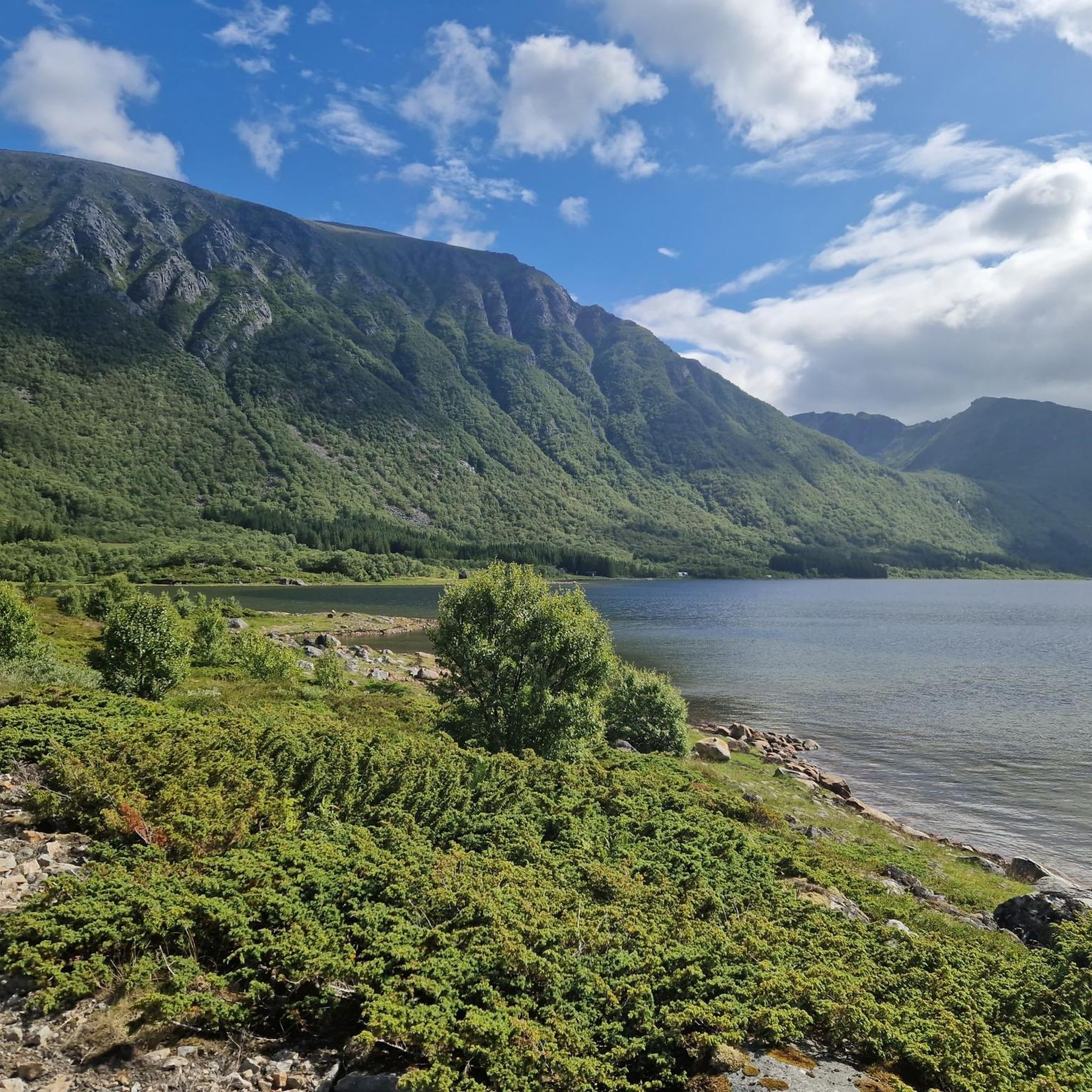
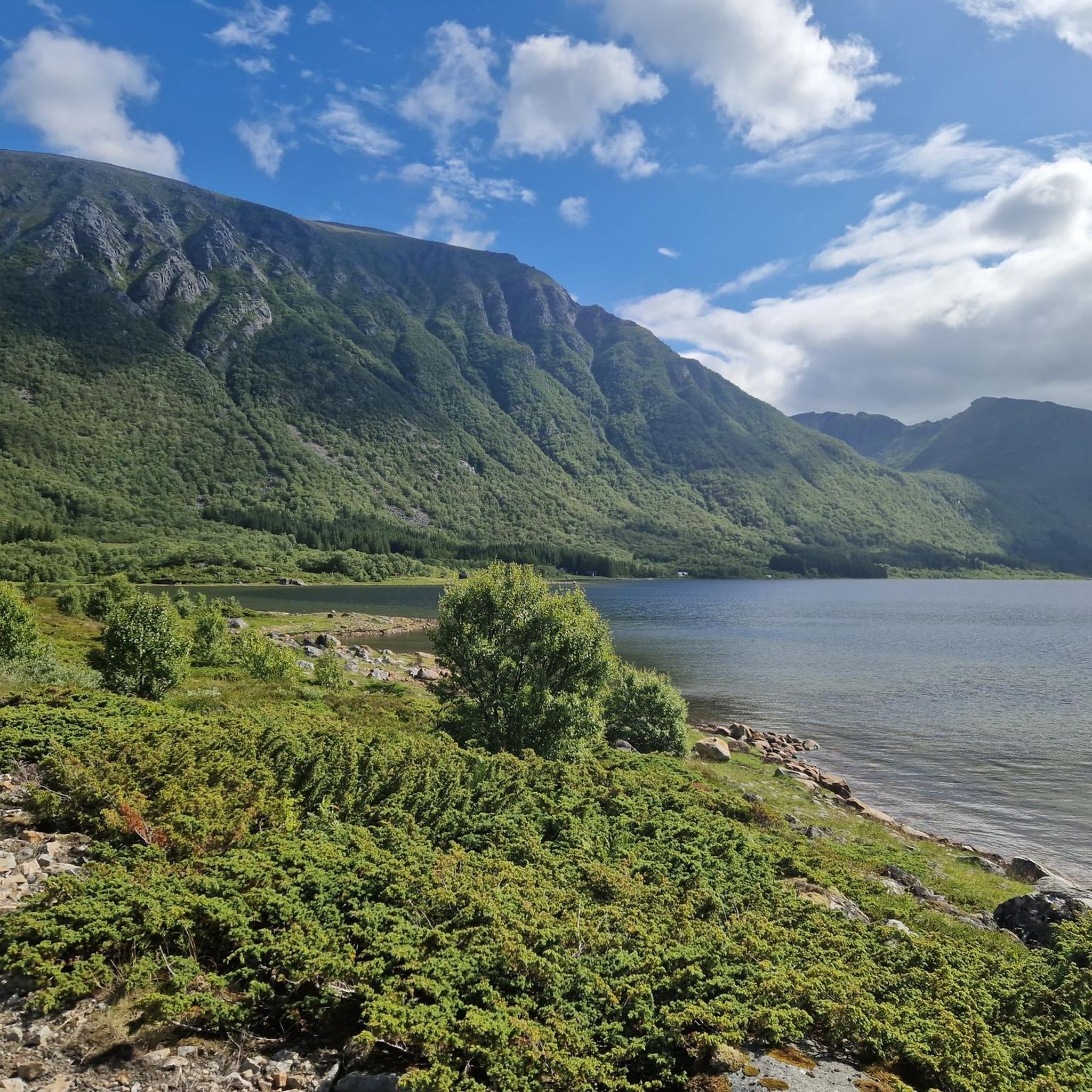
Jogging routes in Laukvikøyene Naturreservat traverse a diverse coastal and wetland environment, characterized by numerous islands, shallow sea areas, and extensive marshes. The region features a dynamic coastline with coves and bays, alongside inland areas dominated by freshwater ponds and bog vegetation. Terrain includes heather moors and patches of birch forest, offering varied natural backdrops for running. Smaller hills like Røyneshaugen and Hellhaugen provide varied vistas across the landscape.
Best jogging routes in Laukvikøyene Naturreservat
- The most popular jogging route…
Last updated: May 23, 2026
9
runners
5.52km
00:34
20m
20m
Moderate run. Good fitness required. Mostly paved surfaces. Suitable for all skill levels.
31
runners
15.3km
02:33
780m
780m
Hard run. Very good fitness required. Sure-footedness, sturdy shoes and alpine experience required.

Sign up for free
19
runners
13.3km
02:37
800m
800m
Hard run. Very good fitness required. Sure-footedness, sturdy shoes and alpine experience required.
21
runners
15.1km
01:34
60m
60m
Hard run. Very good fitness required. Mostly paved surfaces. Suitable for all skill levels.
Our route recommendations are based on thousands of hikes, rides, and runs completed by other people on komoot.
Start today with a free account
Your next adventure awaits.
Login or Signup
Popular around Laukvikøyene Naturreservat
Tips from the Community

This wide plateau is in stark contrast to the airy Matmora ridge to the south. However, the views are similarly superb, especially across Grunnførfjorden and the peaks that form a crown above Storvatnet. From here, its a short hike to Matmora, which is a sensational ridge to traverse.
0
0
The early stages on the ascent to the Matmora ridge reveal some lovely views across towards Laukvik and beyond towards Festvågtinden and Gimsøya. This section is either the start or finish of the Lofoten Long Crossing long-distance trail, a stunning traverse of the archipelago.
0
0
Matmora is the 788-metre (2,585 ft) summit of what is a stunning ridge traverse, with some photogenic pinnacles that lean across the void. Narrow, airy and spectacular, it's a real highlight of the Lofoten Long Crossing long-distance trail. Expect superb views across the archipelago's jagged peaks and down to Grunnførfjorden.
0
0

It is worth climbing up from the north (hiking car park => Plus Code CG23+G2) as you have a wonderful view of the sandbank for long stretches. If possible, I would also plan the hike so that you are at the summit at high tide, as the different colors of the sea are more noticeable then.
1
0

Nice spot to look at Laukvik and the mountains behind it!
0
0


Frequently Asked Questions
How many running routes are available in Laukvikøyene Naturreservat?
There are 5 dedicated running routes in Laukvikøyene Naturreservat, offering a variety of experiences across the diverse coastal and wetland landscapes.
Are there easy running routes for beginners or casual joggers?
Yes, for those seeking a more relaxed run, the Nordtjønna loop from Nautøya is a moderate option. It covers about 5.5 km with minimal elevation gain, making it suitable for a comfortable jog through the coastal scenery.
What kind of terrain can I expect on the jogging trails?
The terrain in Laukvikøyene Naturreservat is quite varied. You'll encounter coastal paths, wetland areas, heathlands, and even some patches of birch forest. While many routes offer relatively flat sections, some, like the Matmora loop from Jordholman, include significant elevation changes, providing a more challenging experience and panoramic views.
Are there any circular running routes?
Yes, all the routes listed in this guide are circular, allowing you to start and finish at the same point. Examples include the Nordtjønna loop from Nautøya and the more challenging Hesttjønna – Haraldtjønna loop from Strandlandet kirke.
What are some interesting natural features or landmarks I might see while running?
While running, you can enjoy the dramatic coastal scenery, numerous bays and coves, and the unique wetland areas with freshwater ponds. Keep an eye out for cultural elements such as traditional stockfish drying racks and the charming Laukvik Harbor. The reserve also features five named hills, with Røyneshaugen being the highest, offering gentle elevation changes and varied vistas.
What is the best time of year to go jogging in Laukvikøyene Naturreservat?
The warmer months, typically late spring through early autumn, offer the most pleasant conditions for jogging, with longer daylight hours and milder temperatures. This is also when birdlife is most active, making for excellent wildlife spotting opportunities. However, the dramatic coastal landscape can be enjoyed year-round, with winter offering a unique, serene experience for those prepared for colder weather.
Are the running routes suitable for families?
While the guide doesn't specifically list 'easy' routes, the moderate Nordtjønna loop from Nautøya, with its relatively flat profile and coastal views, could be a good option for families looking for a less strenuous run or walk. Always consider the fitness level of all family members before choosing a route.
What kind of wildlife might I spot while jogging?
Laukvikøyene Naturreservat is a significant nesting area for sea and wetland birds, being a Ramsar site. Joggers may observe various species, including gulls, ducks, and waders, especially during migratory seasons. The rich eelgrass meadows in the sea areas also support diverse marine life.
Are there any longer, more challenging running options for experienced runners?
Absolutely. For experienced runners seeking a challenge, routes like the Hesttjønna – Haraldtjønna loop from Strandlandet kirke (15.3 km with significant elevation) or the Sørvest for Gjersvollheia – Matmora loop from Delp (13.3 km with over 800m elevation gain) offer demanding terrain and rewarding views.
Where can I find parking for the jogging routes?
Specific parking information for each trailhead is often available on the individual route pages. Generally, you can find parking near common starting points like Laukvika, Nautøya, Jordholman, or Gimsøy kirke, depending on your chosen route.
Are there cafes or places to relax after a run?
Yes, the charming Laukvik Harbor and Café is a notable spot mentioned in the region's description, providing a pleasant place to relax and refuel after your run, often incorporated into coastal routes.

Get inspired with the komoot mobile app


Explore more
Browse the best Running Trails & Routes in other regions.
