The best running trails around Brattforshedens naturvårdsområde
4.0
(1)
12
runners
5
runs
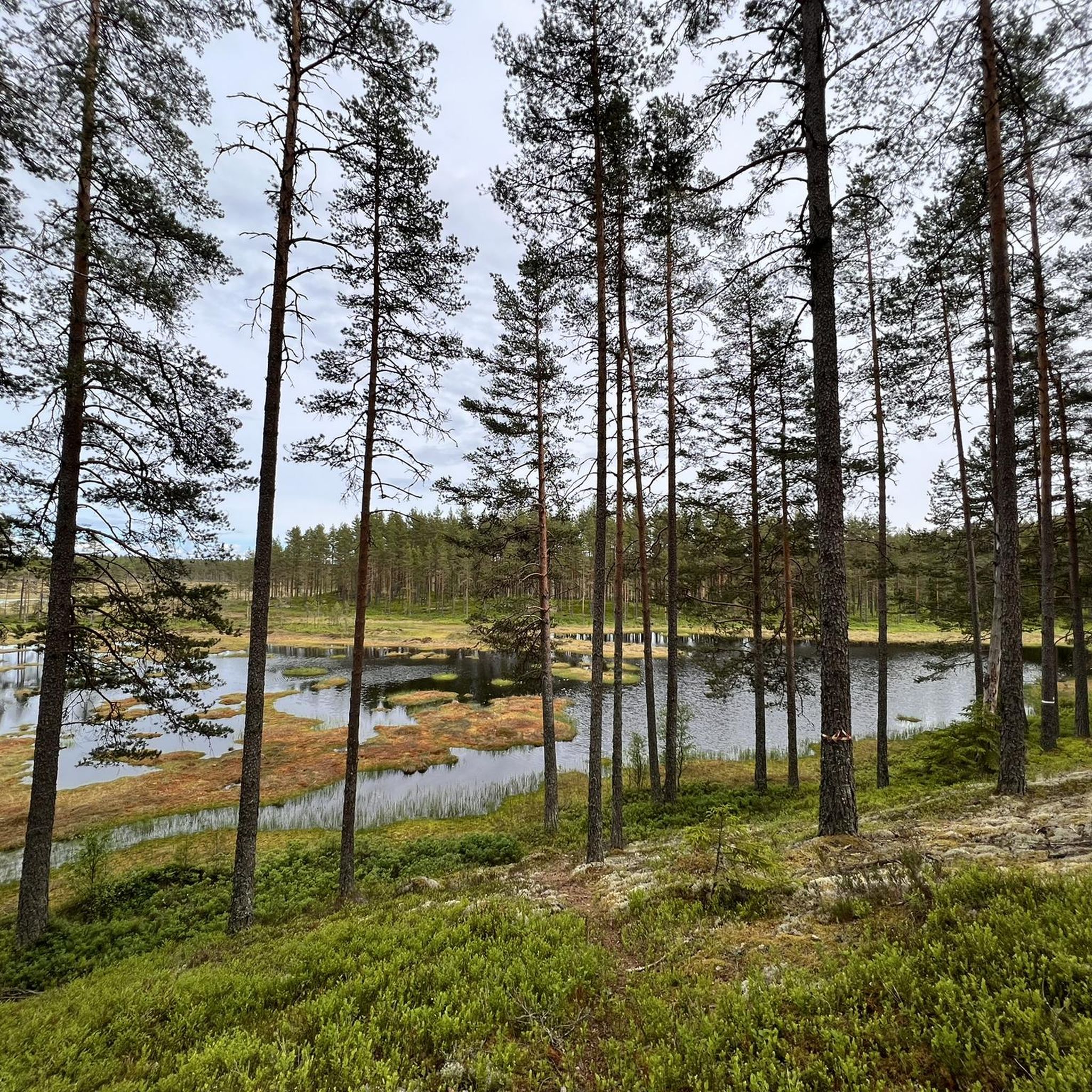
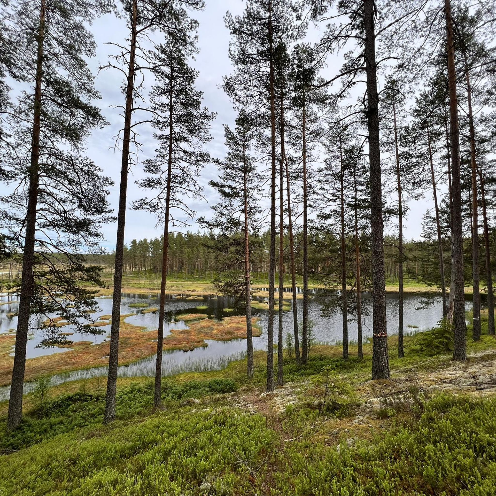
Jogging around Brattforshedens naturvårdsområde offers a diverse natural environment with an extensive trail system. The region is characterized by varied terrain, including meandering waterways, steep ridges, ravines, and sandy heaths with pine forests. It sits on one of Sweden's largest ice-river deposits, featuring numerous Ice Age formations such as kettle holes and sand dune fields. This landscape provides a range of experiences for runners, from soft forest paths to more uneven trails.
Best jogging routes around Brattforshedens naturvårdsområde
- The most…
Last updated: May 14, 2026
4
runners
8.12km
00:57
20m
20m
Moderate run. Good fitness required. Mostly paved surfaces. Suitable for all skill levels.
4
runners
7.77km
00:55
20m
20m
Moderate run. Good fitness required. Mostly paved surfaces. Suitable for all skill levels.

Sign up for free
2
runners
5.80km
00:42
30m
30m
Moderate run. Good fitness required. Mostly paved surfaces. Suitable for all skill levels.
1
runners
9.21km
01:00
50m
50m
Moderate run. Good fitness required. Mostly paved surfaces. Suitable for all skill levels.
4.0
(1)
1
runners
14.2km
01:35
140m
140m
Moderate run. Good fitness required. Mostly paved surfaces. Suitable for all skill levels.
Our route recommendations are based on thousands of hikes, rides, and runs completed by other people on komoot.
Start today with a free account
Your next adventure awaits.
Login or Signup
Popular around Brattforshedens naturvårdsområde
Tips from the Community

Frequently Asked Questions
How many running routes are available in Brattforshedens naturvårdsområde?
Brattforshedens naturvårdsområde offers a network of over 75 kilometers of marked trails, with at least 8 dedicated running routes available on komoot. These routes cater to various preferences, from moderate to more challenging sections.
What kind of terrain can I expect on the jogging trails in Brattforshedens naturvårdsområde?
The area features a highly varied terrain, including sandy heaths with pine forests, steep ridges, ravines, and meandering waterways. You'll find a mix of soft forest paths and more uneven trails, providing a dynamic experience for runners. The region is also known for its unique Ice Age formations, such as kettle holes and sand dunes.
Are there any easy or beginner-friendly running routes in the area?
While many routes are classified as moderate, the extensive trail network includes sections suitable for an easy introduction to the area's nature. For example, there are shorter loops, like an easy 4.2 km loop through a dune landscape, that are less demanding. The trails around the former Brattforsheden Airfield offer relatively flat terrain.
Can I find more challenging running trails in Brattforshedens naturvårdsområde?
Yes, for those seeking a challenge, the area includes more difficult sections, particularly within the ravines. The 24-kilometer Brattforsleden loop, for instance, has a 3 km section in the Lungälvsravinerna that is considered difficult due to steeper slopes and varied surfaces.
What natural features or landmarks can I see while running in Brattforshedens naturvårdsområde?
Runners can explore a wealth of natural and historical features. You'll encounter unique Ice Age formations like kettle holes and prominent sand dune fields, as well as ancient pine forests and lush ravine forests. Historical sites include the old ironworks in Brattfors, remnants of ancient charcoal production, and the preserved Krigsflygfält 16 Brattfors, a former military airfield from World War II.
Are the running routes in Brattforshedens naturvårdsområde suitable for families?
Yes, the area offers a variety of trails, including shorter, easier loops that are well-suited for families. The diverse landscapes and interesting features like sand dunes and historical sites can make for an engaging outing for all ages. Just be sure to choose a route that matches your family's fitness level.
Is Brattforshedens naturvårdsområde dog-friendly for runners?
Generally, dogs are welcome on trails in natural areas in Sweden, provided they are kept on a leash, especially during certain times of the year to protect wildlife. It's always a good idea to check local regulations or signage at trailheads for any specific rules within Brattforshedens naturvårdsområde to ensure a pleasant experience for everyone.
Are there circular running routes available?
Yes, many of the trails in Brattforshedens naturvårdsområde are designed as circular routes. A notable example is the 24-kilometer Brattforsleden loop, which takes you through four different nature reserves. Shorter loops, such as the Bläcktjärnen loop, are also available.
What do other runners enjoy most about jogging in Brattforshedens naturvårdsområde?
The area is highly rated by the komoot community, with an average score of 4.7 stars. Reviewers often praise the diverse natural environment, the extensive and well-marked trail system, and the unique geological features that make for an engaging running experience. Many appreciate the mix of soft forest paths and more challenging sections.
Is there parking available for accessing the running trails?
Yes, there are designated parking areas available within Brattforshedens naturvårdsområde, making it convenient to access the various trailheads. Specific parking information can often be found on local maps or at the start of popular routes.
Are there any rest areas or facilities along the trails?
Yes, along the trails, you'll find several shelters where you can rest. Some designated fireplaces are also available, with firewood regularly replenished, though bringing your own is recommended to ensure availability. These spots are perfect for a short break or a picnic during your run.
What is the best time of year to go running in Brattforshedens naturvårdsområde?
Brattforshedens naturvårdsområde offers a great running experience throughout much of the year. Spring and autumn provide pleasant temperatures and beautiful scenery, while summer allows for longer daylight hours. Even winter running can be magical, though trails might be covered in snow, requiring appropriate gear. Always check local weather conditions before heading out.
Most popular routes around Brattforshedens naturvårdsområde

Get inspired with the komoot mobile app


Explore more
Browse the best Running Trails & Routes in other regions.
