The best waterfall hikes and walks around Bezirk Arlesheim
4.4
(1165)
8,439
hikers
16
hikes
Waterfall hiking trails around Bezirk Arlesheim lead through a diverse landscape of lush forests, rolling hills, and gentler valleys. The region is characterized by the prominent Birs River, which supports rich biodiversity and offers peaceful walks along its banks. Elevated views are available from the Gempenplateau, providing panoramic vistas across the Basel area. These natural features combine with historical sites to create varied hiking experiences.
Best waterfall hiking trails around Bezirk Arlesheim
- The most popular waterfall hiking route is Old…
Last updated: September 29, 2026
4.0
(13)
39
hikers
6.46km
01:43
70m
70m
Easy hike. Great for any fitness level. Easily-accessible paths. Suitable for all skill levels.
4.6
(5)
29
hikers
7.68km
02:25
250m
250m
Moderate hike. Good fitness required. Mostly accessible paths. Sure-footedness required.

5.0
(1)
20
hikers
13.9km
04:03
330m
330m
Moderate hike. Good fitness required. Mostly accessible paths. Sure-footedness required.
4.6
(8)
16
hikers
11.9km
03:37
350m
350m
Moderate hike. Good fitness required. Mostly accessible paths. Sure-footedness required.
5.0
(1)
10
hikers
9.16km
02:26
90m
90m
Moderate hike. Good fitness required. Easily-accessible paths. Suitable for all skill levels.
Get access to more routes and recommendations from other explorers.
Already have an account?
Our route recommendations are based on thousands of hikes, rides, and runs completed by other people on komoot.
Start today with a free account
Your next adventure awaits.


Tips from the Community

The Schalberghöhle cave today presents itself as a narrow, winding passage. The Schalberghöhle cave today presents itself as a narrow, winding passage. It lies near the ridge, which is formed by the Rauracienfels; therefore, the thickness of the cave roof is in places barely 2 m. In 1926, Emil Vogt conducted an excavation. Numerous finds from pre-Christian times are exhibited in the Heimatmuseum Aesch under the designation "Schalbergfels".
0
0

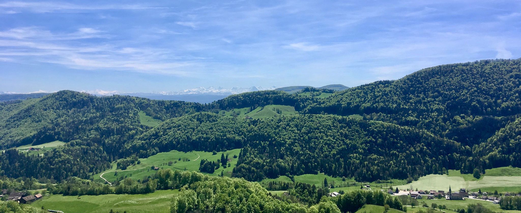
I would say it is the canton of Baselland. Between the middle and the right edge, you can see the 2 Rochtürme (Dasel-Stadt)
0
0


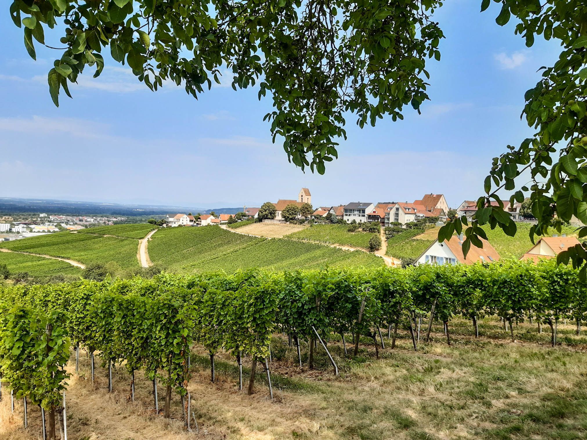
The Aescher Klus is the largest contiguous wine-growing region in the canton of Basel-Landschaft. A wide variety of grape varieties thrive here on over 20 hectares. Numerous paths crisscross the vineyards, and it seems like every section of the vines has its own vineyard cottage. An interesting fact: In 1966, excavations at a depth of four meters uncovered the remains of grapevines that could be dated to the 3rd to 4th centuries AD.
0
0

The overhanging canopy of the forest forms a kind of forest tunnel, bathing the scenery in an almost mystical light. Could fairies 🧚 and goblins 🧌 live here? It wouldn't surprise us.
0
0

The old Allschwil village church is surrounded by beautiful Sundgau half-timbered houses.
0
0

Here, you pass through the largest contiguous wine-growing region in the canton of Basel-Landschaft. Grapes were cultivated here as early as Roman times (Augusta Raurica). Those interested can learn a great deal about vines and winemaking along the wine hiking trail here in the Chlustal Valley. There are several wineries and winery restaurants in the valley; please check their opening hours online.
0
0
Frequently Asked Questions
How many waterfall hiking trails are there in Bezirk Arlesheim?
There are 19 dedicated waterfall hiking trails around Bezirk Arlesheim. These routes offer a diverse range of experiences, from leisurely strolls to more challenging paths, all featuring the region's natural beauty.
What is the best time of year to experience the waterfalls in Bezirk Arlesheim?
The best time to hike and enjoy the waterfalls in Bezirk Arlesheim is generally from late spring to early fall (May to September). During these months, the weather is pleasant, and trails are typically dry, making for ideal hiking conditions. Water levels in the waterfalls are also usually good after spring melts or summer rains.
Are there easy waterfall hikes suitable for beginners or families in Bezirk Arlesheim?
Yes, Bezirk Arlesheim offers several easy waterfall hikes perfect for beginners or families. For example, the Old Mill Ruins – Fitness Trail Schönbrunnen loop from Hégenheim is an easy 4.0-mile (6.5 km) trail with a gentle elevation gain, ideal for a relaxed outing.
What kind of terrain can I expect on waterfall hikes in Bezirk Arlesheim?
Waterfall hikes in Bezirk Arlesheim typically lead through a varied landscape of lush forests, rolling hills, and gentler valleys. You'll often find paths winding along the tranquil Birs River, which is a prominent natural feature. Some routes may include slight inclines or descents, but many are well-maintained and suitable for different fitness levels.
Can I bring my dog on waterfall hikes in Bezirk Arlesheim?
Generally, dogs are welcome on hiking trails in Bezirk Arlesheim, but it's always recommended to keep them on a leash, especially in nature reserves, near livestock, or in crowded areas. Please be mindful of local regulations and ensure your dog is well-behaved around other hikers and wildlife.
Are there any circular waterfall hiking routes in Bezirk Arlesheim?
Yes, many of the waterfall hiking trails in Bezirk Arlesheim are designed as circular routes, allowing you to start and end at the same point. An example is the Ruins of Engenstein Castle – Schalberg Castle Ruins loop from Aesch BL, a moderate 4.8-mile (7.7 km) path that offers both natural beauty and historical exploration.
What interesting landmarks or natural features can I see along waterfall hikes in Bezirk Arlesheim?
Beyond the waterfalls, you can discover a wealth of natural and historical attractions. The Ermitage Arlesheim Landscape Garden, Switzerland's largest English landscape garden, is a significant natural monument with serene ponds and grottoes. You might also encounter historical sites like Schalberg Cave or the impressive Holi Felse Caves with View of Birseck Castle, offering glimpses into the region's past.
How accessible are the waterfall hiking trails in Bezirk Arlesheim by public transport?
Most trails in the Arlesheim District are easily accessible by public transportation. Connections from Basel are available to various starting points throughout the region, making it convenient to reach the trailheads without a car.
What do other hikers enjoy most about hiking in Bezirk Arlesheim?
The hiking trails in Bezirk Arlesheim are highly rated by the komoot community, with an average score of 4.5 stars from over 900 reviews. Hikers often praise the diverse landscapes, the tranquility of the Birs River, and the well-marked paths that combine natural beauty with historical sites, making for a truly enriching experience.
Are there any more challenging waterfall hikes for experienced hikers?
Yes, for those seeking a more challenging experience, Bezirk Arlesheim offers routes with greater distances and elevation changes. An example is the Big Bench at Blatten Pass – Pfeffingen Panorama Trail loop from Reinach, an 8.5-mile (13.7 km) trail that includes panoramic viewpoints and historical ruins, providing a rewarding challenge.
Can I find places to eat or rest near the waterfall hiking trails?
While specific cafes or pubs directly adjacent to every waterfall are not guaranteed, the villages and towns within Bezirk Arlesheim, such as Arlesheim itself, offer various amenities including cafes, restaurants, and accommodation options. Many trails pass through or near these settlements, providing opportunities for refreshments and rest.
What should I wear for waterfall trails in Bezirk Arlesheim?
For waterfall trails in Bezirk Arlesheim, it's advisable to wear comfortable, layered clothing suitable for varying weather conditions. Sturdy hiking boots with good grip are essential, as paths can sometimes be damp or uneven, especially near waterfalls. Bringing a waterproof jacket is also recommended, particularly during spring and autumn.
Most popular routes around Bezirk Arlesheim
Most popular attractions around Bezirk Arlesheim

Get inspired with the komoot mobile app


Explore more
Browse the best Hikes in other regions.
