Easy hikes and walks around Lake Sils
4.6
(3133)
24,391
hikers
326
hikes
Easy hiking trails around Lake Sils are set within the Upper Engadine valley in Switzerland, characterized by the lake's varied colors and surrounding larch forests. The region features prominent mountains such as Piz Corvatsch, Piz Grevasalvas, and Piz da la Margna, providing an alpine backdrop. The landscape includes wooded peninsulas like Chastè, islands such as Chaviolas, and the high Val Fex with its alpine meadows and mountain streams.
Best easy hiking trails around Lake Sils
- The most popular easy hiking…
Last updated: September 27, 2026
4.9
(8)
145
hikers
Easy hike. Great for any fitness level. Easily-accessible paths. Suitable for all skill levels.
4.7
(18)
112
hikers
Easy hike. Great for any fitness level. Easily-accessible paths. Suitable for all skill levels.

24
hikers
3.33km
00:52
20m
20m
Easy hike. Great for any fitness level. Easily-accessible paths. Suitable for all skill levels.
5.0
(4)
25
hikers
Easy hike. Great for any fitness level. Easily-accessible paths. Suitable for all skill levels.
4.8
(10)
127
hikers
6.75km
01:49
90m
90m
Easy hike. Great for any fitness level. Easily-accessible paths. Suitable for all skill levels.
Get access to more routes and recommendations from other explorers.
Already have an account?
Our route recommendations are based on thousands of hikes, rides, and runs completed by other people on komoot.
Start today with a free account
Your next adventure awaits.
Popular around Lake Sils
Other adventures around Lake Sils

Tips from the Community

It rolls well, it's fun ...
0
0
Beautiful place... great to ride there
0
0
Very nice in good weather
0
0

Sils Maria is a historic village in the Engadine, known for its connection to Friedrich Nietzsche and its cultural significance. In the beautiful Engadine village of Sils, at 1802 meters above sea level, everything is a little more intense: the tranquility, the changing seasons, the light, nature – happiness. Vacationers who found St. Moritz too hectic continued on to Sils Maria. That's how it was a hundred years ago; and that's how it still is today. It's palpable at every turn: those who come to Sils want to nourish their souls. And in doing so, they want to experience the warmth of a small village with around 810 inhabitants, where tourism has a long tradition and has been a way of life for over 100 years. Two Hearts, One Soul Sils Maria and Sils Baselgia: Our village has two names because it comprises two settlements. Sils Baselgia grew up around the Church of San Lurench. It was first mentioned in 1356 and still stands today. "Baselgia" is derived from basilica (church). In Sils Maria, the larger of the two villages, the large dairy farm once stood. The name "Maria" refers not to a proper name, but to the term "dairy farm." "Sils" means something like "green meadow" or "long strip of land." This also referred to the Sils lake plain. It is still a "green meadow"—thanks to landscape and nature conservation efforts and the awareness of these values that the people of Sils possess. Text / Source: Sils Information Center "Engadin Tourism AG", Via da Marias 38, Sils/Segl Maria https://www.sils.ch/de/guide/sils-im-engadin/dorfportrait
15
0
Lambrecht Weather Column, Sils A measuring station was put into operation as early as 1863, and the systematic measurement of meteorological parameters began. This makes the Sils weather series one of the longest in the entire Alpine region and highly valuable for observing climate change. The stations were located at various points throughout the village. Text / Source: Sils Tourism (Back Office), Via da Marias 93, Sils / Segl Maria https://www.sils.ch/de/guide/sils-im-engadin/sehenswuerdigkeiten/kultur-architektur/lambrecht-wettersaeule
16
0

There are a few spots here with beautiful, sometimes almost surreal views of the lake, its islands and the Isola peninsula.
0
0

"Chastè" means "castle" in Romanesque. This is no coincidence and indeed indicates the existence of a castle complex. Today, however, very little is known about this castle, as documented records are lacking, and the sparse remains of the walls do not allow for a more precise dating. However, it is assumed that the castle was of strategic importance in the Middle Ages, as movements by sea and on the left bank route could be easily monitored. Furthermore, the castle grounds were protected by steep, rocky slopes. At the very top, faint traces of a tower-like rectangular structure can be seen, and the entrance to this structure is believed to be in the east. Source: https://www.sils.ch/de/guide/kraft-der-natur/halbinsel-chaste
1
0
Frequently Asked Questions
How many easy hiking trails are available around Lake Sils?
There are nearly 100 easy hiking trails around Lake Sils, offering diverse options for exploring the Upper Engadine valley. In total, the region features over 300 hiking routes across various difficulty levels.
What is the best time of year for easy hikes around Lake Sils?
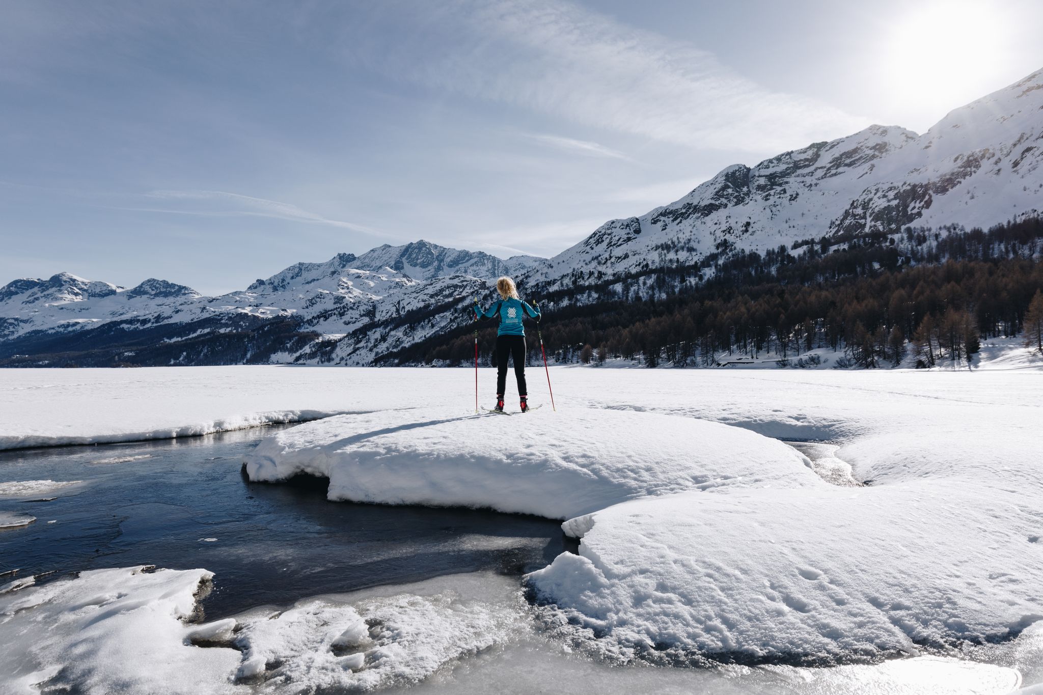
Each season offers a unique experience for easy hikes around Lake Sils. Autumn is particularly stunning when the larch forests turn a vibrant golden hue. In summer, the trails are lush, and you can enjoy the Sils Maria boat dock for scenic cruises. Even in winter, the frozen lake can transform into a unique path for walking.
Are there any circular easy walks around Lake Sils?
Yes, many easy routes around Lake Sils are circular. For example, the Plan Brüsciabräga at Lake Sils – View of Lake Sils loop from Maloja Posta is a popular 4.5-mile loop offering continuous lake views. Another option is the Chastè Viewpoint – Bench with a view over Lake Sils loop from Sils im Engadin, a shorter 2.3-mile trail through the wooded Chastè peninsula.
Are the easy trails around Lake Sils suitable for families?
Absolutely. The easy hiking trails around Lake Sils are generally well-maintained and suitable for families. Many routes feature gentle inclines and offer opportunities to enjoy the natural beauty, such as the flower-filled alpine meadows of Val Fex or the serene lake shores.
Can I bring my dog on easy hikes around Lake Sils?
Yes, dogs are generally welcome on the hiking trails around Lake Sils. It's always recommended to keep your dog on a leash, especially in areas with wildlife or near livestock, and to clean up after them. The diverse landscapes, from larch forests to lake shores, provide plenty of enjoyable terrain for you and your canine companion.
Are there any easy hikes with waterfalls near Lake Sils?
Yes, you can find easy hikes that feature waterfalls. The Plan Brüsciabräga at Lake Sils – Isola Waterfall loop from Passo della Maloja - Malojapass 1815 m is an easy 4.6-mile path that offers views of the Isola Waterfall and the lake.
What kind of terrain can I expect on easy hikes around Lake Sils?
Easy hikes around Lake Sils typically feature varied terrain, including well-trodden lake shore paths, gentle trails through picturesque larch forests, and open alpine meadows. The routes generally have minimal elevation gain, making them accessible for most hikers.
What interesting places or landmarks can I explore on easy hikes?
Along easy hikes, you can explore several notable landmarks. The Nietzsche Memorial Plaque on the Chastè Peninsula is a cultural highlight. You can also discover the charming village of Isola, situated on a delta, or the idyllic village of Grevasalvas, known as the Engadine 'Heidi village'.
Are there any viewpoints along the easy trails?
Yes, many easy trails offer stunning viewpoints. The Chastè Viewpoint – Bench with a view over Lake Sils loop from Sils im Engadin provides exceptional views over Lake Sils. The entire region is surrounded by mountains like Piz Corvatsch and Piz Grevasalvas, offering dramatic alpine backdrops from various points along the lake.
What do other hikers enjoy the most about hiking in Lake Sils?
The area is highly rated by the komoot community, with an average score of 4.6 stars from over 500 reviews. Hikers often praise the stunning natural beauty, the incredible color variations of the lake, the peaceful larch forests, and the well-maintained trails that offer continuous, changing views of the landscape.
Are there short walks suitable for beginners around Lake Sils?
Yes, there are several short and easy walks perfect for beginners. The Church of St. Lawrence, Sils – Shore of Lake Sils loop from Sils im Engadin is a pleasant 2.2-mile route, and the Chastè Viewpoint – Bench with a view over Lake Sils loop from Sils im Engadin is another excellent short option at 2.3 miles.
Can I combine hiking with a boat trip on Lake Sils?
Yes, during summer, you can combine hiking with a unique boat trip on Lake Sils. The highest scheduled passenger boat in Europe operates between Sils Maria, Chastè, Plaun da Lej, and Maloja, allowing you to shorten your hike or simply enjoy the scenic cruise across the lake.
Most popular routes around Lake Sils
Most popular attractions around Lake Sils

Get inspired with the komoot mobile app


Explore more
Browse the best Hikes in other regions.
