Easy hikes and walks in John Muir Wilderness
4.6
(238)
4,676
hikers
275
hikes
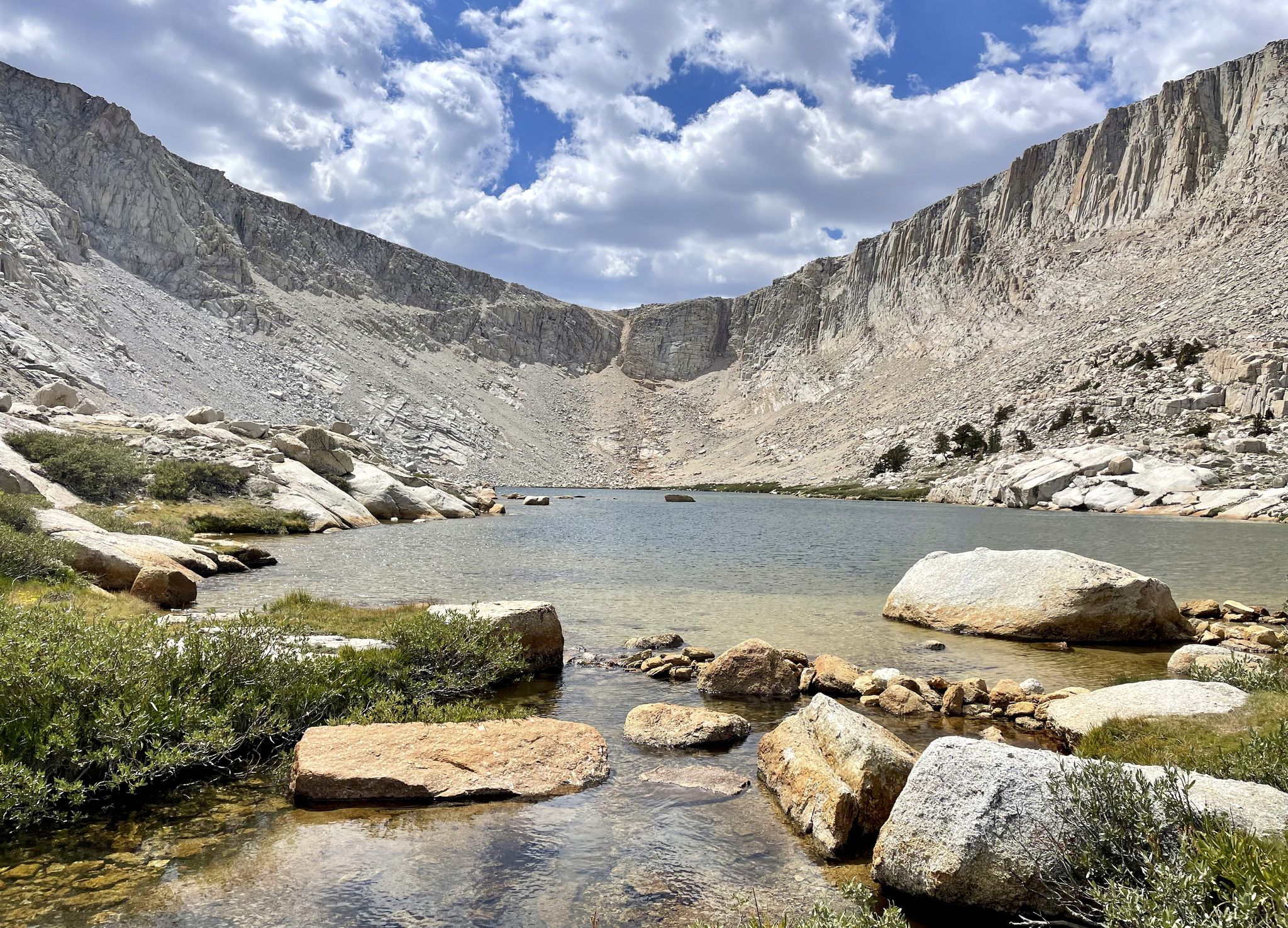
Easy hiking trails in John Muir Wilderness traverse a landscape characterized by high Sierra granite peaks, glacially carved canyons, and numerous alpine lakes. The region spans over 650,000 acres, with elevations ranging from 4,000 feet to nearly 14,500 feet. This diverse terrain includes extensive pine and fir forests, subalpine meadows, and a network of over 590 miles of maintained trails. Notable landmarks and natural features include many peaks over 13,000 feet and nearly a thousand alpine lakes.
Best easy hiking trails in John Muir Wilderness
- The most popular easy hiking route is Long Lake — Mammoth Lakes, a 4.1 miles (6.6 km) trail that takes 1 hour 49 minutes to complete. This route features minimal elevation gain and offers views of Long Lake.
- Another top favourite among local hikers is Emerald Lake Trail – Arrowhead Lake loop from Crowley Lake, an easy 3.3 miles (5.4 km) path. This loop winds through varied terrain, including sections near Arrowhead Lake.
- Local hikers also love the Little Pothole Lake loop from Little Pothole Lake, a 3.2 miles (5.2 km) trail leading through forested areas and past Little Pothole Lake, often completed in about 1 hour 42 minutes.
- Hiking in John Muir Wilderness is defined by high alpine lakes, granite peaks, and diverse forest ecosystems. The extensive trail network offers options for various ability levels, including many easy hiking trails.
- The routes in John Muir Wilderness are highly rated by the komoot community with an average score of 4.5 stars from over 120 reviews. More than 1,900 hikers have used komoot to explore John Muir Wilderness's varied terrain.
Last updated: August 4, 2026
7
hikers
2.96km
01:00
250m
0m
The Skelton Lake Trail offers a classic High Sierra experience without the strenuous effort often required. You will hike through beautiful alpine forests, with the terrain gradually climbing over rocky and sandy sections. The journey culminates at the stunning Skelton Lake, a crystal-clear alpine gem known for its reflective waters and serene atmosphere, framed by rugged peaks. Keep an eye out for potential detours to other picturesque lakes like Arrowhead Lake or Emerald Lake along the way.
Planning your visit to the Skelton Lake Trail is straightforward, with the trailhead conveniently located near Mammoth Lakes. The route is considered an easy 1.8-mile (3.0 km) hike with 818 feet (249 metres) of elevation gain, typically taking about 1 hour to complete. The best time to go is between May and mid-October, as the access road closes seasonally. Parking is available, but it is wise to arrive early during peak times to secure a spot.
Situated within the vast John Muir Wilderness, this trail provides a quintessential wilderness experience, complete with opportunities for wildlife viewing. Skelton Lake is also a popular spot for fishing, home to rainbow, brown, and brook trout. The area is highly regarded by photographers for its vibrant natural colors, especially around the lake's inlet and meadows, making it a rewarding destination for a relatively short outing.
7
hikers
3.85km
01:16
280m
0m
Embark on an easy hike along the Bishop Pass Trail, covering 2.4 miles (3.8 km) with an elevation gain of 921 feet (281 metres). You can complete this route in about 1 hour and 15 minutes, offering a quick journey into the high Sierra backcountry. As you follow the path, you will pass the picturesque Long Lake, enjoying views of majestic peaks like Hurd Peak and Mt. Thompson. The trail provides a clear path through alpine scenery, with the dramatic backdrop of the Inconsolable Range in sight.
While this particular section is easy, the overall Bishop Pass Trail can be moderate to strenuous, with snow possible in early summer or during shoulder seasons. If you plan an overnight trip, remember that permits are required and can be competitive. Bear-resistant food storage containers are also mandatory due to active bears in the area. Parking at the trailhead often gets busy, especially during peak season, so plan to arrive early.
This route gives you a glimpse into the vast Inyo National Forest in California. You will see panoramic views that include Cloudripper, Chocolate Peak, and Picture Puzzle. The trail is known for its high alpine environment, making it a popular choice for those seeking a taste of the Sierra Nevada's rugged beauty without committing to a full-day excursion. It serves as an accessible entry point to explore the region's natural grandeur.

Sign up for free
6
hikers
3.42km
01:09
280m
0m
Embark on the Bull Lake via Bishop Pass Trail, an easy hiking route that guides you through diverse alpine scenery. You will traverse forested sections, catching glimpses of South Lake before arriving at the serene Long Lake. The path then opens into expansive alpine meadows, eventually leading to Saddlerock Lake, beautifully nestled among towering granite cliffs. This 2.1-mile (3.4 km) hike involves a manageable 911 feet (278 metres) of elevation gain, typically taking about 1 hour and 8 minutes to complete. Along the way, you can enjoy impressive mountain vistas, featuring prominent peaks such as Hurd Peak and Mount Agassiz.
The optimal period for hiking the Bull Lake via Bishop Pass Trail is from late June through September, when snow has melted and weather conditions are most favorable. If you plan an overnight stay within the Inyo National Forest, remember that permits are required. To avoid crowds, especially during peak season, an early start to your day is highly recommended, ensuring a more tranquil experience on the trail.
This trail offers a rewarding experience for those seeking a shorter, accessible hike within the stunning Inyo National Forest. As you progress, you will encounter views of other notable peaks like Cloudripper, Chocolate Peak, and Picture Puzzle, providing excellent opportunities for photography. The route's progression from forested areas to alpine meadows and lakes showcases the rich natural beauty of the Sierra Nevada landscape.
2
hikers
2.31km
00:45
120m
90m
Embark on an easy hike along the Big Pine Creek Campground and Glacier Lodge Loop Trail, a family-friendly route that winds through scenic mountain terrain. This loop covers 1.4 miles (2.3 km) with a gentle elevation gain of 407 feet (124 metres), making it perfect for a quick outing. You can expect to complete the hike in about 45 minutes, enjoying views of the cascading creek as you go. A highlight is crossing the footbridge over Big Pine Creek, where you can pause to appreciate the sounds and sights of the water. Keep an eye out for local wildlife, as the area is rich in natural beauty.
When planning your visit, be aware that trail conditions can become challenging if Big Pine Creek is experiencing floodwaters. It is wise to check local conditions before heading out, especially after heavy rain or snowmelt. Additionally, mosquitoes can be quite active during certain times of the year, so remember to pack bug spray and consider wearing protective clothing. Taking these precautions will help ensure a more comfortable and enjoyable experience on the trail.
This route is nestled within the vast Inyo National Forest, an area renowned for its diverse ecosystems and stunning alpine landscapes. The trail offers a glimpse into the region's natural splendor, from its mountain terrain to the vibrant creek. It serves as an excellent introduction to the area's outdoor offerings, providing a peaceful escape into nature without requiring a strenuous effort. The trail's accessibility and gentle nature make it a popular choice for those looking to connect with the environment.
2.90km
00:56
220m
0m
Hike the easy 1.8-mile McGee Creek Trail in Inyo National Forest, gaining 711 feet in 55 minutes, offering diverse scenery.
Get access to more routes and recommendations from other explorers.
Sign up for free
Already have an account?
Our route recommendations are based on thousands of hikes, rides, and runs completed by other people on komoot.
Start today with a free account
Your next adventure awaits.
Login or Signup
Popular around John Muir Wilderness



Other adventures in John Muir Wilderness


Tips from the Community

Meanwhile, this pond has no water left
0
0

Long Lake is one of several lakes surrounding Chocolate Peak. From the trail, you are treated to wonderful views of Long Lake, Cloudripper, Chocolate Peak and Mount Goode.
0
0

So, I’ve taken a VERY rudimentary measurement to determine exactly how long Long Lake is, and according to my calculation, Long Lake is approximately 3,400ft / .64mi / 1.03km long! (Measurement was taken “as the crow flies”) Standing at the northern end of the lake, you will be treated to brain melting views of Cloudripper, Chocolate Peak and Picture Puzzle to the southeast, as well as Hurd Peak just across the lake, and Mt Goode to the southwest!
0
0
STELLAR view onto Cloudripper (left), Chocolate Peak (center) and Picture Puzzle (right) as soon as you exit the trees in this section!
0
0
Should you take the eastern trail to the Chocolate Lakes here? I guess it depends on what your intentions are. If your goal is set the FKT (Fastest Known Time) from South Lake to Bishop Pass, then “no”- don’t take the Chocolate Lakes Loop. If you are a PCT hiker descending from Bishop Pass, you ran out of food two days ago and you don’t think you’ll be able to see through the hunger and genuinely appreciate the beauty that awaits you on this trail, then “maybe”- you might be surprised. Under ANY other circumstance, the answer is “YES”- absolutely take the Chocolate Lakes trail!! With it’s immaculate views onto Chocolate Peak and Cloudripper, and the majestic lakes of teal and turquoise resting beneath them, it is MORE than worth the minute amount of additional effort!!
1
0
A short side trail here leads northeast to Marie Louise Lake! Continue south to Bishop Pass, or north to South Lake!
0
0
At this junction, head southeast for Bishop Pass, southwest for Treasure Lakes, or north for South Lake!
1
0
Here lies the magic, invisible border between “JMT Wilderness” and “Not JMT Wilderness.”
0
0
Frequently Asked Questions
How many easy hiking trails are there in John Muir Wilderness?
The John Muir Wilderness offers nearly 70 easy hiking trails. These routes traverse diverse landscapes, from forested areas to alpine lakes, providing accessible options for various skill levels.
What is the best time of year for easy hikes in John Muir Wilderness?
The ideal time for hiking in the John Muir Wilderness is generally from June through early September. Late July through August is often considered prime, with less snow and fewer bugs. Early September also offers favorable conditions with fewer crowds and pleasant weather.
Are there any family-friendly easy hikes in the John Muir Wilderness?
Yes, many easy trails are suitable for families. For example, the Long Lake — Mammoth Lakes route is a popular 4.1-mile trail with minimal elevation gain, making it a great choice for families. The Rock Creek Lake loop from Rock Creek Lake is another short and easy option, perfect for a leisurely family outing.
Can I bring my dog on easy hikes in John Muir Wilderness?
Yes, dogs are generally permitted on trails within the John Muir Wilderness, but they must be kept on a leash. Always check specific trailhead regulations before you go, as some areas or seasons might have restrictions. Remember to pack out all pet waste.
What kind of terrain can I expect on easy hikes in John Muir Wilderness?
Easy hikes in the John Muir Wilderness typically feature well-maintained paths through varied terrain. You can expect to encounter forested sections, subalpine meadows, and trails leading to picturesque alpine lakes. While generally gentle, some routes may have slight elevation gains, such as the Arrowhead Lake — Mammoth Lakes trail with its gradual climb.
Are there any circular easy hiking routes in the John Muir Wilderness?
Yes, there are several circular routes perfect for easy hikes. The Emerald Lake Trail – Arrowhead Lake loop from Crowley Lake is a 3.3-mile loop that winds through varied terrain. Another great option is the Little Pothole Lake loop from Little Pothole Lake, which takes you through forested areas and past the lake.
What notable natural features or landmarks can I see on easy hikes?
Even on easy hikes, you can experience the stunning natural beauty of the John Muir Wilderness. Many trails lead to beautiful alpine lakes, such as Skelton Lake or First Lake. The region is characterized by majestic granite peaks and glacially carved canyons, offering breathtaking views even from lower elevations.
What do other hikers enjoy the most about hiking in John Muir Wilderness?
The John Muir Wilderness is highly rated by the komoot community, with an average score of 4.5 stars from over 120 reviews. Hikers often praise the stunning high-alpine scenery, the tranquility of the wilderness, and the abundance of beautiful lakes and viewpoints along the trails.
Are permits required for easy day hikes in John Muir Wilderness?
While overnight trips into the John Muir Wilderness require permits, day hikes generally do not. However, it's always wise to check with the local ranger station for any specific regulations or quota systems that might apply to certain popular trailheads, especially during peak season.
Is parking available at the trailheads for easy hikes?
Parking is typically available at most major trailheads leading into the John Muir Wilderness. However, during peak season, popular trailheads can fill up quickly, especially for routes near areas like Mammoth Lakes or Bishop. Arriving early is recommended to secure a spot.
What kind of wildlife might I encounter on easy trails?
The diverse ecosystems of the John Muir Wilderness support various wildlife. On easy trails, you might spot yellow-bellied marmots, pikas, and golden-mantled ground squirrels. Birdwatchers can look out for Clark's nutcrackers. While less common on easy, well-trafficked paths, black bears are also present in the wilderness, so always practice bear-safe food storage.
How long do easy hikes in John Muir Wilderness typically take?
The duration of easy hikes varies depending on the route's distance and your pace. For example, the Long Lake — Mammoth Lakes trail, at 4.1 miles, typically takes around 1 hour 49 minutes. Shorter loops like the Rock Creek Lake loop can be completed in under an hour.
Most popular routes in John Muir Wilderness
Most popular attractions in John Muir Wilderness

Get inspired with the komoot mobile app


Explore more
Browse the best Hikes in other regions.
