Easy hikes and walks in White River National Forest
4.7
(268)
8,388
hikers
572
hikes
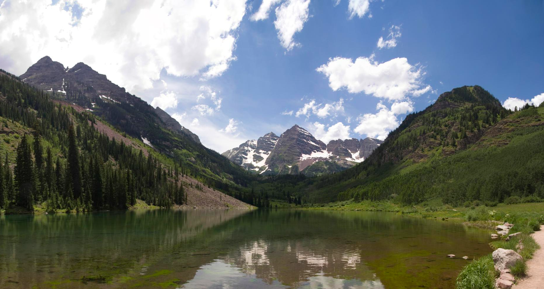
Easy hiking trails in White River National Forest traverse a vast landscape spanning nearly 2.3 million acres in Colorado. The region is characterized by diverse terrain, including lush forests, alpine lakes, and areas with towering peaks. Hikers can expect to find a network of trails that wind through aspen groves and evergreen trees, offering varied natural features. This national forest is known for its extensive trail system, providing numerous opportunities for outdoor exploration.
Best easy hiking trails in White River…
Last updated: October 11, 2026
4.7
(3)
12
hikers
5.24km
01:41
250m
170m
Embark on an easy hike to experience the lower slopes of North Star Mountain Summit. This route covers 3.3 miles (5.2 km) with a manageable elevation gain of 812 feet…
4.0
(1)
12
hikers
2.53km
00:52
230m
0m
Embark on an easy hike to Lily Pad Lake via Meadow Creek Trail, a route that spans 1.6 miles (2.5 km) and involves a gentle climb of 745 feet (227…

7
hikers
3.23km
00:50
10m
20m
Embark on an easy hike along the Keystone Lake via Snake River Trail, a gentle route that follows the tranquil Snake River. You'll cover 2.0 miles (3.2 km) with a…
4.0
(1)
6
hikers
5.61km
01:35
130m
110m
Embark on an easy hiking adventure along the Upper Salt Lick, Too-pwech, So-uv Trail, a 3.5-mile (5.6 km) route that takes about 1 hour and 34 minutes to complete. You…
3
hikers
3.47km
00:54
20m
20m
Embark on the Old Dillon Reservoir Trail for an easy hike spanning 2.2 miles (3.5 km), with a gentle elevation gain of 80 feet (25 metres). This route typically takes…
Get access to more routes and recommendations from other explorers.
Already have an account?
Our route recommendations are based on thousands of hikes, rides, and runs completed by other people on komoot.
Start today with a free account
Your next adventure awaits.



Other adventures in White River National Forest


Tips from the Community

From this spot down a short spur trail off of the Dillion RecPath, you get a great view of Sentinel Island in the Dillon Reservoir. This is a lovely, short detour and a nice spot to snap some photos and eat a snack before continuing on your ride.
0
0

Keystone Lake offers both summer and winter activities. In the winter you can ice skate, and in the summers you can kayak or rent a peddle boat. In the winters you can use one of the fire pits they have located on the shore and they even light up a tree out on the ice.
0
0
Hoosier Pass is a mice mountain climb to begin from Breckenridge. The road has a decent sized shoulder on the way up and you are rewarded with mountain views once you reach the switchbacks. In the winter they do a good job of clearing the roads, but there is quite a bit of sand.
0
0

Excellent spacious campsites on the lakeshore, with restrooms and stellar views, shaded by trees.
0
0
Lovely protected bay lined by forested shores on the island and the park to the west.
0
0

Keystone Lake lies nestled against Hwy 6 in Dillon, Colorado. The lake is the site of ice skating and ice fishing in the winters and swimming, kayaking, and boating in the warmer months. The paved Snake River Trail runs right next to the water.
0
0

Hoosier Pass sits on the Continental Divide at 11,542 feet in elevation and connects the towns of Alma & Breckenridge. It is also the highest point along the TransAmerica bike trail, a 4,200-mile route from Oregon to Virginia.
0
0
Keystone Lake lies nestled against Hwy 6 in Dillon, Colorado. The lake is the sight of ice skating and ice fishing in the winters and swimming, kayaking, and boating in the warmer months. There is a short trail that circles the lake, and the paved Snake River Trail runs right next to the water as well.
0
0
Frequently Asked Questions
How many easy hiking trails can I find in White River National Forest?
White River National Forest offers a wide selection of easy hiking trails, with over 200 routes available. These trails traverse diverse landscapes, from lush forests to alpine lakes, providing numerous opportunities for outdoor exploration.
What is the best time of year for easy hikes in White River National Forest?
The best time for hiking in White River National Forest is generally from June to September. During these months, the weather is most favorable, and trails are typically clear of snow, allowing access to the forest's stunning alpine lakes and vibrant aspen groves.
Are there any easy trails suitable for families with children?
Yes, many easy trails in White River National Forest are great for families. For a scenic and relatively short walk, consider the Old Dillon Reservoir Trail, which is 2.1 miles (3.4 km) and leads through forested areas to a reservoir. Another option is the Keystone Lake via Snake River Trail, an easy 2-mile path that offers pleasant views.
Can I bring my dog on easy hikes in White River National Forest?
Many trails in White River National Forest are dog-friendly, but it's always best to check specific trail regulations before you go. Generally, dogs are welcome on leash. A good option for a walk with your dog could be the Village Road Trail, which offers a pleasant 2.1-mile (3.4 km) path through the area.
Are there easy trails that feature waterfalls or other natural attractions?
Yes, White River National Forest is home to several beautiful waterfalls and natural attractions. While some waterfall trails are more challenging, you can find highlights like Spouting Rock Waterfall or Willow Creek Falls within the forest. For a unique experience, the Hanging Lake Trail is a National Natural Landmark, though it's a steeper, moderate climb to a unique lake and waterfall.
What kind of wildlife might I see on an easy hike?
White River National Forest is a sanctuary for diverse wildlife. On easy hikes, you might spot elk, deer, and various bird species. The varied landscapes, including dense forests and alpine meadows, provide habitats for many animals, offering excellent opportunities for wildlife viewing.
Are there any easy loop trails in the area?
While many trails are out-and-back, you can find options that offer a loop experience or can be combined for one. The Old Dillon Reservoir Trail, for example, provides a pleasant loop around the reservoir, making it a great choice for an easy circular walk.
What do other hikers enjoy most about the easy trails in White River National Forest?
The easy trails in White River National Forest are highly rated by the komoot community, with an average score of 4.7 stars. Hikers often praise the stunning natural beauty, including pristine alpine lakes and lush forests, as well as the accessibility of routes that offer rewarding views without extreme difficulty.
Are there any less crowded easy trails for a more peaceful experience?
While popular spots can get busy, White River National Forest's vastness means you can often find quieter trails. Exploring routes slightly off the main tourist paths or visiting during off-peak hours can lead to a more serene experience. Consider trails that are not explicitly mentioned in major guidebooks for a chance at more solitude.
What are some notable peaks or summits accessible via easy trails?
While many of the highest peaks require more strenuous efforts, some easy trails offer views of impressive summits or lead to lower peaks. For instance, the North Star Mountain Summit is a 3.3-mile (5.2 km) easy trail that provides an accessible ascent to a summit with rewarding views of the surrounding landscape. You can also find highlights like Shrine Mountain within the forest.
Are there easy trails that lead to scenic lakes?
Absolutely. White River National Forest is known for its beautiful alpine lakes. The Lily Pad Lake via Meadow Creek Trail is an easy 1.6-mile (2.5 km) path that leads directly to a scenic lake, passing through diverse forest environments along the way. Another option is the Keystone Lake via Snake River Trail, which offers views of Keystone Lake.
Where can I find information about parking or public transport for easy trailheads?
Parking availability varies by trailhead. Many popular trailheads have designated parking lots, but these can fill up quickly during peak season. For specific details on parking and any potential public transport options to trailheads, it's recommended to check local visitor center websites or resources like Visit Glenwood for the most current information.
Most popular routes in White River National Forest
Most popular attractions in White River National Forest

Get inspired with the komoot mobile app


Explore more
Browse the best Hikes in other regions.
