Easy hikes and walks in McCreary County
5.0
(17)
150
hikers
29
hikes
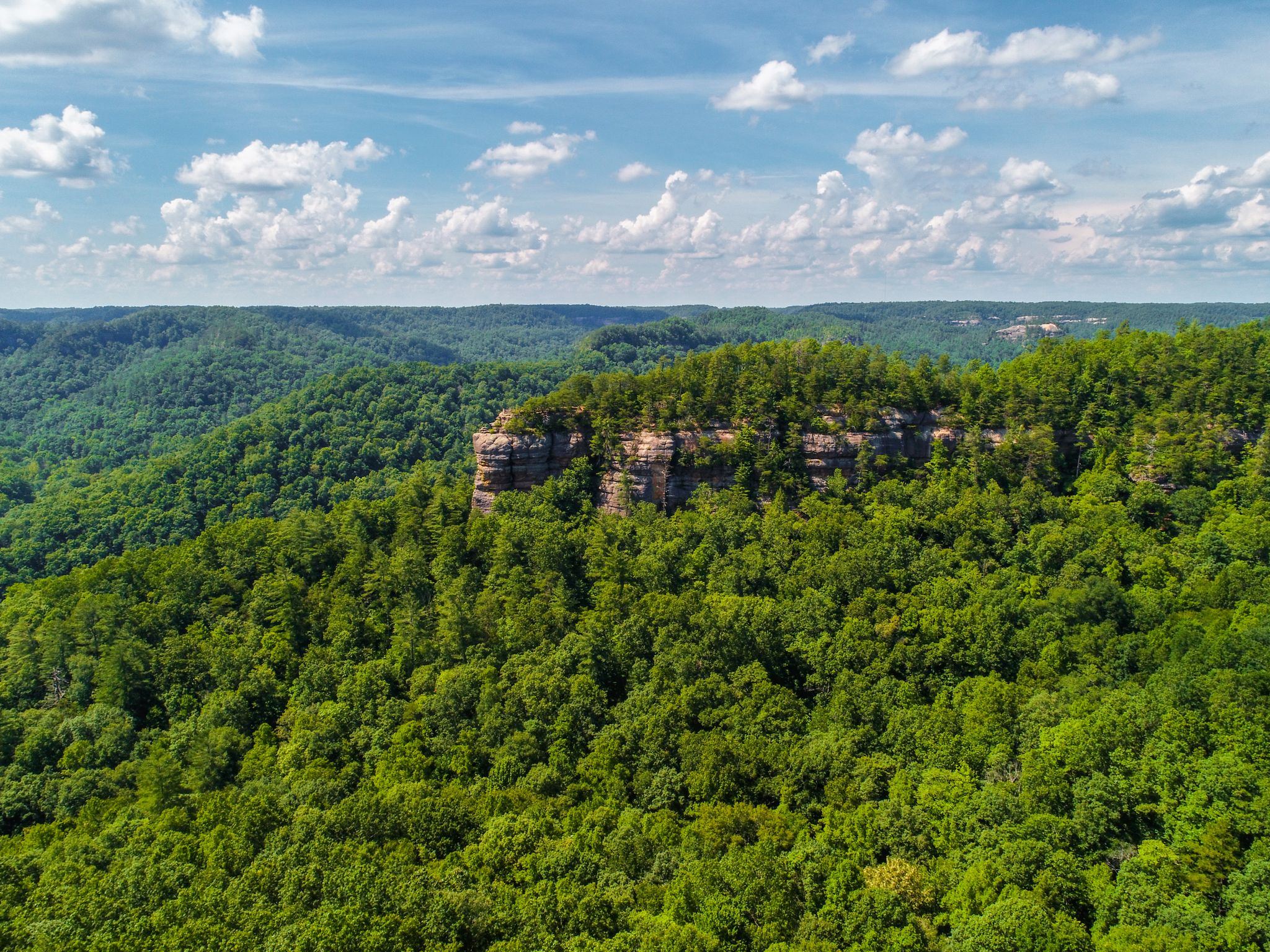
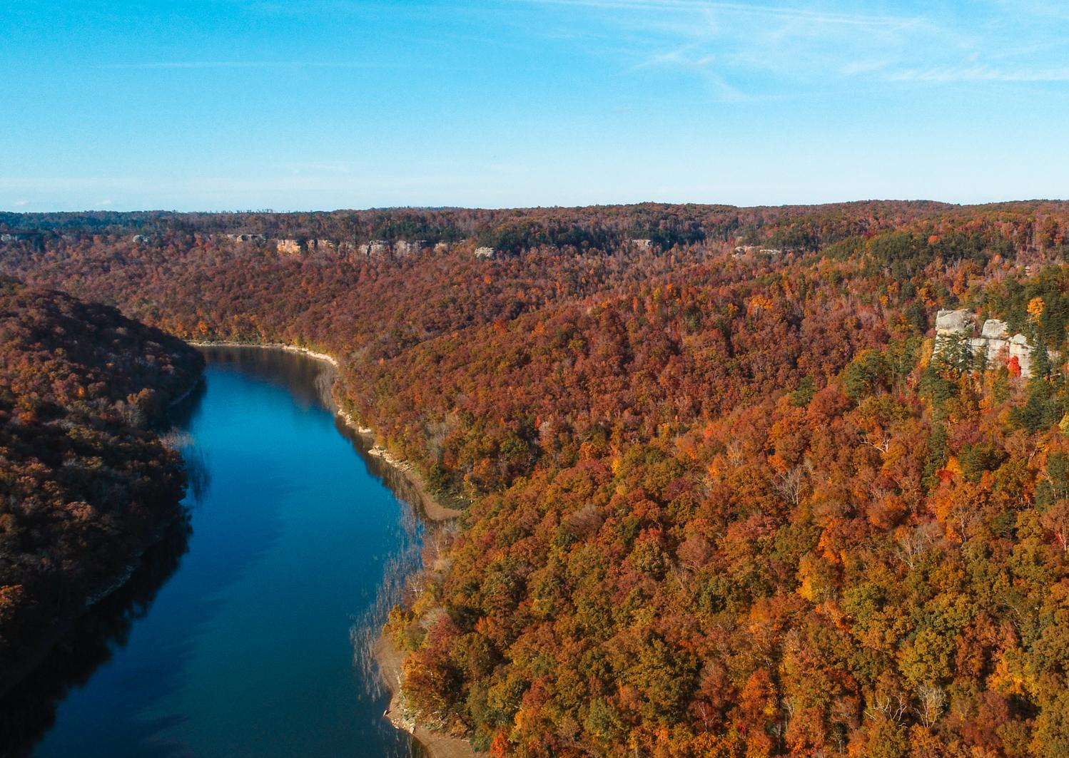
Easy hiking trails in McCreary County, Kentucky, traverse a landscape characterized by sandstone cliffs, winding rivers, and lush forests within the Appalachian region. The area features numerous natural arches and waterfalls, particularly within the Big South Fork National River and Recreation Area and Daniel Boone National Forest. These geological formations and extensive woodlands provide diverse terrain for easy hikes, offering a variety of scenic paths. The region's topography includes rolling hills and gorges, making it suitable for accessible outdoor exploration.
Best easy hiking trails in McCreary County
- The most popular easy hiking route is Cumberland Falls – Eagle Falls loop from Cumberland Falls, a 1.3 miles (2.1 km) trail that takes 37 minutes to complete. This route offers views of the Cumberland Falls and the surrounding forest.
- Another top favourite among local hikers is Dog Slaughter Falls loop from Dog Slaughter Falls, an easy 2.5 miles (4.1 km) path. This trail leads through forested areas to the Dog Slaughter Falls.
- Local hikers also love the Yahoo Arch – Yahoo Arch loop from Nats Knob, a 2.5 miles (4.1 km) trail leading through forested areas to the impressive Yahoo Arch, often completed in about 1 hour 10 minutes.
- Hiking in McCreary County is defined by natural arches, waterfalls, and extensive forest systems. The network offers options for different ability levels, with many trails suitable for easy, family-friendly outings.
- The routes in Mccreary County are highly rated by the komoot community with an average score of 5.0 stars from over 10 reviews. More than 140 hikers have used komoot to explore Mccreary County's varied terrain.
Last updated: August 18, 2026
1
hikers
3.92km
01:03
20m
100m
Step into a world of natural wonder on the Van Hook Falls and Cane Creek Valley trail, where the air hums with the sound of falling water and ancient rock formations rise around you. This easy 2.4-mile (3.9 km) hike, taking about 1 hour and 3 minutes with only 71 feet (22 metres) of elevation gain, guides you through a lush, forested valley. You'll discover numerous smaller waterfalls and cascades along Cane Creek, culminating in the impressive 40-foot Van Hook Falls, dramatically set within a sandstone recess. It's a truly picturesque journey for all skill levels.
Planning your visit is straightforward, though timing is key to fully appreciate the area's beauty. The trail is best used from March to October, offering vibrant foliage and optimal water flow for the falls. Dogs are permitted on a leash, making it a great family-friendly outing. While specific parking information isn't detailed, arriving early is always a good strategy to ensure a spot and a peaceful experience on this popular route.
This trail is a standout in Kentucky's Daniel Boone National Forest, celebrated for its striking geological formations and abundant water features. It's a segment of the longer Sheltowee Trace National Recreational Trail, offering a taste of its rugged beauty. The Cane Creek Gorge section, with its dynamic waterways and rock formations, is particularly notable, often compared to more famous national parks. It's recognized as one of the best kid-friendly hikes in Kentucky, providing a rich experience for families and day hikers.
1
hikers
2.18km
00:34
20m
10m
Embark on an easy hike along the Sheltowee Trace Trail to Princess Falls, a route that winds through the scenic Daniel Boone National Forest. This pleasant journey covers 1.4 miles (2.2 km) with a gentle elevation gain of just 57 feet (17 metres), making it perfect for a quick outdoor escape. You can expect to reach the picturesque Princess Falls, a 13-foot high waterfall where you can get close to the cascading water and even splash in Lick Creek. The entire hike typically takes around 34 minutes, offering a refreshing experience amidst diverse natural beauty.
The trail is accessible year-round, allowing you to experience its charm in any season. However, be prepared for potentially muddy conditions, especially following rainfall. You might also encounter challenging creek crossings along the way, so waterproof footwear is highly recommended for a more comfortable and enjoyable hike. Plan your visit accordingly to make the most of your time on the route.
This particular section of the Sheltowee Trace Trail is nestled within the expansive Daniel Boone National Forest, an area known for its rich biodiversity. Beyond Princess Falls, you might also find the impressive 64-foot high Lick Creek Falls nearby, adding to the region's natural allure. If you visit during spring, you will be treated to a vibrant display of abundant wildflowers, enhancing the trail's scenic appeal and offering a unique seasonal perspective.

Sign up for free
995m
00:18
40m
0m
Enjoy an easy 0.6-mile hike to the historic Pinnacle Knob Lookout fire tower in Cumberland Falls State Resort Park for scenic river views.
1.60km
00:28
50m
40m
Embark on the Yahoo Falls Short Loop, an easy hiking route that takes you through impressive natural scenery. This trail covers 1.0 miles (1.6 km) with an elevation gain of 163 feet (50 metres), and you can complete it in about 28 minutes. You will discover towering sandstone cliffs and an outstanding overlook of the Big South Fork River, all centered around Kentucky's highest waterfall, the 113-foot Yahoo Falls.
When planning your visit, you will find picnic facilities and scenic overlooks near the falls, making it a great spot for a day out. Parking is generally available right at the trailhead, providing easy access to the loop. If you want to see the waterfall at its most powerful, visit in spring after good rains; the water volume can decrease during drier summer months.
The highlight of this route is the opportunity to descend to the base of Yahoo Falls, where you can even walk directly behind the cascading water under a massive rock shelter. While the trail is generally easy, be aware that it includes some steep metal steps. Many hikers suggest going clockwise to make the ascent up these steps less strenuous, ensuring a more comfortable experience.
930m
00:15
0m
30m
Embark on an easy hike along the Crystal Falls via Hidden Passage Trail, a short but rewarding journey through hardwood forests and past striking sandstone bluff lines. This route covers just 0.6 miles (0.9 km) with a gentle elevation gain of 9 feet (3 metres), making it perfect for a quick outing. You can expect to complete this scenic loop in about 14 minutes, with the highlight being the beautiful Crystal Falls, a 15-foot waterfall that tumbles over stairstep ledges into a clear pool.
Planning your visit is straightforward, as the trail is well-maintained and clearly marked within Pickett CCC Memorial State Park. Parking is typically available right at the trailhead, offering easy access to your adventure. Consider visiting after a good rain, as the waterfalls will be particularly impressive and full. This accessible trail is suitable for most hikers looking for a brief escape into nature.
Beyond the cascading falls, the trail reveals unique rock formations, including natural rock shelters and the namesake natural arch that forms the "Hidden Passage." As you hike, you'll enjoy views of Thompson Creek and have the chance to spot various wildflowers depending on the season. This trail offers a glimpse into the rich natural environment of the park, showcasing its geological wonders and diverse plant life.
5.0
(7)
18
hikers
3.05km
01:04
80m
80m
Hike the easy 1.9-mile Eagle Falls Trail in Cumberland Falls State Resort Park, featuring beautiful waterfalls and scenic views.
11
hikers
Easy hike. Great for any fitness level. Easily-accessible paths. Suitable for all skill levels.
11
hikers
4.08km
01:10
100m
100m
Easy hike. Great for any fitness level. Easily-accessible paths. Suitable for all skill levels.
5.0
(1)
9
hikers
2.06km
00:37
70m
70m
Easy hike. Great for any fitness level. Easily-accessible paths. Suitable for all skill levels.
5.0
(1)
7
hikers
Easy hike. Great for any fitness level. Easily-accessible paths. Suitable for all skill levels.
Get access to more routes and recommendations from other explorers.
Sign up for free
Already have an account?
Our route recommendations are based on thousands of hikes, rides, and runs completed by other people on komoot.
Start today with a free account
Your next adventure awaits.
Login or Signup



Tips from the Community

Julia Lynn Falls is a picturesque 21-foot plunge waterfall best visited after recent rainfall, as it tends to dry up during prolonged dry spells. A short 75-foot side trail leads you to the falls; the trail is well-marked and easily navigated.
0
0
Known as the “Niagara of the South,” Cumberland Falls is a must-see with its powerful 70-foot drop. The state park also features other waterfalls like Eagle Falls, and during a full moon, it's one of the few places in the world where you can witness a rare moonbow. Easy trails lead to great viewpoints, and the surrounding park offers plenty of quiet spots by the river. Best visited after heavy rain for peak flow. Cumberland Falls Campground is a solid choice for camping, with prices starting at $22 per night. Other campground options are also available nearby if you prefer something different.
0
0

The well-known and well-visited Cumberland Falls can show different faces depending on the season and recent weather. Viewable from both banks of the Cumberland River, the falls is a popular site for a reason!
0
0

Dog Slaughter Falls is an incredible beauty spot and just the place to sit and take in the wonder of nature. Some say it is the best waterfall in all of Daniel Boone National Forest. Don't be put off by the name. It is simply stunning.
1
0
Above Eagle Creek Falls the trail continues alongside Eagle Creek. You can see where the water has carved smooth curves in the rocks as it meanders downstream.
0
0
Yahoo Falls is said to be the highest waterfall in Kentucky. If you are in the area it is definitely worth running here as you can get right up to, and behind it. For the best experience, a visit during the spring is recommended while there is plenty of water flowing.
0
0
Yahoo Falls is said to be the highest waterfall in Kentucky. If you are in the area it is definitely worth hiking here as you can get right up to, and walk behind it. For the best experience, a visit in the spring is recommended while there is plenty of water flowing.
0
0
This is a spectacular natural wonder that is well worth spending time exploring. It's really special to see the trees growing out of the top of it while you stand below.
0
0
Frequently Asked Questions
How many easy hiking trails are available in McCreary County?
McCreary County offers 9 easy hiking trails, perfect for exploring the region's natural beauty without strenuous effort. In total, there are 20 routes of varying difficulty.
Are there any easy loop trails in McCreary County?
Yes, many of the easy trails in McCreary County are loops, offering a convenient way to experience the scenery. Examples include the Cumberland Falls and Eagle Falls Loop, the Hazard Cave and Natural Bridge Trail loop, and the Yahoo Arch loop.
What natural attractions can I see on easy hikes in McCreary County?
Easy hikes in McCreary County lead to stunning natural features. You can visit the impressive Cumberland Falls, often called the 'Niagara of the South,' or the scenic Eagle Falls. The region is also known for its natural arches, such as the Yahoo Arch and the Twin Arches. The Big South Fork National River and Recreation Area itself is a major attraction with dramatic cliffs and winding rivers.
Are there any easy trails that feature waterfalls?
Absolutely! The Cumberland Falls and Eagle Falls Loop is an excellent easy option to see both Cumberland Falls and Eagle Falls. Another great choice is the Dog Slaughter Falls loop, which takes you to a beautiful waterfall. You can also find Princess Falls and Julia Lynn Falls on an easy loop from Hill Top.
Can I bring my dog on easy hiking trails in McCreary County?
Many trails in McCreary County, especially within the Big South Fork National River and Recreation Area and Daniel Boone National Forest, are dog-friendly. It's generally required to keep dogs on a leash. Always check specific trail regulations before heading out.
What are some family-friendly easy hikes in the area?
McCreary County offers several family-friendly easy hikes. The Twin Arches loop is a relatively short and impressive walk to two of the largest natural sandstone arches. The Hazard Cave and Natural Bridge Trail loop is another excellent choice for families, featuring unique geological formations.
Are there any easy trails that lead to natural arches?
Yes, McCreary County is famous for its natural arches. The Yahoo Arch loop is an easy trail leading to the impressive Yahoo Arch. The Twin Arches loop provides access to two massive natural arches. The Natural Arch Scenic Area also offers accessible pathways to a prominent arch.
What do other hikers say about the easy trails in McCreary County?
The easy trails in McCreary County are highly regarded by the komoot community, with an average rating of 5.0 stars from over 15 reviews. Hikers often praise the stunning natural arches, beautiful waterfalls, and the peaceful, lush forest environments.
Are there any easy trails near Whitley City?
Yes, there are easy trails accessible from or near Whitley City. The Cumberland Falls loop from Whitley City is an easy option, offering a pleasant walk. Many other trails in the Big South Fork National River and Recreation Area are also a short drive away.
What is the typical duration for an easy hike in McCreary County?
Most easy hikes in McCreary County can be completed within 1 to 1.5 hours. For example, the Cumberland Falls and Eagle Falls Loop takes about 1 hour 4 minutes, while the Yahoo Arch loop typically takes around 1 hour 10 minutes.
Are there any historical or cultural points of interest along easy trails?
While the focus is on natural beauty, some areas offer glimpses into the region's past. The Blue Heron Loop Trail, for instance, showcases riverfront scenery and coal mining history, providing a blend of nature and heritage. You can also see the Blue Heron Railroad Bridge.
What kind of terrain can I expect on easy hikes in McCreary County?
Easy hikes in McCreary County typically feature well-maintained paths through lush forests, often alongside winding rivers or leading to impressive sandstone cliffs and natural arches. While generally gentle, some trails may have minor elevation changes or uneven surfaces, characteristic of the Appalachian region.
Most popular routes in McCreary County
Most popular attractions in McCreary County

Get inspired with the komoot mobile app


Didn’t find what you were looking for?
Check out more Hikes throughout Mccreary County below and find the perfect route in your destination.
Explore more
Browse the best Hikes in other regions.
