Easy hikes and walks in Transylvania County
4.7
(324)
4,614
hikers
163
hikes
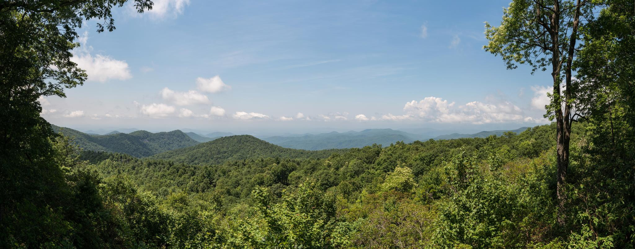
Easy hiking trails in Transylvania County, North Carolina, traverse a landscape characterized by dense forests, numerous waterfalls, and varied mountainous terrain within the Blue Ridge Mountains. The region includes significant portions of Pisgah National Forest and DuPont State Recreational Forest. Rivers like the Davidson River also feature prominently, offering diverse natural settings for outdoor exploration. This area provides a wide array of easy routes suitable for different skill levels.
Best easy hiking trails in Transylvania County
- The most popular easy…
Last updated: September 27, 2026
5.0
(3)
24
hikers
5.79km
01:39
140m
130m
Embark on an easy 3.6-mile (5.8 km) hike through DuPont State Recreational Forest, gaining 443 feet (135 metres) in elevation. This loop, estimated to take 1 hour and 38 minutes,…
5
hikers
6.23km
01:49
180m
170m
Embark on an easy hike along the Cove Creek Falls and Toms Spring Falls Trail, a delightful route through young forests in Pisgah National Forest. This trail is perfect for…

6
hikers
2.47km
00:38
10m
10m
The Davidson River Exercise Trail offers a delightful, easy 1.5-mile (2.5 km) loop through the scenic Pisgah National Forest. You'll follow a clean, wide path, often singletrack or a dirt…
3
hikers
4.83km
01:29
150m
150m
Embark on an easy hike along the Aunt Sally and Rhapsodie Falls Trail, a 3.0-mile (4.8 km) route that winds through Pisgah National Forest. You will gain 476 feet (145…
1
hikers
1.72km
00:29
20m
70m
Embark on an easy hike along the Reese Place Falls Trail, a short route that covers 1.1 miles (1.7 km) with a gentle elevation gain of 66 feet (20 metres).…
1
hikers
3.37km
00:56
20m
130m
Hickorynut Mountain via Foothills Trail offers an easy hiking experience, leading you through a classic Southern Appalachian 'green tunnel' of lush forests. You will find yourself surrounded by rhododendron, mountain…
1
hikers
3.28km
01:06
100m
280m
Embark on an easy hike to Sassafras Knob, where you'll experience diverse terrain ranging from smooth dirt paths to occasional rocky sections. As you ascend, you'll pass through dense balsam…
1
hikers
2.51km
00:41
0m
90m
Embark on the easy Wilkie Trail, a pleasant hike covering 1.6 miles (2.5 km) with a gentle elevation gain of just 14 feet (4 metres). You can expect to complete…
1
hikers
4.08km
01:05
50m
40m
Embark on an easy hike to Lake Julia, a serene journey through wooded areas within DuPont State Recreational Forest. This route spans 2.5 miles (4.1 km) with a gentle elevation…
1
hikers
2.90km
01:03
270m
20m
Embark on the Cedar Rock Mountain Trail, an easy 1.8 miles (2.9 km) hiking route that takes you through unique terrain in Pisgah National Forest. You will ascend 890 feet…
Get access to more routes and recommendations from other explorers.
Already have an account?
Our route recommendations are based on thousands of hikes, rides, and runs completed by other people on komoot.
Start today with a free account
Your next adventure awaits.
Popular around Transylvania County





Other adventures in Transylvania County


Tips from the Community

The Covered Bridge in DuPont State Forest spans the Little River atop High Falls and is accessible via a short, gently-graded trail just 0.5 miles from the High Falls access area. It is a popular spot in the forest and often has visitors taking photos in front of the bridge.
1
0

Old covered bridge passing over fast flow water. Worth pausing and taking in the noise of rushing water.
0
0

There is a pretty sweet view of Lake Julia from here where it feeds into Reasonover Creek. There is a lot of great singletrack next to the water, and Reasonover Creek Trail is probably the most popular. This trail stretches a lot further across DuPont State Recreational Forest.
0
0

The viewing platform at the top of Sassafras Mountain is the perfect reward for all that climbing. On the border of North and South Carolina, the views are breathtaking.
0
0
Standing on the summit of Sassafras Mountain puts you on the highest point in the state of South Carolina. At 3,554 feet, the peak offers multiple observation areas and platforms that point in different directions off the top of the mountain. Being part of the Blue Ridge Mountain Range, the peak is highly popular, allowing both car and foot access from the bottom to the summit area (there is a steep incline from the parking lot to the observation deck).
0
0
The Lake Julia spillway is at the northern end of the lake. You can see the creek feeding the reservoir here, or you can bike down the road a little further to the dam at the southern end.
0
0
Cedar Rock is a mountain summit in DuPont State Recreational Forest. It's located off the side of the Big Rock Trail and is on a pretty open bald of smooth granite rock.
0
0
The Lake Julia spillway is at the northern end of the lake. You can see the creek feeding the reservoir here, or you can bike down the road a little further to the dam at the southern end.
0
0
Frequently Asked Questions
How many easy hiking trails are there in Transylvania County?
Transylvania County offers a wide selection of easy hiking trails, with over 70 routes specifically categorized as easy. In total, the region boasts more than 160 hiking trails across various difficulty levels.
Are there easy hiking trails in Transylvania County that feature waterfalls?
Yes, Transylvania County is known as the "Land of Waterfalls," and many easy trails lead to stunning cascades. You can explore routes like the Cove Creek Falls and Toms Spring Falls Trail or the Aunt Sally and Rhapsodie Falls Trail. Other notable waterfalls in the region include Hooker Falls, Bridal Veil Falls, and Looking Glass Falls.
What are some family-friendly easy hikes in Transylvania County?
Many easy trails in Transylvania County are suitable for families. The Davidson River Exercise Trail is a short, flat option perfect for a leisurely stroll. For a slightly longer adventure with waterfall views, consider the Reese Place Falls Trail.
Are dogs allowed on the easy hiking trails in Transylvania County?
Generally, dogs are welcome on most trails in Transylvania County, especially within Pisgah National Forest and DuPont State Recreational Forest, provided they are kept on a leash. Always check specific trail regulations before heading out. Trails like the Big Rock, Cedar Rock, Little River and Corn Mill Shoals Loop are popular choices for hikers with canine companions.
What kind of natural features and landmarks can I expect to see on easy hikes?
Beyond the abundant waterfalls, easy hikes in Transylvania County often feature dense forests, granite outcrops, and scenic river views. You might encounter overlooks offering panoramic mountain vistas, such as Triple Falls Overlook or View of High Falls. The region is nestled in the Blue Ridge Mountains, providing a quintessential Appalachian experience.
Are there any easy loop hikes in Transylvania County?
Yes, there are several easy loop options available. A popular choice is the Big Rock, Cedar Rock, Little River and Corn Mill Shoals Loop, which offers diverse scenery and granite views within DuPont State Recreational Forest.
What is the best time of year to go on easy hikes in Transylvania County?
The spring and fall offer pleasant temperatures and beautiful scenery, with wildflowers blooming in spring and vibrant foliage in autumn. Summer provides lush green forests and cool mountain breezes, while winter can offer unique views, such as ice formations on waterfalls like Looking Glass Falls. Always be prepared for changing weather conditions.
How long do easy hikes in Transylvania County typically take?
The duration of easy hikes varies depending on the trail length and your pace. Many easy routes can be completed in 1 to 2 hours. For example, the Aunt Sally and Rhapsodie Falls Trail takes about 1 hour 29 minutes, while the Big Rock, Cedar Rock, Little River and Corn Mill Shoals Loop typically takes around 1 hour 39 minutes.
What do other hikers enjoy most about easy hiking in Transylvania County?
The area is highly rated by the komoot community, with an average score of 4.7 stars. Reviewers often praise the abundance of stunning waterfalls, the well-maintained trails suitable for all skill levels, and the serene beauty of the dense forests within Pisgah National Forest and DuPont State Recreational Forest.
Are there any easy trails that offer views of the Blue Ridge Mountains?
Yes, Transylvania County is nestled in the Blue Ridge Mountains, and many trails offer glimpses or expansive views of the range. While specific easy trails might not always lead to high-elevation overlooks, the general terrain provides a constant connection to the mountainous landscape. The Hickorynut Mountain via Foothills Trail offers a taste of the mountain environment.
Where can I find parking for easy hiking trails?
Most popular trailheads in Transylvania County, especially within Pisgah National Forest and DuPont State Recreational Forest, offer designated parking areas. It's advisable to arrive early during peak seasons or weekends, as parking lots can fill up quickly. Specific parking information is often available on individual route pages.
What is the shortest easy hike available in Transylvania County?
One of the shorter easy hikes is the Reese Place Falls Trail, which is approximately 1.7 miles (2.7 km) long and can be completed in about 30 minutes. It offers a quick and rewarding experience to a waterfall.
Most popular routes in Transylvania County
Most popular attractions in Transylvania County

Get inspired with the komoot mobile app


Didn’t find what you were looking for?
Check out more Hikes throughout Transylvania County below and find the perfect route in your destination.
Explore more
Browse the best Hikes in other regions.
