Routes

Planner

Features

Updates

App

Login or Signup

Get the App

Login or Signup

Routes
Hikes
United States
Pennsylvania

Somerset County

Easy hikes and walks in Somerset County

4.6

(52)

579

hikers

40

hikes

Easy hiking trails in Somerset County are characterized by diverse natural landscapes, including wooded areas, river valleys, and historic pathways. The region offers varied terrain suitable for different hiking preferences, from gentle riverside strolls to paths with moderate elevation changes. Hikers can explore areas featuring forests, open spaces, and water features.

Best easy hiking trails in Somerset County

  • The most popular easy hiking route is Cole Run Trail, a 2.7 miles (4.4 km) trail that takes 1 hour 18 minutes to complete. This route features varied terrain through wooded landscapes.
  • Another top favourite among local hikers is Laurel Highlands Hiking Trail, an easy 3.1 miles (5.0 km) path. This section offers a scenic experience through natural surroundings.
  • Local hikers also love the Great Allegheny Passage: Fort Hill to Markleton, a 4.3 miles (6.9 km) trail leading through a historic pathway, often completed in about 1 hour 50 minutes.
  • Hiking in Somerset County is defined by wooded trails, river access, and historic pathways. The network offers options for different ability levels, focusing on accessible outdoor experiences.
  • The routes in Somerset County are highly rated by the komoot community with an average score of 4.6 stars from over 40 reviews. More than 400 hikers have used komoot to explore Somerset County's varied terrain.

Last updated: July 21, 2026

3.0

(1)

3

hikers

#1.

Cole Run Trail

4.37km

01:18

130m

130m

The Cole Run Trail is a delightful journey through Forbes State Forest, offering a rich tapestry of natural beauty centered around its namesake waterfalls. You'll wander through lush, shaded forest on a dirt singletrack path, encountering exposed roots and rocky sections as you follow cascading streams. The star attraction is the picturesque Cole Run Falls, a 15-foot, two-tiered waterfall, but don't miss the deep blue waters of the 'Blue Hole' or the smaller Cave Falls with its unique cave opening.

This easy 2.7-mile (4.4 km) hiking route involves a modest 424 feet (129 metres) of elevation gain, typically taking about 1 hour and 17 minutes to complete. While the trail is generally accessible, expect potential muddy spots after rain and slick rocks near the falls, so sturdy hiking boots are recommended. The main Cole Run Falls are conveniently located just 100 feet from a parking area, making them an easy stop for anyone.

What truly sets the Cole Run Trail apart is its abundance of water features, from the main falls to numerous smaller cascades and the distinctive Blue Hole. It's a serene and highly photogenic setting, particularly rewarding for waterfall enthusiasts and nature photographers. The trail's seasonal beauty, with vibrant fall foliage and unique winter ice formations, ensures a different experience each time you visit.

Navigate with device

Send to Phone

Save

Easy

1

hikers

The LHHT - PA31 Shelter Trail offers a delightful, easy hike through the southern section of the Laurel Highlands, known for its diverse scenery. You'll wander through lush hardwood forests, often blanketed with dense ferns, and encounter intriguing rock features like corridors and giant boulders. In season, the trail bursts with vibrant mountain laurel and rhododendrons, creating a picturesque setting around the Route 31 Shelter Area.

This 1.6-mile (2.6 km) route is rated easy, with a minimal 46 feet (14 metres) of elevation gain, and typically takes about 43 minutes to complete. The trail is exceptionally well-maintained and marked, making it ideal for beginner backpackers or families looking for a gentle outing. If you plan an overnight stay at the PA31 Shelter, remember that reservations are mandatory, and any water from the pump needs filtering.

This section of the Laurel Highlands Hiking Trail is part of a unique system featuring Adirondack-style shelters spaced every 6-12 miles, a defining characteristic of the LHHT. The trail's geological features, including numerous rock formations, add significant interest to the path, making it more than just a simple forest walk. It's a great way to experience the trail's charm without committing to a longer, more challenging trek.

Easy
guide_signup
Let us show you the way with the komoot mobile app
With a free komoot account, you can easily find, customize, and navigate endless outdoor adventures.

Sign up for free

1

hikers

Embark on the Laurel Ridge Shelter Trail for an easy 1.3 miles (2.0 km) hike, where you will gain a gentle 41 feet (12 metres) in elevation. This route takes about 32 minutes to complete, winding through beautiful deciduous forests. You can expect to see abundant mountain laurel, especially when it blooms, and vibrant spring wildflowers in early April, with stunning fall colors later in the year. Keep an eye out for interesting rock formations and scenic streams along the way.

Planning your visit is straightforward, as the trail is well-maintained and clearly marked with yellow blazes. You will find concrete mile markers along the path to help you track your progress. Parking is generally available at the Route 271 Shelter Area, which also offers convenient facilities for hikers. This makes it an ideal spot for a quick outdoor escape without much fuss.

This trail is an integral part of the much longer Laurel Highlands Hiking Trail, offering a taste of its natural beauty in a manageable segment. It provides a perfect opportunity to experience the region's unique ecosystem, whether you are looking for a short, refreshing walk or a starting point to explore more of the area's extensive trail network.

Easy

1

hikers

720m

00:11

0m

0m

Hike the easy 0.4-mile Bog Trail in Laurel Summit State Park, exploring the unique Spruce Flats Bog ecosystem via a boardwalk.

Easy

Embark on an easy hike along the Laurel Highlands Hiking Trail, a route that spans 3.1 miles (5.0 km) and involves a gentle climb of 457 feet (139 metres). You can expect to complete this journey in about 1 hour and 25 minutes. As you hike, you will pass through varied landscapes, from open hardwoods to fern meadows. Look out for impressive rock formations, giant boulders, and even rock grottos along the way. Many wooden footbridges cross over creeks, adding to the scenic charm. If you reach a spot like Beam Rocks, you will be rewarded with expansive views of the surroundings. The path also features beautiful streams and trickling springs from mossy rocks.

The Laurel Highlands Hiking Trail is accessible year-round, offering different experiences with each season. Be aware that spring and fall can bring muddy conditions, so plan your footwear accordingly. If you are considering an overnight trip on longer sections of the trail, remember that reservations and a fee are required for shelter areas. Stays in these areas are limited to one night per location.

This trail is nestled within Laurel Ridge State Park, providing a well-maintained and enjoyable outdoor experience. The diverse terrain, featuring both open woodlands and unique rock formations, makes it a notable destination in the region. It offers a perfect opportunity to immerse yourself in the natural beauty of the Laurel Highlands, whether you are looking for a short outing or a starting point for longer adventures.

Easy

Embark on an easy hike along the Great Allegheny Passage from Fort Hill to Markleton, a pleasant 4.3 miles (6.9 km) route. You will experience a gentle ascent of 265 feet (81 metres) over approximately 1 hour and 50 minutes. The trail meanders alongside the Casselman River, providing frequent scenic views of the water. You will pass through areas with picturesque rocky hills and diverse trees offering ample shade. A notable feature is the historic Pinkerton Tunnel, which you can walk through or bypass for an alternative view.

This section of the Great Allegheny Passage is ideal for hikers of all skill levels, including families and beginners, due to its easy classification. The path is primarily composed of hard-packed limestone and gravel, ensuring a smooth and accessible journey. You will find several benches and picnic areas thoughtfully placed along the route, perfect for taking a break or enjoying a packed lunch. Consider starting your hike in the morning to enjoy cooler temperatures and fewer people on the trail.

The Great Allegheny Passage is a historic rail-trail, offering a glimpse into the region's past while providing a peaceful outdoor escape. This particular segment highlights the trail's commitment to accessibility and natural beauty, making it a popular choice for those seeking a serene environment. The trail's design along the Casselman River showcases the area's unique geology and provides a continuous connection to the broader GAP network.

Easy

1.33km

00:23

60m

0m

Embark on the Wolfs Rock Trail for an easy hike through a diverse wooded environment that transforms beautifully with the seasons. This short route covers just 0.8 miles (1.3 km) with a gentle elevation gain of 185 feet (56 metres), making it a perfect quick escape you can complete in about 23 minutes. The highlight of your journey will be the Wolf Rocks overlook, where massive sandstone boulders frame expansive 180-degree views of the Linn Run Valley and Chestnut Ridge.

While the trail is generally considered easy, be prepared for some rocky sections and uneven footing, especially if you visit after rain. Supportive hiking boots are highly recommended to ensure a comfortable experience on the terrain. You can typically find parking information available at the trailhead, which is located within Forbes State Forest or Laurel Summit State Park.

This trail offers more than just a walk; it's a chance to witness nature's artistry. Beyond the impressive Wolf Rocks vista, you will pass through sections lined with rhododendrons and mountain laurel, providing lush greenery in spring and vibrant fall foliage. The overlook is particularly renowned for its scenic viewpoints, offering spectacular sunset views from September through March, making it a memorable spot for photography or quiet reflection.

Easy

1.47km

00:23

20m

0m

Hike the easy 0.9 miles (1.5 km) High Point Trail in Mount Davis Natural Area, gaining 58 feet (18 metres) with lake views.

Easy

1.44km

00:23

0m

30m

The Tree Army Trail at Kooser State Park is a delightful, easy hike that meanders alongside the picturesque Kooser Run. This 0.9-mile (1.4 km) route, with its minimal 2 feet (0 metres) of elevation gain, is perfect for a quick, relaxing outing. You can expect a gentle grade and few obstacles, making it an excellent choice for a beginner hike or a family-friendly stroll, especially with its scenic beauty in winter and stream access for fishing in summer.

Planning your visit to the Tree Army Trail is straightforward, as it's easily accessible within Kooser State Park. The trail is well-marked with blue diamond blazes, and you won't need any special permits or have to pay fees. It's a short 22-minute walk, so it fits easily into any day, and parking is generally available at the park. This route is a great way to enjoy the outdoors without a strenuous commitment.

This trail holds a special place in history, named in honor of the Civilian Conservation Corps (CCC), often called "Roosevelt's Tree Army." These young men played a crucial role during the Great Depression, building park infrastructure, planting trees, and fighting wildfires across Pennsylvania and the country. Hiking the Tree Army Trail offers a glimpse into their legacy while enjoying the natural beauty they helped preserve.

Easy

5.0

(2)

19

hikers

6.93km

01:49

60m

60m

Hike the easy 4.3-mile Wolf Rocks Loop Trail in Forbes State Forest for panoramic views from Wolf Rocks and diverse woodland scenery.

Easy
Sign up for free to see 31 more hikes in Somerset County.

Get access to more routes and recommendations from other explorers.

Sign up for free

Already have an account?

Our route recommendations are based on thousands of hikes, rides, and runs completed by other people on komoot.

Start today with a free account

Your next adventure awaits.

Login or Signup

Popular around Somerset County

Easy hikes in Kooser State Park

Easy hikes around Seven Springs

Easy hikes in Laurel Hill State Park

Easy hikes around Edie

Laurel Highlands Hiking Trail — Miles of summits, streams, & shelters
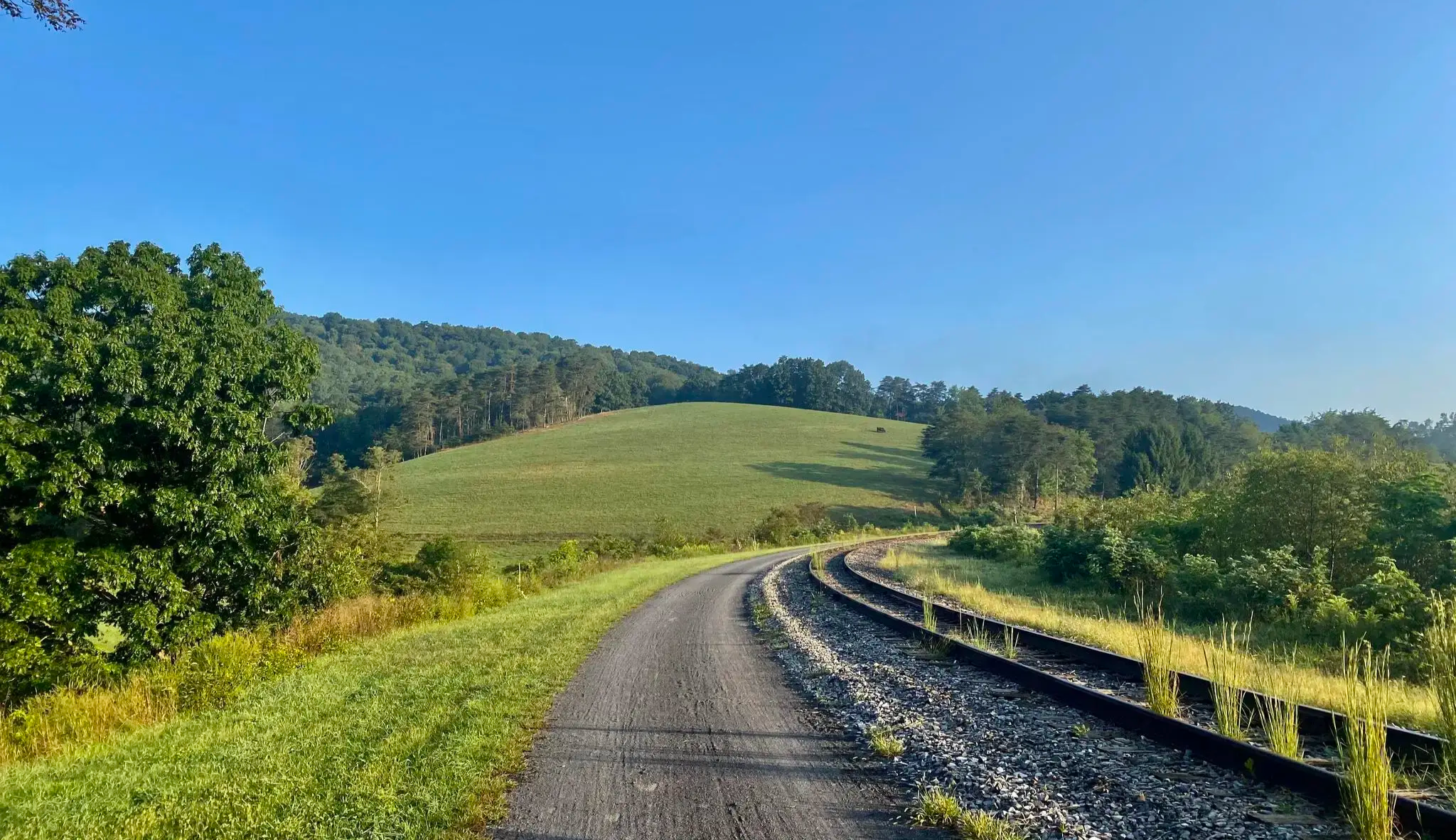
The Great Allegheny Passage — A scenic walk through the mountains of Southwest Pennsylvania
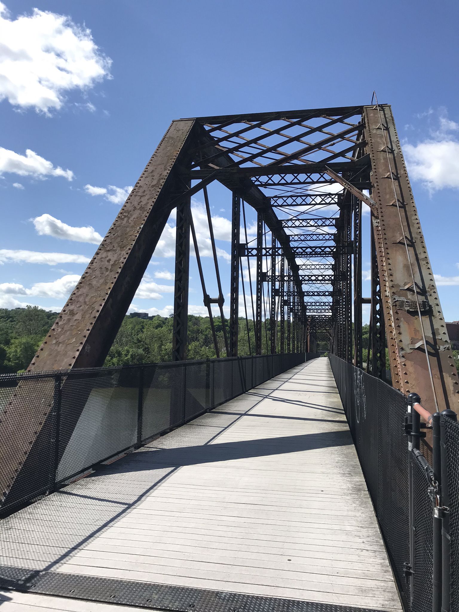
The Great Allegheny Passage — A rail trail adventure through Maryland and Pennsylvania

Other adventures in Somerset County

Laurel Highlands Hiking Trail — Miles of summits, streams, & shelters

Hiking Collection by

Will

Tips from the Community

Dylan Sacco
April 16, 2026, Penny Farthing on Scenic Bike Path

That’s actually a penny farthing

2

0

This shelter area located north of Route 31 is one of eight strategically placed along the Laurel Highlands Hiking Trail. Each shelter area has five Adirondack-style lean-to shelters, room for up to 25 tents, bathrooms, fire pits, and garbage cans. Overnight stays at shelter areas must be reserved ahead of time with Laurel Ridge State Park. There is a seasonal stream that runs through the south end of this shelter area near shelters #1 and #2 that can serve as a good water supply.

0

0

This shelter area just off Route 271 is one of eight strategically placed along the Laurel Highlands Hiking Trail. Each shelter area has five Adirondack-style lean-to shelters, room for up to 25 tents, bathrooms, fire pits, and garbage cans. Overnight stays at shelter areas must be reserved ahead of time with Laurel Ridge State Park.

0

0

mtm05005
March 28, 2025, Wooden bridge

Nice wooden bridge over the Casselman River. As you are crossing, make sure to stop to enjoy the wonderful view of the river and the surrounding forest.

0

0

Though Laurel Summit State Park is only 6 acres, the trails that start run for miles through Forbes State Forest and along the Laurel Ridge.

0

0

Heading out the Laurel Summit State park, you can choose different paths to go deep into the Forbes State Forest. One of them is the Wolf Rocks Trail, that will get you to the marvelous viewpoint at the end, where you can enjoy the dense trees and refreshing air.

0

0

Located at the parking lot of Laurel Summit State Park, this trailhead will take you all the way up to Wolf Rocks, where the views will most certainly reward the effort as you approach the Parks Hill mountain side.

0

0

Laurel Summit State Park offers a wide picnic area accessible from many trails. There's a parking lot at the entrance of the park, at the side of Forbes State Park.

0

0

Frequently Asked Questions

How many easy hiking trails are available in Somerset County?

Somerset County offers a good selection of easy hiking trails, with 18 specifically categorized as easy. In total, there are nearly 40 routes available for various skill levels across the region.

What kind of landscapes can I expect on easy hikes in Somerset County?

Easy hikes in Somerset County feature diverse natural landscapes. You can expect to find wooded areas, historic canal paths, river valleys, and open spaces. Notable areas include the rocky woodlands of Sourland Mountain Preserve, the scenic towpath along the Delaware and Raritan Canal, and the extensive lawns and woodlands of Natirar Park.

Are there family-friendly easy hikes in Somerset County?

Yes, many easy trails in Somerset County are suitable for families. The Great Allegheny Passage: Fort Hill to Markleton offers a historic pathway experience. Other family-friendly options can be found in parks like Colonial Park, which combines natural areas with gardens, and the Environmental Education Center, known for its diverse habitats.

Can I bring my dog on easy hikes in Somerset County?

Many parks and trails in Somerset County are dog-friendly, though leash laws typically apply. Always check specific park regulations before heading out. Trails like the Cole Run Trail are popular choices for hikers with canine companions.

What are some scenic easy hikes in Somerset County?

For scenic easy hikes, consider routes along the Delaware and Raritan Canal State Park, which offers picturesque views along its historic towpath. Natirar Park also provides scenic views and river access along the North Branch Raritan River. The Laurel Highlands Hiking Trail section is also noted for its natural surroundings.

Are there any interesting landmarks or attractions near these easy trails?

Yes, Somerset County offers several interesting landmarks. You can find the Mason-Dixon Line Monument, the Eastern Continental Divide, and the historic Big Savage Tunnel. The Salisbury Viaduct is another notable structure. Washington Rock State Park also offers historic significance and scenic views.

What do other hikers say about the easy trails in Somerset County?

The easy trails in Somerset County are highly rated by the komoot community, with an average score of 4.6 stars from over 40 reviews. Hikers often praise the varied terrain, quiet woodlands, and well-maintained paths that make for enjoyable outdoor experiences.

What is the best time of year to go hiking in Somerset County?

Somerset County offers pleasant hiking experiences throughout the year. Spring and fall provide comfortable temperatures and vibrant foliage. Summer is ideal for shaded trails or those near water, while winter can offer unique snowy landscapes, especially in areas like Washington Valley Park or Sourland Mountain Preserve.

Are there any easy trails suitable for wheelchairs or strollers?

While specific data on wheelchair accessibility for all trails is limited, the flat, historic towpath sections of the Delaware and Raritan Canal State Park are generally well-suited for strollers and some wheelchairs. Parks like Colonial Park also feature paved paths and accessible areas.

How long do easy hikes in Somerset County typically take?

Easy hikes in Somerset County vary in length and duration. For example, the Cole Run Trail is about 2.7 miles (4.4 km) and takes around 1 hour 18 minutes. The Great Allegheny Passage: Fort Hill to Markleton is longer at 4.3 miles (6.9 km), typically completed in about 1 hour 50 minutes.

Are there any easy trails that feature water bodies like rivers or reservoirs?

Yes, several easy trails in Somerset County offer access to water features. The Delaware and Raritan Canal State Park provides walks along the canal. Natirar Park offers river access along the North Branch Raritan River, and Washington Valley Park features a 21-acre reservoir. The Six Mile Run Reservoir Site also has wooded trails with reservoir views.

Are there any easy circular walks in Somerset County?

Yes, you can find easy circular walks in the region. The Wolf Rocks Loop Trail is an easy circular route. The Sourland Mountain Preserve also offers loop options, such as the Devil's Half-Acre, Ridge, and Tributary Trail Loop, or a longer loop via the White Square Trail.

Where can I find parking for easy hikes in Somerset County?

Most major parks and preserves in Somerset County, such as Sourland Mountain Preserve, Delaware and Raritan Canal State Park, Natirar Park, and Washington Valley Park, offer designated parking areas for trail access. It's always advisable to check specific park websites for detailed parking information before your visit.

Most popular routes in Somerset County

Hiking in Somerset County

Most popular attractions in Somerset County

Places to see

Store rating

Get inspired with the komoot mobile app

With a free komoot account, you can easily find, customize, and navigate endless outdoor adventures.

or

Join komoot Now

Store rating

Didn’t find what you were looking for?

Check out more Hikes throughout Somerset County below and find the perfect route in your destination.

EdieSeven SpringsKooser State ParkLaurel Hill State Park

Nearby adventure guides

Things to Do around Friedens

background

Get ready to conquer new peaks

Sign up for Free

Explore
RoutesRoute plannerFeaturesHikesMTB TrailsRoad cycling routesBikepackingSitemap
Download the app
Follow Us on Socials

© komoot GmbH

Privacy Policy