The best MTB trails around Caccuri
4.3
(8)
48
riders
11
rides
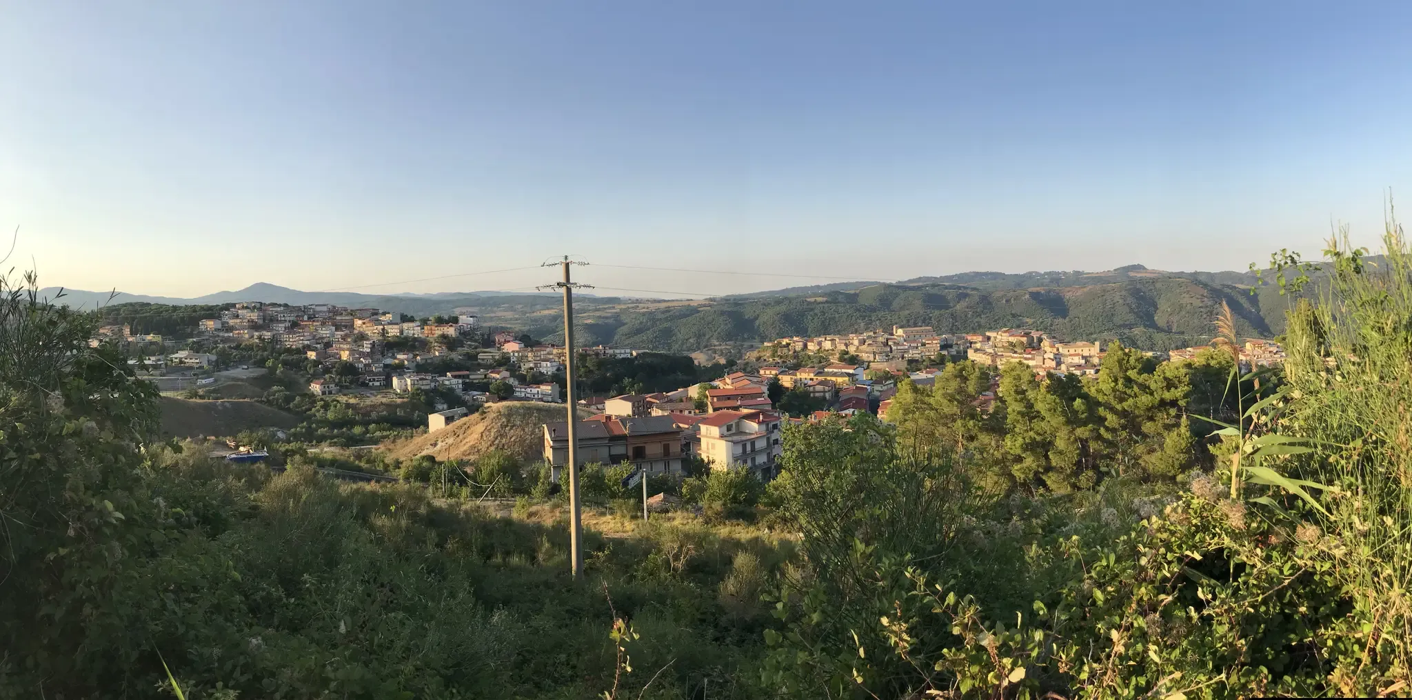
Mountain biking around Caccuri offers diverse terrain in the heart of Calabria, Italy. The region is characterized by its elevated position at 646 meters, providing panoramic views of olive groves, forests, and the rugged Neto Valley. Caccuri is also strategically located near the Sila National Park, known for its vast forests, grasslands, and an almost alpine landscape, offering extensive networks of trails. The Neto River plays a significant role in the area's natural beauty, with its valley providing a scenic backdrop for outdoor pursuits.
Best mountain bike trails around Caccuri
- The most popular mountain bike trail is Lago Ampollino – Lake Ampollino loop from Villaggio Baffa, a 25.7 miles (41.4 km) trail that takes 3 hours 35 minutes to complete. This moderate route explores the scenic surroundings of Lake Ampollino.
- Another top favourite among local mountain bikers is Bridge Over the Tacina River – Tacina River loop from Villaggio Baffa, a moderate 23.1 miles (37.1 km) path. This route features varied terrain along the Tacina River.
- Local mountain bikers also love the Lago di Cecita – Monoliths of Caccuri loop from San Giovanni in Fiore, a 19.1 miles (30.7 km) trail leading through the diverse landscapes near Lake Cecita, often completed in about 2 hours 20 minutes.
- Mountain biking around Caccuri is defined by its proximity to the Sila National Park, the scenic Neto River Valley, and panoramic views from its elevated position. The network offers options for moderate to difficult routes, catering to various ability levels.
- The routes in Caccuri are highly rated by the komoot community with an average score of 4.3 stars from 8 reviews. More than 40 mountain bikers have used komoot to explore Caccuri's varied terrain.
Last updated: May 17, 2026
4.0
(1)
11
riders
51.4km
03:01
530m
530m
Moderate mountain bike ride. Good fitness required. Suitable for all skill levels.
3.5
(2)
5
riders
41.7km
03:38
660m
660m
Moderate mountain bike ride. Good fitness required. Suitable for all skill levels.

Sign up for free
4.8
(4)
6
riders
37.1km
03:36
710m
710m
Moderate mountain bike ride. Good fitness required. Suitable for all skill levels.
5
riders
30.7km
02:21
620m
620m
Moderate mountain bike ride. Good fitness required. Advanced riding skills necessary.
4
riders
44.4km
02:58
620m
620m
Moderate mountain bike ride. Good fitness required. Suitable for all skill levels.
Get access to more routes and recommendations from other explorers.
Sign up for free
Already have an account?
Our route recommendations are based on thousands of hikes, rides, and runs completed by other people on komoot.
Start today with a free account
Your next adventure awaits.
Login or Signup
Other adventures around Caccuri

Tips from the Community

Among the three large Calabrian lakes of the Sila, the Ampollino is certainly the least contaminated and consequently the most authentic to be appreciated by lovers of nature and landscapes.
0
0

Unfortunately, you can't pass through here. To get to Feghito, you have to reach the Berberano crossroads via the Ciricilla ditch (path next to the gate).
0
0

In summer, you can take advantage of numerous cycling routes that lead through diverse landscapes - from mountain spruce forests to water areas of lakes. In winter, the area is home to the Camigliatello Silano ski resort, which attracts skiing and winter sports enthusiasts with its well-prepared facilities and picturesque location in the Sila massif. This is a place more for local skiing enthusiasts and beginners who want to combine active recreation with a vacation in the warm climate of Calabria. If you are looking for more serious skiing routes, you have to go further north in Italy or to the Alps. In Calabria, on the other hand, you will certainly appreciate nature, peace and a unique mountain climate.
1
0
The Ampollino Valley is surrounded by the mountains of the Sila massif, with clearly distinguishable peaks: Scorciavuoi (1627 m above sea level), Gariglione (1623 m above sea level), Zingomarro (1463 m above sea level) and Monte Nero (1747 m above sea level). There are extensive pine, beech and fir forests here, creating a Mediterranean mountain landscape characteristic of the region. The central element of the valley is the artificial reservoir Lago Ampollino, created by a dam (diga) on the Ampollino River. The shores of the lake are overgrown with reed beds and water lilies, and in the area you can see wild animals - deer, wild boars, waterfowl and birds of prey.
1
0

Beautiful Sila lake, with beautiful scenery along the perimeter
1
0
Piciaro torrent waterfalls, beautiful fresh water even in summer.
0
0
A magical place to pedal alone among woods and valleys.
1
0

The route takes place partly on an asphalt road and partly on a dirt road
0
0
Frequently Asked Questions
What types of mountain bike trails can I find around Caccuri?
Caccuri offers a diverse range of mountain bike trails, from moderate to difficult. The region's proximity to the Sila National Park means you'll find routes exploring vast forests, grasslands, and an almost alpine landscape. The Val di Neto Greenway also provides a gentle, sustainable itinerary along the Neto River, suitable for various bike types including mountain bikes.
Are there any easy or family-friendly mountain bike trails near Caccuri?
Yes, while many routes are moderate, the Sila National Park offers easy excursions suitable for families. The Val di Neto Greenway, which passes through Caccuri's territory, is also described as a gentle and sustainable itinerary, making it a good option for a more relaxed ride. Currently, komoot lists 8 moderate routes and 2 difficult routes in the immediate vicinity, but the broader Sila area has options for all levels.
What are the typical distances and durations for mountain bike trails in the Caccuri area?
Mountain bike trails around Caccuri vary in length and duration. For example, the Lago Ampollino – Lake Ampollino loop from Villaggio Baffa is about 25.7 miles (41.4 km) and takes around 3 hours 35 minutes. Other routes like the Lago di Cecita – Monoliths of Caccuri loop from San Giovanni in Fiore are around 19.1 miles (30.7 km) and can be completed in about 2 hours 20 minutes. You'll find a good range of options to suit your available time and fitness level.
What can I see along the mountain bike trails near Caccuri?
The trails offer stunning natural beauty and points of interest. You can explore the scenic surroundings of Lake Ampollino, ride along the Tacina River, or discover the diverse landscapes near Lake Cecita. Notable attractions include the Lago Ampollino Dam, the Lago Ampollino Lakeside Cycle Path, and the Calusia Pedestrian and Cycle Bridge. The Val di Neto Greenway also features archaeological sites and charming villages.
Are there any challenging mountain bike routes for experienced riders?
Yes, for experienced riders seeking a challenge, there are difficult routes available. The Sila National Park, easily accessible from Caccuri, is known for its extensive network of trails, including adrenaline-filled options. Komoot currently lists 2 difficult mountain bike routes in the area, alongside 8 moderate ones, ensuring there's something for every skill level.
What do other mountain bikers enjoy most about Caccuri's trails?
The mountain bike trails around Caccuri are highly rated by the komoot community, with an average score of 4.3 stars from 8 reviews. Riders often praise the diverse terrain, the panoramic views of olive groves and the Neto Valley, and the proximity to the Sila National Park's extensive trail network. The routes offer a great mix of natural beauty and engaging rides.
Is Caccuri a good base for exploring the Sila National Park by mountain bike?
Absolutely. Caccuri's strategic location provides direct access to the Sila National Park, often called the 'green lung of Calabria.' The park offers an extensive network of well-signposted and maintained trails, ranging from easy family excursions to challenging routes. You can explore wild woods, pristine mountains, and scenic roads, making Caccuri an excellent starting point for your Sila mountain biking adventures.
Can I bring my dog on the mountain bike trails near Caccuri?
While specific regulations for each trail can vary, Sila National Park generally welcomes dogs on trails, provided they are kept on a leash. It's always recommended to check local signage or park guidelines for the specific trail you plan to ride to ensure a pleasant and safe experience for everyone, including your furry companion.
What is the best time of year for mountain biking in Caccuri?
The spring and autumn months typically offer the most pleasant conditions for mountain biking in Caccuri, with milder temperatures and lush landscapes. Summer can be warm, especially at lower elevations, but Caccuri's elevated position and the Sila National Park offer cooler alternatives. Winter riding is possible, but conditions can be colder, especially in the Sila mountains, and some higher trails might be affected by snow.
Are there any circular mountain bike routes in the Caccuri area?
Yes, many of the mountain bike routes around Caccuri are designed as loops, allowing you to start and finish in the same location. Examples include the Bridge Over the Tacina River – Tacina River loop from Villaggio Baffa and the Lago di Cecita – Lago Ariamacina loop from San Giovanni in Fiore. These circular routes are convenient for planning your ride.
Are there any specific scenic viewpoints or panoramic spots along the trails?
Caccuri itself is perched at 646 meters, offering sweeping panoramic views of olive groves, forests, and the rugged Neto Valley, extending towards the Ionian coast. Many trails in the Sila National Park, such as those along the 'Strada delle Vette,' also provide impressive viewpoints. The elevated terrain ensures numerous opportunities for breathtaking vistas throughout your ride.
How many mountain bike routes are available on komoot for the Caccuri region?
Komoot features 10 mountain bike routes in the Caccuri region, offering a variety of experiences for riders. These include 8 moderate and 2 difficult trails, allowing you to choose an adventure that matches your skill level and preferences.
Most popular routes around Caccuri
Most popular attractions around Caccuri

Get inspired with the komoot mobile app


Explore more
Browse the best MTB trails in other regions.
