The best road cycling routes in Mackerricher State Park
5.0
(3)
131
riders
7
rides
Road cycling in Mackerricher State Park offers routes along the scenic Mendocino County coastline. The park features a mix of paved roads and former logging routes, providing varied surfaces for road cyclists. Terrain includes coastal bluffs, sandy beaches, and some forested sections, with gentle elevation changes. The area provides opportunities for coastal rides with views of the Pacific Ocean.
Best road cycling routes in Mackerricher State Park
- The most popular road cycling route is MacKerricher Haul Road Trail & Little…
Last updated: November 7, 2026
1
riders
28.7km
03:49
270m
270m
47
riders
167km
08:25
2,660m
2,660m
Hard road ride. Very good fitness required. Some segments of this route may be unpaved and difficult to ride.

14
riders
43.4km
02:02
510m
510m
Moderate road ride. Good fitness required. Mostly well-paved surfaces and easy to ride.
5.0
(1)
21
riders
25.6km
01:06
150m
150m
Easy road ride. Mostly well-paved surfaces and easy to ride.
8
riders
14.3km
00:36
80m
80m
Easy road ride. Mostly well-paved surfaces and easy to ride.
Get access to more routes and recommendations from other explorers.
Already have an account?
Our route recommendations are based on thousands of hikes, rides, and runs completed by other people on komoot.
Start today with a free account
Your next adventure awaits.
Popular around Mackerricher State Park


Tips from the Community

MacKerricher Beach is a long beach in MacKerricher State Park. It is a great place for a break during a long walk.
0
0
Fort Bragg is a small coastal city that was originally founded as a military garrison in 1857. It later became a lumber and fishing hub. Now, it is a popular stop for cyclists and hikers who are traveling along the Pacific Coast.
0
0

The Guest House was built primarily of coast redwood in 1892 by the Fort Bragg Redwood Company as a private residence for the Johnson Family owners of the company. The house was also used for visiting senior officials from the San Francisco headquarters and VIP guest visitors to the Fort Bragg mill and logging sites. Today it serves as a Museum and the historical society’s headquarters. https://www.fortbragghistory.org
0
0

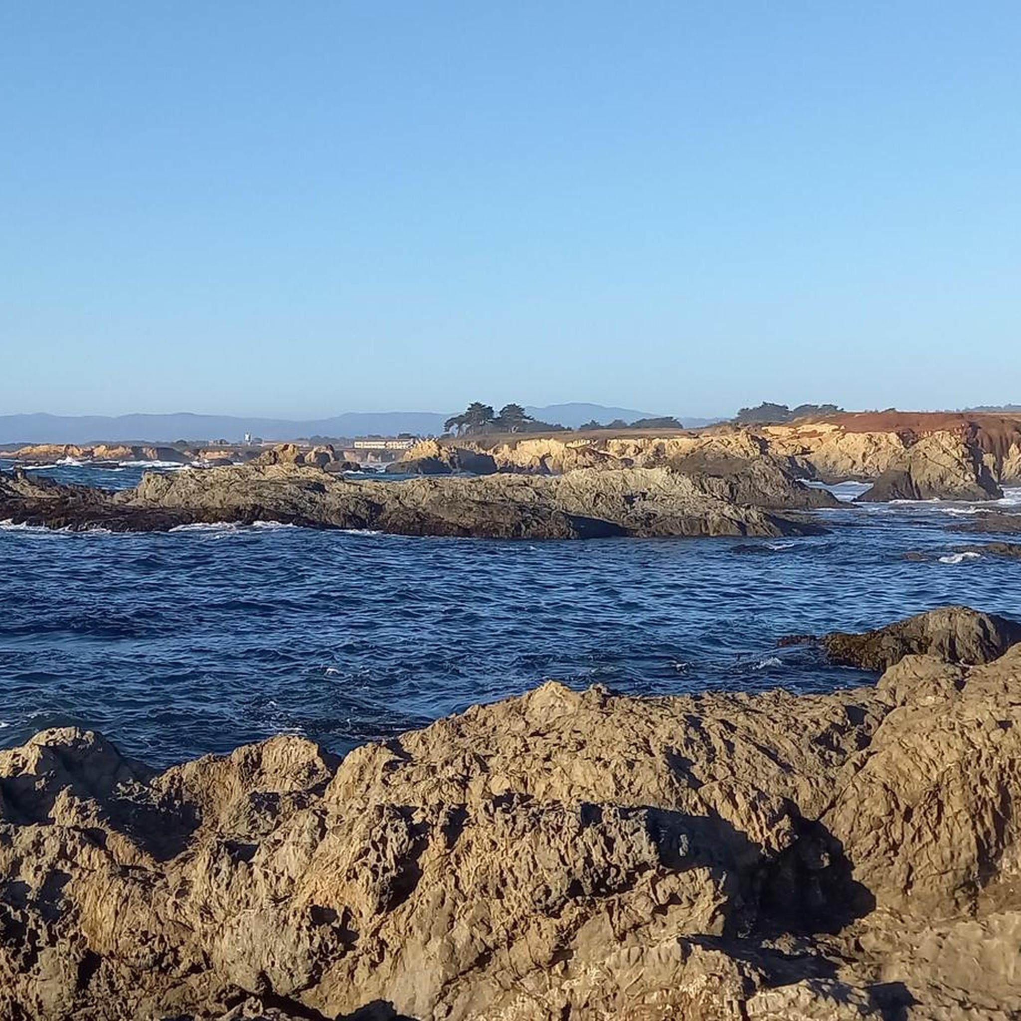
This multi-use trail runs along the bed of an old logging haul road and railroad, along the majestic coastal bluffs of the Pacific, and is one of the longest continuous whale-watching locations on the West Coast. It's a spectacular stretch of coastline worthy of stopping to capture some fantastic photos.
0
0

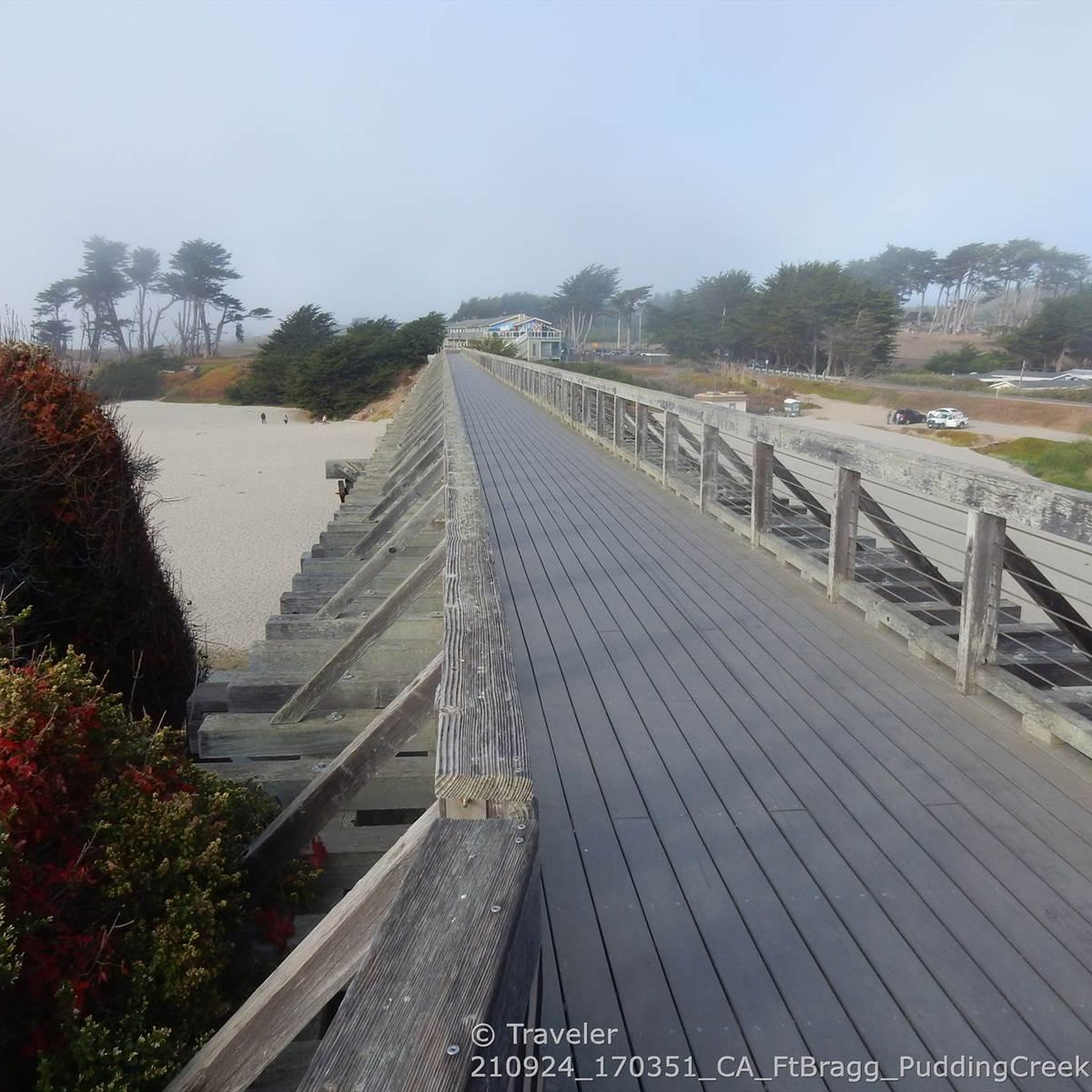
After crossing the famous Pudding Creek Trestle - a famous and historic trestle bridge - you reach Pudding Creek Beach. This beautiful beach is a great place to relax, sunbathe, take in the truly stunning views, and walk on the famous “squeaky sand."
0
0
The Ka Kahleh Trail in Fort Bragg, California, offers a scenic hiking experience close to town. Known for its breathtaking, panoramic views of the Pacific Ocean, and rugged coastline, the trail traverses along the top of coastal bluffs, providing ample opportunities for photography, wildlife viewing, and birdwatching.
0
0
Historic highway 1 concrete bridge span, higher than long, across a natural rock Canyon, with spectacular views down to the sandy beach
0
0
Iconic bridge, built in 1940, linking the coastal towns of Caspar and Fort Bragg. An earlier wooden structure had been in place here since the late 1800s.
1
0
Frequently Asked Questions
How many road cycling routes are available in Mackerricher State Park?
There are 6 dedicated road cycling routes within Mackerricher State Park, offering a range of experiences along the coast.
Are there road cycling routes suitable for beginners in Mackerricher State Park?
Yes, Mackerricher State Park offers several easy road cycling routes. For instance, the MacKerricher Haul Road Trail – Noyo River Harbor loop from Cleone is a great option, covering 14.1 miles with gentle elevation changes. Another easy route is the Pudding Creek Beach – Ka Kahleh Trail loop from Cleone, which is 13.3 miles long.
What is the best time of year for road biking in Mackerricher State Park?
The Mendocino County coastline generally offers mild temperatures year-round. However, late spring through early fall (May to October) typically provides the most pleasant weather for road cycling, with less rain and often clearer skies, ideal for enjoying the coastal views.
Are there any longer or more challenging road cycling routes for experienced riders?
For those seeking a longer ride, the Cleone Grocery – Westport loop from Cleone is a moderate 26.2-mile route that extends north along the coast, offering open views and more significant elevation changes compared to shorter loops.
What kind of views and scenery can I expect while road cycling in Mackerricher State Park?
Road cycling in Mackerricher State Park is defined by stunning coastal paths, views of the Pacific Ocean, and sections that follow former logging routes. You'll encounter coastal bluffs, sandy beaches, and some forested areas, providing a diverse and scenic backdrop for your ride.
Are there any loop trails for road cyclists in Mackerricher State Park?
Yes, several routes in the park are designed as loops. The MacKerricher Haul Road Trail & Little Valley loop is a popular 17.8-mile option, combining coastal paths with inland sections for a varied loop experience.
What are some interesting landmarks or attractions to see along the road cycling routes?
While cycling, you can pass by notable attractions such as the Pudding Creek Trestle and Pudding Creek Beach. Further south, you might also explore Glass Beach and Noyo Headlands Park, offering additional scenic stops.
Where can I find parking for road cycling routes in Mackerricher State Park?
Mackerricher State Park offers various parking areas accessible from Highway 1. Specific trailheads often have designated parking lots, such as those near Cleone or the main park entrance, providing convenient access to the road cycling routes.
Are the road cycling routes in Mackerricher State Park suitable for families?
Many of the easy-rated routes with gentle elevation changes, such as the Noyo River Bridge – MacKerricher Haul Road Trail loop from Noyo, can be suitable for families, especially those with some cycling experience. These routes often follow paved or well-maintained former haul roads, offering a smoother ride.
What do other road cyclists enjoy most about road cycling in Mackerricher State Park?
The area is highly rated by the komoot community, with an average score of 5.0 stars. Reviewers often praise the stunning coastal views, the variety of terrain from paved roads to former logging routes, and the overall scenic beauty of the Pacific Ocean backdrop.
What are the typical weather conditions for road biking in Mackerricher State Park?
Coastal weather can be variable. Expect cool mornings, potential fog, and afternoon breezes, especially closer to the ocean. Summers are generally mild and dry, while winters are cooler and wetter. Always check the local forecast before heading out.
Are there any cafes or places to stop for refreshments near the road cycling trails?
While the park itself focuses on natural experiences, the nearby towns of Fort Bragg and Cleone offer various cafes, restaurants, and grocery stores where you can refuel before or after your ride. Many routes, like the Cleone Grocery – Westport loop from Cleone, start or pass through areas with amenities.
Most popular routes in Mackerricher State Park
Most popular attractions in Mackerricher State Park

Get inspired with the komoot mobile app


Explore more
Browse the best Road cycling routes in other regions.
