The best walks and hikes in Conway County
4.7
(11)
141
hikers
10
hikes
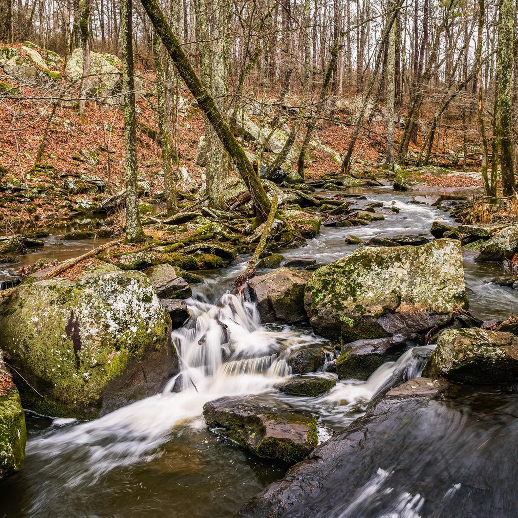
Hikes in Conway County are centered around the landscape of Petit Jean Mountain, a mesa featuring canyons, streams, and bluffs on the south bank of the Arkansas River. The region's terrain is characterized by forests, unique rock formations, and waterfalls. Most of the primary hiking trails are located within Petit Jean State Park, offering a variety of routes through this distinct geological area.
Best hiking trails in Conway County
- The most popular hiking route is Seven Hollows Trail loop — Ouachita National Forest, a 4.1 mile (6.6 km) trail that takes about 1 hour 48 minutes to complete. This route features a natural arch and unique rock formations.
- Another top favourite among local hiking enthusiasts is Boy Scout — Canyon Trails loop — Ouachita National Forest, a moderate 7.7 mile (12.4 km) path. The trail combines sections of the Boy Scout and Canyon trails, descending into a canyon.
- Local hiking enthusiasts also love the Cedar Falls loop from Oppelo, a 2.2 mile (3.5 km) trail leading through Cedar Creek Canyon, often completed in about 1 hour 10 minutes.
- Hiking in Conway County is defined by canyon descents, forested paths, and routes leading to waterfalls. The trail network provides options for different ability levels, from easy walks to more moderate hikes with elevation changes.
- The routes in Conway County are highly rated by the komoot community with an average score of 4.9 stars from a number of reviews. More than 90 hikers have used komoot to explore Conway County's varied terrain.
Last updated: July 21, 2026
7
hikers
20.0km
05:39
410m
430m
Prepare for a demanding hike on the Winthrop P. Rockefeller Boy Scout Trail, a difficult route covering 12.4 miles (20.0 km). You will traverse varied terrain, from dense woodlands to impressive canyons and hollows, encountering the diverse natural beauty of Petit Jean State Park. The trail requires careful footing over numerous rock steps and jagged sections as you climb 1353 feet (412 metres) in elevation. Plan for approximately 5 hours and 38 minutes to complete this rugged journey, where you can discover unique geological formations like Turtle Rocks.
Given the trail's length and challenging nature, it is wise to start your hike early in the day. Make sure to carry plenty of food and water to sustain you throughout the journey. For your safety, it is recommended to check in and out at the Petit Jean State Park Visitor Center before and after your hike. Be aware that the terrain can be uneven, so appropriate footwear is essential.
This route offers a comprehensive exploration of the park's natural features, including the historic Rock House Cave, believed to be an ancient Native American shelter. You will also encounter Cedar Creek, with opportunities to view its lower canyon and the impressive Cedar Falls during wetter periods. The Seven Hollows section further enhances the experience with its natural bridge and grotto, showcasing the unique geology of the area.
2
hikers
1.72km
00:34
50m
90m
The Cedar Falls Trail in Petit Jean State Park plunges you into a mystical ancient cedar forest, guiding you along Cedar Creek to the base of the impressive 95-foot Cedar Falls. You'll navigate through lush woodlands and past massive stone boulders, with the air often feeling cooler and fresher as you descend into the canyon. The gnarled, 300-year-old trees create a unique atmosphere, making the journey to the waterfall as captivating as the destination itself.
This moderate 1.1-mile (1.7 km) hike, with 166 feet (51 metres) of elevation gain, typically takes around 33 minutes, but don't let the short distance fool you; the initial descent and subsequent climb back out are quite steep and rocky. The trailhead is easily accessible behind Mather Lodge, offering convenient parking. For the best experience and most dramatic waterfall flow, consider visiting after a good rain, but be mindful of potentially slick surfaces.
As one of the most popular routes in Arkansas's first state park, the Cedar Falls Trail is a National Recreation Trail with rich historical connections. While swimming at the falls is prohibited, the large grotto and surrounding boulders provide a perfect spot for a rest and some photography. This trail is a must-do for anyone visiting Petit Jean State Park looking for a rewarding natural spectacle.

Sign up for free
1
hikers
7.05km
02:02
180m
170m
Hike the 4.4-mile Rock House Cave and Lookout Trail in Petit Jean State Park to see ancient Native American rock art.
1.14km
00:19
10m
10m
Explore the unique geology of Bear Cave Trail, an easy hike that winds through massive sandstone boulders and bluff formations. This 0.7-mile (1.1 km) route involves a gentle 49 feet (15 metres) of elevation gain, taking about 18 minutes to complete. You will navigate a natural maze, walking under and around ancient rocks, with a highlight being the 'Eye of the Needle,' a very narrow opening to experience.
When planning your visit, remember that while the trail is easy, it does include some steps and rocky sections. Wearing sturdy shoes is a good idea, especially if you plan to explore the various rock formations. The trail is generally accessible and suitable for most visitors looking for a quick outdoor adventure.
This trail is notable for its distinctive landscape, where wind and water have sculpted the sandstone into impressive shapes, some reaching 50 feet high. It offers a close-up look at the geological forces that shaped the area, providing a memorable experience within Petit Jean State Park.
2.30km
00:35
0m
0m
Embark on an easy hike along the Tucker Creek Trail, a paved multi-use path that stretches for 1.4 miles (2.3 km). You will find yourself surrounded by lush greenery as the route gently winds alongside the tranquil waters of Tucker Creek. The trail is mostly tree-lined, providing ample shade, and you will cross several charming bridges over the creek. This pleasant outing involves a minimal elevation gain of just 14 feet (4 metres) and takes approximately 34 minutes to complete, making it perfect for a quick, refreshing walk. Keep an eye out for unique mosaics and painted animal footprints that add a touch of whimsy to your journey.
Maintained by Conway Parks and Recreation, the Tucker Creek Trail offers convenient amenities for your visit. You will find restrooms, picnic tables, and doggie doo stations along the route, ensuring a comfortable experience. While parts of the trail pass through urban areas, new crosswalks with motion-activated lighting enhance safety. Certain sections are also well-lit, allowing you to enjoy the trail even after sunset.
This multi-use path is ideal for a leisurely stroll or a brisk walk, offering a peaceful escape within the city. The serene views and natural surroundings make it a popular choice for observing local flora and fauna. Whether you are looking for a short exercise break or a quiet moment outdoors, the Tucker Creek Trail provides an accessible and enjoyable option for everyone.
1.33km
00:20
0m
0m
Embark on an easy hike along the Hendrix Creek Preserve Trail, a tranquil 0.8-mile (1.3 km) route that winds through lush wetlands. You will experience serene waters and vibrant plant life, making it a prime spot for observing local wildlife. The path is well-maintained, featuring sections of fine gravel and boardwalks that guide you through this ecological wonderland. With a minimal elevation gain of just 5 feet (1 metre), this short adventure takes approximately 20 minutes to complete. It's a perfect way to immerse yourself in nature without a strenuous effort.
Planning your visit to the preserve is straightforward, as the trail is designed for accessibility. You will find the gentle paths accommodating for strollers and even bicycles, making it an excellent choice for a family outing. This easygoing route is suitable for all ages and fitness levels, ensuring everyone can enjoy the natural surroundings. Consider visiting during the morning or late afternoon for the best light and cooler temperatures, especially if you are hoping to spot wildlife.
The Hendrix Creek Preserve Trail stands out as a unique 18-acre environment, showcasing a rich blend of fields, wetlands, and forests. This area is particularly notable for its biodiversity, offering a glimpse into a thriving ecosystem right within the preserve. The well-maintained paths and boardwalks ensure you can explore this ecological gem with ease, providing an accessible window into a vibrant natural habitat.
4.7
(6)
43
hikers
6.55km
01:48
110m
110m
The Seven Hollows Trail offers an easy hiking experience through diverse landscapes, covering 4.1 miles (6.6 km) with a gentle elevation gain of 356 feet (109 metres). You can expect to complete this loop in about 1 hours and 48 minutes, making it a perfect outing for many skill levels. As you hike, you will encounter impressive bluff lines and unique "turtle rocks," leading you to the remarkable Natural Bridge, a massive rock formation you can walk under.
When planning your visit, remember that the trail is rated as easy, but its rocky sections and continuous ups and downs mean you should wear sturdy hiking shoes to protect your ankles. While much of the route is shaded, bringing enough water is always a good idea, especially on warmer days. The trailhead provides ample parking, making access straightforward for visitors.
This trail stands out for its captivating geological features and varied terrain, showcasing the power of natural erosion. Beyond the Natural Bridge, you will discover the Grotto, a distinctive box canyon featuring a large rock overhang and a seasonal waterfall that is particularly impressive after rainfall. The route winds through dense hardwood and pine forests, offering a rich natural environment to explore.
4.5
(2)
11
hikers
12.4km
03:38
320m
320m
The Boy Scout Trail in Joshua Tree National Park offers a captivating journey through the Mojave Desert, transitioning from classic Joshua Tree forests to the dramatic granite formations of the "Wonderland of Rocks." You'll experience a mix of flat, sandy paths and rocky descents, with expansive views of plains and distant mountains like San Jacinto Peak. The trail provides a true sense of desert solitude and the chance to see the desert come alive with blooms in spring.
Planning your visit requires careful consideration of the desert environment; there's minimal shade and no water, so carry plenty. While the trail is generally well-marked, the last two miles involve a steep, rocky descent with loose gravel, making trekking poles a good idea. Many hikers choose the 7.8-mile point-to-point option, but a 16-mile out-and-back is also popular, offering a challenging climb on the return.
This moderate 7.7-mile (12.4 km) hike, with 1034 feet (315 metres) of elevation gain and an estimated duration of 3 hours and 38 minutes, is one of the most popular and longest routes in Joshua Tree. It's an excellent way to explore the park's unique geology and offers access to numerous rock climbing opportunities. The trail's varied terrain and stunning desert scenery make it a standout choice for those seeking a substantial day hike.
5.0
(3)
74
hikers
3.48km
01:11
140m
140m
The Cedar Falls Trail loop from Petit Jean State Park offers a captivating journey through diverse forest ecosystems, leading you deep into Cedar Creek Canyon. You'll traverse lush woodlands, encounter massive stone boulders, and eventually reach the dramatic 95-foot Cedar Falls, a true highlight of the park. The trail itself is a moderate 2.2-mile (3.5 km) hike with 460 feet (140 metres) of elevation gain, typically taking around 1 hour and 10 minutes to complete.
Planning your visit means starting at the historic Mather Lodge, where the trailhead is easily accessible. Be ready for a significant descent into the canyon via stone steps at the beginning, followed by a steep climb back out. Good, sturdy footwear is highly recommended for the rocky and uneven terrain, ensuring a safer and more enjoyable experience on this popular route.
This trail is renowned for its iconic Cedar Falls, one of Arkansas's most photographed natural attractions, and showcases the enduring craftsmanship of the Civilian Conservation Corps (CCC) through its historic stone steps. The immersive experience within Cedar Creek Canyon, with its unique rock formations and the tranquil flow of the creek, makes it a must-do for anyone exploring Petit Jean State Park.
5
hikers
10.4km
02:59
250m
240m
Moderate hike. Good fitness required. Easily-accessible paths. Suitable for all skill levels.
Our route recommendations are based on thousands of hikes, rides, and runs completed by other people on komoot.
Start today with a free account
Your next adventure awaits.
Login or Signup
Popular around Conway County

Tips from the Community

Not actually a cave but technically a deep bluff shelter which is an overhang in a rock cliff. Archeological findings have determined this shelter was used by native people for about 8000 years. The walls contain petroglyphs and pictographs that are believed to be between 1,000 and 2,000 years old.
0
0
Scenic and popular spur trail off of the Canyon Trail with large boulders and big trees along the way. It ends at Cedar Falls, the site of one of the tallest continuously flowing waterfalls in Arkansas at 95 feet.
0
0
Not actually a cave but technically a deep bluff shelter which is an overhang in a rock cliff. Archeological findings have determined this shelter was use in use by native people for about 8000 years. The walls contain petroglyphs and pictographs that are belived to be between 1,000 and 2,000 years old.
0
0
Scenic and popular spur trail off of the Canyon trail with large boulders and big trees along the way. It ends at Cedar Falls, the site of one of the tallest continuously flowing waterfalls in Arkansas at 95 feet.
0
0
This loop trail travels through 4 small but specatcular canyons under a canopy of dense hardwood trees. Features include bluff lines, a natural stone arch, rock shelters and Native American bluff dwellings. This moderately strenuous trail is considered as one of the most scenic in Arkansas.
0
0
Frequently Asked Questions
Are there any easy, family-friendly hikes in Conway County?
Yes, the region offers several options suitable for families. A great choice is the Seven Hollows Trail loop, which is a relatively flat walk through a forested area known for its unique rock formations and a natural arch. For another relaxing option slightly outside the main park, Hendrix Creek Preserve is highly regarded for its short, well-maintained, and pet-friendly trail.
Can I bring my dog on the hiking trails?
Many trails in and around Conway County are dog-friendly, but dogs must be kept on a leash. Trails within Petit Jean State Park generally permit leashed dogs. Always check specific park regulations before you go, as rules can vary, especially in sensitive ecological areas or on more strenuous trails.
Are there any hikes that lead to a waterfall?
Absolutely. The most famous waterfall hike in the area is the trail to Cedar Falls, a spectacular 95-foot waterfall in a picturesque canyon. The Cedar Falls loop from Oppelo is a rewarding, moderately challenging route that takes you through Cedar Creek Canyon to the base of the falls.
What are the trails like in terms of difficulty?
Conway County offers a mix of difficulties. You'll find everything from easy, relatively flat walks to more strenuous routes with significant elevation changes. For a more challenging hike, consider the Boy Scout — Canyon Trails loop. This route involves descending into a canyon and requires a good level of fitness.
Where can I find the best views on Petit Jean Mountain?
Many trails on Petit Jean Mountain offer breathtaking vistas. The trails often wind along bluff lines, providing expansive views over the Arkansas River Valley. The area around Mather Lodge and the CCC Overlook are classic spots, and many trails, including parts of the Canyon Trail, feature scenic overlooks looking out from the mesa.
Are there circular or loop trails available?
Yes, many of the most popular trails in Conway County are loops, allowing you to enjoy a continuous journey without backtracking. The main trails in Petit Jean State Park, such as the Seven Hollows Trail and the Cedar Falls Trail, are designed as loops.
What kind of scenery and terrain should I expect?
The hiking here is defined by the unique geology of Petit Jean Mountain. Expect to hike through dense forests, navigate rocky paths, and descend into canyons. Key features include sheer bluffs, unique sandstone formations like the 'turtle rocks', natural bridges, rock shelters, and streams that lead to waterfalls, especially after rain.
What do other hikers say about the trails in Conway County?
The trails in this region are highly rated by the komoot community, with an average score of 4.9 stars. Hikers frequently praise the dramatic canyon landscapes, the well-maintained paths through Petit Jean State Park, and the rewarding views from the bluff overlooks.
Are there opportunities for camping combined with hiking?
Yes, Petit Jean State Park offers extensive camping facilities, including campsites for tents and RVs, as well as rustic cabins, making it easy to access the trailheads for multi-day hiking adventures. Nearby, Woolly Hollow State Park is another popular option known for its lakeside campsites and hiking trails.
Where can I park to access the main trails?
Within Petit Jean State Park, there are designated parking areas at the primary trailheads for routes like Cedar Falls, Seven Hollows, and Rock House Cave. These are well-marked on the park map. Arrive early on weekends and holidays, as parking spots at popular trailheads can fill up quickly.
Are there any interesting historical or geological sites to see on the trails?
Definitely. The area is rich in both history and geology. The Rock House Cave trail leads to a large rock shelter featuring ancient Native American pictographs. The Seven Hollows area showcases a natural arch, and the entire park is a testament to the work of the Civilian Conservation Corps (CCC), with many rustic stone and log structures still in use.
Are there other places to hike near Conway County?
Yes, if you're looking to explore beyond Petit Jean, Cadron Settlement Park is a popular local spot with several hiking trails in a historic setting. For a quieter experience with well-kept paths, Stone Dam Creek Trail offers a beautiful walk where you might see local wildlife.
Most popular routes in Conway County

Get inspired with the komoot mobile app


Explore more
Browse the best Hikes in other regions.
