The best road cycling routes around Etang De Gabriau
3.0
(1)
54
riders
8
rides
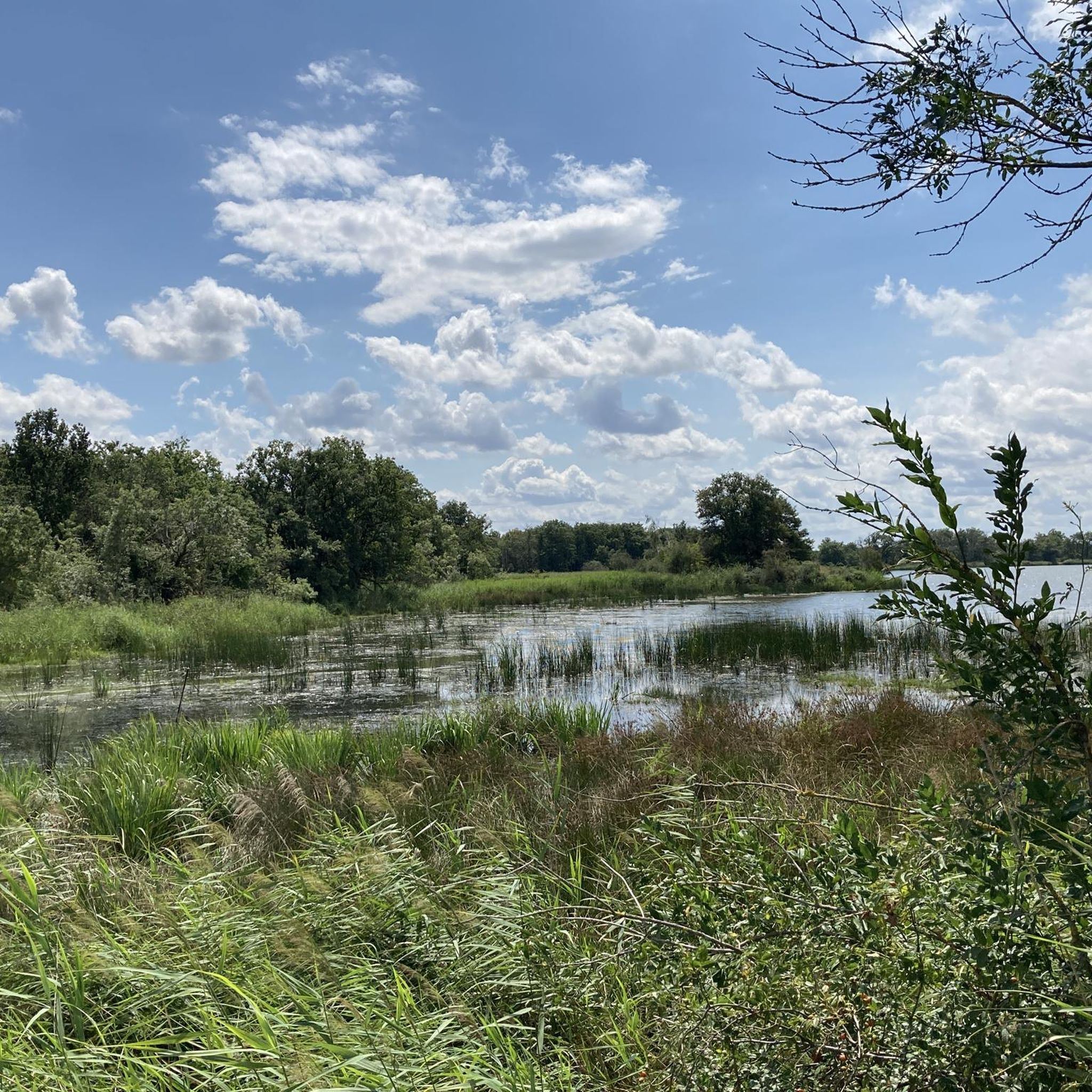
Road cycling routes around Etang De Gabriau are situated within the Brenne Regional Natural Park, a region characterized by extensive wetland systems, over 2,000 lakes and ponds, and a gentle, often flat topography. The landscape also features bocage, prairies, and ancient oak forests, providing varied scenery for cyclists. This terrain, with its minimal elevation changes and mostly paved country roads, is well-suited for road cycling, offering accessible and tranquil routes.
Best road cycling routes around Etang De Gabriau
- The most…
Last updated: July 21, 2026
2
riders
50.1km
02:11
210m
210m
Moderate road ride. Good fitness required. Mostly well-paved surfaces and easy to ride.
12
riders
27.0km
01:10
100m
100m
Easy road ride. Great for any fitness level. Mostly well-paved surfaces and easy to ride.

Sign up for free
3
riders
14.2km
00:37
50m
50m
Easy road ride. Great for any fitness level. Mostly well-paved surfaces and easy to ride.
2
riders
48.3km
02:11
230m
230m
Moderate road ride. Good fitness required. Some segments of this route may be unpaved and difficult to ride.
3.0
(1)
5
riders
36.3km
01:46
190m
190m
Moderate road ride. Great for any fitness level. Some segments of this route may be unpaved and difficult to ride.
Get access to more routes and recommendations from other explorers.
Sign up for free
Already have an account?
Our route recommendations are based on thousands of hikes, rides, and runs completed by other people on komoot.
Start today with a free account
Your next adventure awaits.
Login or Signup
Tips from the Community

This park is known for its 3,000 ponds, 267 species of birds, 100,000 pond turtles, 1,600 plant species including wild orchids and thousands of insects and animals. The Brenne Regional Natural Park attracts thousands of visitors each year in search of a calm, natural and authentic setting.
0
0

Hard to miss, this ancient 11th century fortress stands proudly on a hill of red sandstone and dominates the area around it. Open to visits from April to November, this castle has been completely renovated to make you feel what it was like during its history, especially during the Hundred Years War.
3
0

Nice restaurant, shaded terrace with a nice view... service hours wide enough for cyclists or hikers.
0
0
Frequently Asked Questions
What kind of terrain can I expect when road cycling around Etang De Gabriau?
The region around Etang De Gabriau, part of the Brenne Regional Natural Park, is characterized by a gentle, mostly flat to slightly rolling topography. You'll cycle through extensive wetland systems, past over 2,000 lakes and ponds, and through bocage landscapes (small fields with hedgerows), prairies, and ancient oak forests. The minimal elevation changes make for leisurely and accessible cycling.
Are there road cycling routes suitable for beginners or families in the Etang De Gabriau area?
Yes, many routes in the Brenne Regional Natural Park are rated as easy, with minimal elevation gain, making them perfect for cyclists of all skill levels, including beginners and families. For example, the Château d'Azay-le-Ferron loop from Saint-Michel-en-Brenne is an easy 44.9 km path winding through diverse habitats.
What are some notable landmarks or attractions I can see while road cycling in the Brenne Regional Natural Park?
While cycling, you can encounter various natural and cultural landmarks. The park is known for its 'Land of a Thousand Ponds' scenery. Some routes may pass by cultural stops like the Château du Bouchet, which also serves as the Park's information center, or the historic capital of Brenne, Mézières-en-Brenne. The Étang de Montiacre – Étang de la Planche Maillet loop from Château du Bouchet offers a tranquil journey through natural landscapes.
Are there any circular road cycling routes available around Etang De Gabriau?
Yes, the area offers several excellent circular routes. For instance, the Étang de Montiacre – Étang de la Planche Maillet loop from Château du Bouchet is a popular 26.6 km option. Another great choice is the Riding along the sunflowers loop from Douadic, which is 36.3 km and takes you through bocage and open fields.
What is the best time of year for road cycling around Etang De Gabriau?
The Brenne Regional Natural Park is beautiful throughout the warmer months. Spring and autumn offer pleasant temperatures and vibrant scenery, with fewer crowds. Summer is also suitable, though it can be warmer, making early morning or late afternoon rides ideal. The tranquil atmosphere and diverse habitats are enjoyable in any season with good weather.
How many road cycling routes are available in the Etang De Gabriau area on komoot?
There are over 8 road cycling routes available on komoot for the Etang De Gabriau area, ranging in difficulty from easy to moderate, ensuring options for various skill levels.
What do other road cyclists say about their experience in Etang De Gabriau?
The area is highly rated by the komoot community, with an average score of 3.0 stars. Cyclists often praise the tranquil journeys through natural landscapes, the well-maintained paved surfaces, and the diverse scenery of wetlands, woodlands, and bocage.
Is it possible to find longer road cycling routes for more experienced riders?
Absolutely. While many routes are easy, there are also moderate options for those seeking a bit more distance. For example, the Roadbike loop from Rosnay is a moderate 56.5 km route with over 330 meters of elevation gain, offering a more extended challenge.
Are there cafes or restaurants easily accessible from the road cycling routes?
While the routes offer a tranquil journey away from urban areas, you can find cafes and restaurants in nearby villages and towns within the Brenne Regional Natural Park, such as Mézières-en-Brenne or Lingé. Planning your route to pass through these locations can provide convenient refreshment stops.
What kind of natural features will I encounter on a road cycling trip here?
The region is famous for its 'Land of a Thousand Ponds,' so you'll frequently encounter extensive wetland systems, numerous sparkling ponds, and reed beds. The routes also weave through bocage landscapes, prairies, and ancient oak forests, offering a rich mosaic of diverse natural environments and supporting abundant biodiversity.
What is the typical elevation gain on road cycling routes around Etang De Gabriau?
The terrain around Etang De Gabriau is generally flat to gently rolling, meaning minimal elevation changes. Most routes feature modest elevation gains, making them accessible. For instance, the Étang de Montiacre – Étang de la Planche Maillet loop has about 94 meters of elevation gain over 26.6 km, while a longer route like the Roadbike loop from Rosnay has around 335 meters over 56.5 km.
Are the road surfaces generally well-maintained for road bikes?
Yes, the road cycling infrastructure in the Brenne Regional Natural Park includes numerous country roads with mostly paved surfaces. This ensures a smooth and enjoyable experience for road cyclists, allowing for comfortable and efficient rides through the scenic landscape.
Most popular routes around Etang De Gabriau

Get inspired with the komoot mobile app


Explore more
Browse the best Road cycling routes in other regions.
