The best mountain hikes around Bassin Du Cheylas
4.6
(8)
56
hikers
7
hikes
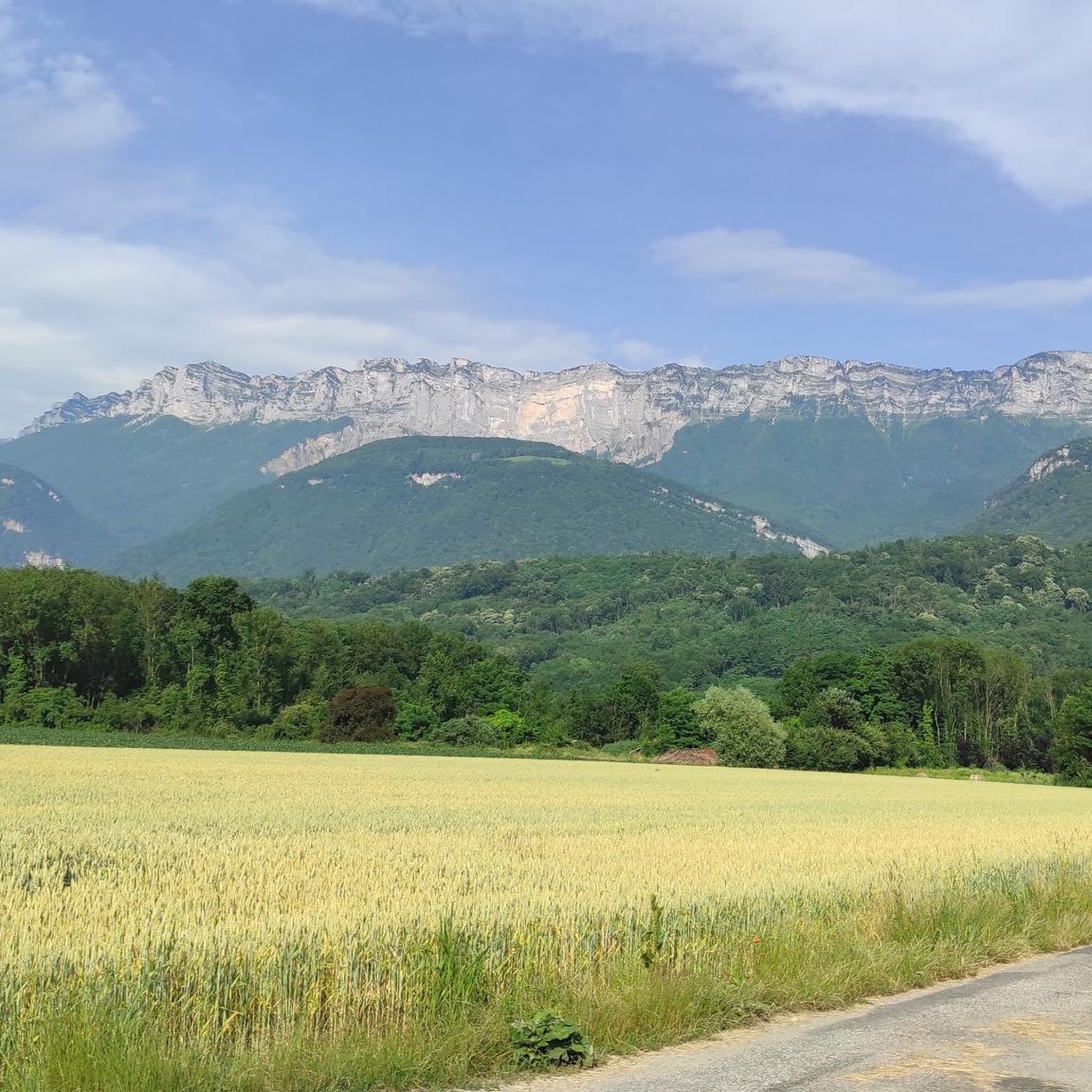
Mountaineering around Bassin Du Cheylas offers a diverse landscape characterized by significant elevation changes, alpine meadows, and notable rock formations. The region features a mix of challenging ascents and moderate loops, providing varied terrain for mountaineers. Peaks like Crêt Luisard, at over 1,800 meters, define the higher elevations, while passes and valleys offer scenic routes.
Best mountaineering routes around Bassin Du Cheylas
- The most popular mountaineering route is Pas de Belles Ombres loop from Sainte-Marie-du-Mont, a 3.3 miles (5.4…
Last updated: May 11, 2026
5.0
(1)
6
hikers
5.40km
02:36
390m
390m
Moderate mountaineering route. Good fitness required. Mostly accessible paths. Sure-footedness required.
11
hikers
9.98km
05:12
860m
860m
Hard mountaineering route. Very good fitness required. Sure-footedness, sturdy shoes and alpine experience required.

Sign up for free
7
hikers
7.29km
03:57
740m
740m
Moderate mountaineering route. Good fitness required. Mostly accessible paths. Sure-footedness required.
4.0
(4)
18
hikers
10.8km
03:43
570m
570m
Moderate mountaineering route. Good fitness required. Easily-accessible paths. Suitable for all skill levels.
5
hikers
10.4km
03:09
350m
350m
Moderate mountaineering route. Good fitness required. Easily-accessible paths. Suitable for all skill levels.
Get access to more routes and recommendations from other explorers.
Sign up for free
Already have an account?
Our route recommendations are based on thousands of hikes, rides, and runs completed by other people on komoot.
Start today with a free account
Your next adventure awaits.
Login or Signup


Tips from the Community

The cross of the Aulp du seuil is located at 1825m above the cirque and marks the entrance to the high plateaus.
0
0

Beautiful pass. Relatively steep climbs from the valley. There are rest stops at the top.
0
0

Great hike! Make sure you have good shoes with crampons because some slopes are a bit slippery. Magnificent view at the top.
0
0

Only for people with surefootedness and climbing experience. You have to climb a bit on the ascent and descent. The ascent is not recommended when it is wet.
1
0

on private property, with no-entry signs, especially at hunting time
0
0

Magnificent 360° view of the North Belledonne massifs, the Grésivaudan valley overlooked by the long cliff of Chartreuse, the Bauges and the foot of Bugey behind the lake of the same name...
0
0

As you climb up to the Col de l'Alpe, you will find a summit cross dating from the early 20th century. Erected in 1926, it was built to commemorate local climbers and hikers who lost their lives in the Alps.
2
0

Perched at an altitude of 1,799 meters under the rocks of Belles Ombres, the pass is one of the gateways to the Hauts de Chartreuse nature reserve. A few meters from the pass is the cross of the same name.
1
0
Frequently Asked Questions
Are there any easy mountaineering routes in Bassin Du Cheylas for beginners?
While there are no routes specifically rated as 'easy' in Bassin Du Cheylas, the region offers several 'moderate' options that could be suitable for beginners with some prior hiking experience. For example, the Pas de Belles Ombres loop from Sainte-Marie-du-Mont is a moderate 3.3-mile route with manageable elevation gain.
What are some challenging mountaineering routes in Bassin Du Cheylas?
For those seeking a challenge, Bassin Du Cheylas features 'difficult' routes with significant elevation changes. The Miracle Arch loop from Saint-Bernard is a notable difficult option, covering 6.2 miles with over 860 meters of ascent to a distinctive rock formation.
Are there circular mountaineering routes available in Bassin Du Cheylas?
Yes, all the mountaineering routes listed in Bassin Du Cheylas are circular loops, allowing you to start and finish at the same point. An example is the L'Alpette – Passage de l'Aulp du Seuil loop from Saint-Bernard, which takes you through mountain passes and alpine landscapes.
What is the best time of year for mountaineering in Bassin Du Cheylas?
The ideal time for mountaineering in Bassin Du Cheylas is typically from late spring to early autumn (May to October). During these months, the weather is generally more stable, and trails are free of snow, offering the best conditions for exploring the alpine meadows and higher peaks.
What kind of wildlife might I encounter on the trails?
The mountainous terrain and alpine meadows of Bassin Du Cheylas are home to various wildlife. You might spot chamois, ibex, marmots, and a variety of bird species, including birds of prey. Maintaining a respectful distance and observing quietly is always recommended.
Are there any hidden gem routes in Bassin Du Cheylas that are less frequented?
While the komoot community highly rates all routes, for a potentially quieter experience, consider exploring routes that venture into less prominent areas. The L'Alpette loop from Saint-Bernard offers a moderate 3-mile journey through scenic landscapes, providing a sense of tranquility.
What are the typical distances and durations for mountaineering routes here?
Mountaineering routes in Bassin Du Cheylas vary in length and duration. You'll find routes ranging from approximately 3 miles (5 km) taking around 2.5 hours, to longer, more challenging paths up to 6.8 miles (11 km) that can take over 4 hours to complete, such as the Crêt Luisard (1,803 m) – Crêt du Luisard - 1803m loop from Le Grand Plan.
Are there any cafes or pubs near the mountaineering trailheads?
The villages surrounding Bassin Du Cheylas, such as Saint-Bernard and Sainte-Marie-du-Mont, often have small local cafes or auberges where you can find refreshments before or after your mountaineering trip. It's advisable to check opening hours, especially outside peak season.
What do other mountaineers enjoy most about Bassin Du Cheylas?
The area is highly rated by the komoot community, with an average score of 4.5 stars. Reviewers often praise the diverse landscape, including significant elevation changes, beautiful alpine meadows, and distinctive rock formations. The mix of moderate and difficult routes also caters to various skill levels.
Do I need any special permits for mountaineering in Bassin Du Cheylas?
Generally, no special permits are required for day mountaineering trips on established trails in Bassin Du Cheylas. However, it's always good practice to check local regulations, especially if you plan to venture into protected areas or undertake activities beyond standard hiking.
What should I wear for mountaineering in this region?
Given the significant elevation changes and alpine environment, it's crucial to dress in layers. Essential gear includes sturdy mountaineering boots, waterproof and windproof outer layers, warm clothing, a hat, gloves, and sun protection. Always be prepared for sudden weather changes in the mountains.
Most popular routes around Bassin Du Cheylas

Get inspired with the komoot mobile app


Explore more
Browse the best Mountain Hikes & Routes in other regions.
