The best walks and hikes around Windsor
4.3
(3)
40
hikers
11
hikes
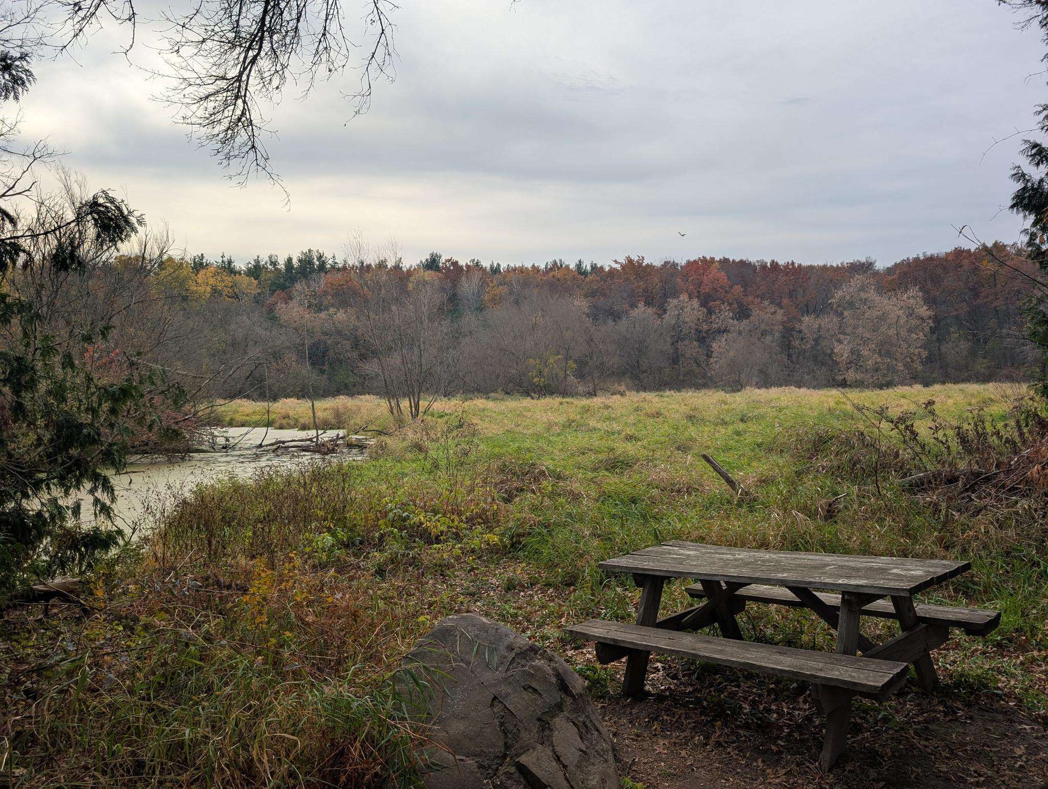
Hikes around Windsor explore a landscape defined by wetlands, river corridors, and prairie lands. The region is characterized by its low elevation, with routes following the Yahara River and circling natural features like marshes and ponds. The trail network consists mainly of easy, flat paths suitable for a wide range of abilities.
Best hiking trails around Windsor
- The most popular hiking route is Cherokee Marsh North Unit loop — Madison, a 2.5 mile (4.0 km) trail that takes about…
Last updated: August 12, 2026
1
hikers
4.68km
01:13
20m
20m
Easy hike. Great for any fitness level. Easily-accessible paths. Suitable for all skill levels.
2.00km
00:30
10m
0m
Easy hike. Great for any fitness level. Easily-accessible paths. Suitable for all skill levels.

Sign up for free
4.27km
01:07
20m
40m
Easy hike. Great for any fitness level. Easily-accessible paths. Suitable for all skill levels.
2.74km
00:42
10m
10m
Easy hike. Great for any fitness level. Easily-accessible paths. Suitable for all skill levels.
640m
00:10
0m
0m
Easy hike. Great for any fitness level. Easily-accessible paths. Suitable for all skill levels.
Get access to more routes and recommendations from other explorers.
Sign up for free
Already have an account?
Our route recommendations are based on thousands of hikes, rides, and runs completed by other people on komoot.
Start today with a free account
Your next adventure awaits.
Login or Signup
Popular around Windsor

Frequently Asked Questions
Are the hiking trails around Windsor suitable for families and children?
Yes, the area is very family-friendly. Most trails are rated as easy and feature flat terrain, making them accessible for all ages. The Cherokee Marsh North Unit loop — Madison is a great option, offering a relatively short walk through an interesting wetland environment.
Can I bring my dog on the trails in Windsor?
Dogs are generally welcome on the trails around Windsor, but they should be kept on a leash. The paths through local parks and conservancy lands provide excellent opportunities for walking with your canine companion. Always check local signage at the trailhead for specific regulations.
Are there any long-distance hikes available in the Windsor area?
For those seeking a longer trek, the Upper Yahara River Trail to Sunfish Pond — Windsor is a great choice. This moderate route covers about 7.4 miles (12 km) and follows the scenic Upper Yahara River Trail, offering a more substantial hiking experience.
What kind of scenery can I expect on hikes near Windsor?
The landscape is primarily defined by its natural wetlands, river corridors, and prairie lands. You'll encounter routes that follow the Yahara River, feature boardwalks across marshes, and circle serene ponds. The terrain is mostly flat, providing open views of the surrounding conservancy areas.
Are there any circular or loop trails?
Yes, there are several loop trails that allow you to start and end at the same point without retracing your steps. A popular choice is the Sunfish Pond loop from The Promenade a Conservancy Place, which is a pleasant 3.5-mile (5.6 km) walk through local conservancy lands.
What do other hikers think of the trails around Windsor?
The trails are well-regarded by the komoot community, which has given the area an average rating of 3.6 stars. Hikers often appreciate the easy, flat paths and the peaceful walks through the region's wetlands and along the river.
How difficult are the hikes in this region?
The vast majority of hikes around Windsor are rated as easy, with very little elevation change. There is one moderate trail available for those looking for a bit more distance, but overall, the area is perfect for casual walkers and those seeking gentle, relaxing hikes.
Are there trails that go around ponds or lakes?
Absolutely. Many trails are centered around the local water features. For a classic pond-side walk, consider the Frog Pond South loop from Sun Prairie. It's an easy route that provides a lovely experience of the area's characteristic landscape.
Is parking available at the trailheads?
Most of the main trailheads for parks and conservancy areas, such as Cherokee Marsh, have designated parking areas. For trails starting in residential or commercial zones, on-street parking is typically available. It's always a good idea to check for any local parking restrictions.
How can I get to the trails using public transport?
While some trailheads near Madison may be accessible via local bus routes, many of the conservation areas and trail systems around Windsor are best reached by car. Public transport options can be limited, so driving is often the most convenient way to access the start of your hike.
Most popular routes around Windsor

Get inspired with the komoot mobile app


Explore more
Browse the best Hikes in other regions.
