The best gravel rides in Lucky Peak State Recreation Area
5.0
(1)
25
riders
5
rides
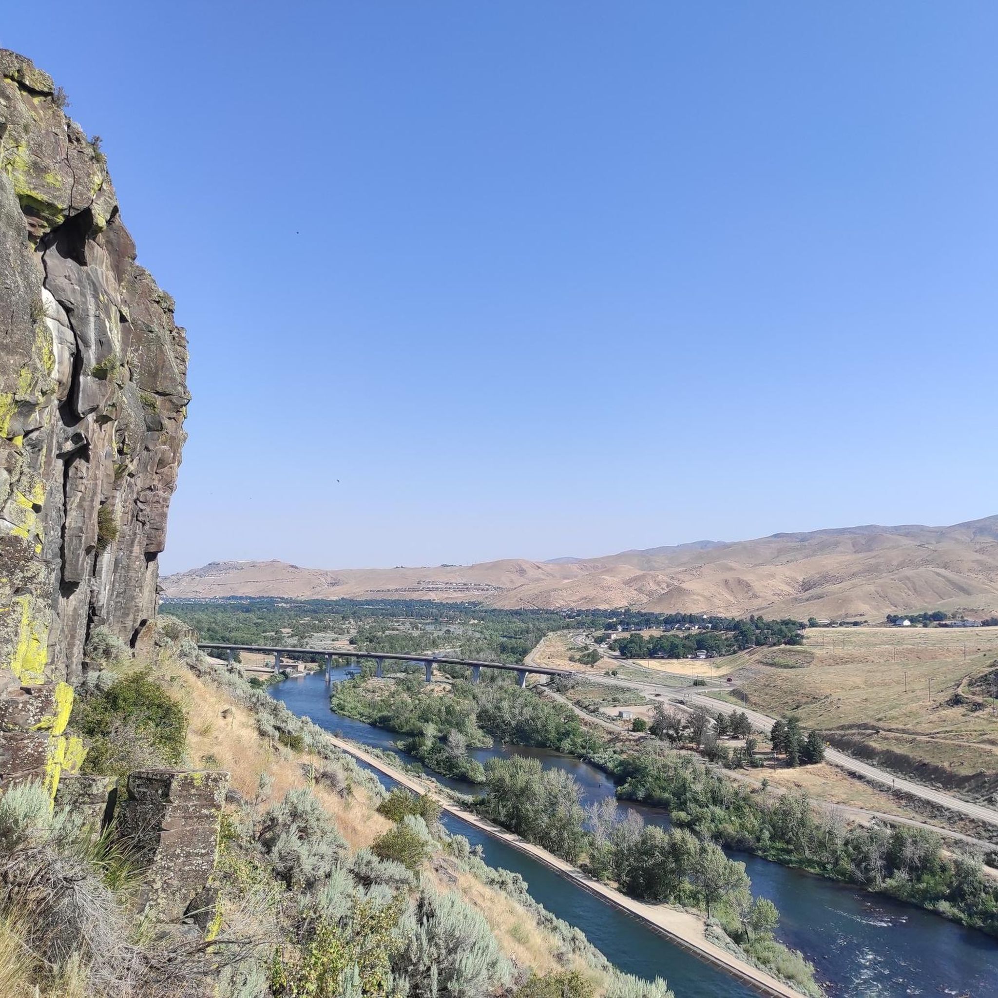
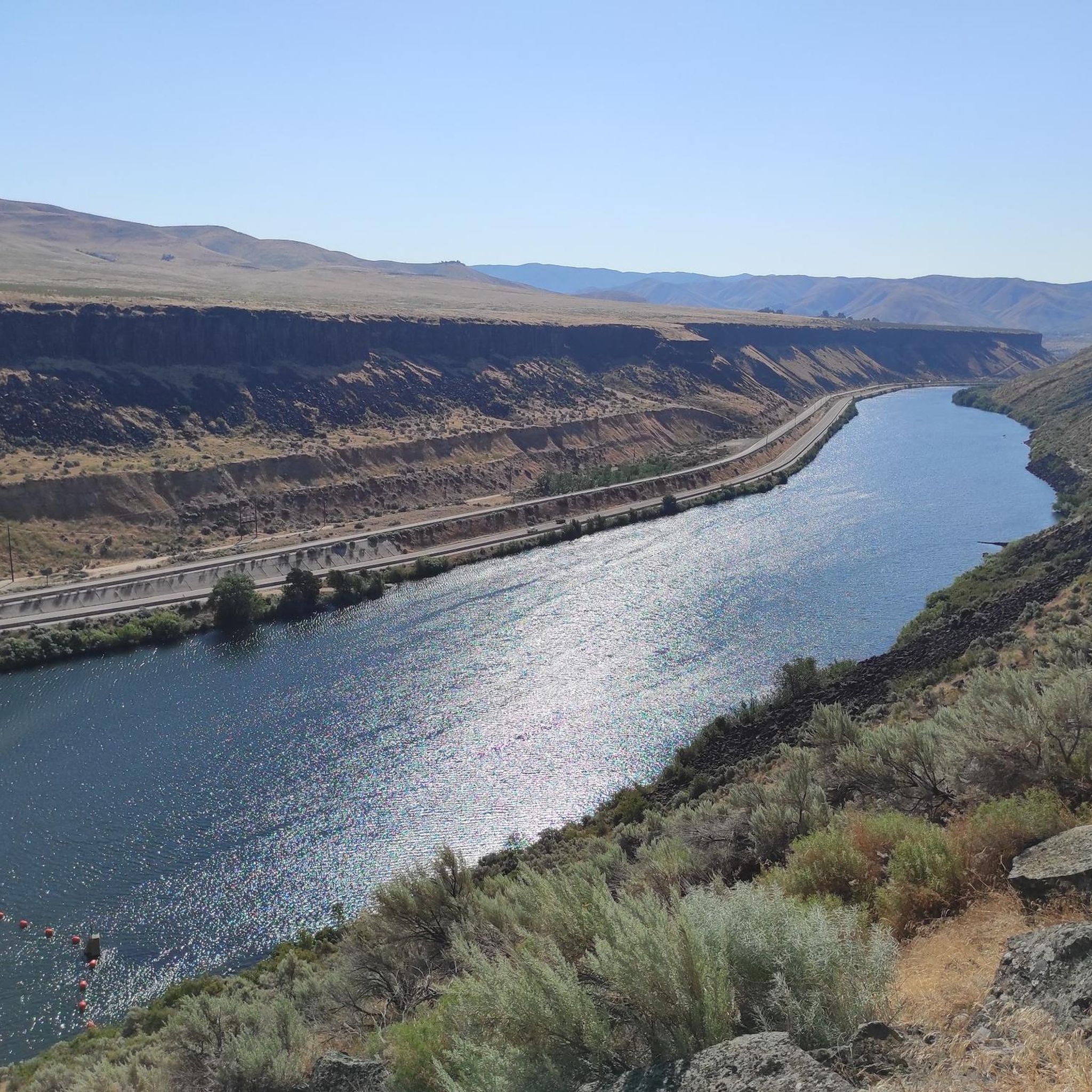
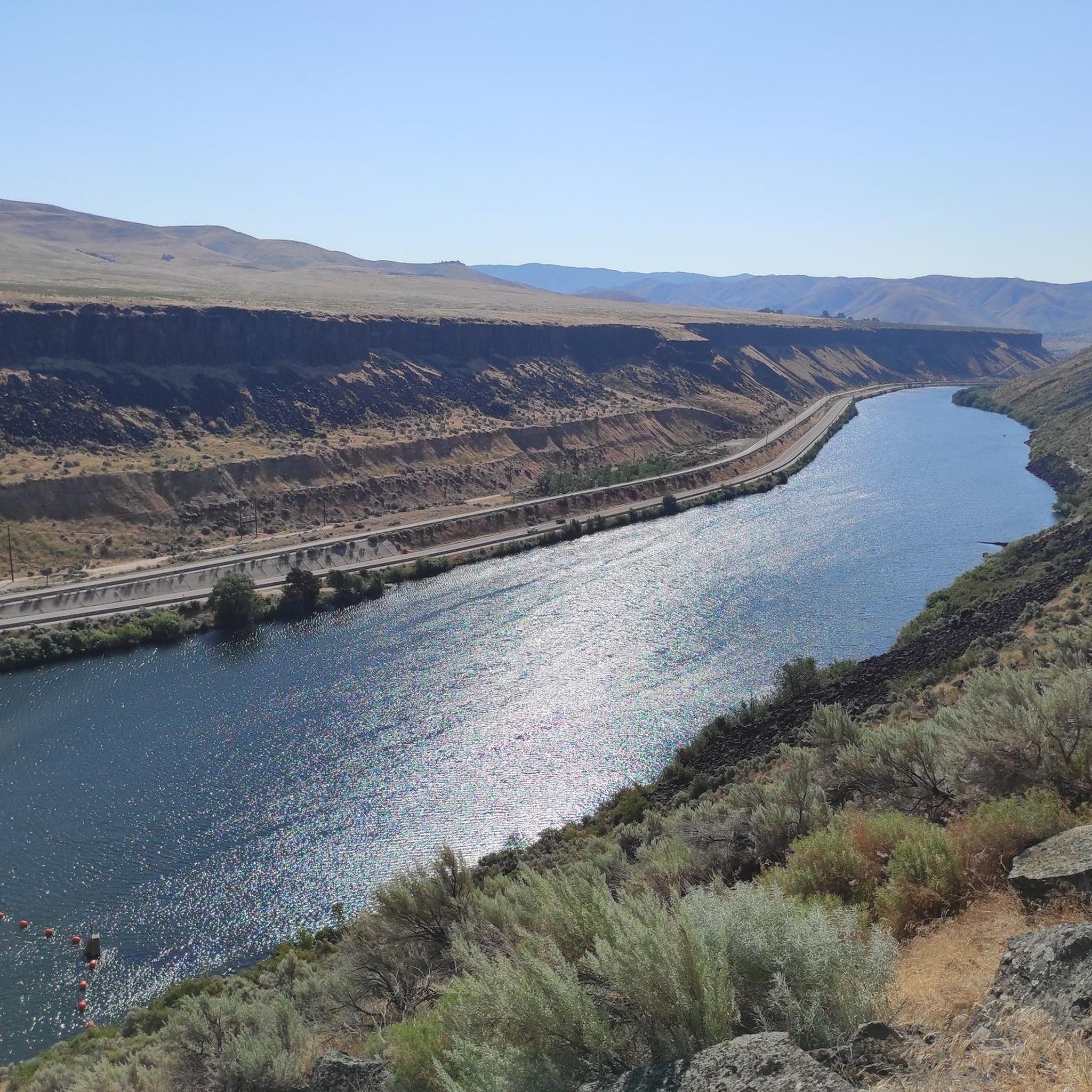
Gravel bike trails in Lucky Peak State Recreation Area traverse a landscape characterized by dramatic basalt cliffs and rocky canyons. The region features the expansive Lucky Peak Lake, formed by the 340-foot-high Lucky Peak Dam, with deep blue waters contrasting against the dark rock formations. The Boise River flows from the dam, contributing to a mix of flat and rugged terrain suitable for gravel biking. This area offers diverse routes for various skill levels, from moderate paths to challenging, long-distance…
Last updated: August 7, 2026
4
riders
63.1km
05:14
820m
820m
Hard gravel ride. Very good fitness required. Mostly paved surfaces. Suitable for all skill levels.
4
riders
133km
11:50
2,410m
2,410m
Hard gravel ride. Very good fitness required. Mostly paved surfaces. Suitable for all skill levels.

Sign up for free
3
riders
Moderate gravel ride. Good fitness required. Mostly paved surfaces. Suitable for all skill levels.
5.0
(1)
8
riders
Hard gravel ride. Very good fitness required. Mostly paved surfaces. Suitable for all skill levels.
6
riders
Moderate gravel ride. Good fitness required. Mostly paved surfaces. Suitable for all skill levels.
Our route recommendations are based on thousands of hikes, rides, and runs completed by other people on komoot.
Start today with a free account
Your next adventure awaits.
Login or Signup
Tips from the Community

Sandy Point Beach is just off the Boise River Greenbelt in Lucky Peak Dam State Park. Sandy Point offers restrooms, showers, picnic tables, a disc golf course, sand volleyball courts, and a swim beach.
0
0

The Boise River Greenbelt is 25 miles long and provides a road-bike worthy path on both sides. The path has a number of rest areas to stop and admire the views of the river.
0
0

Winding through Boise for 25 miles, the Boise River Greenbelt is a favorite hiking destination. With its tree-lined paths along the river, it offers scenic views and wildlife sightings. However, it's also a popular biking spot, so hikers should stay alert for cyclists zooming by.
0
0
Covering 25 scenic miles in Boise, the Boise River Greenbelt is a beloved biking destination. With tree-lined paths tracing the river's edge, cyclists can enjoy stunning views, wildlife sightings, and easy access to riverside parks, making it perfect for biking adventures.
0
0
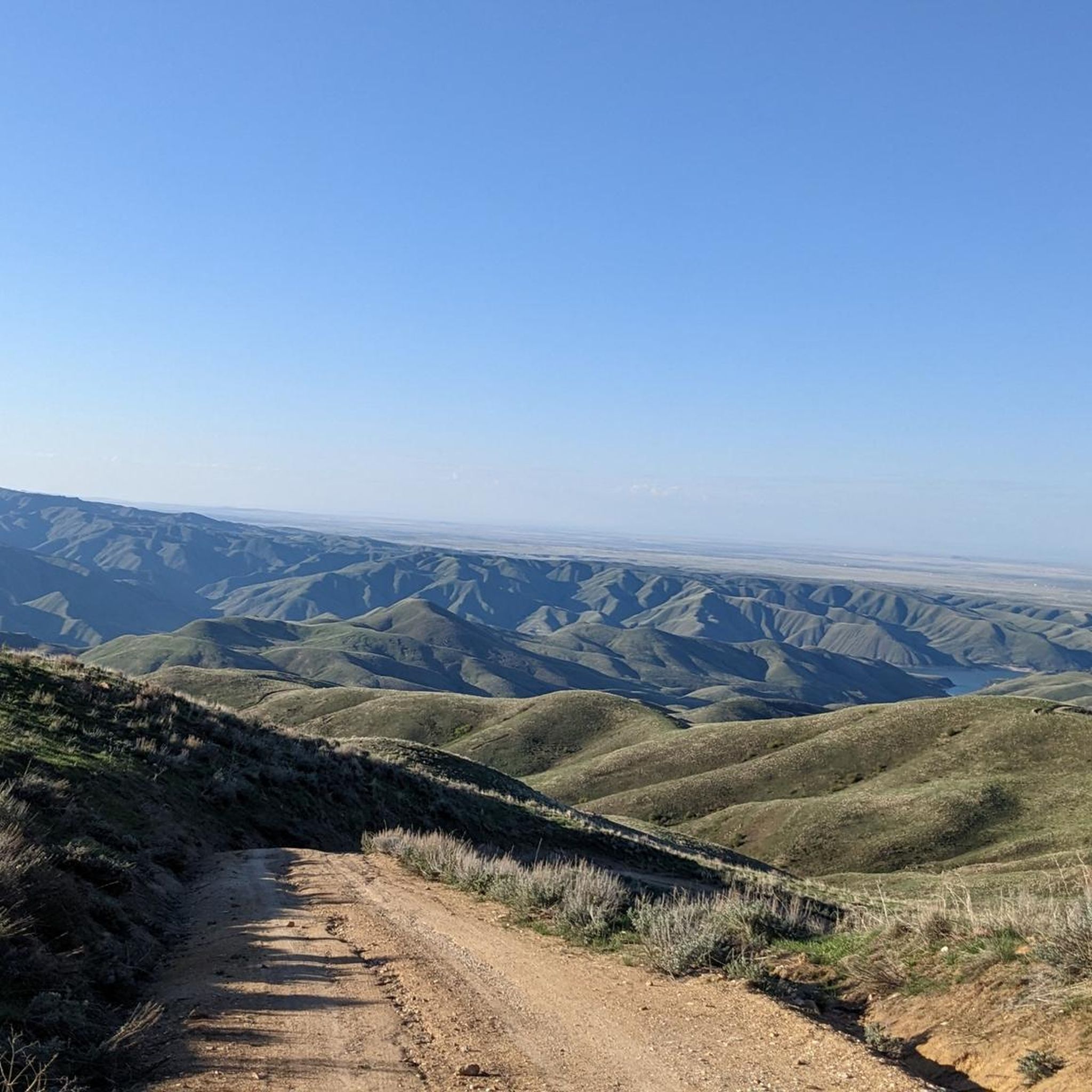
A quiet track that isn't particularly technical and has lovely view to the reservoir below. Perfect for a mountain bike loop.
0
0
True to its name, this location boasts a beautiful sandy beach and shallow waters, retaining warmth compared to other river spots. Alongside picnic areas and volleyball courts, the park offers access to trails, adding an adventurous dimension to your outdoor experience.
0
0
Arrowrock Dam, situated on the Boise River in southwestern Idaho, is a concrete arch dam in the western United States. Constructed over a century ago in 1915, it straddles the border between Boise and Elmore counties, serving as a vital water source for irrigation in the region. The road here is compact dirt.
0
0

The Ponderosa Pine Scenic Route is a 131-mile route that connects Highway 21 with the cities of Boise and Idaho City. This route travels through a mixture of terrain, including mountain roads, woodlands, and some lush forested landscapes. Here, near Lucky Peak Reservoir, the route gives way to arid foothills and scenic river views, along with dramatic vistas of the Lucky Peak Reservoir itself. This is a stunning byway to do on a bicycle.
1
0
Frequently Asked Questions
How many gravel bike trails are available in Lucky Peak State Recreation Area?
There are 5 gravel bike trails documented in Lucky Peak State Recreation Area, offering a range of experiences from moderate to difficult.
Are there any challenging gravel bike routes for experienced riders?
Yes, Lucky Peak State Recreation Area offers several challenging routes. For a significant test, consider the Arrowrock Dam & Reservoir – Lucky Peak Reservoir loop from Arrow Benchmark, which spans over 132 km with substantial elevation gain. Another difficult option is the Bonneville Point loop from Bonneville Point, covering over 63 km with over 800 meters of ascent.
What are the best times of year for gravel biking in Lucky Peak State Recreation Area?
The spring and fall seasons generally offer the most pleasant conditions for gravel biking in Lucky Peak State Recreation Area, with milder temperatures. While summer is popular, be prepared for warmer weather. Winter riding is possible, but conditions can vary, so checking local forecasts is advisable.
Are there any family-friendly gravel biking options?
For a more moderate and family-friendly experience, the Oregon Trail Reserve – Oregon Trail Reserve loop from Golda Harris Nature Preserve is a good choice. It's about 27.5 km long and winds through natural reserves, typically completed in under two hours.
What kind of natural features and landmarks can I expect to see along the trails?
The area is rich in natural beauty. You'll encounter dramatic basalt cliffs and rocky canyons, especially around the expansive Lucky Peak Reservoir. The Boise River flows from the dam, offering scenic views. You might also pass by areas like Lydle Gulch.
Where can I park when visiting Lucky Peak State Recreation Area for gravel biking?
Lucky Peak State Recreation Area offers various parking options across its day-use areas. For example, Discovery Park, located along the Boise River, provides large grassy areas and bike racks. Spring Shores Marina also offers ample parking with lakeside access. Specific trailheads may have designated parking as well.
Are dogs allowed on the gravel bike trails?
Lucky Peak State Recreation Area is generally dog-friendly, but specific regulations may apply to certain areas or trails. It's always best to check the official Idaho State Parks website for the most current rules regarding pets, especially concerning leash laws and restricted areas. You can find more information at idaho.gov.
What amenities are available near the gravel biking routes?
The recreation area offers several amenities. Sandy Point features sandy beaches, swimming areas, and picnic spots. Discovery Park has picnic areas, fishing access, and bike tool stations. Spring Shores Marina provides a full-service marina, convenience store, and rentals. These areas can serve as good starting or ending points for your rides.
Are there any loop routes for gravel biking?
Yes, many of the gravel biking routes in Lucky Peak State Recreation Area are designed as loops. Examples include the Bonneville Point loop and the Arrowrock Dam & Reservoir – Lucky Peak Reservoir loop, allowing you to start and finish at the same point without retracing your path.
Can I expect to see any wildlife while gravel biking?
Yes, the diverse habitats within Lucky Peak State Recreation Area provide opportunities for wildlife viewing. Discovery Park, along the Boise River, is particularly known for frequent sightings of waterfowl, owls, songbirds, and even bald eagles. Keep an eye out, especially during quieter times of day.
What makes the terrain unique for gravel biking in this region?
The terrain in Lucky Peak State Recreation Area is characterized by a mix of landscapes. You'll find long stretches of unpaved roads, varied elevation changes, and scenic vistas. The dramatic basalt cliffs and rocky canyons provide a stunning backdrop, while the Boise River and Lucky Peak Lake add a refreshing element to the routes.
Are there any easy gravel bike trails for beginners?
While many routes have moderate to difficult ratings, the Oregon Trail Reserve – Oregon Trail Reserve loop from Golda Harris Nature Preserve is a good option for those seeking a less strenuous ride. It's a moderate 27.5 km loop with manageable elevation, suitable for beginners looking to explore gravel biking.
Most popular routes in Lucky Peak State Recreation Area
Most popular attractions in Lucky Peak State Recreation Area

Get inspired with the komoot mobile app


Explore more
Browse the best Gravel rides in other regions.
