The best gravel rides in Georges River National Park
4.5
(2)
53
riders
4
rides
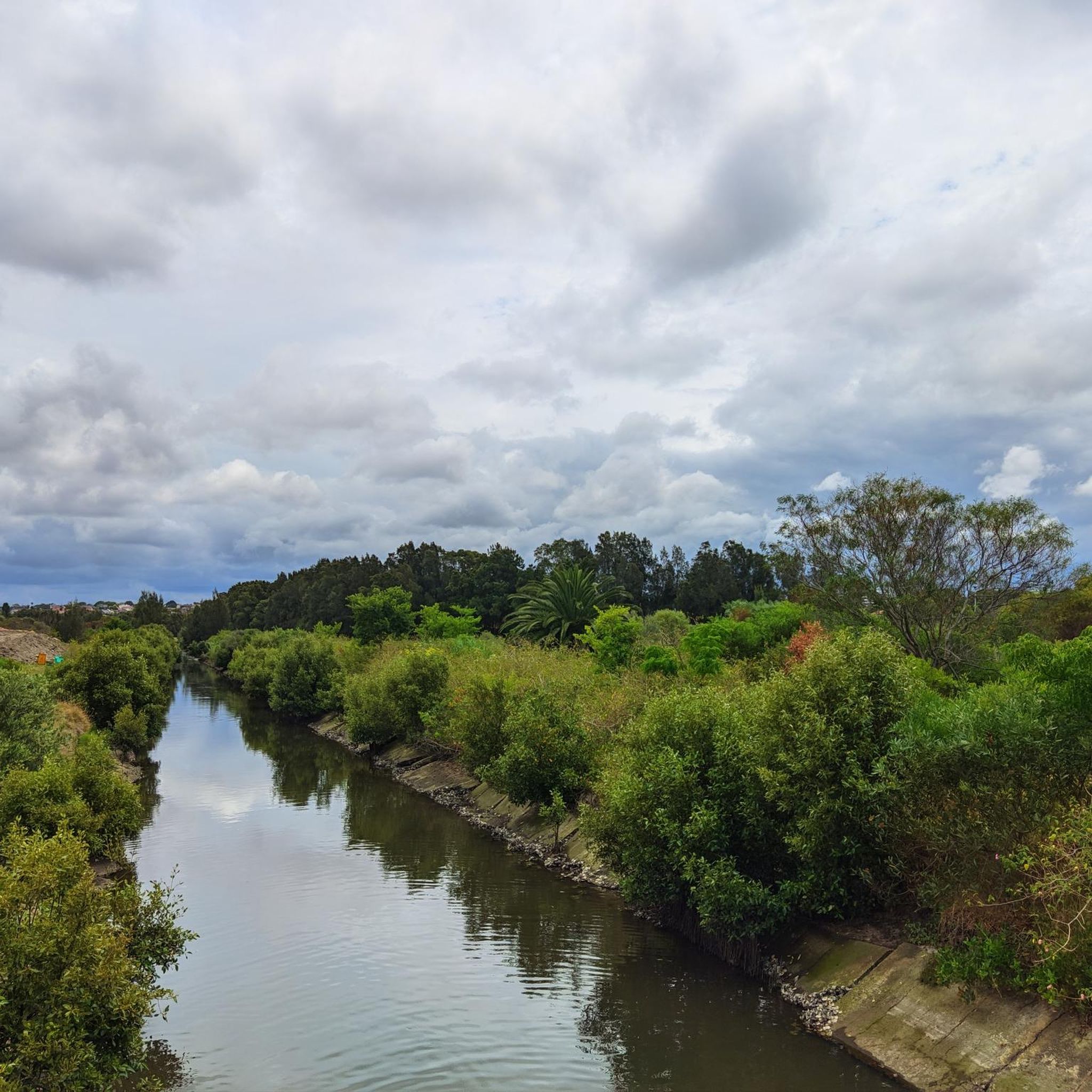
Gravel biking in Georges River National Park offers diverse terrain across its varied topography, including striking rock formations, steep forested hillsides, and riverside flats. The park lies on thick beds of Hawkesbury sandstone, contributing to its unique geological features. Centered around the Georges River estuary, the area features mangrove-lined wetlands, eucalyptus forests, and heathlands. This mix of environments provides a range of challenges and scenic backdrops for gravel cyclists.
Best gravel bike trails in Georges River National Park
- The most popular gravel bike trail is Lady Carrington Drive – Uloola Falls Trailhead loop from Jannali, a 25.5 miles (41.1 km) trail that takes 2 hours 38 minutes to complete. This moderate route features varied terrain through the park's interior.
- Another top favourite among local gravel bikers is Lady Carrington Drive – Left Bower Café loop from Jannali, a difficult 27.3 miles (44.0 km) path. This route includes significant elevation gain and passes through diverse landscapes.
- Local gravel bikers also love the Pipeline Track – Lady Carrington Drive loop from Sutherland, a 32.8 miles (52.8 km) trail leading through forested hills and along established cycle routes, often completed in about 4 hours 9 minutes.
- Gravel biking in Georges River National Park is defined by riverside paths, forested hills, and sandstone plateaus. The network offers options for different ability levels, from moderate rides to more challenging routes.
- The routes in Georges River National Park are highly rated by the komoot community with an average score of 5.0 stars from 1 review. More than 40 gravel bikers have used komoot to explore Georges River National Park's varied terrain.
Last updated: November 2, 2026
10
riders
40.8km
02:37
430m
430m
Moderate gravel ride. Good fitness required. Mostly paved surfaces.
5
riders
44.0km
03:07
570m
560m
Hard gravel ride. Very good fitness required. Mostly paved surfaces.

4.5
(2)
28
riders
52.8km
04:07
840m
840m
Hard gravel ride. Very good fitness required. Mostly paved surfaces.
11
riders
24.2km
02:08
230m
230m
Moderate gravel ride. Good fitness required. Mostly paved surfaces.
Our route recommendations are based on thousands of hikes, rides, and runs completed by other people on komoot.
Start today with a free account
Your next adventure awaits.



Tips from the Community

Forbes Creek is a tributary into Loftus Creek with a damp microclimate. Bushwalkers and bikers who cross the creek should come prepared as tracks that pass the banks can become heavily overgrown, muddy, and boggy after heavy rainfall. Keep offline navigation handy to not get confused at the intersecting tracks. Forbes Creek is only a few kilometres long but an important habitat for a diverse range of Australian wildlife. Birds such as sulphur-crested cockatoos, laughing kookaburras and rainbow lorikeets call this waterway home, as well as other animals like grey-headed flying-foxes, common brushtail possums, ringtail possums, and the occasional passing koala.
0
0
Bola Creek Picnic Area is a scenic rest spot with picnic tables tucked deep inside the shaded forest canopy. There are nearby maps and informational signs to read up on as well.
0
0
The Hacking River flows 26 kilometres, starting at Kellys Creek and Gills Creek, plunging off the towering cliffs of the Illawarra Escarpment, then travelling though ancient valleys and Royal National Park before emptying into the Tasman Sea. The river flows north-east, starting as a narrow jungle river and transforming into a wide, tidal delta bounded by dense mangroves near its end.
0
0
Lady Carrington Drive stretches 10 kilometres across the Royal National Park, and though "drive" is in the name, it has long been closed to motor vehicles. Originally opened to the public in 1886, it was used by horse and carriage. Today it's a wide, flat, family-friendly dirt track popular for bushwalking, running, and mountain biking. There are some pretty unique rock overhands along the track, some with picnic benches underneath them. Lady Carrington Drive hugs the eastern bank of the Hacking River and winds though through forests of tall blue gums and turpentines. The track can be accessed at its northern end at Fig Tree Flat in the Audley precinct, or from the southern gate off Sir Bertram Stevens Drive.
0
0

Royal National Park is Australia's oldest and one of its most visited national parks. Its location, just south of Sydney put it within easy range for the six million visitors it gets each year. You'll find everything from beaches and headlands to waterfalls and towering eucalyptus forest within its boundaries.
0
0
Rawson Parade is a dirt, double-track road that parallels and old railroad. It's a shared-use path so expect to see hikers, bikers, and the occasional vehicle. The trail itself is only 2 kilometres but it is easy to connect to others trail to make a loop around the park.
0
0
Royal National Park is Australia's oldest and one of its most visited national parks. Its location, just south of Sydney puts it within easy range for the six million visitors it gets each year. You'll find everything from beaches and headlands to waterfalls and towering eucalyptus forest within its boundaries.
0
0

Audley Visitor Centre and the surrounding picnic area sit right along the Hacking River in the central valley of Royal National Park. The historic precinct includes open lawns, picnic areas, and access to walking and cycling routes through the park. Set along the river near the Audley weir, it is a popular starting point for exploring the park’s bushland and waterways.
0
0
Frequently Asked Questions
How many gravel bike trails are available in Georges River National Park?
Georges River National Park offers a selection of 5 gravel bike routes, ranging from moderate to difficult. These trails provide diverse experiences across the park's varied topography.
What kind of terrain can I expect on gravel bike trails in Georges River National Park?
You can expect a diverse range of terrain, from relatively flat riverside paths along the Georges River estuary to more undulating trails through eucalyptus forests and heathlands. The park features striking rock formations, steep forested hillsides, and plateaus, with thick beds of Hawkesbury sandstone contributing to its unique geological features.
Are there family-friendly gravel biking options in Georges River National Park?
While many routes are moderate to difficult, some sections or shorter loops can be suitable for families with some biking experience. For a moderate option, consider the Gravel loop from Loftus, which covers 24.2 km and takes around 2 hours 8 minutes.
Are there challenging gravel bike routes for experienced riders?
Yes, experienced riders will find several challenging routes. The Pipeline Track – Lady Carrington Drive loop from Sutherland is a difficult 52.8 km trail with significant elevation gain, often completed in about 4 hours 9 minutes. Another demanding option is the Lady Carrington Drive – Left Bower Café loop from Jannali, a 44.0 km route also rated as difficult.
What are some notable natural features or viewpoints along the gravel bike trails?
The park is centered around the scenic Georges River estuary, offering beautiful views. You might also encounter Yeramba Lagoon, known for its birdlife, and various panoramic lookouts that provide sweeping views of the river and surrounding bushland. The diverse flora includes mangroves, saltmarshes, eucalyptus forests, and heathlands.
Is Georges River National Park suitable for dog-friendly gravel biking?
Georges River National Park is part of the NSW National Parks system. Generally, dogs are not permitted in NSW national parks, except in designated areas. It's best to check the official NSW National Parks website for current regulations regarding pets before planning your ride. You can find more information at nationalparks.nsw.gov.au.
What is the best time of year to go gravel biking in Georges River National Park?
The park is accessible year-round, but spring (September to November) and autumn (March to May) generally offer the most pleasant conditions for gravel biking. Temperatures are milder, and the natural scenery is often at its best. Summer can be hot, while winter mornings can be cool but often lead to clear, crisp riding days.
Are there any loop trails for gravel biking in the park?
Yes, many of the gravel routes in Georges River National Park are designed as loops. For example, the popular Lady Carrington Drive – Uloola Falls Trailhead loop from Jannali is a 41.1 km moderate loop, and the Lady Carrington Drive loop from Engadine is a challenging 50.8 km option.
Where can I find parking for gravel biking in Georges River National Park?
Parking is available at various access points and trailheads around the park. Common starting points for rides, such as Jannali, Sutherland, Loftus, and Engadine, typically have parking facilities nearby. Always check local signage for specific parking regulations and fees.
Are there any cafes or places to get refreshments near the gravel trails?
While the park itself is primarily natural bushland, the surrounding suburbs like Jannali, Sutherland, Loftus, and Engadine offer various cafes and shops where you can refuel before or after your ride. Some routes, like the Lady Carrington Drive – Left Bower Café loop from Jannali, even incorporate stops at local establishments.
What do other gravel bikers enjoy most about Georges River National Park?
The area is highly rated by the komoot community, with an average score of 5.0 stars. Reviewers often praise the diverse terrain, from riverside paths to forested hills, and the opportunity to experience nature so close to Sydney. The well-maintained trails and variety of route difficulties are also frequently highlighted.
How long do gravel bike rides typically take in Georges River National Park?
Ride durations vary significantly based on the route length and your fitness level. Moderate routes like the Lady Carrington Drive – Uloola Falls Trailhead loop from Jannali (41.1 km) can take around 2 hours 38 minutes. More challenging and longer routes, such as the Lady Carrington Drive loop from Engadine (50.8 km), might require over 4 hours 47 minutes to complete.
Most popular routes in Georges River National Park

Get inspired with the komoot mobile app


Explore more
Browse the best Gravel rides in other regions.
