The best gravel rides around Zarszyn
4.8
(3)
22
riders
5
rides
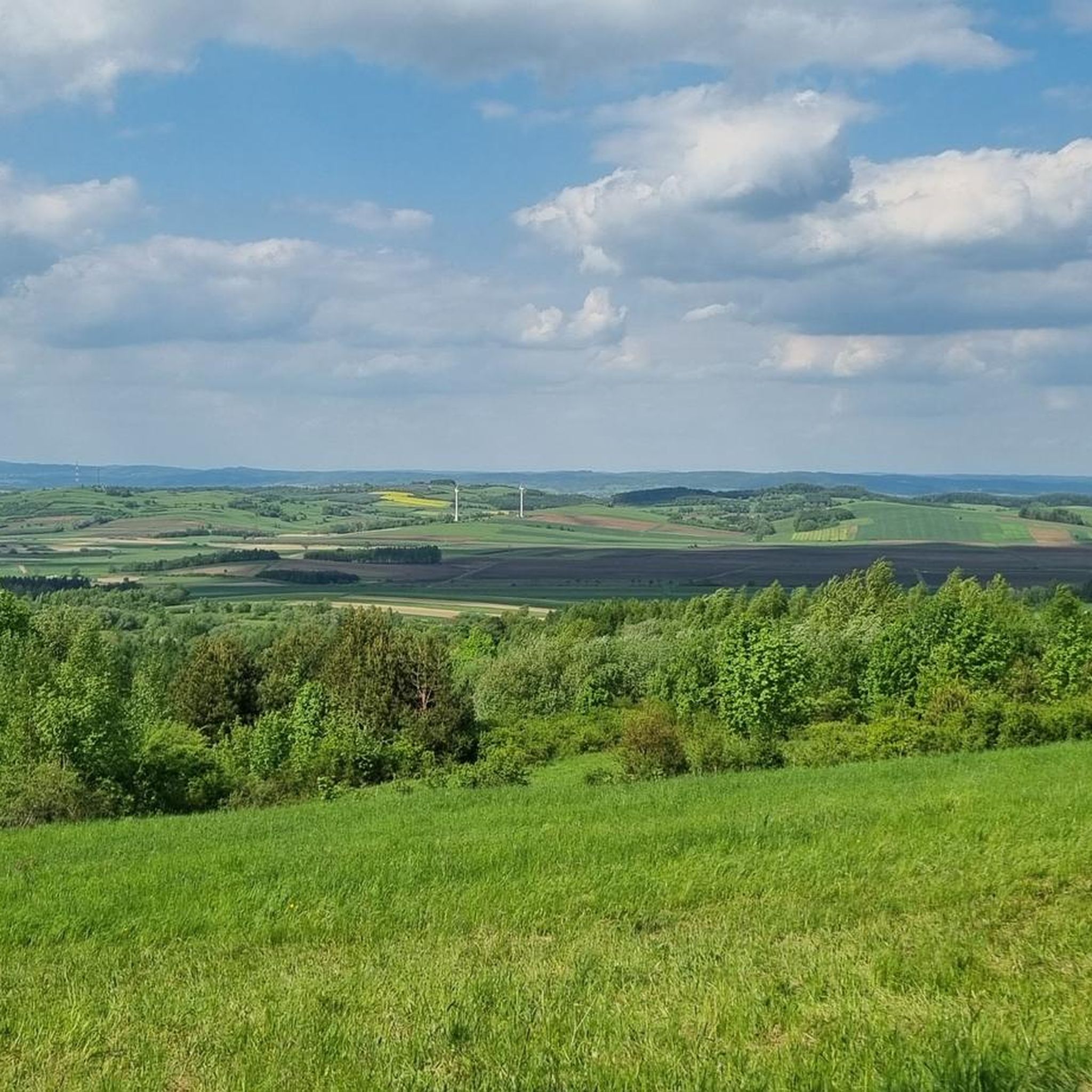
Gravel biking around Zarszyn offers diverse landscapes, from the hilly terrain of the Słonne Mountains to scenic routes along streams. The region features a mix of paved and unpaved paths, providing varied surfaces for gravel cyclists. Elevations range from moderate climbs to more challenging ascents, making it suitable for different fitness levels. The area is characterized by natural features such as the Wisłoczek stream and forested sections.
Best gravel bike trails around Zarszyn
- The most popular gravel bike trail is…
Last updated: November 2, 2026
5.0
(1)
6
riders
81.8km
05:52
1,460m
1,460m
Hard gravel ride. Very good fitness required. Mostly paved surfaces.
4.5
(2)
8
riders
23.0km
01:24
270m
270m
Moderate gravel ride. Good fitness required. Mostly paved surfaces.

4
riders
Hard gravel ride. Very good fitness required. Mostly paved surfaces.
1
riders
30.8km
02:19
360m
360m
Moderate gravel ride. Good fitness required. Mostly paved surfaces.
1
riders
17.1km
01:22
420m
420m
Moderate gravel ride. Good fitness required. Mostly paved surfaces.
Our route recommendations are based on thousands of hikes, rides, and runs completed by other people on komoot.
Start today with a free account
Your next adventure awaits.
Tips from the Community

More information and photos: https://pl.wikipedia.org/wiki/Rezerwat_przyrody_%C5%B9r%C3%B3dliska_Jasio%C5%82ki https://www.zielonepodkarpacie.pl/pl/obszary-chronione1/rezerwaty-przyrody/zrodliska-jasiolki/ https://www.zielonepodkarpacie.pl/rezerwaty-przyrody/zrodliska-jasiolki/ https://rymanow.krosno.lasy.gov.pl/rezerwaty-przyrody https://parkikrosno.pl/475-parki/12515-jasliski-park-krajobrazowy/12572-rezerwat-przyrody-zrodliska-jasiolki.html
2
0

Data form for a natural monument. Name Zofia (...) Description The Japanese magnolia (Magnolia kobus) tree measures 9.9 m in height, and the trunk circumference measured at a height of 130 cm is 152 cm. (...) The magnolia is a distinctive landscape element due to its slightly inclined form and very high ornamental value during flowering and vegetation. It also stands out for its size and spreading crown – among other trees of the same genus or species at least in the municipality. The tree stands out in the area for its advanced age, estimated at approximately 70 years. The tree remains in good sanitary condition, has a fully leafy crown, and blooms profusely in spring, attracting the attention of residents and tourists. (...) Source and more: https://crfop.gdos.gov.pl/CRFOP/download/pdf/PL.ZIPOP.1393.PP.1817011.2617.pdf
0
0
Recently, asphalt was laid on the last missing section (counting from the observation tower through Dolina to the Sewage Treatment Plant in Zagórz) - I mean the short section from the barbecue area on the San River towards the buildings of the village of Dolina. The section where the bicycle route moves away from the San River and has the character of a local street, without the "pedestrian and bicycle path" signs. When driving after dark, be careful of the deep ditch along this street.
1
1

The bald peak of the Przymiarki mountain, 626 m above sea level. Sometimes you can even see the Tatra Mountains from here.
2
0
A gravel and dirt road leading along the edge of the forest on the slopes of Kiczerka. There is a nice view of the village of Królik Polski from here.
1
0
A small (only 3 meters high), but very picturesque waterfall on the Wisłoczek stream.
1
0
Student Tent Base "Wisłoczek" run by the Student Beskid Guides Association from Rzeszów. In the summer months, you can find accommodation here in large tents with bunks or pitch your own tent.
1
0
A stone roadside cross from 1929 with an oak twig motif.
1
0
Frequently Asked Questions
What kind of terrain can I expect on gravel bike trails around Zarszyn?
The gravel bike trails around Zarszyn offer a diverse mix of landscapes. You'll encounter the hilly terrain of the Słonne Mountains, forested sections, and scenic routes along stream valleys. The paths vary from predominantly paved sections to unpaved gravel, providing a varied surface for cycling.
Are there gravel bike trails suitable for beginners or families in Zarszyn?
While many routes in Zarszyn feature significant elevation gains, some are more moderate. For a route with predominantly paved paths and a moderate elevation, consider the Parking Area – Above Moszczaniec loop from Moszczaniec. It's a 23.1 km trail that requires good basic fitness.
Are there any scenic viewpoints or natural attractions along the gravel bike routes?
Yes, the region is rich in natural beauty. You can find routes that offer views towards Cergowa Mountain, such as the View of Cergowa Mountain – Scenic View of Rolling Hills loop from gmina Rymanów. The area also features the notable Waterfall on the Wisłoczek, which is a significant natural attraction in the Low Beskids region.
Can I visit the Waterfall on the Wisłoczek while gravel biking?
Absolutely. The Waterfall on the Wisłoczek – Wisłoczek Tent Base loop from Rymanów is a 30.5 km gravel tour that passes directly by the Waterfall on the Wisłoczek, offering a scenic stop during your ride. This route is considered difficult due to its significant elevation gain.
What cultural attractions are near the gravel biking trails in Zarszyn?
Beyond the trails, Zarszyn's surroundings offer cultural insights. The Museum of Folk Architecture in Sanok, an extensive open-air museum, is a notable attraction nearby. You can also explore the historic Sanok Market Square with its Franciscan church and fountains.
Are there circular gravel bike routes in Zarszyn?
Yes, all the featured gravel bike routes around Zarszyn are designed as loops. This means you'll start and end at the same point, making logistics easier. Examples include the Parking Area – Above Moszczaniec loop from Moszczaniec and the View of Cergowa Mountain – Scenic View of Rolling Hills loop from gmina Rymanów.
Where can I park when accessing gravel bike trails in Zarszyn?
While specific parking facilities aren't detailed for all routes, the Parking Area – Above Moszczaniec loop from Moszczaniec explicitly indicates a parking area as its starting point. It's advisable to check the individual route details on komoot for precise starting locations and potential parking information.
What is the best time of year for gravel biking in Zarszyn?
The region's diverse landscapes are enjoyable throughout the warmer months. Spring and autumn generally offer pleasant temperatures and beautiful scenery, making them ideal for gravel biking. Summer is also suitable, though it can be warmer.
What do other gravel bikers enjoy most about gravel biking in Zarszyn?
The komoot community highly rates the gravel biking experience in Zarszyn, with an average score of 5.0 stars from over 3 reviews. Users often praise the varied terrain, the mix of paved and unpaved paths, and the scenic natural features like the Słonne Mountains and stream valleys.
Are there any longer, more challenging gravel bike routes for experienced riders?
For experienced riders seeking a longer and more challenging adventure, the Former Łemko cemetery – Scenic Forest Climb loop from gmina Bukowsko is an excellent option. This difficult route spans 72.4 km with over 1000 meters of elevation gain, offering a significant test of endurance through scenic forest climbs.
What is the typical duration for gravel bike trails around Zarszyn?
The duration of gravel bike trails around Zarszyn varies depending on the route's length and difficulty. For example, the moderate Parking Area – Above Moszczaniec loop from Moszczaniec typically takes about 1 hour 42 minutes, while the more challenging View of Cergowa Mountain – Scenic View of Rolling Hills loop from gmina Rymanów can take around 2 hours 57 minutes.
Most popular attractions around Zarszyn

Get inspired with the komoot mobile app


Explore more
Browse the best Gravel rides in other regions.
