The best gravel rides around Antietam
4.9
(16)
118
riders
7
rides
Gravel biking around Antietam features a landscape characterized by rolling hills, open fields, and historical waterways such as the Potomac River and Antietam Creek. The region offers a mix of paved and unpaved surfaces, including gravel roads and packed dirt trails, suitable for gravel bikes. Riders can expect varied terrain, from gentle slopes to more challenging ascents, often passing through wooded areas and alongside agricultural lands. The area's historical significance adds a unique dimension to the riding experience.
Best gravel…
Last updated: May 11, 2026
5.0
(2)
50
riders
Hard gravel ride. Very good fitness required. Mostly paved surfaces. Suitable for all skill levels.
5.0
(2)
34
riders
56.6km
04:25
130m
130m
Moderate gravel ride. Good fitness required. Mostly paved surfaces. Suitable for all skill levels.

Sign up for free
5.0
(2)
12
riders
23.4km
02:02
140m
140m
Moderate gravel ride. Good fitness required. Mostly paved surfaces. Suitable for all skill levels.
5.0
(3)
12
riders
23.3km
02:01
110m
110m
Moderate gravel ride. Good fitness required. Mostly paved surfaces. Suitable for all skill levels.
4.7
(7)
10
riders
27.9km
02:21
100m
100m
Moderate gravel ride. Good fitness required. Mostly paved surfaces. Suitable for all skill levels.
Get access to more routes and recommendations from other explorers.
Sign up for free
Already have an account?
Our route recommendations are based on thousands of hikes, rides, and runs completed by other people on komoot.
Start today with a free account
Your next adventure awaits.
Login or Signup



Tips from the Community

One of my favorite rides! The trail is well maintained and smooth. So many spots to rest and take breathtaking pics
1
0

28 Sept 2025: staircase closed as they rebuild it
0
0

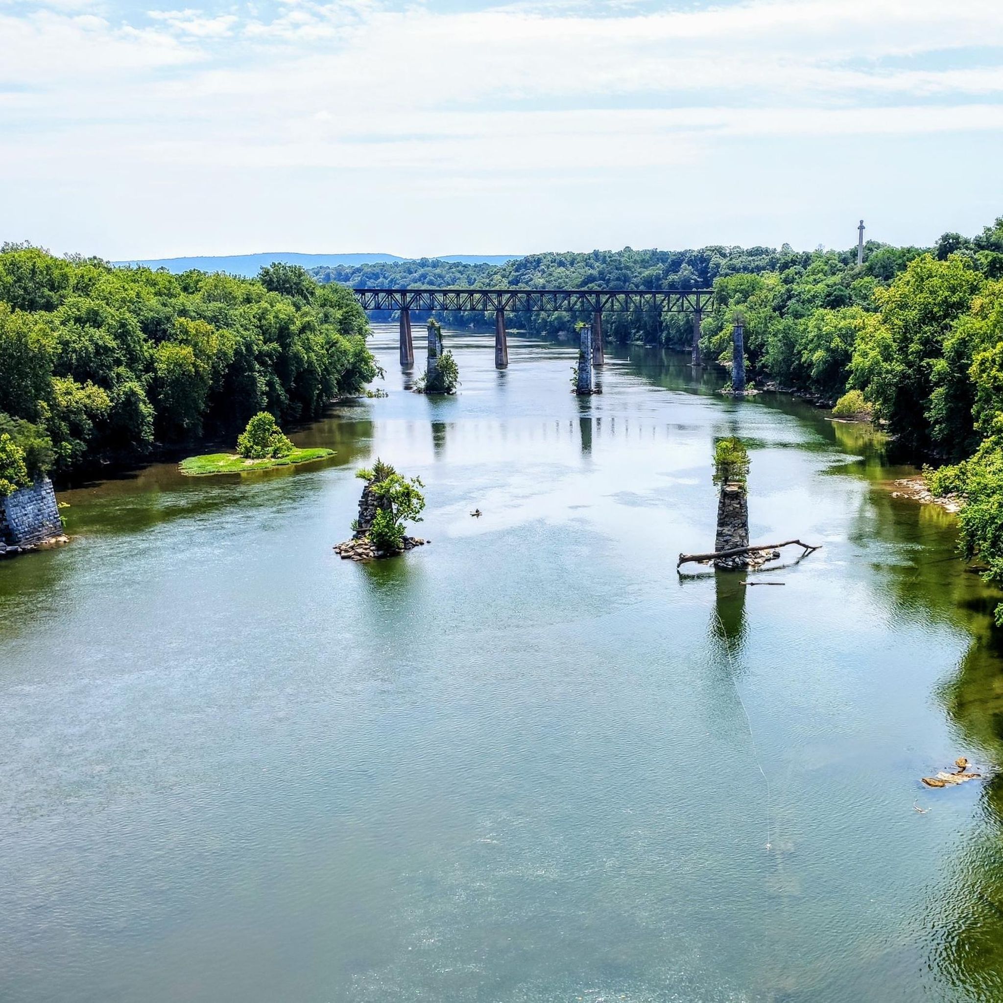
A paved elevated boardwalk stretches out along the water, giving you a fantastic view of the Potomac River. This spot can get pretty popular on summer weekends.
0
0

Dam No. 4 is located around mile 84 of the C&O Canal Towpath. Built in 1856, this dam was crucial for maintaining water levels for canal operations and remains an impressive structure along the river. The area around the dam is known for its scenic views and wildlife.
0
0
The Antietam Aqueduct was built in 1834 to carry canal boats over Antietam Creek. It is over 140 feet long and is one of many such aqueducts along the C&O Canal.
0
0
The Antietam Aqueduct, located at mile 69.4 of the C&O Canal Towpath, is a three-arch stone aqueduct that once carried the canal over Antietam Creek. Built in 1834, it is constructed from limestone quarried nearby and remains one of the best-preserved aqueducts along the canal. During the Civil War, it was near the site of Confederate troop movements before and after the Battle of Antietam in 1862. Though it suffered some damage over the years, it has been fully restored and now serves as a scenic and historic stop along the towpath, offering great river views and picnic spots.
0
0
Dam No. 4 is located around mile 84 of the C&O Canal Towpath. Built in 1856, this dam was crucial for maintaining water levels for canal operations and remains an impressive structure along the river. The area around the dam is known for its scenic views and wildlife, making it a nice spot to pause before continuing on your ride.
0
0

to get from trail to Harper's Ferry, you have to go up these stairs. There are bike racks at the base, or you carry your bike up with you
0
0
Frequently Asked Questions
How many gravel bike trails are available in Antietam?
There are several gravel biking routes around Antietam, with komoot featuring 6 distinct tours. These range from moderate loops to more challenging long-distance rides, catering to various skill levels.
Are there any easy or beginner-friendly gravel bike trails in Antietam?
While many routes in Antietam offer varied terrain, there are options suitable for those looking for a less strenuous ride. For a moderate experience, consider the Horseshoe Bend campsite loop from Shepherdstown, which covers 14.5 miles (23.3 km) through rolling terrain and riverside paths.
What are the most challenging gravel bike routes in Antietam?
For experienced riders seeking a challenge, Antietam offers several difficult routes. The Big Slackwater – Big Slackwater View loop from Sharpsburg is a demanding 71.6 miles (115.2 km) trail with significant elevation gain, offering extensive riding along the C&O Canal Towpath. Another difficult option is the Shepherdstown – Antietam Aqueduct loop from Dargan, which explores varied terrain over 50.1 miles (80.6 km).
Are there any long-distance gravel biking routes in the Antietam area?
Yes, Antietam is home to several long-distance gravel routes. The Big Slackwater – Big Slackwater View loop from Sharpsburg is a substantial 71.6 miles (115.2 km) ride, while the Big Slackwater – Big Slackwater View loop from Dargan offers a challenging 70.7 miles (113.9 km) journey.
What kind of terrain can I expect on gravel bike trails around Antietam?
The terrain around Antietam is characterized by rolling hills, open fields, and historical waterways like the Potomac River and Antietam Creek. You'll encounter a mix of paved and unpaved surfaces, including gravel roads and packed dirt trails. Riders can expect varied terrain, from gentle slopes to more challenging ascents, often passing through wooded areas and alongside agricultural lands.
What attractions or scenic viewpoints can I find along the gravel trails?
The Antietam area is rich in history and natural beauty. Along your rides, you might encounter historical sites like the Maryland Heights Stone Fort or Gathland State Park. For scenic views, look for spots like the View of the Potomac River from the Shepherdstown Bridge. The Ferry Hill – Horseshoe Bend campsite loop from Mercersville offers riverside paths and views.
Are there any loop trails for gravel biking in Antietam?
Yes, many of the gravel biking routes in Antietam are designed as loops. Examples include the Horseshoe Bend campsite loop from Shepherdstown and the Shepherdstown – Antietam Aqueduct loop from Dargan, allowing you to start and end at the same point.
What do other gravel bikers enjoy most about the Antietam trails?
The gravel biking routes in Antietam are highly rated by the komoot community, with an average score of 5.0 stars. Reviewers often praise the unique blend of historical significance with varied natural landscapes, offering a rewarding experience for different skill levels.
What is the best time of year for gravel biking in Antietam?
The Antietam region offers enjoyable gravel biking throughout much of the year. Spring and fall are particularly popular due to milder temperatures and beautiful foliage. Summer can be warm, so early morning rides are recommended, while winter rides are possible but require appropriate gear for colder conditions.
Are there any specific considerations for trail conditions after rain?
After heavy rain, some unpaved sections, especially along riverbanks or in wooded areas, may become muddy or slippery. The C&O Canal Towpath, which features in several routes, is generally well-drained but can have standing water in low-lying areas. It's always advisable to check local weather conditions and recent trail reports before heading out.
Is parking available near the gravel bike trails in Antietam?
Yes, parking is generally available at various access points, particularly near historical sites and trailheads within the Antietam National Battlefield area and along the C&O Canal Towpath. Specific parking details can often be found on individual route pages or local park service websites.
Are there any coffee shops or amenities near the gravel bike trails?
While the trails themselves often traverse rural landscapes, nearby towns like Sharpsburg and Shepherdstown offer amenities including coffee shops, restaurants, and convenience stores where you can refuel and refresh before or after your ride.
Most popular routes around Antietam
Most popular attractions around Antietam

Get inspired with the komoot mobile app


Explore more
Browse the best Gravel rides in other regions.
