The best gravel rides around Bostonia
2.5
(6)
28
riders
4
rides
Gravel biking around Bostonia offers diverse landscapes and accessible trail systems for outdoor exploration. The region features a mix of natural areas, including parks and varied terrain suitable for mixed-surface riding. Riders can find everything from flat paths to routes with significant elevation gains, traversing rail trails and paths around reservoirs. This network provides a range of gravel biking experiences across different skill levels.
Best gravel bike trails around Bostonia
- The most popular gravel bike trail is Upper Otay Reservoir…
Last updated: October 29, 2026
4.0
(1)
9
riders
37.6km
03:16
570m
570m
Hard gravel ride. Very good fitness required. Mostly paved surfaces.
2.0
(3)
6
riders
28.4km
02:09
340m
340m
Moderate gravel ride. Good fitness required. Mostly paved surfaces.

6
riders
39.0km
03:29
590m
590m
Hard gravel ride. Very good fitness required. Mostly paved surfaces.
2
riders
Moderate gravel ride. Good fitness required. Mostly paved surfaces.
1.0
(1)
2
riders
41.6km
02:52
410m
410m
Moderate gravel ride. Good fitness required. Mostly paved surfaces.
Our route recommendations are based on thousands of hikes, rides, and runs completed by other people on komoot.
Start today with a free account
Your next adventure awaits.

Tips from the Community

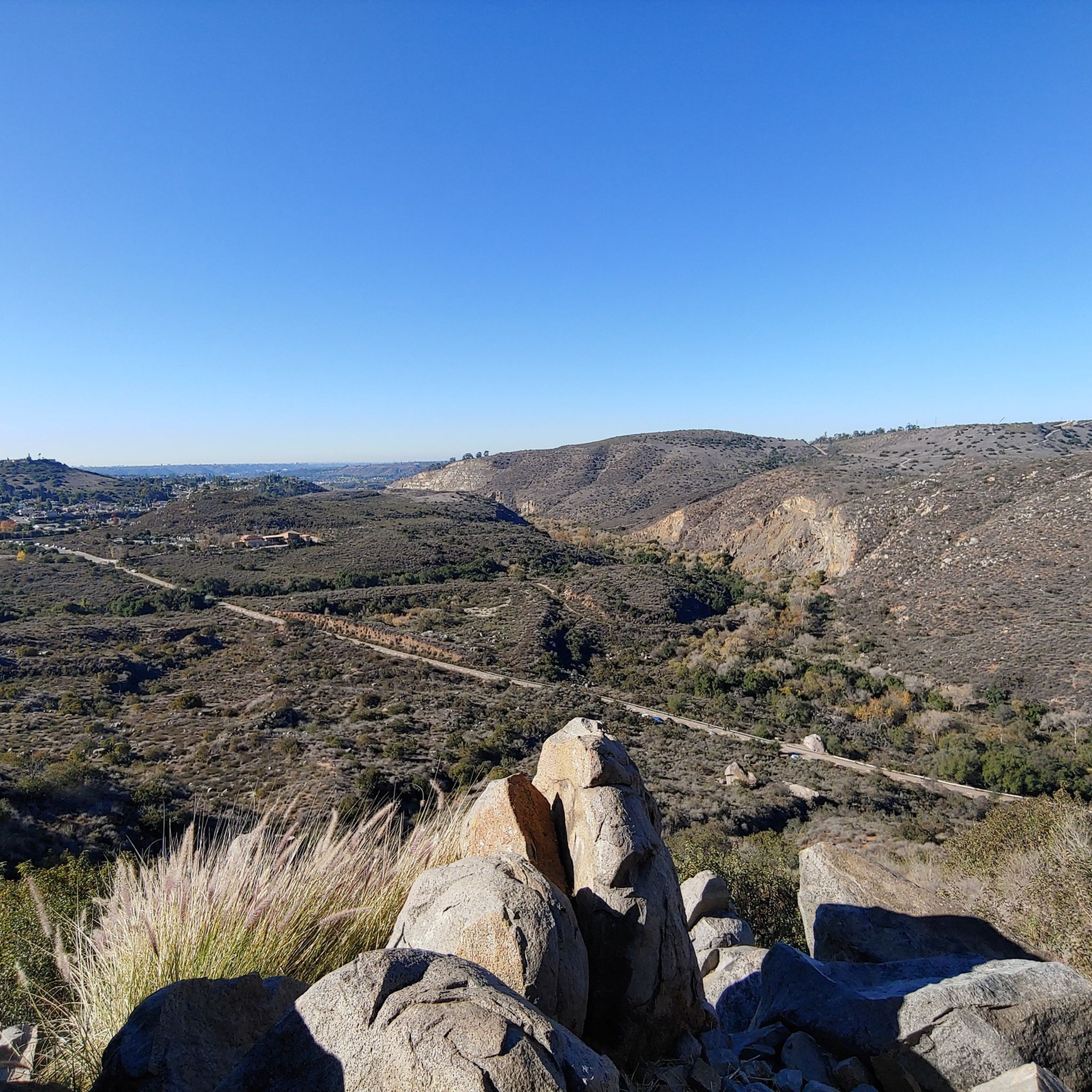
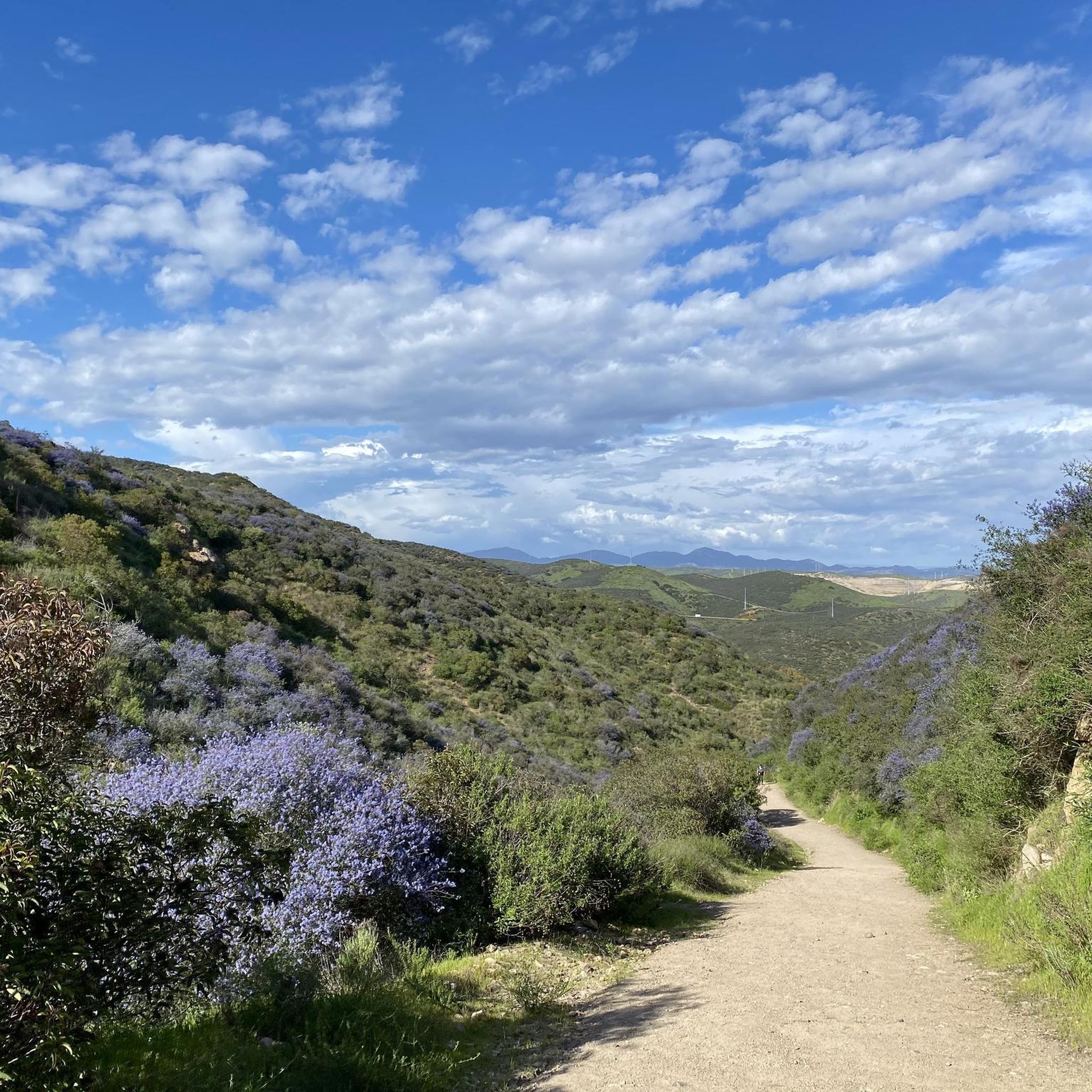
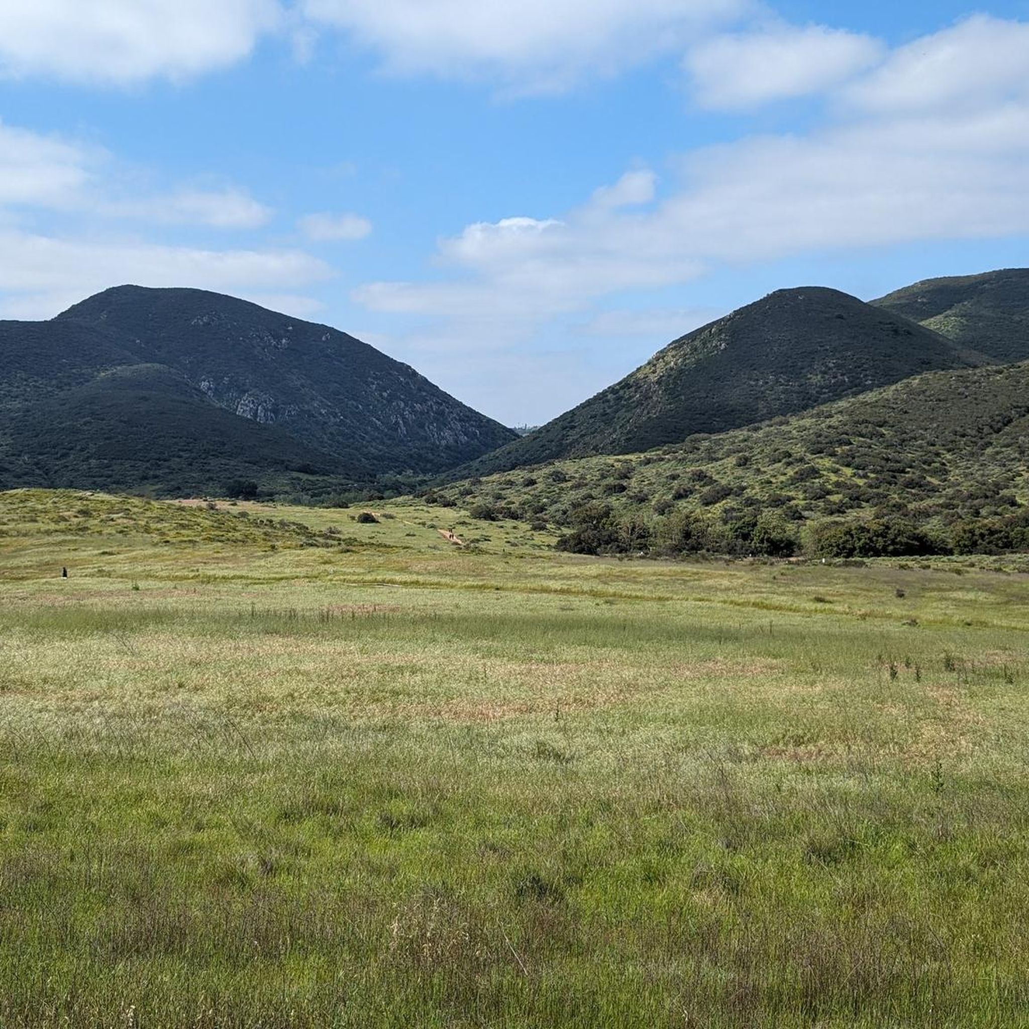
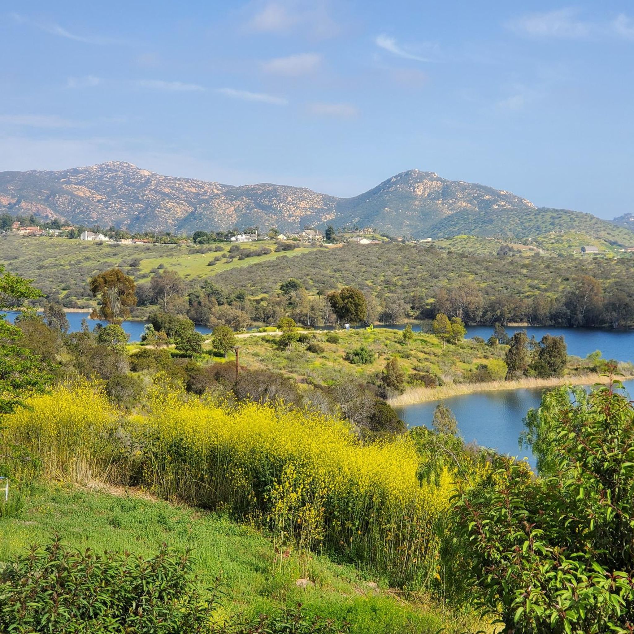
Photos taken from the Mission Trails 50k course.
0
0


The paths around Sweetwater Reservoir are primarily well-worn dirt, with most junctions clearly signed, though some of the less frequented routes can become overgrown. As you near San Miguel Mountain, the terrain becomes increasingly rugged and challenging, while open views of the reservoir and surrounding hills remain a constant backdrop.
1
0

Shepherd Pond is a lovely spot to have a rest during your ride in Mission Trails Regional Park.
0
0
Along the Visitor's Center Loop Trail at Mission Trails Regional Park, you'll come across beautiful views and an exciting journey for mountain bikers. Be sure to wear waterproof shoes as creek crossings can get you slightly wet!
0
0

The Steele Canyon Bridge, also known as the Sweetwater River Bridge, is a beautiful landmark crossing the Sweetwater River. It is on the National Register of Historic places, and is no longer used for vehicles but is a great hiking, running or biking spot.
0
0

River crossing near the Visitor's Center. Can be nearly dry or full of storm runoff, depending on the season. It's a nice bit of water in an otherwise dry area.
0
0
Frequently Asked Questions
What kind of terrain can I expect on gravel bike trails in Bostonia?
Gravel biking in Bostonia offers a diverse range of terrain, from easy, flat paths to more challenging routes with significant elevation gains. You'll find mixed-surface trails traversing natural areas, rail trails, and paths around reservoirs, providing varied experiences for different skill levels.
Are there any easy or beginner-friendly gravel bike routes in Bostonia?
While the komoot guide currently features moderate to difficult routes, the broader Bostonia region is known for diverse trail options, including easier, flatter paths suitable for beginners. For a moderate option, consider the Sweetwater Reservoir – Tiki Hut loop from Rancho San Diego, which is 18.0 miles long and offers varied terrain.
What are some longer gravel biking routes available in Bostonia?
For a longer ride, the EB Loop Trail – Sweetwater River loop from Rancho San Diego covers approximately 28.8 miles (46.3 km) and is considered difficult. Another challenging option is the Upper Otay Reservoir Dam – Tiki Hut loop from Rancho San Diego, which is 23.2 miles (37.4 km) long.
Are there any circular gravel bike routes in Bostonia?
Yes, several routes in Bostonia are loops. For example, the Old Mission Dam – San Diego River Crossing loop from East Fortuna Staging Area is a moderate 10.6-mile trail. Other loop options include the Sweetwater Reservoir – Tiki Hut loop from Rancho San Diego and the Proctor Valley Road loop from Spring Valley.
What kind of natural attractions can I see along the gravel bike trails in Bostonia?
Bostonia's gravel routes often pass by significant natural features. You can explore areas around reservoirs like Lake Murray Reservoir and the Santee Lakes Recreation Preserve. The region also features diverse landscapes, including coastal ecosystems and unique geological formations, offering a scenic backdrop for your ride.
Are there any historical landmarks or points of interest near the gravel biking routes?
While specific historical landmarks directly on the listed gravel routes are not detailed, the broader Bostonia region is rich in history. Areas like the Minute Man National Historical Park offer a blend of outdoor activity and historical exploration. The city itself seamlessly blends its rich history with natural beauty, providing a unique backdrop for active exploration.
What do other gravel bikers enjoy most about riding in Bostonia?
The area is highly rated by the komoot community, with an average score of 2.2 stars from over 4 reviews. Riders often praise the diverse landscapes and accessible trail systems that allow for varied mixed-surface riding experiences.
How many gravel bike trails are featured in this guide for Bostonia?
This guide features 5 gravel bike trails around Bostonia, ranging from moderate to difficult in intensity. These routes offer a good representation of the diverse landscapes and accessible trail systems in the region.
What is the best time of year for gravel biking in Bostonia?
Bostonia offers opportunities for gravel biking throughout much of the year due to its diverse landscapes. Fall foliage can be particularly scenic, and spring and early summer provide pleasant temperatures. However, some popular areas might experience congestion during peak times.
Are there any challenging gravel bike routes for experienced riders in Bostonia?
Yes, Bostonia offers several challenging routes. The Upper Otay Reservoir Dam – Tiki Hut loop from Rancho San Diego and the EB Loop Trail – Sweetwater River loop from Rancho San Diego are both rated as difficult, featuring significant elevation gains and longer distances suitable for experienced gravel bikers.
Can I find scenic views on the gravel bike trails in Bostonia?
Absolutely. Gravel biking in Bostonia allows riders to experience the city's historic sites, beautiful waterfronts, and diverse neighborhoods from a fresh perspective. Routes often offer scenic views, especially around reservoirs and through natural areas like those found near Mission Trails Regional Park.
Most popular attractions around Bostonia

Get inspired with the komoot mobile app


Explore more
Browse the best Gravel rides in other regions.
