The best gravel rides around Mountain View
4.7
(41)
368
riders
40
rides
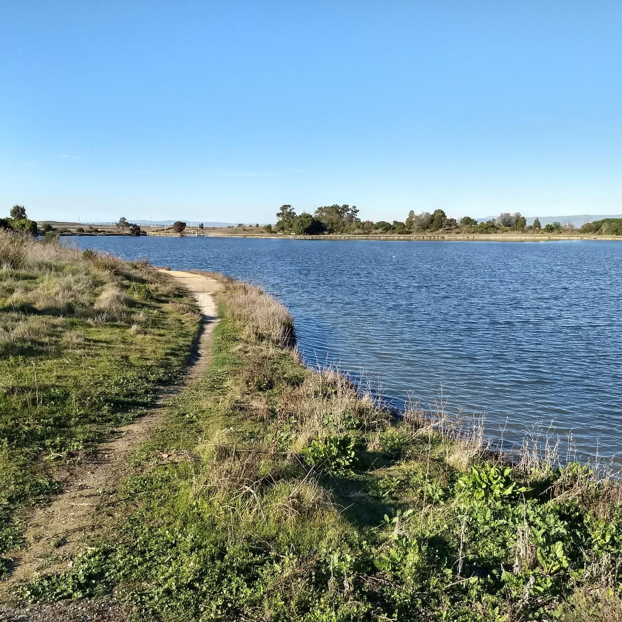
Gravel biking around Mountain View offers a diverse landscape characterized by its location at the southern end of the San Francisco Bay. The region features extensive, interconnected trail systems, including the Shoreline at Mountain View and the Stevens Creek Trail, which provide a mix of gravel and crushed-shell paths. Riders can explore flat routes along the bay, through wetlands, and alongside creeks, experiencing varied ecosystems. The terrain is generally flat, with some routes incorporating short, steep hills.
Best gravel bike trails around Mountain View
- The most popular gravel bike trail is Moffett Boulevard Bike Bridge – Stevens Creek bridge loop from Whisman, an 18.7 miles (30.1 km) trail that takes 2 hours 4 minutes to complete. This route connects major trail systems and offers expansive views of the San Francisco Bay.
- Another top favourite among local gravel bikers is San Francisco Bay Trail – Shoreline Lake loop from San Antonio, a moderate 19.7 miles (31.7 km) path. This trail provides a mostly flat ride through the Shoreline at Mountain View wildlife refuge, with opportunities for birdwatching.
- Local gravel bikers also love the Stevens Creek bridge – San Francisco Bay Trail loop from Sunnyvale, a 52.3 miles (84.2 km) trail leading through interconnected bay trails and creek-side paths, often completed in about 5 hours 50 minutes.
- Gravel biking around Mountain View is defined by San Francisco Bay views, diverse wetlands, and interconnected trail systems. The network offers options for different ability levels, from easy, flat rides to longer, more challenging routes.
- The routes in Mountain View are highly rated by the komoot community with an average score of 4.6 stars from more than 10 reviews. More than 200 gravel bikers have used komoot to explore Mountain View's varied terrain.
Last updated: October 1, 2026
5.0
(3)
22
riders
Easy gravel ride. Great for any fitness level. Mostly paved surfaces. Suitable for all skill levels.
4.3
(3)
12
riders
Moderate gravel ride. Good fitness required. Mostly paved surfaces. Suitable for all skill levels.

5.0
(1)
21
riders
Easy gravel ride. Great for any fitness level. Mostly paved surfaces. Suitable for all skill levels.
5.0
(5)
37
riders
Moderate gravel ride. Good fitness required. Mostly paved surfaces. Suitable for all skill levels.
11
riders
Easy gravel ride. Great for any fitness level. Mostly paved surfaces. Suitable for all skill levels.
Get access to more routes and recommendations from other explorers.
Already have an account?
Our route recommendations are based on thousands of hikes, rides, and runs completed by other people on komoot.
Start today with a free account
Your next adventure awaits.
Tips from the Community


The San Francisco Bay Trail is a flat, paved trail that runs along the border of the bay. It is a great place for a run because it is traffic free and has great views.
0
0

This spot is a fantastic place to view the many American White Pelicans and other birds on the island of Adobe Creek. A lovely bench is here, ideal for taking a quiet break and capturing some beautiful photos.
0
0
Nestled in Baylands Nature Preserve, Byxbee Park is beautiful, featuring an array of sculpted earth & conceptual art. The park has trails for cyclists and hikers, restrooms, drinking fountains, and lovely benches to relax and enjoy the scenery in a peaceful atmosphere.
0
0
The Donald M. Somers Water Pollution Control Plant, also called the Sunnyvale Water Treatment Center, is a wastewater treatment plant focused on making the water clean enough to be safely released into San Francisco Bay or used for non-drinking purposes. The plant produces about 300 million gallons of recycled water each year.
0
0

Ravenswood Preserve, a 376-acre wetland in the San Francisco Bay, is a great spot for birdwatching and family fun. Open from half an hour before sunrise to half an hour after sunset, it features a flat trail for walking and biking along the marsh levee. Migrating birds like sandpipers, avocets, and herons frequent the area, while the marshland are home to endangered species like the Ridgway's rail.
0
0
The SF Bay Trail crosses over the San Tomas Aquino Creek, offering an option to pass under Highway 237. This section of the trail provides a scenic route with multiple paths for cyclists and hikers to explore. San Tomas Aquino Creek, a 16.5-mile stream flowing from El Sereno mountain through several cities before reaching the Guadalupe Slough. This creek has played an important role in historical land grant boundaries in the 1850s. While it has seen habitat changes, native fish species, such as rainbow trout, persist in the creek, and in 1996, a large Chinook salmon was seen.
0
0
Frequently Asked Questions
What types of terrain can I expect on gravel bike trails in Mountain View?
Gravel biking in Mountain View primarily features a mix of gravel and crushed-shell paths, especially along the San Francisco Bay Trail, Shoreline at Mountain View, and Stevens Creek Trail. The terrain is generally flat, offering accessible rides, but some routes may include short, steep hills and even beginner-friendly singletrack sections for added variety.
Are there any easy, family-friendly gravel bike trails in Mountain View?
Yes, Mountain View offers several easy, family-friendly options. The trails around Shoreline at Mountain View are mostly flat and scenic, perfect for a relaxed ride. The Stevens Creek Trail also has many accessible sections. These areas provide a safe and enjoyable environment for riders of all ages.
Can I find circular gravel bike routes in Mountain View?
Absolutely. Many of the gravel routes in Mountain View are designed as loops, allowing you to start and end at the same point. For example, the Moffett Boulevard Bike Bridge – Stevens Creek bridge loop from Whisman is a popular 18.7-mile circular route that connects major trail systems. Another great option is the San Francisco Bay Trail – Shoreline Lake loop from San Antonio, which offers a moderate 19.7-mile ride through the wildlife refuge.
What kind of views and natural features can I expect while gravel biking in Mountain View?
You can expect stunning views of the San Francisco Bay, diverse wetlands, and lush creek-side paths. The region is known for its wildlife, especially migratory birds like egrets, avocets, herons, and white pelicans, particularly around Shoreline at Mountain View. You'll also encounter varied ecosystems, from forested foothills to marshy areas.
Are there any specific landmarks or points of interest along the gravel trails?
Yes, the trails offer access to several interesting points. You can spot the Former salt ponds – Alviso wetlands, explore the Pond SF2 with Historical Baylands Exhibit, or enjoy panoramic views from Byrne Preserve Lookout. The Bedwell Bayfront Park (SF Bay Trail) is also a notable spot for scenic bay views.
How many gravel bike trails are available in Mountain View?
There are over 40 gravel bike trails around Mountain View, catering to various skill levels. This includes 10 easy routes, 21 moderate routes, and 12 more challenging options, ensuring there's a ride for every preference.
What do other gravel bikers say about the trails in Mountain View?
The gravel biking routes in Mountain View are highly rated by the komoot community, with an average score of 4.6 stars from over 18 reviews. Riders often praise the stunning bay views, the well-maintained interconnected trail systems, and the opportunities for wildlife observation.
Are there any long-distance gravel routes for experienced riders?
For experienced riders seeking a longer challenge, the Stevens Creek bridge – San Francisco Bay Trail loop from Sunnyvale is a difficult 52.3-mile route that takes approximately 5 hours and 50 minutes to complete. Another demanding option is the Stevens Creek Reservoir – Altamont Road Vineyard loop from Downtown Mountain View, spanning 51.5 miles with significant elevation gain.
Is parking available at the trailheads in Mountain View?
Yes, parking is generally available at various access points for the major trail systems. For instance, Shoreline at Mountain View and Stevens Creek Trail have designated parking areas to accommodate visitors. It's advisable to check specific trailhead information for detailed parking instructions.
Are there any bike repair facilities along the gravel trails?
Yes, the Mountain View segment of the Stevens Creek Trail is known to have multiple bike repair stations available, which can be very convenient for riders needing quick adjustments or minor fixes during their ride.
What is the best season for gravel biking in Mountain View?
Mountain View generally offers good gravel biking conditions year-round due to its mild climate. However, spring and fall provide particularly pleasant temperatures. While winter riding is possible, be mindful of potential rain, which can affect trail conditions. Summers are typically dry and warm, ideal for long rides.
Can I access the gravel trails using public transport?
Mountain View has public transport options that can get you close to various trail access points. The city's VTA bus system and Caltrain service can connect you to areas near the Stevens Creek Trail and other parts of the interconnected trail network. Check local transit schedules for the most convenient access points.
Most popular routes around Mountain View
Most popular attractions around Mountain View

Get inspired with the komoot mobile app


Explore more
Browse the best Gravel rides in other regions.
