The best gravel rides in Dakota County
4.1
(6)
56
riders
16
rides
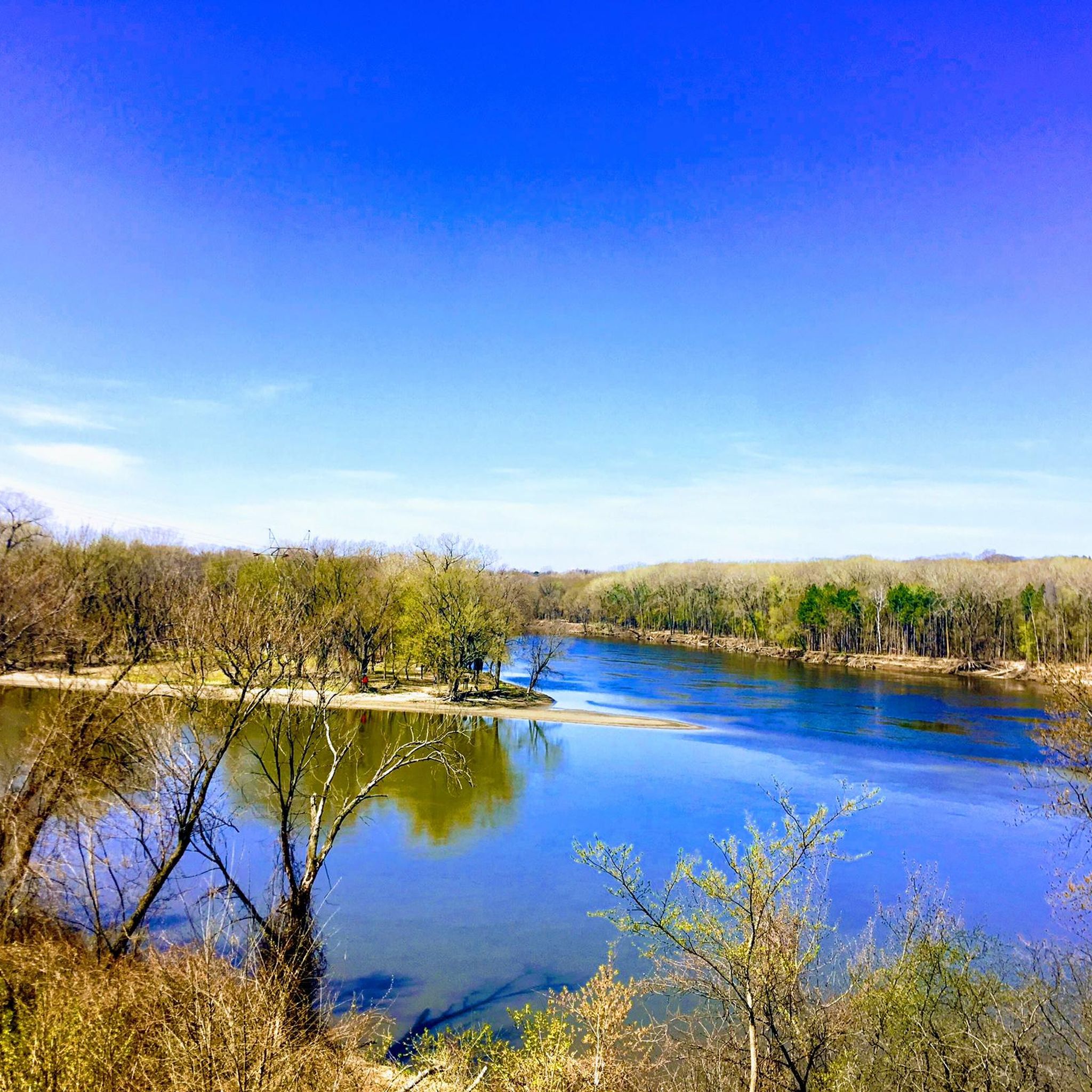
Gravel biking in Dakota County offers diverse landscapes, from river valleys and bluffs to prairies, woodlands, and wetlands. The region features an extensive network of trails and greenways, providing varied terrain for gravel riders. Prominent features include the Mississippi and Minnesota River valleys, offering scenic views from bluffs and trails. The county's natural resources provide a mix of challenging climbs and flatter routes suitable for various skill levels.
Best gravel bike trails in Dakota County
- The most popular gravel bike trail is Minnesota River Bluffs Trail – St. Albans Bay Bridge loop from Dewey Hill, a 37.77 miles (60.79 km) trail that takes 3 hours 55 minutes to complete. This moderate route blends natural beauty with accessibility along the Minnesota River.
- Another top favourite among local gravel bikers is Hand-Pulled Bike Ferry – View of the Minnesota River loop from Bloomington Ferry, a moderate 15.51 miles (24.96 km) path. This route offers scenic views of the Minnesota River valley.
- Local gravel bikers also love the View of the Minnesota River – Old Cedar Avenue Bridge loop from 16 Av S, a 10.11 miles (16.27 km) trail leading through river views and natural areas, often completed in about 1 hour 22 minutes.
- Gravel biking in Dakota County is defined by river valleys, bluffs, and diverse ecosystems including woodlands and prairies. The network offers options for different ability levels, from easy loops to more challenging moderate routes.
- The routes in Dakota County are highly rated by the komoot community with an average score of 4.1 stars from over 6 reviews. More than 50 gravel bikers have used komoot to explore Dakota County's varied terrain.
Last updated: October 28, 2026
9
riders
Embark on a truly unique gravel biking experience with the Hand-Pulled Bike Ferry – View of the Minnesota River loop, a moderate 15.5-mile (25.0 km) journey. This route winds through the Minnesota River floodplain, offering picturesque views as it meanders along the river through wooded areas and open fields. You'll encounter varied terrain, from hardpack dirt to challenging sandy sections, making each ride a dynamic adventure.
Before you go, be aware that this trail is prone to periodic flooding, which can significantly change its features and conditions. Always check current trail status, as river levels dictate accessibility and the presence of features like the hand-pulled bike ferry. The estimated duration for this ride is around 2 hours and 7 minutes, with a modest 308 feet (94 metres) of elevation gain.
Part of the broader Minnesota River Bottoms area, this trail is continually shaped by the river's activity, ensuring no two rides are exactly alike. It's a popular spot for wildlife spotting and birdwatching, shared with hikers and runners, so expect to share the path. The hand-pulled bike ferry itself is a notable landmark, adding a memorable and interactive element to your ride.
7
riders
The View of the Minnesota River – Hand-Pulled Bike Ferry loop offers a truly distinctive gravel biking experience, guiding you through a rich tapestry of prairies, woodlands, and wetlands alongside the Minnesota River. This 21.9-mile (35.3 km) route, with its unique hand-pulled bike ferry across Nine Mile Creek, provides ever-changing scenery and the chance to spot diverse wildlife like bald eagles and white-tailed deer. Expect a moderate challenge due to varied surfaces, including crushed gravel, dirt, and occasional loose sand, making it best suited for gravel bikes with wider tires.
Planning your ride on this 2 hours and 43 minutes loop means preparing for dynamic trail conditions, as the Minnesota River periodically reshapes the path with fresh sand and silt. While the 376 feet (115 metres) of elevation gain is modest, the variable terrain contributes to its moderate difficulty. Be sure to check the operational status of the hand-pulled bike ferry, as it can be seasonally affected by river conditions. Spring and fall are particularly beautiful times to visit, offering wildflowers or vibrant autumn colors.
This loop stands out as a prime example of Minnesota River Hand-Pulled Bike Ferry loop gravel biking routes, providing a wild, natural experience within an urban setting. The Minnesota Valley National Wildlife Refuge, home to this trail, boasts approximately 50 miles of trails, making it a significant hub for outdoor activity. The valley's landscape, carved by the ancient Glacial River Warren, adds a layer of geological interest to the diverse ecosystems you'll encounter.

4.0
(1)
11
riders
65.7km
04:42
290m
290m
Moderate gravel ride. Good fitness required. Mostly paved surfaces.
4.3
(3)
8
riders
The View of the Minnesota River – Old Cedar Avenue Bridge loop from 16 Av S offers a delightful gravel biking experience, winding through the rich ecosystems of the Minnesota River Valley. You'll traverse a mix of paved and firm-pack gravel paths, passing through lush floodplain forests and expansive marshlands. The highlight is undoubtedly the historic Old Cedar Avenue Bridge, which provides stunning Minnesota River valley scenic views and access to observation boardwalks over Long Meadow Lake, perfect for spotting local wildlife.
This easy 10.6-mile (17.1 km) route, with a gentle 233 feet (71 metres) of elevation gain, typically takes just over an hour to complete, making it a great option for a quick outing. Parking is readily available near the 16 Av S trailhead. While the trail is generally accessible, some sections can get muddy after rain, so it's wise to check conditions. The best time to gravel bike Minnesota River is often during the drier months of late spring or early fall for optimal comfort and wildlife sightings.
Beyond the scenic ride, this Old Cedar Avenue Bridge loop gravel biking trail connects you to the Minnesota Valley National Wildlife Refuge, a unique metropolitan refuge teeming with fox, otters, eagles, and migrating waterfowl. The rehabilitated Old Cedar Avenue Bridge itself is a significant historical landmark, linking an extensive network of trails and offering excellent vantage points for birdwatching. It's a fantastic way to experience the natural beauty and historical Old Cedar Avenue Bridge loop points of interest in the area.
7
riders
This easy 15.0-mile (24.1 km) gravel biking loop, taking about 1 hour and 38 minutes with only 276 feet (84 metres) of elevation gain, offers a relaxing ride through the Minnesota River Valley. You'll enjoy mostly paved surfaces, with the historic Old Cedar Avenue Bridge providing stunning views of wetlands and bluffs. Keep an eye out for eagles, pelicans, and other wildlife as you pedal through this scenic refuge.
Planning your visit is straightforward, as the trailhead features amenities like a nature play area, picnic shelter, and restrooms. This route is suitable for all skill levels, making it a great choice for families or anyone looking for an accessible outdoor adventure. It's an ideal spot for a quick escape into nature, especially if you appreciate a well-maintained path.
The Old Cedar Avenue Bridge is a significant landmark, restored and reopened for cyclists and pedestrians, serving as a vital link within the Minnesota Valley National Wildlife Refuge. The area is a key stopping point along the Mississippi Flyway, attracting diverse birdlife, and the loop connects to an extensive network of other trails for further exploration.
Get access to more routes and recommendations from other explorers.
Already have an account?
Our route recommendations are based on thousands of hikes, rides, and runs completed by other people on komoot.
Start today with a free account
Your next adventure awaits.
Popular around Dakota County

Gravel biking around Burnsville

Gravel biking in Mississippi National River And Recreation Area

Gravel biking around Eagan

Gravel biking around Mendota

Gravel biking around Mendota Heights

Gravel biking around Apple Valley

Gravel biking around Lilydale

Gravel biking around West St. Paul
Hiking in Dakota County

Cycling in Dakota County
Tips from the Community

Good parking lot for hiking or biking of various kinds. You can either get on the single track trail, the grass trail, or the paved trail.
0
0
I hadn't been here in maybe 40 years since I was in 6th grade. There is quite a bit to see here in this rebuilt fort. Neat to see how many different trades people they had at the fort and what life would have been like on the frontier.
2
0
This is a different name for the Old Cedar Avenue Bridge.
2
0
Finally made it across this bridge, it's in really good shape. 2 big bike lanes in the center with walking paths on the outside.
1
0
Big bridge with a neat bike section mounted lower than the car section. Nice way to cross the river on a bike.
2
0
The "Ferry" looks upgraded, as does the new bridge across fallen trees. Both options were not what I needed at my turn around point today, but I finally made it here from the West today! Woohoo!
1
0
The bridge made over fallen trees looked more less scary today, as it was just a foot or so above the water. Still looks a little scary, I didn't cross.
1
0
This path apparently is for foot traffic only, according to sign on the south side of the Singletrack.
1
0
Frequently Asked Questions
What kind of terrain can I expect on gravel bike trails in Dakota County?
Dakota County offers a diverse range of terrain for gravel biking. You'll find routes traversing river valleys and bluffs, particularly along the Mississippi and Minnesota Rivers, offering scenic views. Many trails also weave through woodlands, prairies, and wetlands, providing varied natural backdrops. Some routes, like those in the heart of Dakota County's farm country, offer a rural charm with cornfields and pastures. The trails range from relatively flat sections to rolling hills and some challenging climbs.
How many gravel bike trails are available in Dakota County?
There are over 15 gravel bike trails available in Dakota County, offering a variety of experiences for different skill levels. These routes are highly rated by the komoot community, with an average score of 4.1 stars.
Are there any easy or beginner-friendly gravel bike routes in Dakota County?
Yes, Dakota County has several easy and moderate routes suitable for beginners or those looking for a more relaxed ride. For instance, the View of the Minnesota River – Old Cedar Avenue Bridge loop from 16 Av S is an easy 10-mile (16 km) trail that leads through river views and natural areas. Another easy option is the View of the Minnesota River – Old Cedar Avenue Bridge loop from Bloomington Central, which covers about 15 miles (24 km).
What are some scenic highlights or landmarks I might see along the gravel trails?
Dakota County's gravel trails offer numerous scenic views and points of interest. You can enjoy spectacular blufftop views of the Mississippi River at Spring Lake Park Reserve, or expansive river views along the Mississippi River Greenway. The Hand-Pulled Bike Ferry – View of the Minnesota River loop from Bloomington Ferry offers great views of the Minnesota River valley. You might also encounter diverse ecosystems like dense forests, lakeshores, and rolling prairies in areas like Lebanon Hills Regional Park.
Are there any circular gravel bike routes in Dakota County?
Yes, many of the gravel routes in Dakota County are designed as loops. For example, the Minnesota River Bluffs Trail – St. Albans Bay Bridge loop from Dewey Hill is a popular moderate 37-mile (60 km) loop. Another option is the View of the Minnesota River – Hand-Pulled Bike Ferry loop from Minnesota Valley National Wildlife Refuge, a moderate 21-mile (34 km) loop.
What is the best time of year for gravel biking in Dakota County?
The best time for gravel biking in Dakota County is generally during the spring, summer, and fall months when the weather is mild and the trails are in good condition. Spring brings blooming wildflowers, while fall offers vibrant foliage. Always check local weather and trail conditions before heading out, as conditions can vary seasonally.
Are there any family-friendly gravel biking options in Dakota County?
While specific 'family-friendly' designations aren't always explicit, many of the easier and moderate routes with gentler grades and scenic views can be suitable for families. Trails like the View of the Minnesota River – Old Cedar Avenue Bridge loop from 16 Av S, with its shorter distance and easy difficulty, could be a good starting point for families.
Where can I find parking for gravel bike trails in Dakota County?
Many regional parks and trailheads throughout Dakota County offer designated parking areas. For example, you can often find parking near access points for trails like the Minnesota River Bluffs Trail or within parks such as Lebanon Hills Regional Park and Spring Lake Park Reserve. It's advisable to check specific route details or park websites for precise parking locations.
What do other gravel bikers enjoy most about gravel biking in Dakota County?
The area is highly rated by the komoot community, with an average score of 4.1 stars. Reviewers often praise the diverse landscapes, from river valleys to woodlands, and the extensive network of trails that cater to various skill levels. The scenic views, particularly along the Mississippi and Minnesota Rivers, are frequently highlighted as a major draw.
Are there any longer, more challenging gravel bike routes in Dakota County?
Yes, for those seeking longer or more challenging rides, Dakota County offers several moderate routes. The Minnesota River Bluffs Trail – St. Albans Bay Bridge loop from Dewey Hill is a moderate 37-mile (60 km) trail with significant elevation gain. Another moderate option is the Minnehaha Falls – Fort Snelling loop from Fairview Avenue, which spans over 40 miles (65 km).
Can I access gravel bike trails in Dakota County using public transport?
While specific public transport access points directly to all trailheads might vary, some areas of Dakota County are served by Metro Transit, which operates bus services. Planning your route in advance and checking bus schedules and bike-on-bus policies would be recommended to see if public transport can get you close to your desired starting point.
Are there any specific parks known for gravel biking in Dakota County?
Lebanon Hills Regional Park, while known for mountain biking, offers diverse terrain that can appeal to gravel riders with its deep woods, lakes, and rolling prairies. Spring Lake Park Reserve is another notable area, featuring a bison prairie and blufftop views of the Mississippi River, which can be incorporated into gravel rides. Whitetail Woods Regional Park also provides trails through pristine woods.
Most popular routes in Dakota County
Most popular attractions in Dakota County

Get inspired with the komoot mobile app


Didn’t find what you were looking for?
Check out more Gravel rides throughout Dakota County below and find the perfect route in your destination.
Explore more
Browse the best Gravel rides in other regions.
