The best gravel rides around Aguilcourt
3.0
(2)
18
riders
4
rides
Gravel biking around Aguilcourt offers a diverse landscape characterized by extensive arable land and significant forest areas, providing varied terrain for cyclists. The region features gentle inclines and descents, with elevations ranging from 54 to 102 meters. The Suippe river forms part of Aguilcourt's northeastern border, offering potential for scenic riverside paths. This rural commune provides a tranquil environment ideal for quiet gravel rides through the French countryside.
Best gravel bike trails around Aguilcourt
- The most popular gravel bike trail…
Last updated: May 22, 2026
2
riders
21.8km
01:44
300m
310m
Moderate gravel ride. Good fitness required. Mostly paved surfaces. Suitable for all skill levels.
1
riders
22.2km
01:40
300m
300m
Moderate gravel ride. Good fitness required. Mostly paved surfaces. Suitable for all skill levels.

Sign up for free
3
riders
54.1km
03:33
520m
520m
Hard gravel ride. Very good fitness required. Mostly paved surfaces. Suitable for all skill levels.
1
riders
42.2km
03:17
450m
450m
Hard gravel ride. Good fitness required. You may need to push your bike for some segments of this route.
4.0
(1)
2
riders
36.6km
02:23
330m
330m
Hard gravel ride. Good fitness required. You may need to push your bike for some segments of this route.
Our route recommendations are based on thousands of hikes, rides, and runs completed by other people on komoot.
Start today with a free account
Your next adventure awaits.
Login or Signup
Tips from the Community


Église Saint-Rémi in Loivre is a 12th-century church dedicated to Saint Remigius, the Bishop of Reims who baptized King Clovis. The church is Romanesque in style, with a square tower, a three-aisled nave and a choir with a semicircular apse. The church also has some interesting works of art, such as a 16th-century statue of Saint Remigius, a 17th-century painting of the Coronation of the Virgin Mary and an 18th-century organ.
8
0
Loivre is a commune in the Marne department in northeastern France. Loivre has a railway station with connections to Reims and Laon. Loivre is located near the Chemin des Dames, a historic route that witnessed several battles during World War I. Loivre also has a 12th-century church dedicated to Saint-Martin.
9
0


For cyclists who like climbs, you can leave from Muizon and enjoy 4% slopes over 4 km with the added bonus of a passage through two timeless villages. A cross in tribute to the fighters of the First World War serves as the highest point of the pass.
0
0
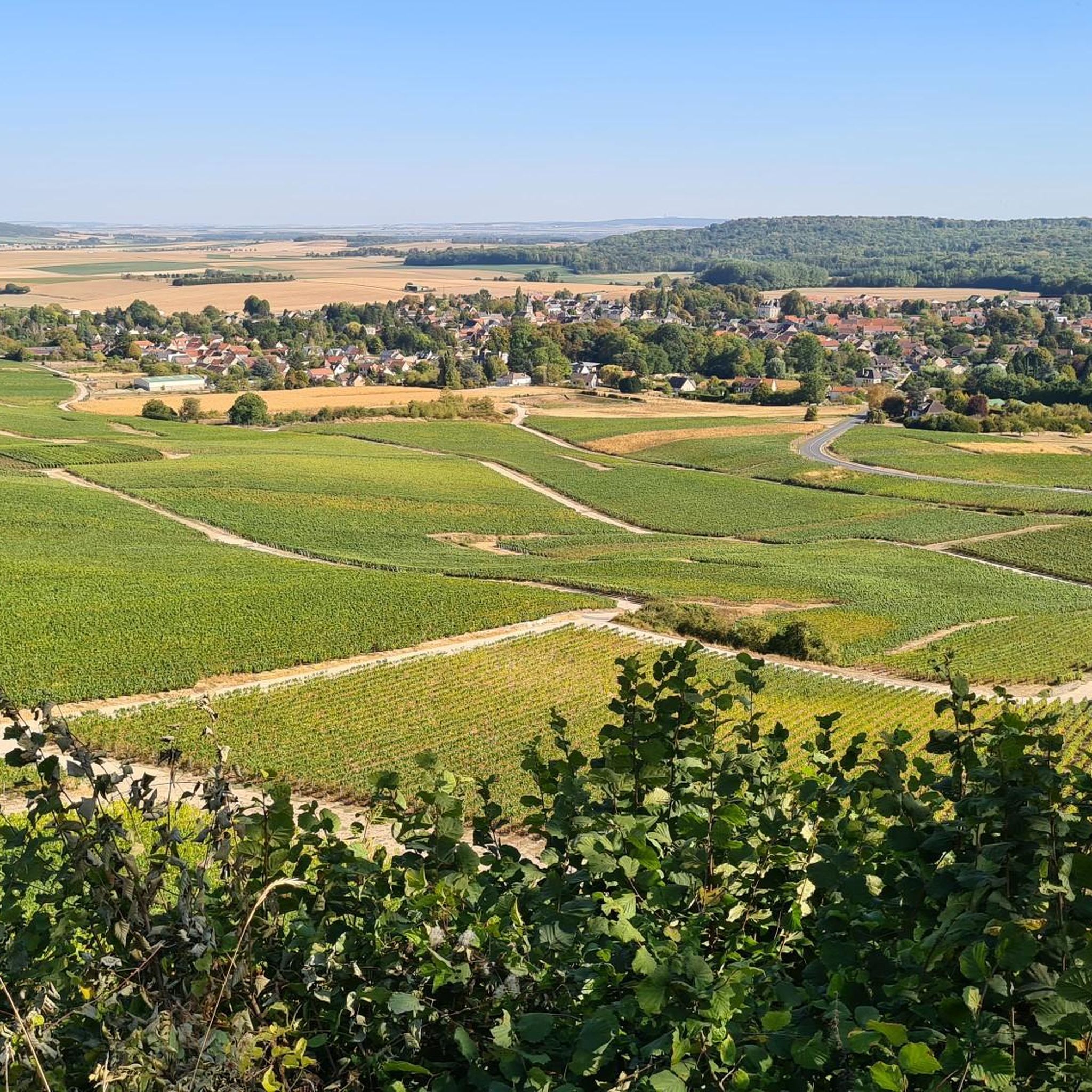
Chenay is a village steeped in traditions, narrow cobbled streets, stone houses, a wash house; a gourmet restaurant completes the charm of this village perched on a hill. You can also admire the Champagne valley with its vineyards and the city of Reims in the distance.
0
0
Pretty little town up high, with a center full of culture, its church, its castle and its town hall. It is a good starting point with more sites and memorials in and around the city.
0
0
The Nécropole nationale de Cormicy is a French military cemetery from the First World War, located in the municipality of Cormicy, near Reims. The cemetery was created during the war to collect the bodies of the soldiers who died during the fighting on the Chemin des Dames. The cemetery was later expanded to include bodies excavated from other temporary cemeteries in the Vesle valley12. The cemetery has an area of 44,213 m² and contains 14,431 graves, of which 6,945 are in two ossuaries. Among the buried soldiers are two British from the First World War and ten from the Second World War. The cemetery is also called “La Maison Bleue”, after the farm that used to be there.
13
0
Frequently Asked Questions
What kind of terrain can I expect on gravel bike trails around Aguilcourt?
Gravel biking around Aguilcourt offers a diverse landscape. You'll find routes traversing extensive arable land, providing open views, and then delving into significant forest areas for shaded woodlands. The elevation ranges from 54 to 102 meters, meaning gentle inclines and descents rather than steep climbs. The Suippe river also forms part of the northeastern border, suggesting potential for scenic riverside paths.
Are there any easier gravel routes suitable for beginners in Aguilcourt?
While many routes around Aguilcourt are rated moderate to difficult, the overall elevation changes are gentle. For a moderate option, consider the Trail Path 3 – The Forest Pond loop from Bouvancourt, which is 14.3 miles (23.1 km) long and leads through forest areas. Another moderate choice is the End of the canal at berry-au-bac – Lock n°6 loop from Courcy - Brimont, offering a flatter experience along the canal.
What are the more challenging gravel biking options near Aguilcourt?
For a more challenging ride, the Saint-Hilaire Church – Fort de Chenay loop from Saint-Thierry is a difficult 21.5 miles (34.6 km) trail that explores historical sites and varied terrain. Another demanding option is the Hermonville – Chenay Heights loop from Guyencourt, a difficult 33.6 miles (54.1 km) path offering expansive views across the landscape.
What natural features or landmarks can I see along the gravel bike trails?
The region is characterized by its tranquil rural environment, with routes often passing through open fields and shaded woodlands. The Suippe river is a notable natural feature. For historical and cultural landmarks, you might encounter sites like the Cormicy National Necropolis or the St. Pierre Church - Guignicourt. The End of the canal at berry-au-bac is also a point of interest that some routes pass by.
Are there any circular gravel routes available around Aguilcourt?
Yes, many of the gravel routes around Aguilcourt are designed as loops. For example, the Trail Path 3 – The Forest Pond loop from Bouvancourt and the Vineyard view – Pévy Horse Wash loop from Bouvancourt are both circular routes, allowing you to start and finish in the same location.
What is the best time of year to go gravel biking in Aguilcourt?
The Hauts-de-France region, where Aguilcourt is located, offers pleasant conditions for cycling during spring, summer, and early autumn. These seasons provide comfortable temperatures for exploring the open fields and shaded woodlands. Winter riding is possible, but be prepared for colder, potentially wetter conditions on the unpaved paths.
Is Aguilcourt a good destination for family-friendly gravel biking?
Aguilcourt's gentle inclines and tranquil rural environment make it suitable for families, especially on the less challenging routes. The mix of open fields and forest roads provides a safe and scenic setting away from heavy traffic. Look for routes rated 'moderate' or those with lower elevation gains for a more relaxed family outing.
What do other gravel bikers enjoy the most about gravel biking in Aguilcourt?
The area is highly rated by the komoot community, with an average score of 4.5 stars from 5 reviews. Reviewers often praise the varied terrain, which includes both open fields and shaded woodlands, and the peaceful, immersive experience of riding through the French countryside. The network offers options for different ability levels, from moderate to difficult routes.
Are there options for parking or public transport access to the gravel trails?
Aguilcourt is a rural commune, so public transport options might be limited. It's generally recommended to arrive by car, and you can often find parking in or near the starting points of the routes, such as in villages like Bouvancourt or Guyencourt, which are mentioned as starting points for several tours.
Are there any cafes or places to stop for refreshments along the routes?
While Aguilcourt itself is a small commune, the routes often connect villages within the broader Aisne region. It's advisable to check the specific route details on komoot for potential stops in nearby towns or villages. Planning your route to pass through larger settlements will increase your chances of finding cafes or small shops for refreshments.
How many gravel bike trails are available around Aguilcourt?
There are 8 gravel bike trails available around Aguilcourt on komoot, catering to various skill levels from easy to difficult. This provides a good selection for exploring the diverse landscape of the region.
Can I bring my dog on the gravel bike trails in Aguilcourt?
Many rural paths and forest roads in France are dog-friendly, especially if your dog is well-behaved and kept on a leash, particularly when passing through agricultural areas or near livestock. However, always be mindful of local regulations and respect private property. It's best to check specific route details or local signage for any restrictions.
Most popular routes around Aguilcourt
Most popular attractions around Aguilcourt

Get inspired with the komoot mobile app


Explore more
Browse the best Gravel rides in other regions.
