The best gravel rides around Peyriac-De-Mer
4.5
(45)
357
riders
23
rides
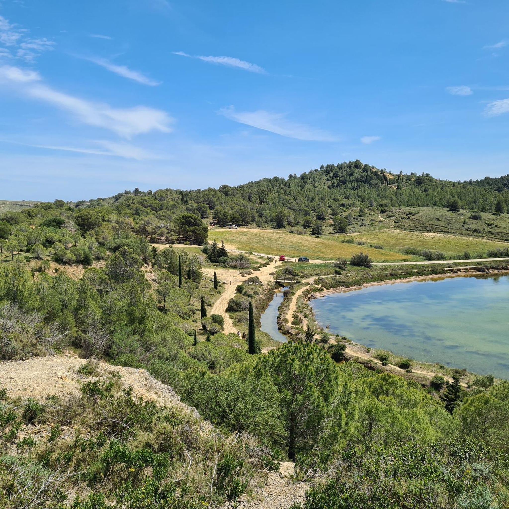
Gravel biking around Peyriac-De-Mer features a diverse landscape characterized by its unique lagoon environment, including the Étang du Doul and former salt flats. The terrain transitions from flat, scenic routes along wooden boardwalks and coastal areas to vineyards and rolling hills. This varied topography provides a range of gravel routes suitable for different fitness levels.
Best gravel bike trails around Peyriac-De-Mer
- The most popular gravel bike trail is Ayrolle Pond – Gruissan Lagoon loop from Sigean, a 21.8 miles…
Last updated: October 6, 2026
4.7
(7)
56
riders
35.1km
01:57
30m
30m
Easy gravel ride. Great for any fitness level. Mostly paved surfaces. Suitable for all skill levels.
5.0
(1)
20
riders
42.7km
03:02
540m
540m
Hard gravel ride. Very good fitness required. Mostly paved surfaces. Suitable for all skill levels.

5.0
(1)
26
riders
21.1km
01:14
70m
70m
Easy gravel ride. Great for any fitness level. Mostly paved surfaces. Suitable for all skill levels.
4.4
(5)
22
riders
22.0km
01:22
220m
220m
Moderate gravel ride. Good fitness required. Mostly paved surfaces. Suitable for all skill levels.
4.7
(3)
15
riders
28.1km
01:31
50m
50m
Easy gravel ride. Great for any fitness level. Mostly paved surfaces. Suitable for all skill levels.
Get access to more routes and recommendations from other explorers.
Already have an account?
Our route recommendations are based on thousands of hikes, rides, and runs completed by other people on komoot.
Start today with a free account
Your next adventure awaits.
Tips from the Community

A very scenic route between the waters, which is better avoided in rain or on wet ground.
0
0

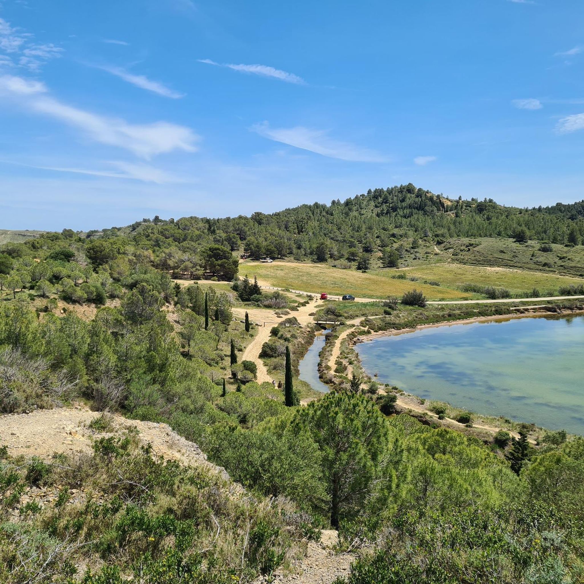
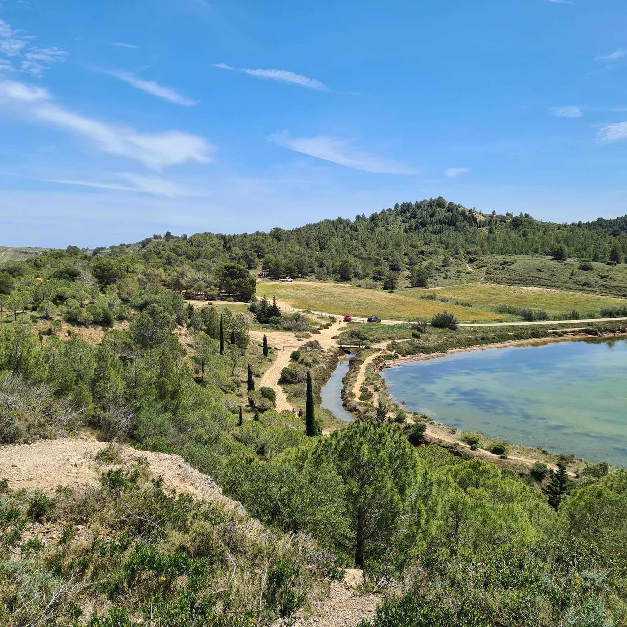
At the end of the island of Saint-Martin, on the edge of the Ayrolle pond, a few huts grouped around a small harbor form a surprising fishing village. Far from the hustle and bustle of the tourist coast, the place has retained a vocation directly linked to the pond: Gruissan fishermen still practice traditional fishing there and sell part of their catch directly.
2
0
On the edge of the Ayrolle pond, a few huts grouped around a small harbor form an astonishing fishing village. Far from the hustle and bustle of the tourist coast, the place has retained a vocation directly linked to the pond: fishermen from Gruissan still practice traditional fishing there and sell part of their catch directly.
2
0
The Salins de Saint-Martin are a remarkable example of a landscape shaped by salt exploitation. Salt marshes have been attested in Gruissan since the Middle Ages, but the current facilities were established at the beginning of the 20th century: the Société des salins de l’île Saint-Martin was created in 1911-1912. For several decades, the salt activity supported many families from Gruissan.
2
0
Dominating the old village, the Tour Barberousse is the main vestige of the former fortified castle of Gruissan. A first fortification is attested as early as 1084, but the current tower belongs to the development of the castle in the 13th century: a document from 1247 mentions the construction of a tower near the entrance, which would be the one preserved today. The name "Barberousse" is, however, more recent and its origin remains uncertain. One should not see in it the trace of a passage of the famous Ottoman corsair Khayr ad-Dîn Barberousse, who died in 1546, long after the construction of the tower. The Heritage Inventory rather suggests a possible confusion with Gaspard Dot, known as "Barbe Roussette" or "Barberousse", a corsair active in the Gulf of Lion at the end of the 16th century.
2
0
Here, we reach the spot where the Canal Sainte-Marie flows into the Gruissan pond. The waters of the canal then mix with those of the lagoon, which have a higher salinity due to the exchange with the sea. On the other side of the pond, the Barberousse Tower reveals itself on its limestone promontory. Built between 1245 and 1247 by the Archbishop of Narbonne, Guillaume de Broa, this tower is the main remnant of the medieval castle that guarded the maritime access to the Narbonne area.
2
0
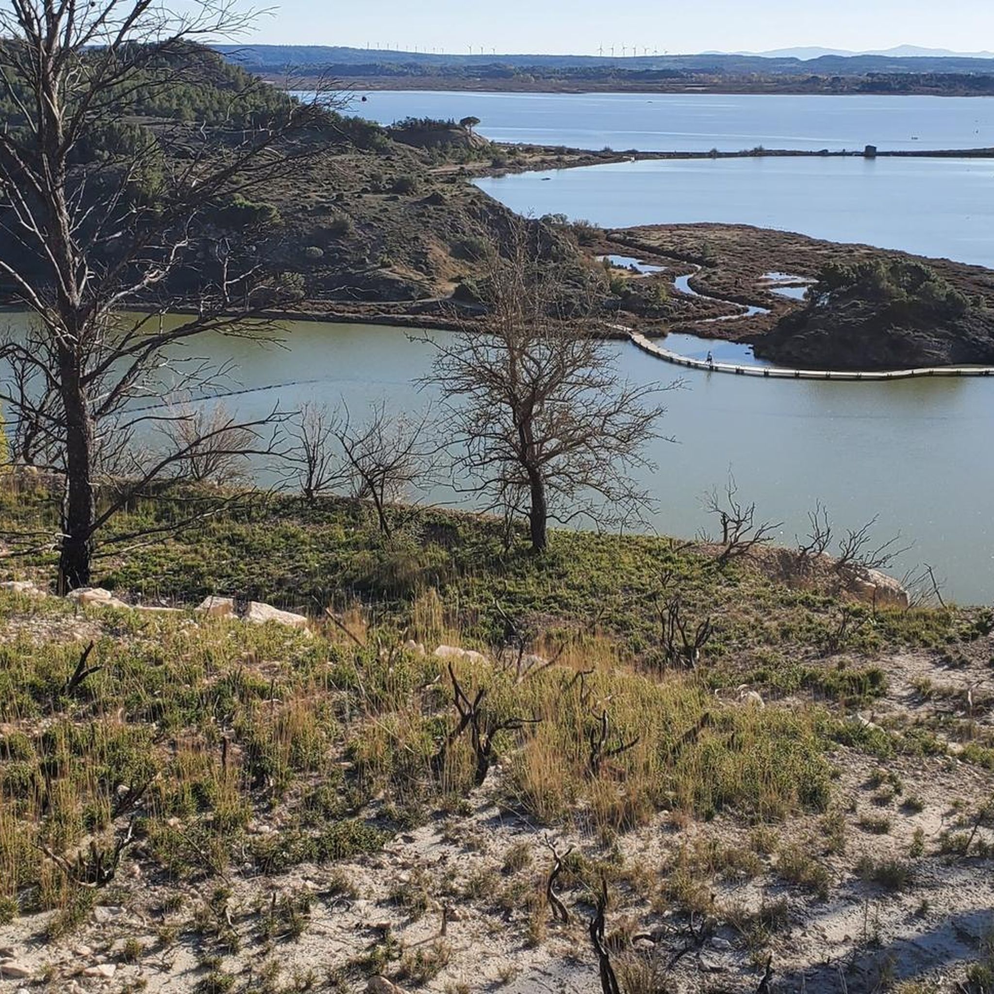
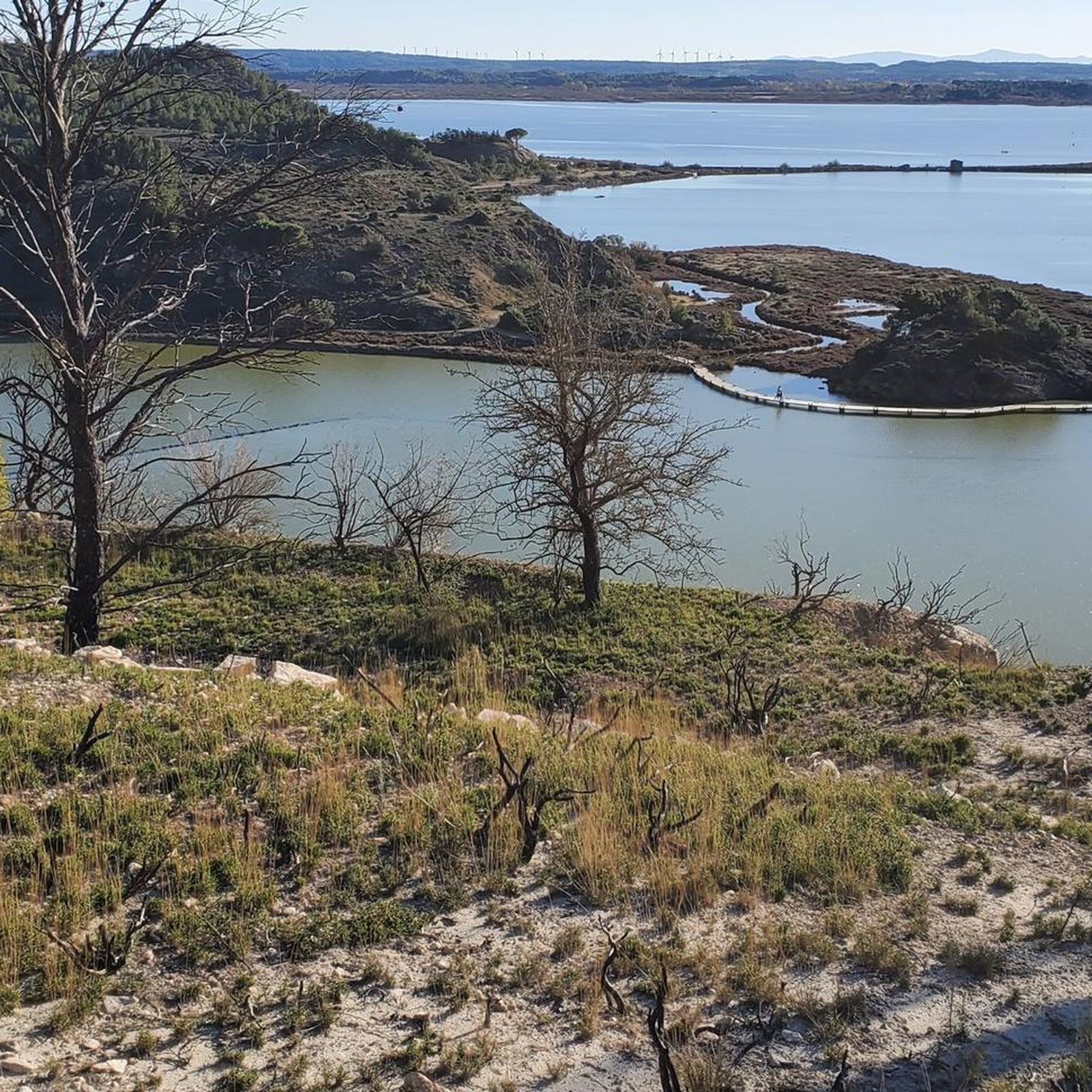
From this narrow strip of land, the lagoon landscape of Gruissan reads almost like a succession of parallel bands: the wetlands and secondary ponds to the south, the path, the Sainte-Marie canal, then the Gruissan pond to the north. The Sainte-Marie canal bears witness to the former hydraulic development of the coastal plain. Integrated into a network of canals intended to manage its waters, it notably participated in the draining of the former salt pond. Today, it contributes to the freshwater supply of the Gruissan pond and thus participates in the salinity variations of the lagoon. Beyond the pond, the reliefs of Gruissan and the Barberousse Tower stand out on the horizon.
2
0
From the pond of Gruissan, there is a wide panorama of the village and the Tour Barberousse. The current tower, built between 1245 and 1247 by the archbishop of Narbonne, Guillaume de Broa, is the main remnant of a medieval castle that guarded the maritime access to the Narbonne area.
2
0
Frequently Asked Questions
What kind of terrain can I expect on gravel bike trails around Peyriac-de-Mer?
The terrain around Peyriac-de-Mer is quite varied. You'll find flat, scenic routes along wooden boardwalks and former salt flats, as well as paths through vineyards and rolling hills. This mix offers both gentle rides and more challenging ascents.
Are there any easy gravel bike routes suitable for beginners or families?
Yes, there are several easy routes. For a gentle ride, consider the Fishermen's Cabins and Harbor – Gruissan Lagoon loop from Gruissan, which is 21.5 km long and takes you through coastal landscapes. Another easy option is the Natural salt – La Littorale Coastal Route loop from Peyriac-de-Mer, covering 15.5 km.
Where can I find challenging gravel bike trails with significant elevation gain?
For a more demanding ride, the Gruissan Lagoon – Panorama of Gruissan loop from Gruissan is an excellent choice. This 42.7 km route features over 540 meters of elevation gain, offering panoramic views of the region and requiring good fitness.
What natural features or wildlife can I see along the gravel routes?
The region is known for its unique lagoon environment, including the Étang du Doul and former salt flats. You can often spot pink flamingos, wild ducks, Black-winged Stilts, and Little Egrets, especially along the wooden boardwalks traversing the ancient saltworks. The highly saline water of the Doul lagoon even allows for swimming.
Are there any viewpoints or scenic spots along the gravel bike trails?
Absolutely. Many routes offer stunning views, particularly from the hills. The hill of Mour, for instance, provides incredible 360° views of the lagoons, the sea, and distant mountains. The Panorama of Gruissan is a notable highlight offering expansive vistas.
What do other gravel bikers say about the trails in Peyriac-de-Mer?
The gravel biking routes around Peyriac-de-Mer are highly rated by the komoot community, with an average score of 4.5 stars from over 40 reviews. Riders often praise the diverse landscapes, from coastal paths and salt flats to vineyard trails, and the variety of options for different ability levels.
Are there any historical landmarks or attractions near the gravel routes?
Yes, there are several interesting historical sites nearby. You could explore the Archbishops' Palace of Narbonne or the ruins of Château de Montséret. The region also features other castles like Château du Lac.
Can I find routes that are primarily loops around Peyriac-de-Mer?
Many of the gravel routes in the area are designed as loops, allowing you to start and finish in the same location. Examples include the Ayrolle Pond – Gruissan Lagoon loop from Sigean and the Étang du Doul – La Littorale Coastal Route loop from Réveillon.
What is the best season for gravel biking in Peyriac-de-Mer?
While specific trail conditions can vary, the region's Mediterranean climate generally makes spring and autumn ideal for gravel biking, offering pleasant temperatures and less crowded trails. Summer can be warm, but coastal breezes often provide relief.
Are there any routes that pass by the Étang du Doul?
Yes, the Étang du Doul is a prominent feature of the local landscape. The Étang du Doul – La Littorale Coastal Route loop from Réveillon is a great option that takes you directly past this unique lagoon.
How many gravel bike routes are available in the Peyriac-de-Mer area?
There are over 25 gravel bike routes available around Peyriac-de-Mer, catering to various skill levels. This includes 7 easy routes, 18 moderate routes, and 4 more challenging options.
Most popular routes around Peyriac-De-Mer
Most popular attractions around Peyriac-De-Mer

Get inspired with the komoot mobile app


Explore more
Browse the best Gravel rides in other regions.
