The best gravel rides around Saint-Pardoux-La-Croisille
5.0
(1)
4
riders
5
rides
Gravel biking around Saint-Pardoux-La-Croisille offers a varied landscape characterized by extensive forests, hilly terrain, and the presence of significant water bodies. The region, situated in the Corrèze department, features altitudes ranging from 424 to 564 meters, providing a mix of climbs and descents suitable for gravel routes. Granitic stone is prevalent, influencing both the natural landscape and traditional architecture, adding a rugged aesthetic to the trails. This area also serves as a gateway to the Gorges de la Dordogne, suggesting…
Last updated: May 21, 2026
3
riders
48.1km
03:11
610m
610m
Hard gravel ride. Very good fitness required. Mostly paved surfaces. Suitable for all skill levels.
5.0
(1)
3
riders
31.5km
02:14
370m
370m
Moderate gravel ride. Good fitness required. Mostly paved surfaces. Suitable for all skill levels.

Sign up for free
18.0km
01:20
210m
210m
Moderate gravel ride. Good fitness required. Mostly paved surfaces. Suitable for all skill levels.
1
riders
20.7km
01:21
190m
190m
Moderate gravel ride. Good fitness required. Mostly paved surfaces. Suitable for all skill levels.
2
riders
36.8km
02:53
760m
760m
Hard gravel ride. Very good fitness required. Mostly paved surfaces. Suitable for all skill levels.
Our route recommendations are based on thousands of hikes, rides, and runs completed by other people on komoot.
Start today with a free account
Your next adventure awaits.
Login or Signup


Tips from the Community

This bridge marks the break between the peaceful Doustre River, which meanders through pastures, and the entrance to a much deeper valley. The rock supporting the cross always seems precariously balanced.
0
0

Flat parking area with available restrooms. Beautiful pond with paths and footbridges around it. Several hiking trails start from the parking area.
0
0

The Roc de Busatier offers one of the most beautiful panoramic views in the Dordogne Gorges. The climb offers challenges for hikers while rewarding them with breathtaking views. The location remains a favorite among nature lovers.
1
0

A water tank east of Lafage-sur-Sombre, along the D146, in a wooded area. A nearby stream provided water for the Tulle-Ussel tramway. This tank has been preserved and restored.
0
0

The Roc de Busatier is one of the most breathtaking views in the Dordogne Gorges. In addition to the viewpoint, you can find a shaded picnic area there. It's the perfect place to stop for a break during your hike.
1
0


Eyrin has an SNCF station served by RER trains. The town also has a beautiful fountain, a listed church and a bar.
0
0

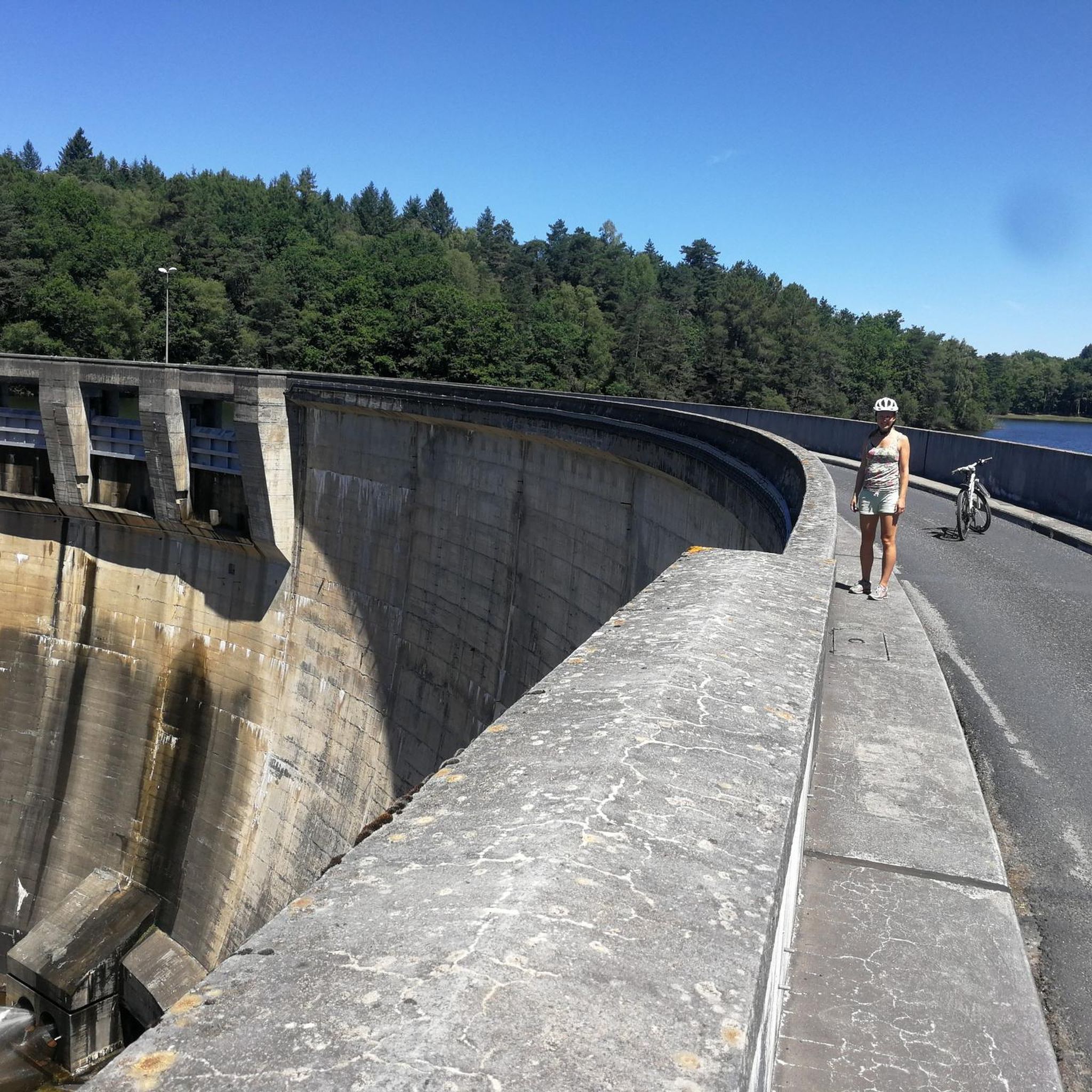
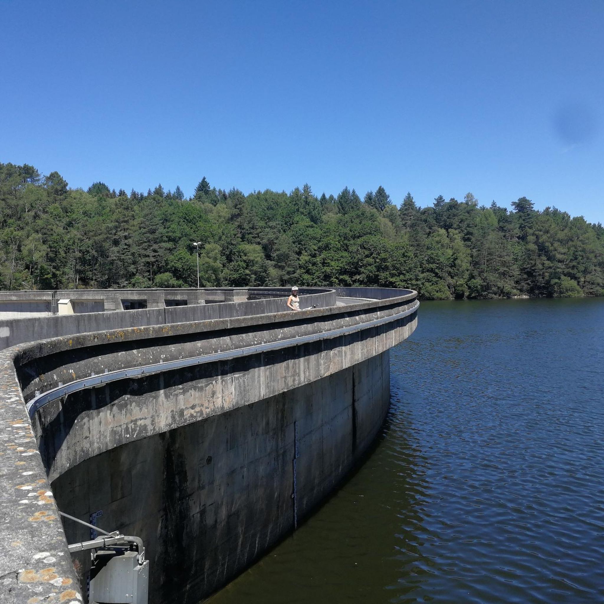
Nice dam near Saint Pradoux with a view of the artificial lake. It was created by the construction in 1949 of the Valette dam located in the town of St Pardoux-la-Croisille on the river Doustre.
1
0
Frequently Asked Questions
What kind of terrain can I expect on gravel bike trails around Saint-Pardoux-La-Croisille?
The region offers a varied landscape with over 60% covered by forests and altitudes ranging from 424m to 564m, meaning you'll encounter a mix of climbs and descents. The trails often feature resistant granitic stone, adding a rugged aesthetic, and many routes pass by significant water bodies like the Doustre river and Lac de la Valette.
Are there any family-friendly gravel biking options in Saint-Pardoux-La-Croisille?
While specific 'easy' family routes aren't highlighted, the region's gravel trails are generally considered moderate. These routes often wind through forests and along historical paths, providing a pleasant experience for families comfortable with some varied terrain. Always check the route details for elevation and distance to ensure it suits your family's ability.
What are some notable natural features or viewpoints I can see while gravel biking here?
You can enjoy picturesque scenery along the Doustre river and Lac de la Valette. The area is also a gateway to the Gorges de la Dordogne, offering dramatic landscapes. Specific highlights include the impressive Chastang Dam viewpoint and Pont vue cascades 1, known for its turbulent torrent and photographic opportunities.
Are there any circular gravel bike routes available?
Yes, several routes are designed as loops. For example, the Château de Sédières – Viewpoint loop from Clergoux offers views towards the Château de Sédières, and the Etang de la Chèze loop from Lallé circles the Etang de la Chèze, providing waterside scenery.
What kind of historical or cultural landmarks can I discover on a gravel bike ride?
The commune is rich in 'petit patrimoine' (small heritage) elements. You might encounter historical washhouses, bread ovens, chestnut dryers, wells, and mills scattered throughout the villages. The area also features a 10th-century Romanesque church and a 12th-century castle, with traditional architecture built from massive granite stones adding character to your rides.
What is the best time of year for gravel biking in Saint-Pardoux-La-Croisille?
Spring is particularly vibrant, with the landscape adorned by 'the purple of the heather, the gold of the gorse, and the green of the ferns,' making it a beautiful time to ride. The varied terrain and forest cover make it enjoyable through much of the year, but checking local weather forecasts is always recommended for optimal conditions.
How many gravel bike trails are there in Saint-Pardoux-La-Croisille?
There are at least 3 dedicated gravel bike trails around Saint-Pardoux-La-Croisille listed on komoot, all offering moderate difficulty. These routes showcase the region's diverse landscape of forests, hills, and water bodies.
What are the typical distances and durations for gravel bike routes in this area?
The gravel routes in Saint-Pardoux-La-Croisille typically range from about 18 km to 21 km in distance. You can expect to spend between 1 hour 20 minutes and 1 hour 40 minutes completing these moderate trails, depending on your pace and stops.
Are there any waterfalls or significant water features to see?
Yes, the region is home to several beautiful water features. You can visit the Cascades de Gimel, a notable waterfall, and the picturesque Pont vue cascades 1, known for its tumultuous torrent.
What is the difficulty level of gravel biking trails in Saint-Pardoux-La-Croisille?
The gravel biking trails in this area are generally classified as moderate. They feature a mix of climbs and descents due to the hilly terrain, making them suitable for riders with some experience looking for an engaging ride through varied landscapes.
What do other gravel bikers say about the trails in Saint-Pardoux-La-Croisille?
While the komoot community is still growing in this specific area, the existing routes are appreciated for showcasing the best of the region's landscape, including dense forests, rolling hills, and paths that often pass by lakes and rivers. Riders enjoy the varied terrain and the scenic beauty of the Corrèze region.
Most popular routes around Saint-Pardoux-La-Croisille
Most popular attractions around Saint-Pardoux-La-Croisille

Get inspired with the komoot mobile app


Explore more
Browse the best Gravel rides in other regions.
