The best gravel rides around Breitenbach-Haut-Rhin
4.2
(50)
376
riders
36
rides
Gravel biking around Breitenbach-Haut-Rhin offers diverse terrain within the Regional Natural Park of Ballons des Vosges. The region is characterized by the Vosges Mountains, featuring significant peaks and mountain passes, alongside extensive forests and varied elevation changes. This landscape provides a range of gravel bike routes suitable for different skill levels, from challenging ascents to scenic trails through preserved natural environments.
Best gravel bike trails around Breitenbach-Haut-Rhin
- The most popular gravel bike trail is Munster Protestant Church – Munster loop…
Last updated: October 6, 2026
4.3
(12)
105
riders
46.3km
02:48
480m
480m
Hard gravel ride. Very good fitness required. Mostly paved surfaces. Suitable for all skill levels.
3.0
(1)
39
riders
59.5km
04:26
1,360m
1,360m
Hard gravel ride. Very good fitness required. Mostly paved surfaces. Suitable for all skill levels.

4.3
(3)
9
riders
33.2km
02:47
940m
940m
Hard gravel ride. Very good fitness required. Mostly paved surfaces. Suitable for all skill levels.
4.7
(3)
30
riders
49.2km
03:27
1,150m
1,150m
Hard gravel ride. Very good fitness required. Mostly paved surfaces. Suitable for all skill levels.
3
riders
23.0km
02:27
710m
710m
Hard gravel ride. Very good fitness required. Mostly paved surfaces. Suitable for all skill levels.
Get access to more routes and recommendations from other explorers.
Already have an account?
Our route recommendations are based on thousands of hikes, rides, and runs completed by other people on komoot.
Start today with a free account
Your next adventure awaits.
Tips from the Community

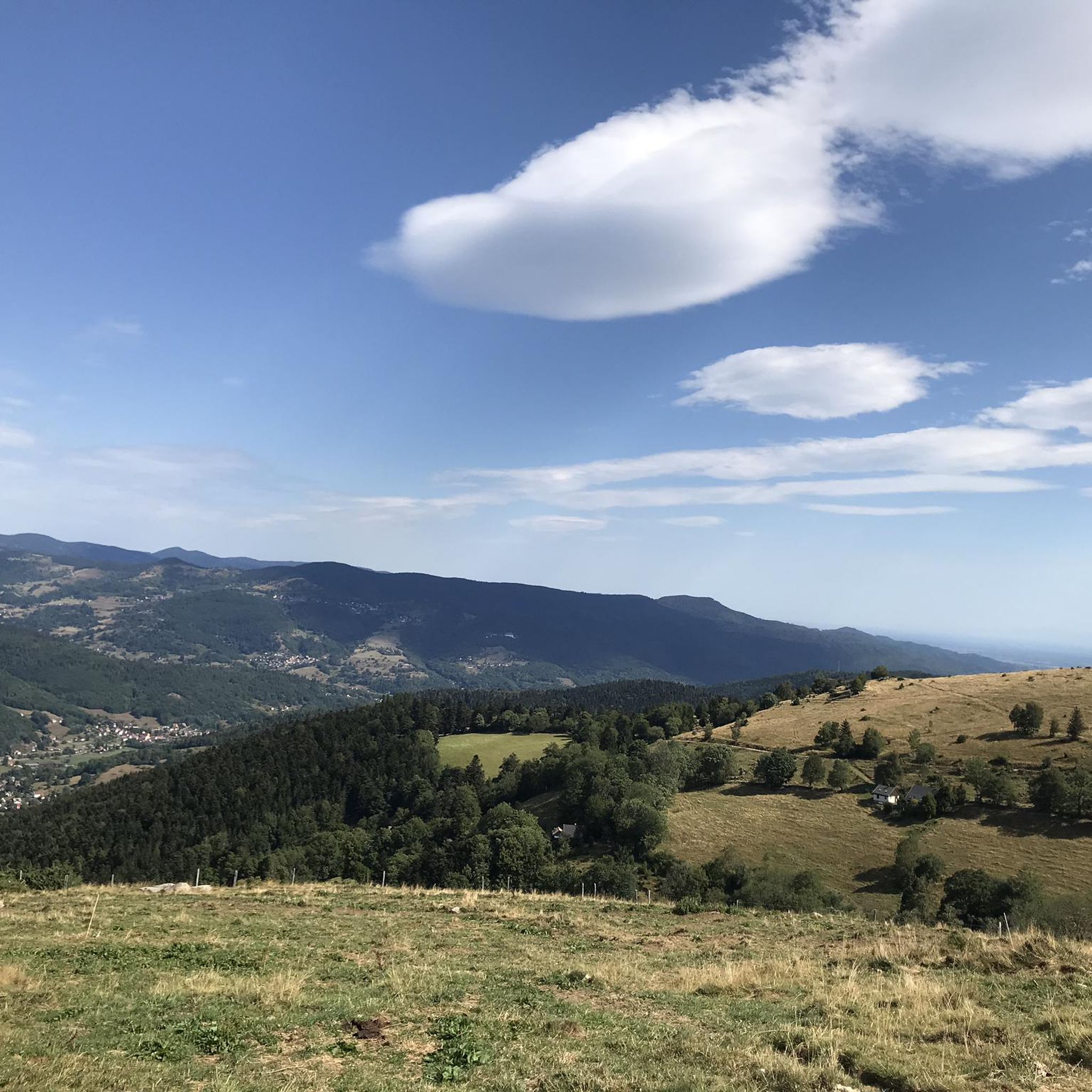
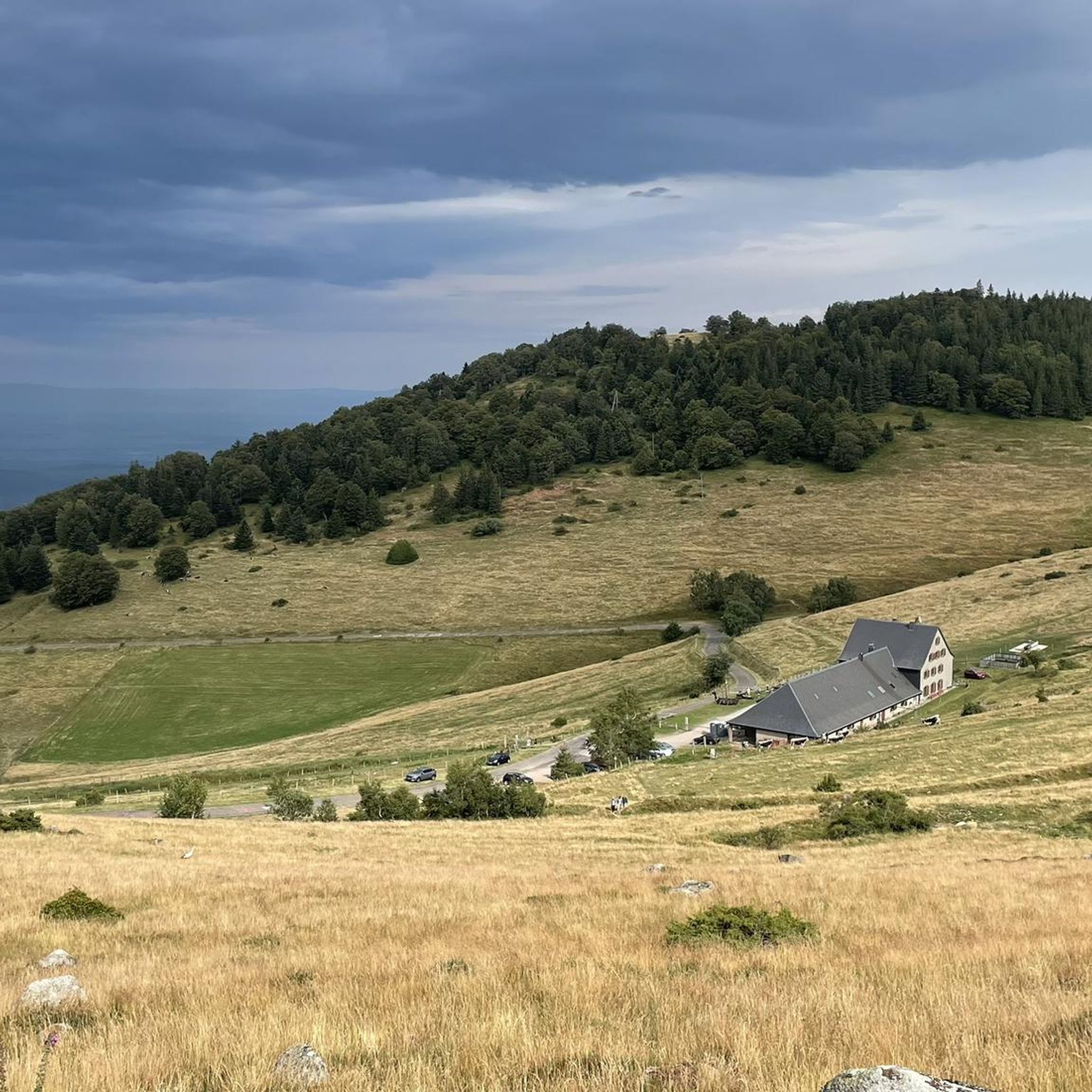
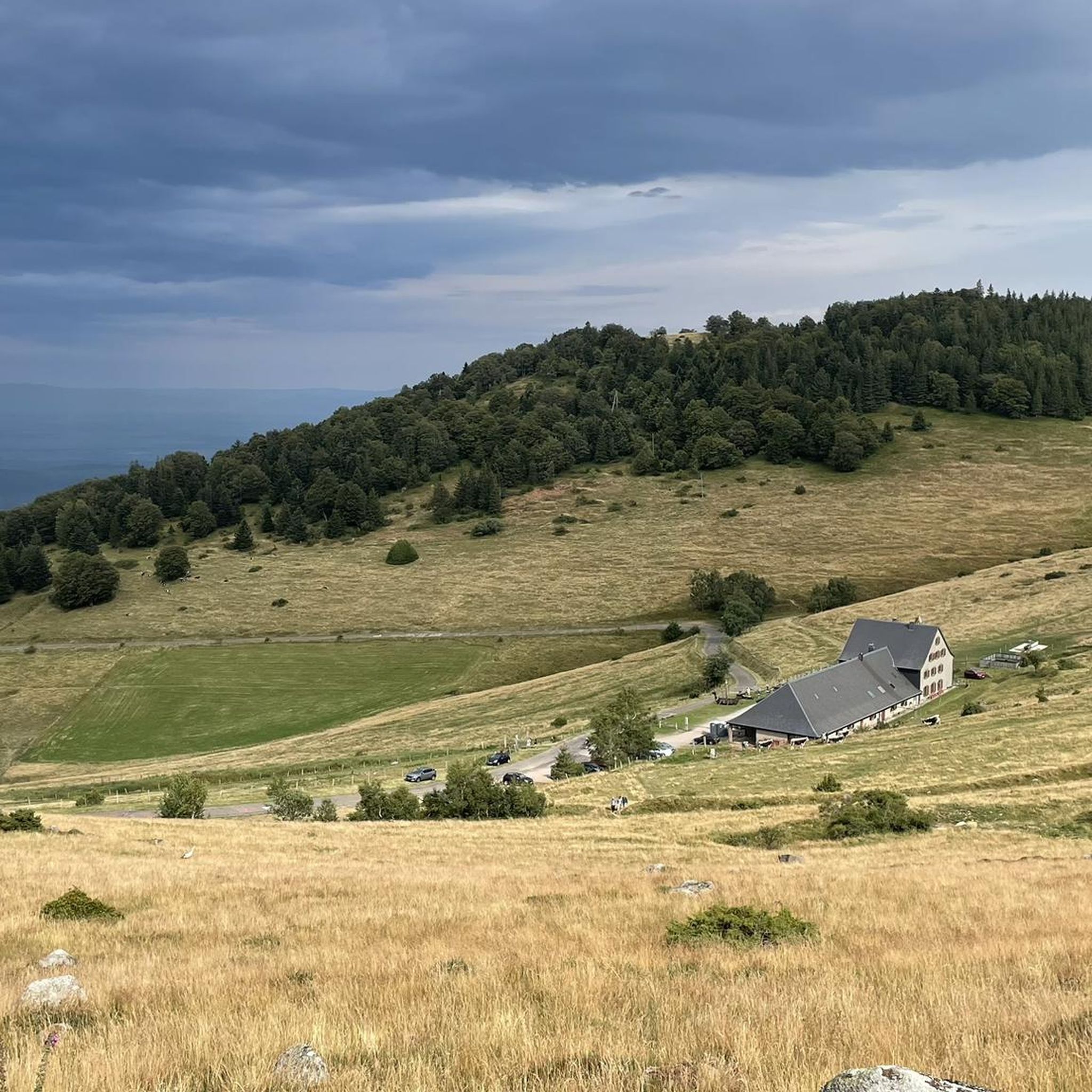
The Ferme-Auberge du Haag is a traditional mountain inn located near the Col du Haag (1233 m), at the foot of the Grand Ballon. For generations, the farms on the higher Vosges ridges have been welcoming hikers, cyclists, and winter sports enthusiasts. The Haag farm is situated in the middle of mountain pastures, with a beautiful view over the southern Vosges and the Grand Ballon.
6
0
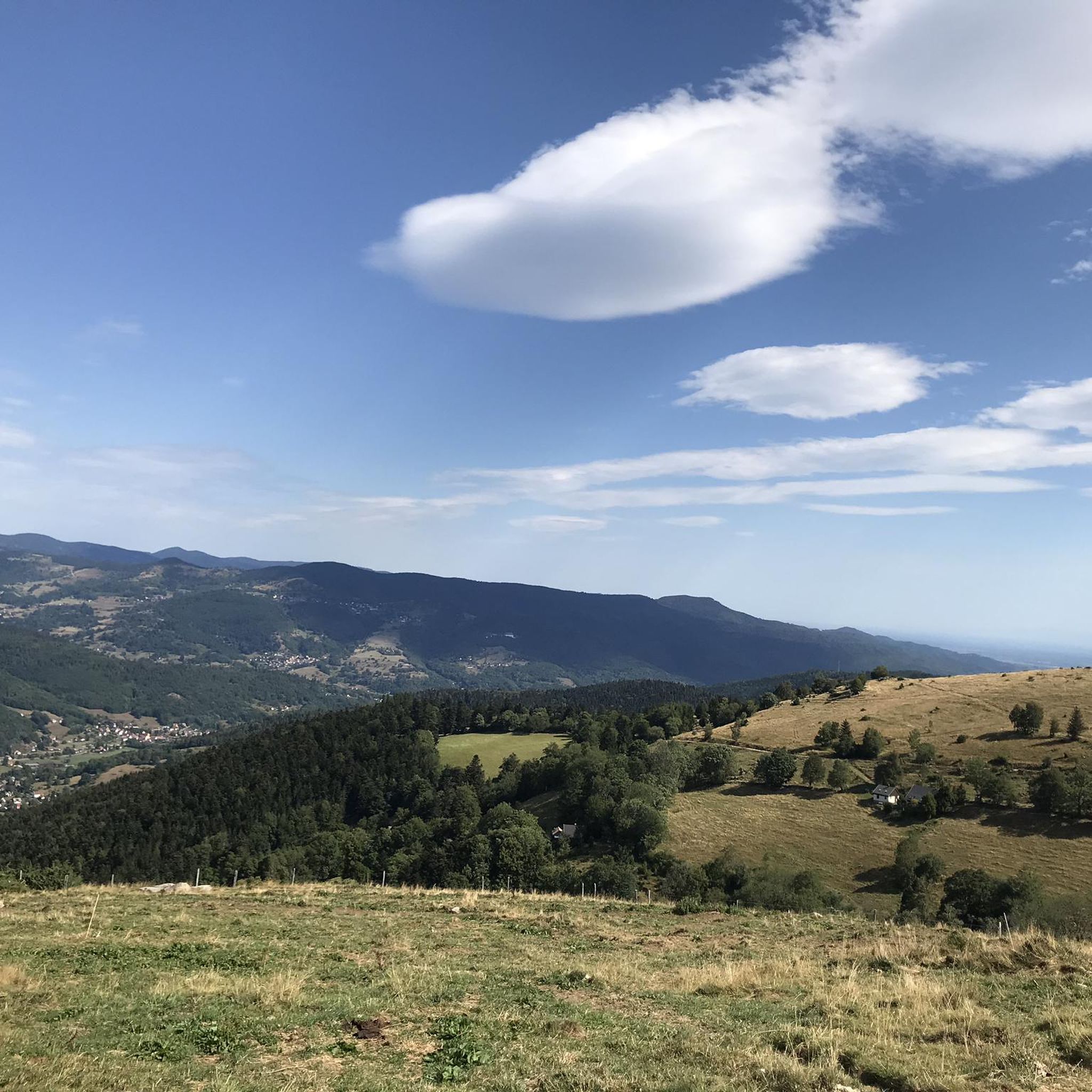
When you drive from the Route des Crêtes towards Le Grand Ballon, you pass the Col du Haag (1233 m) almost unnoticed. Yet, this pass marks a special point on the southern flank of the highest mountain in the Vosges. Here, steep roads from the Thurdal leave the wooded slopes and reach the open heights of the massif. From the col, a typical Vosges landscape unfolds with mountain meadows, scattered farms, and sweeping views. The proximity of the Grand Ballon is felt everywhere: the imposing summit towers above the pass and forms the natural goal of the final climbing kilometers. For cyclists, the Col du Haag is mainly known as the point where difficult climbs from the valleys converge before the road continues to rise to the highest point of the Vosges.
6
0
Le Markstein (1184 m) is meer dan alleen een kruispunt op de Route des Crêtes. Het is echter een echte bergpas en het hoogste punt van de oversteek tussen het Lauch- en Thurdal. Het ligt in het hart van het Vogezenmassief, midden een populair wintersportgebied dat nauw verbonden is met de Grand Ballon
6
0
The Route des Crêtes (from the D430 near Rothenbach) is one of the most beautiful ridge roads in Europe. The road was originally built in 1914 by the French army to supply the troops at the front during World War I. Today, it is an iconic panoramic route that connects the main peaks of the Vosges.
1
0
This view is even more beautiful if you have climbed via the Col de Bramont to the col du Rodenbach. So recognizable.
6
0
The Route des Crêtes (the D430 near Rothenbach) is one of the most beautiful ridge routes in Europe. The road was originally built in 1914 by the French army to supply troops at the front in World War I. Today, it is an iconic panoramic route that connects the main peaks of the Vosges.
6
0
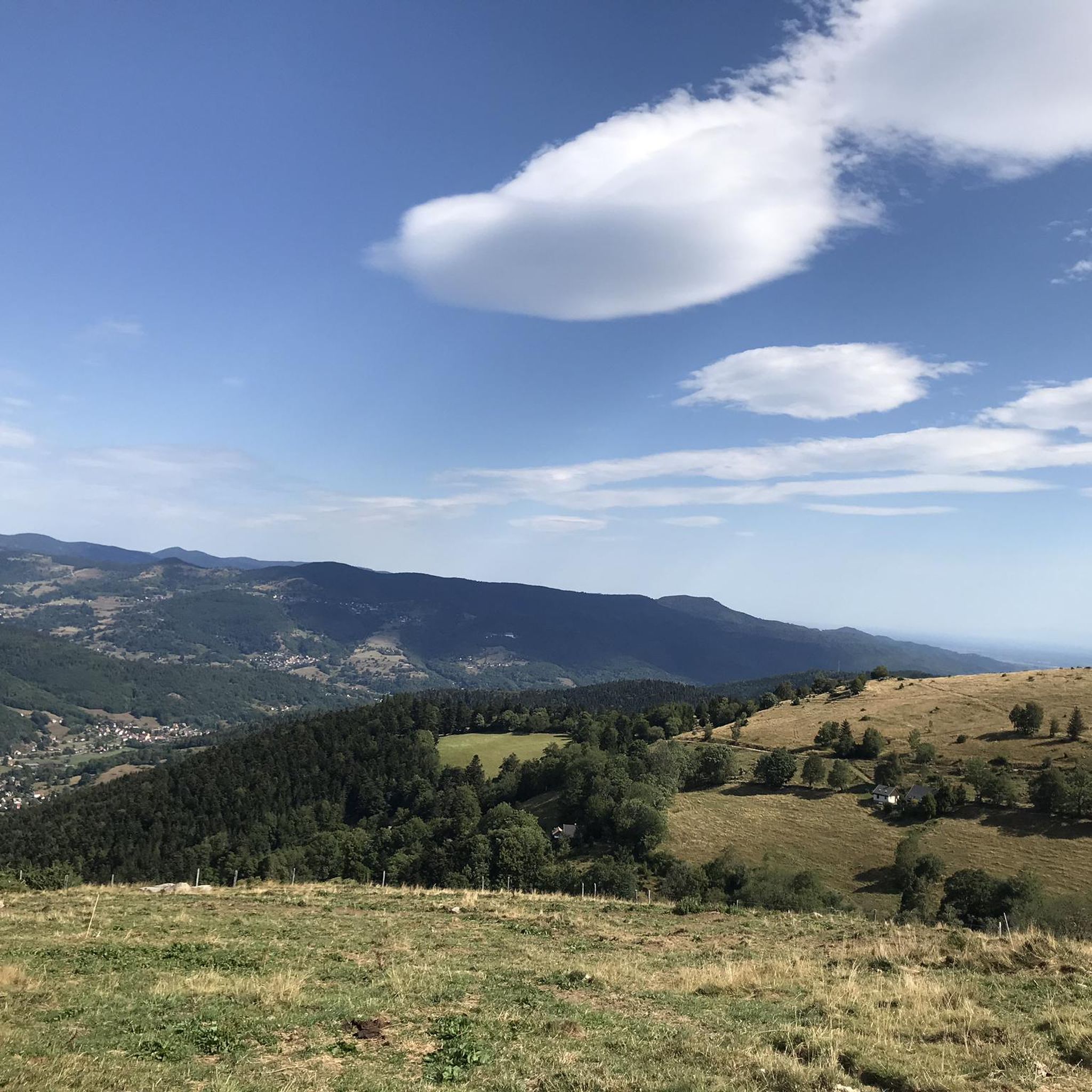
The highlight is on the Route des Crêtes and concerns the Rothenbach pass at 1210m. The kopf is still 100 m higher (1316 m). The Rothenbach pass is located on an open mountain saddle in the High Vosges, just below the Rothenbachkopf (1316 m). The pass is around 1210 meters high and forms a natural transition between the ridges of the Rainkopf and the Batteriekopf. The landscape consists of wide, treeless mountain meadows (chaumes) created by centuries of grazing and the harsh climate at this altitude. From the pass, you have a panoramic view of the Mittlach valley, the Hohneck, and the long ridges of the Ballons massif. Very beautiful pass with those bare expanses.
6
0
The Col du Rothenbach is a 5-kilometer climb. This is a category 2 climb. The average gradient of this climb is 6.6% with a maximum of 9%. The Col du Rothenbach rises from 903 meters at the start to 1,234 meters at the top, with a total of 331 meters of elevation gain.
7
0
Frequently Asked Questions
How many gravel bike trails are available around Breitenbach-Haut-Rhin?
There are over 40 gravel bike routes in the Breitenbach-Haut-Rhin area, catering to various skill levels. These trails traverse the diverse landscape of the Regional Natural Park of Ballons des Vosges, offering everything from moderate rides to challenging ascents.
What kind of terrain can I expect on gravel bike trails in Breitenbach-Haut-Rhin?
The terrain around Breitenbach-Haut-Rhin is characterized by the Vosges Mountains, dense forests, and varied elevation changes. You'll encounter challenging ascents, scenic trails, and paths through traditional villages, often with significant elevation gain. The region is well-suited for gravel biking, with routes that require good to very good fitness and advanced riding skills for the more difficult sections.
Are there any natural landmarks or attractions to see along the gravel bike trails?
Yes, the region is rich in natural beauty. You can find stunning viewpoints and serene lakes. For example, Lac Blanc and Black Lake are notable natural monuments that enhance the scenic beauty of the area.
Are there any waterfalls accessible from the gravel bike routes?
Yes, the area features several beautiful waterfalls. You might encounter the Waterfall on Sentier des Roches, Heidenbad Waterfall, or the Charlemagne Waterfall, among others, providing picturesque spots to pause during your ride.
What do other gravel bikers enjoy most about the trails in Breitenbach-Haut-Rhin?
The komoot community highly rates the gravel biking experience here, with an average score of 4.3 stars from over 50 reviews. Riders often praise the diverse terrain, the challenging ascents, and the preserved natural scenery within the Regional Natural Park of Ballons des Vosges.
Are there any circular gravel bike routes available?
Many routes in the area are designed as loops. For instance, the Munster Protestant Church – Munster loop from Munster is a popular moderate route, and the La route des crêtes – The ridge road loop from Metzeral offers a more challenging experience along ridge roads.
What are some options for more challenging gravel bike rides?
For experienced gravel bikers seeking a challenge, routes like the Munster – Munster Protestant Church loop from Muhlbach-sur-Munster are ideal. This difficult 58.6 km path features significant elevation gain, traversing forests and offering views of traditional villages. Another demanding option is the Haag Pass – Markstein loop from Mittlach.
Can I find routes that go through mountain passes?
Yes, the Vosges Mountains are known for their mountain passes. The La route des crêtes – The ridge road loop from Metzeral specifically leads through mountain passes and along ridge roads, offering panoramic views. The Pinot Bend – Col de Petit Ballon Pass loop from Mittlach also includes a significant pass.
Is Breitenbach-Haut-Rhin suitable for beginner gravel bikers?
While many routes are challenging, there are options for beginners. The region offers a range of difficulty levels, including some easier trails. It's advisable to check the route details on komoot for specific difficulty ratings and elevation profiles to find a suitable path.
What is the best time of year to go gravel biking in Breitenbach-Haut-Rhin?
The region is generally best for gravel biking from spring through autumn. During these seasons, the weather is more favorable, and the trails are typically in good condition. The lush forests and mountain views are particularly enjoyable during these months.
Are there any cultural or historical sites near the gravel trails?
Beyond the natural landscape, the area offers historical insights. You can find ruins of castles such as Château d'Andlau, Château de Bernstein, and Château de l'Ortenbourg, which provide impressive panoramic views and a glimpse into the region's past. Charming towns like Munster and Colmar are also nearby for cultural excursions.
Are there opportunities for family-friendly activities in the area besides gravel biking?
Yes, for family fun, Parc Alsace Aventure at the Col du Kreuzweg offers forest-based activities like accrobranche (tree-top adventure courses), giant ziplines, paintball, and laser tag, suitable for all ages.
Most popular routes around Breitenbach-Haut-Rhin
Most popular attractions around Breitenbach-Haut-Rhin

Get inspired with the komoot mobile app


Explore more
Browse the best Gravel rides in other regions.
