The best gravel rides around Parco naturale regionale di Piana Crixia
5.0
(1)
10
riders
3
rides
Gravel biking around Parco naturale regionale di Piana Crixia features a diverse landscape characterized by a mix of gentle, cultivated hills and rugged, eroded areas. The park is known for its distinctive "calanchi" (eroded gullies), which are unique geological formations providing a dramatic backdrop for rides. Routes often traverse through woods and along alluvial plains, offering varied ecosystems and a dynamic riding experience suitable for gravel bikes. The terrain includes both dramatic rock formations and cultivated hillsides, providing a rich…
Last updated: May 23, 2026
5
riders
39.5km
02:41
660m
660m
Hard gravel ride. Very good fitness required. Mostly paved surfaces. Suitable for all skill levels.
1
riders
28.7km
02:18
790m
790m
Hard gravel ride. Very good fitness required. Mostly paved surfaces. Suitable for all skill levels.

Sign up for free
5.0
(1)
1
riders
22.0km
01:46
600m
600m
Hard gravel ride. Very good fitness required. Mostly paved surfaces. Suitable for all skill levels.
3
riders
36.7km
03:00
1,100m
1,100m
Hard gravel ride. Very good fitness required. Mostly paved surfaces. Suitable for all skill levels.
Our route recommendations are based on thousands of hikes, rides, and runs completed by other people on komoot.
Start today with a free account
Your next adventure awaits.
Login or Signup
Popular around Parco naturale regionale di Piana Crixia
Tips from the Community

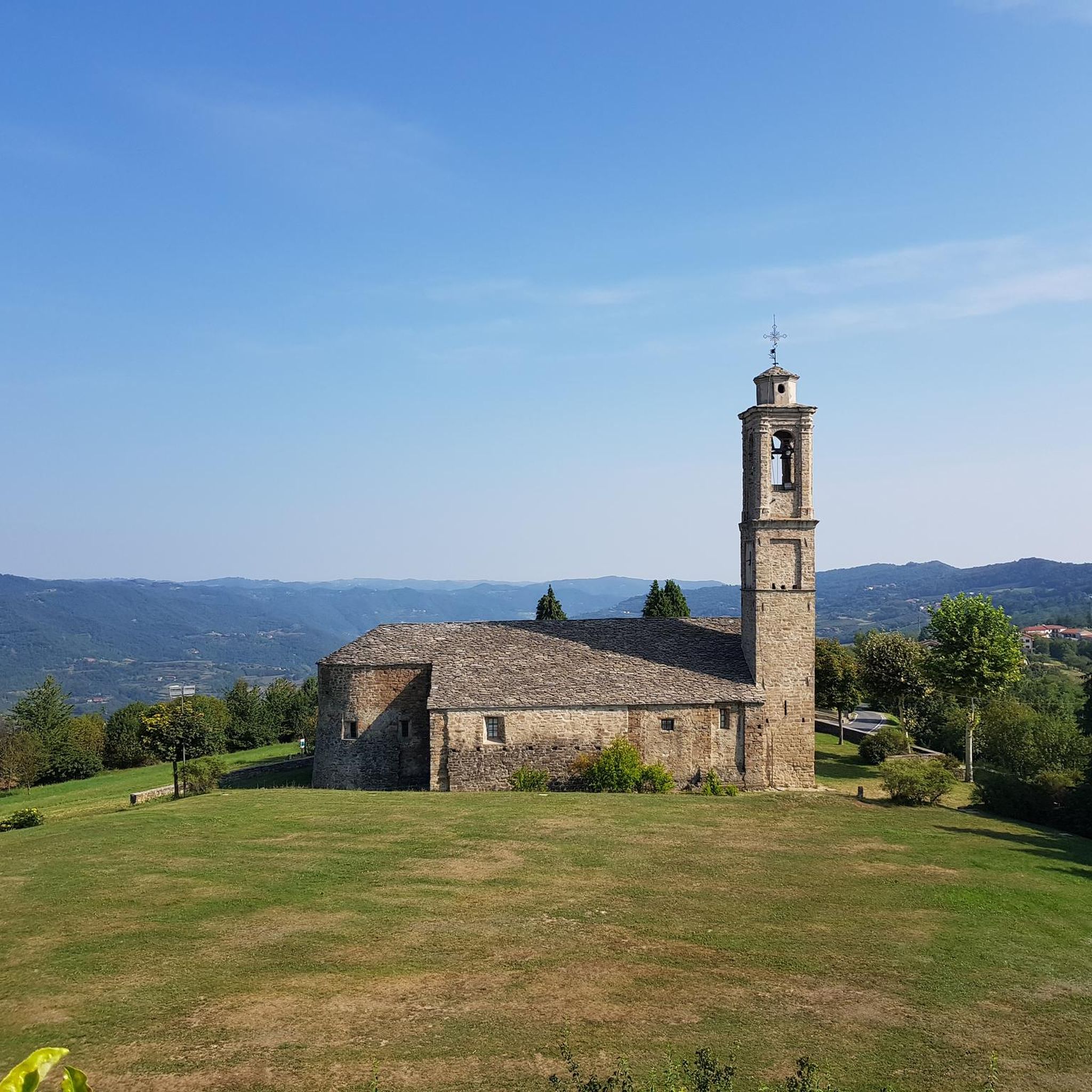
The Castle of Monastero Bormida was not originally built as a defensive structure but as a Benedictine monastery, founded around 1050 by monks from the Abbey of Fruttuaria, called by the Aleramici Marquises to reclaim the lands devastated by Saracen raids. The 27-meter tower still visible today was originally the bell tower, and the river flowing a few meters from the southern tower confirms the non-military nature of the building. In 1393, the Benedictines abandoned the monastery, and its feudal history began: the fief passed to the Del Carretto marquises, who in the 15th century added the first defensive structures, transforming it into a castle. The building is a quadrangular structure with an internal courtyard, protected by towers on multiple sides and connected to the former bell tower by a small suspension bridge. On the south facade, there is a two-arched Renaissance loggia with a small stone column. Inside, the rooms on the main floor—transformed in the 17th century—feature mosaic floors and sail and cross vaults with frescoes of floral and geometric motifs. The castle later passed to the Della Rovere family and subsequently to the Genoese Polleri family, finally becoming the property of the Municipality starting in 1880. Today it is open to visitors and is part of the regional circuit "Castelli Aperti".
0
0

The ROMANESQUE BRIDGE dates back to the 14th century. Through the characteristic Vicolo del Droc—where one of the city gates once stood and where the entrance to an ancient oven can still be seen—you reach the Romanesque bridge over the Bormida River, still in use. It represents one of the most interesting works of medieval civil engineering in the valley, and its counterpart, in Spigno, is the similar bridge at the Abbey of San Quintino. Both were built by Benedictine monks. It is a massive humpbacked structure with four spans. The Monastero bridge was the only one passable year-round from the lower valley: Acqui did not have one.
16
0
Exceptional view of Roccaverano.
6
0
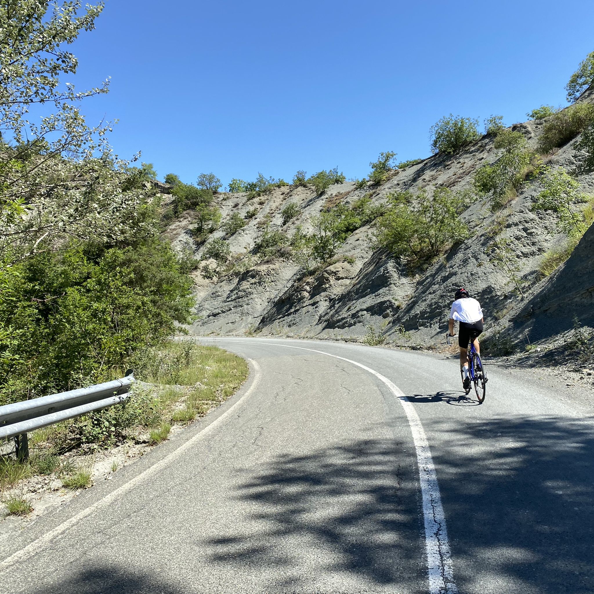
Beautiful climb with asphalt in good condition.
9
0

Serole is an Italian municipality of 97 inhabitants[1] in the province of Asti in Piedmont. It is located in the Langhe on the watershed between Bormida di Spigno and Bormida di Millesimo near the Rio Rigosio. It is the southernmost municipality in the province of Asti.
0
0

Beautiful old arched bridge.
3
1
Fountain with a great view.
18
0
Frequently Asked Questions
How many gravel bike trails are available in Parco naturale regionale di Piana Crixia?
Currently, there are 4 gravel bike routes detailed for Parco naturale regionale di Piana Crixia. These routes are generally considered difficult, offering a challenging experience for riders.
What kind of terrain can I expect on gravel bike trails in Parco naturale regionale di Piana Crixia?
The terrain in Parco naturale regionale di Piana Crixia is highly varied, featuring distinctive "calanchi" (eroded gullies) that create a unique, almost lunar-like landscape. You'll also find gentle hills, cultivated fields, and woodlands. Many trails are unpaved, offering true off-road gravel biking experiences without asphalt sections.
Are there any easy or beginner-friendly gravel routes in the park?
The gravel routes currently listed for Parco naturale regionale di Piana Crixia are all rated as difficult. Riders should be prepared for challenging elevation gains and varied surfaces. There are no easy or beginner-friendly routes specifically highlighted at this time.
What are some notable natural landmarks or points of interest along the gravel routes?
A prominent natural landmark in the area is the "Fungo di pietra," or Stone Mushroom, a 15-meter-tall geological formation. The unique "calanchi" (eroded gullies) also provide a dramatic backdrop for many rides. While not directly on a route, the park's diverse flora, including rare wild orchids in season, adds to the natural beauty.
What is the longest gravel bike route in Parco naturale regionale di Piana Crixia?
The longest gravel bike route available is the Pareto – Mioglia loop from Tenuta Squaneto, which covers approximately 39.5 km (24.5 miles) and typically takes around 3 hours and 15 minutes to complete.
Are there any circular gravel bike routes in the area?
Yes, all the listed gravel bike routes in Parco naturale regionale di Piana Crixia are designed as loops. For example, you can explore the Torre di San Giorgio Scarampi – Olmo Gentile 😍 loop from Serole, which offers panoramic sections through hilly terrain.
What is the best time of year for gravel biking in Parco naturale regionale di Piana Crixia?
The varied terrain and natural beauty of Piana Crixia make it suitable for gravel biking across multiple seasons. Spring and autumn generally offer pleasant temperatures and vibrant landscapes, with lavender fields blooming in warmer months. Winter riding is possible, but conditions may vary, especially in higher or more exposed areas.
What do other gravel bikers enjoy most about the routes in Parco naturale regionale di Piana Crixia?
The komoot community highly rates the gravel biking experience in Parco naturale regionale di Piana Crixia, with an average score of 5.0 stars. Riders often praise the unique geological formations like the "calanchi" and the extensive network of unpaved trails that provide a true off-road adventure.
Can I find routes that offer views of the surrounding countryside?
Absolutely. Routes like the Torre di San Giorgio Scarampi – Olmo Gentile 😍 loop from Serole lead through hilly terrain and offer panoramic sections. The area's position between the Langhe hills and the Bormida river valleys provides diverse vistas of cultivated fields and natural landscapes.
Are there any shorter, yet still challenging, gravel routes available?
For a challenging but slightly shorter option, consider the Tower of Roccaverano – Roccaverano loop from Roccaverano. This route is approximately 22 km (13.7 miles) long and takes about 1 hour and 46 minutes, offering a good workout in a compact timeframe.
Where can I find more information about the Parco naturale regionale di Piana Crixia region?
For additional information about the region and its offerings, you can visit the official tourism guide for the Riviera, which includes details on Piana Crixia: visitriviera.info.
Most popular routes around Parco naturale regionale di Piana Crixia

Get inspired with the komoot mobile app


Explore more
Browse the best Gravel rides in other regions.
