The best gravel rides around Trossingen
4.3
(36)
209
riders
47
rides
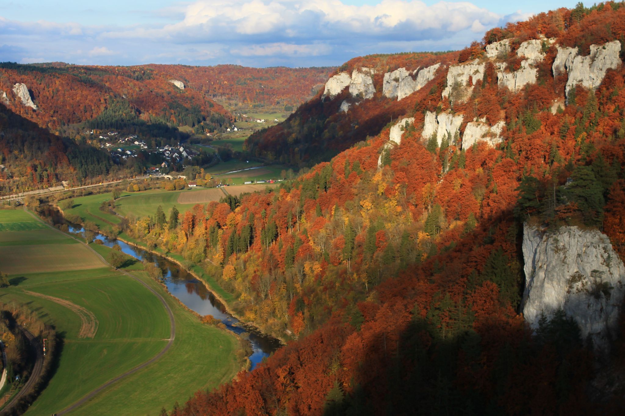
Gravel biking around Trossingen offers access to diverse landscapes at the edge of the Black Forest and the Swabian Alb. The region features rolling hills, extensive forests, and picturesque river valleys, providing varied terrain for off-road exploration. Riders can expect a mix of forest paths, open landscapes, and some paved sections, characteristic of the Baden-Württemberg area. The topography includes both challenging ascents and scenic stretches along rivers like the Brigach and near lakes such as Gaugersee.
Best gravel bike trails…
Last updated: October 6, 2026
4.5
(13)
54
riders
59.6km
03:22
630m
630m
Hard gravel ride. Very good fitness required. Mostly paved surfaces. Suitable for all skill levels.
4.7
(3)
29
riders
38.8km
02:25
420m
420m
Moderate gravel ride. Good fitness required. Mostly paved surfaces. Suitable for all skill levels.

5.0
(1)
21
riders
16.5km
01:09
360m
360m
Moderate gravel ride. Good fitness required. Mostly paved surfaces. Suitable for all skill levels.
6
riders
23.1km
01:39
410m
410m
Moderate gravel ride. Good fitness required. Mostly paved surfaces. Suitable for all skill levels.
13
riders
45.8km
02:54
620m
620m
Hard gravel ride. Very good fitness required. Mostly paved surfaces. Suitable for all skill levels.
Get access to more routes and recommendations from other explorers.
Already have an account?
Our route recommendations are based on thousands of hikes, rides, and runs completed by other people on komoot.
Start today with a free account
Your next adventure awaits.
Other adventures around Trossingen

Tips from the Community

Great view, followed by an exciting descent to Denkingen.
0
0

The planning of the bridge over the Prim took place in 1923 and was completed in 1928. The bridge has a length of 143 meters and a height of 15 meters. The first six reinforced concrete arches have a span of 16.4 meters each. The seventh opening, through which the track to Tuttlingen and Villingen passes, consisted of an iron girder bridge. The bridge survived an air raid on February 9, 1945, without major damage and is today one of the few reinforced concrete railway bridges that have been preserved in their original condition. The bridge was decommissioned in 1968 and is the most significant remnant of the former Rottweil-Schömberg railway line. In 1984, the bridge was added to the list of cultural monuments by the State Office for Monument Preservation Baden-Württemberg.
1
0

This a wonderful bucolic landscape and right near the bridge you cna find nice cafés, bakeries and the Golem bar, great place to appreciate the view
0
0


Tuttlingen has a beautiful city center, ideal for strolling
1
0

Take a break at the "Verschnaufbänkle" next to the self-service machine with chilled drinks and snacks 👍
0
0
Frequently Asked Questions
How many gravel bike trails are available around Trossingen?
There are over 110 gravel bike routes around Trossingen, offering a wide range of options for different skill levels and preferences. The komoot community has explored these trails over 200 times, highlighting the region's popularity for gravel biking.
What kind of terrain can I expect on gravel bike trails in Trossingen?
Gravel biking around Trossingen offers diverse terrain, characteristic of the Baden-Württemberg area. You'll find a mix of rolling hills, extensive forests, and picturesque river valleys. Routes often include forest paths, open landscapes, and some paved sections, with both challenging ascents and scenic stretches along rivers like the Brigach and near lakes such as Gaugersee.
Are there gravel bike routes suitable for beginners in Trossingen?
Yes, Trossingen offers routes suitable for various skill levels. While many routes are moderate or difficult, there are also easier options. For example, the Klippeneck Plateau – View from Klippeneck loop from Spaichingen is a moderate 16.5 km route that provides a good introduction to the area's gravel paths.
What are some challenging gravel bike routes for experienced riders?
Experienced riders looking for a challenge will find several difficult routes. The Car tunnel – Ursental Valley loop from Spaichingen is a difficult 59.6 km trail with significant elevation changes. Another demanding option is the Old Danube Bridge, Immendingen – Amtenhauser Valley loop from Spaichingen Mitte, which spans 63.3 km and features varied terrain.
Are there any circular gravel bike routes in the Trossingen area?
Yes, many gravel routes around Trossingen are designed as loops, allowing you to start and finish at the same point. Examples include the Danube Cycle Route Tuttlingen – Ursental Valley loop from Spaichingen and the Krähenbach Reservoir – Danube Near Möhringen loop from Durchhausen.
What natural attractions can I see along the gravel bike trails near Trossingen?
The region offers beautiful natural sights. You can explore areas near Gauger Lake, the Schura quarry pond, and the Brigach river valley. Highlights include the Schwenninger Moor, Salinensee, Bad Dürrheim, and the Neckar Spring (Möglingshöhe City Park, Schwenningen). These natural features often integrate into or connect with gravel biking routes, offering scenic lakeside stretches and forest paths.
What do other gravel bikers enjoy most about Trossingen's trails?
The gravel bike trails around Trossingen are highly rated by the komoot community, with an average score of 4.8 stars from over 40 reviews. Riders often praise the diverse landscapes, the mix of forest paths and open terrain, and the opportunity to explore the foothills of both the Black Forest and the Swabian Alb.
What is the best time of year for gravel biking in Trossingen?
While gravel biking is enjoyable year-round, the region is particularly popular during June and July. Spring and autumn also offer pleasant conditions with vibrant foliage or blooming landscapes. Winter rides are possible, but it's advisable to check local weather conditions and trail status, especially in forested or higher elevation areas.
Are there any viewpoints or scenic spots along the gravel routes?
Yes, the diverse topography of Trossingen, situated between the Black Forest and the Swabian Alb, provides numerous scenic vistas. Routes often traverse rolling hills and open landscapes, offering panoramic views. The Klippeneck Plateau, for instance, is known for its views.
Can I access gravel bike trails in Trossingen using public transport?
While specific public transport connections directly to trailheads can vary, Trossingen itself has train and bus connections. Many routes, especially those starting from nearby towns like Spaichingen or Durchhausen, may be accessible via regional public transport, allowing for car-free exploration. It's recommended to check local transport schedules for specific starting points.
Are there any facilities like cafes or picnic areas along the gravel bike routes?
While specific cafes directly on every gravel trail might be limited, many routes pass through or near villages and towns where you can find refreshments. The region also features picnic and barbecue areas, such as the Pflanzschulhütte Picnic and Barbecue Area, which can be incorporated into your ride plans.
Most popular routes around Trossingen
Most popular attractions around Trossingen

Get inspired with the komoot mobile app


Explore more
Browse the best Gravel rides in other regions.
