The best gravel rides around Tattendorf
4.5
(61)
336
riders
53
rides
Gravel biking around Tattendorf offers diverse landscapes in Lower Austria's Baden district, characterized by vineyards, agricultural lands, and riverine ecosystems. The region benefits from its position in the Vienna Basin and proximity to the Vienna Woods, providing varied terrain. Key features include the Wiener Neustädter Canal and the Triestingau Cycle Path, offering a mix of paved and unpaved sections suitable for gravel bikes. This network allows for exploration of the area's natural beauty and cultural heritage.
Best gravel bike trails…
Last updated: October 5, 2026
4.2
(5)
33
riders
50.6km
02:41
90m
90m
Moderate gravel ride. Good fitness required. Mostly paved surfaces. Suitable for all skill levels.
5.0
(3)
16
riders
36.9km
01:47
50m
50m
Easy gravel ride. Great for any fitness level. Mostly paved surfaces. Suitable for all skill levels.

5.0
(8)
32
riders
Easy gravel ride. Great for any fitness level. Mostly paved surfaces. Suitable for all skill levels.
4.0
(1)
7
riders
21.0km
01:44
470m
470m
Hard gravel ride. Very good fitness required. Mostly paved surfaces. Suitable for all skill levels.
4.6
(5)
10
riders
20.7km
01:26
210m
210m
Moderate gravel ride. Good fitness required. Mostly paved surfaces. Suitable for all skill levels.
Get access to more routes and recommendations from other explorers.
Already have an account?
Our route recommendations are based on thousands of hikes, rides, and runs completed by other people on komoot.
Start today with a free account
Your next adventure awaits.


Tips from the Community

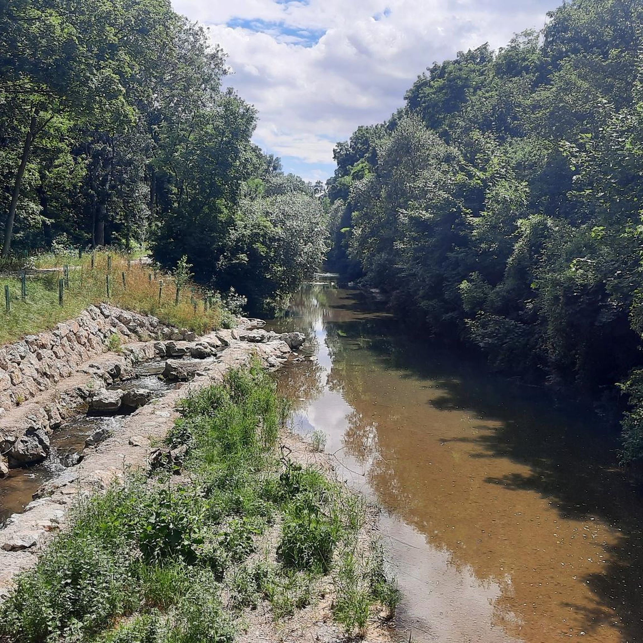
At the river junction, the Wiener Neustädter Canal crosses the Triesting using a historic aqueduct. Directly at this significant junction point, the Lower Austrian Thermenradweg and the Triestingau-Radweg (EuroVelo 9A) also meet. Today, this area is a popular excursion destination, combining the technical history of the former canal structure with nature-oriented cycling and hiking trails.
1
0
The Wiener Neustadt Canal, opened in 1803, was originally built as an artificial waterway for transporting wood, bricks, and coal towards Vienna. With the advent of the railway, historical shipping rapidly lost importance in the 19th century, leading to the abandonment of large parts of the once continuous network. Today, the preserved sections primarily serve as valuable industrial monuments, popular cycling paths, and cherished local recreation areas in the Lower Austrian region.
1
0
The boathouse in Wiener Neustadt is located directly on the banks of the historic Wiener Neustadt Canal and combines a popular boat rental with a welcoming excursion restaurant. After severe damage from a tree falling in the summer of 2025, the business was extensively renovated and expanded by the operating family and successfully reopened at the beginning of 2026. Today, the restaurant invites guests to linger with its expanded, pub-style food offering and its direct recreational area on the water.
1
0

Very pleasant, partially shaded spot along the route. The narrow bridge over the Triesting looks like a relic of the past. An ideal place for a short break to relax and pause.
0
0

Since it hasn't rained, the gravel part can be ridden quite well even with a recumbent trike, so I think it's certainly no obstacle with a bike either, tried both, a little gravel is ok, good bike
0
0

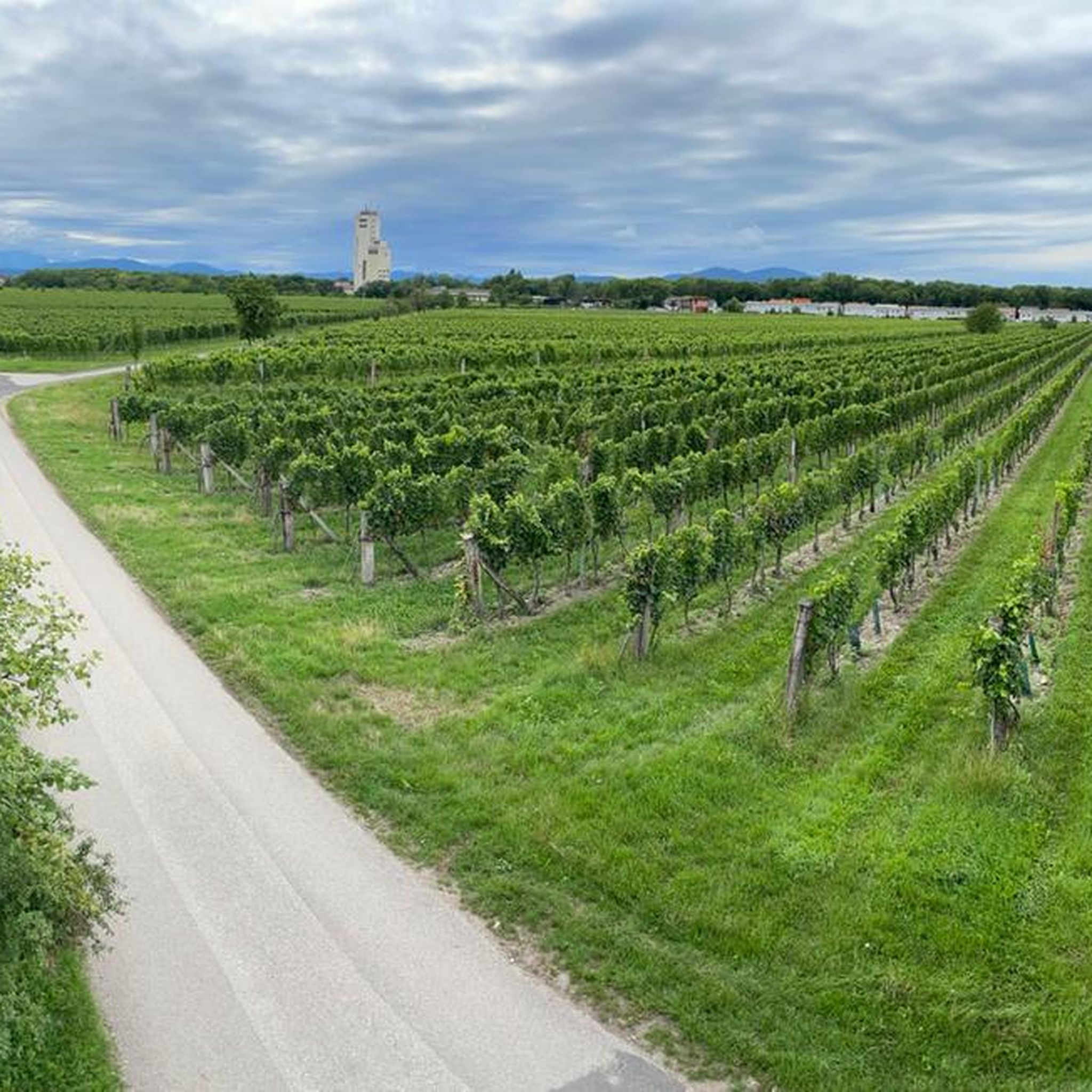
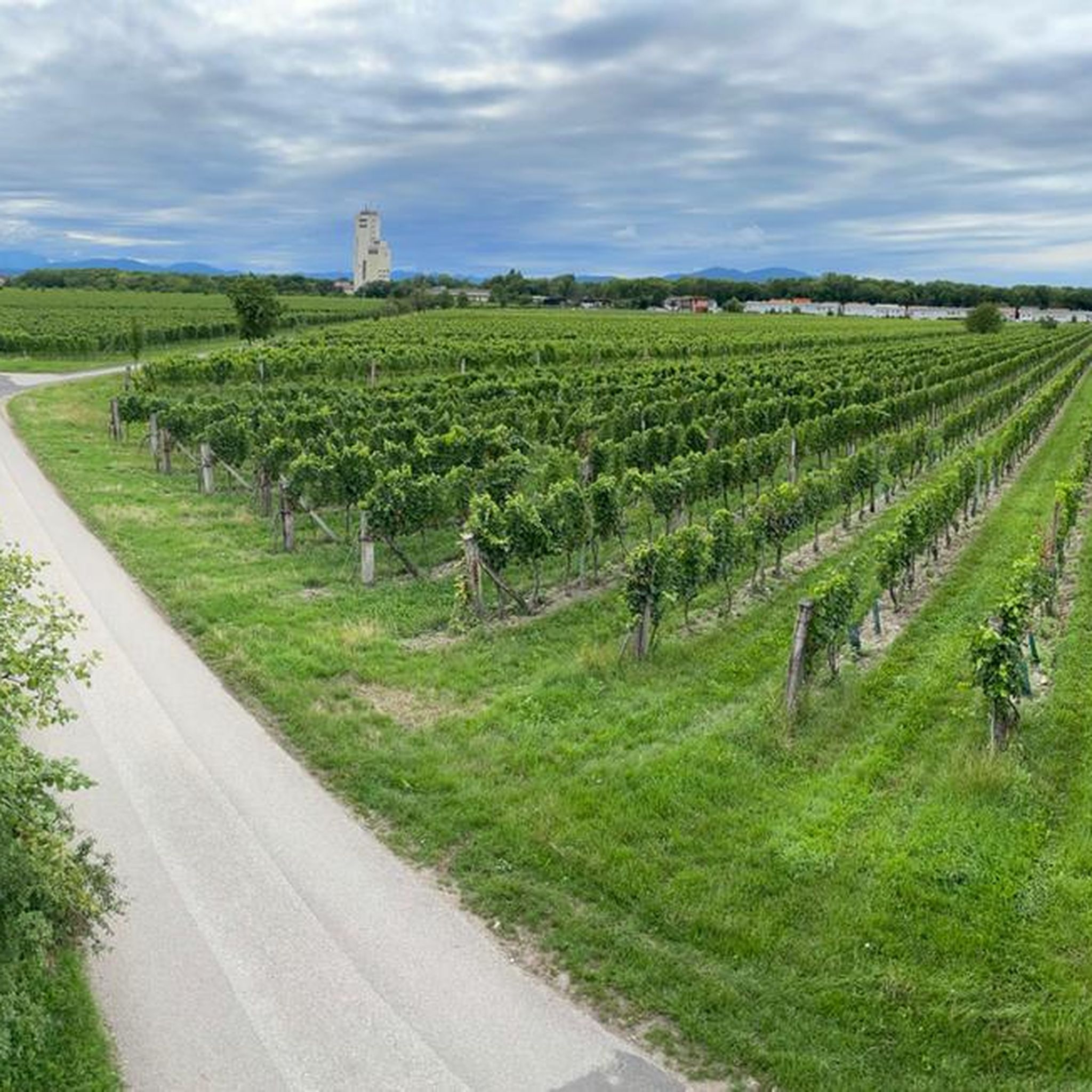
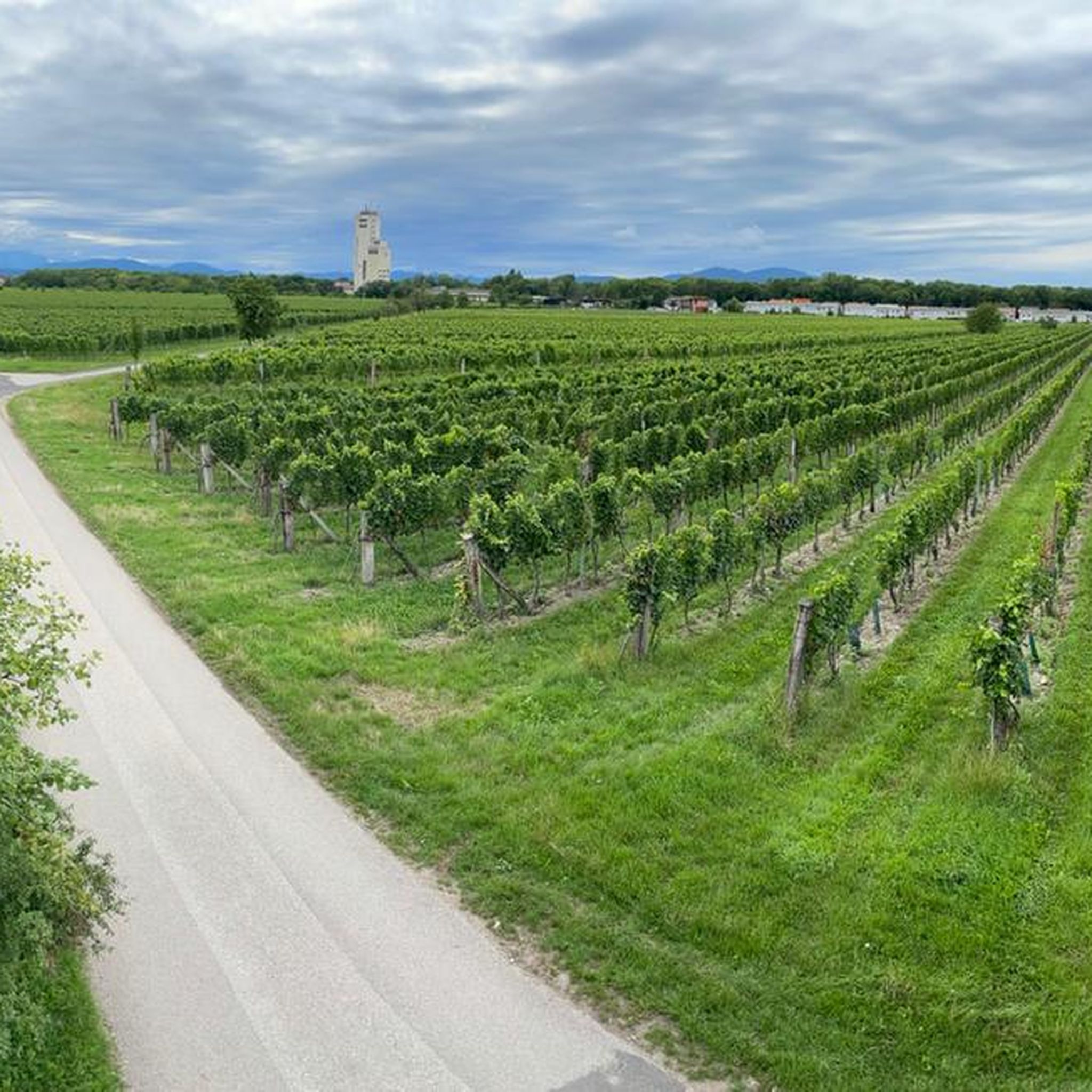
The bridge is suitable for a wide view of the wine hills and vineyards.
0
0
From both sides a beautiful eye-catcher as well as photo motif and lost place.
0
0
Frequently Asked Questions
How many gravel bike trails are available around Tattendorf?
There are over 115 gravel bike trails around Tattendorf, offering a wide range of options for different skill levels and preferences. The komoot community has explored more than 700 of these routes.
What kind of terrain and landscapes can I expect on gravel bike trails in Tattendorf?
Tattendorf's gravel trails feature diverse landscapes, including dedicated cycling paths along the Wiener Neustädter Canal and the Triestingau Cycle Path. You'll also ride through picturesque vineyards, the natural areas of the Triesting-Au, and a mix of agricultural land and natural settings. The terrain is well-suited for gravel biking, offering varied surfaces.
Are there family-friendly gravel bike routes in Tattendorf?
Yes, Tattendorf offers several family-friendly options. The cycle path along the Wiener Neustädter Canal is particularly noted for being family-friendly, with numerous stops along the way. One such route is the Wiener Neustädter Canal – Feldgarten Neufeld loop from Teesdorf, which is 31.5 miles (50.6 km) long and considered moderate in difficulty.
What are the difficulty levels of gravel bike trails in Tattendorf?
The trails around Tattendorf cater to various skill levels. You'll find 21 easy routes, 48 moderate routes, and 46 difficult routes. An easy option is the Himberger Straße – Triestingau Cycle Path loop from Ebreichsdorf, while a more challenging one is the Kottingbrunn Castle – St. Margaret's Church loop from Kottingbrunn, which includes significant elevation gain.
Are there any circular gravel bike routes around Tattendorf?
Many of the gravel bike routes in Tattendorf are designed as loops, allowing you to start and end in the same location. Examples include the Mannswörth Fish Pond – Rothmühle Castle loop from Trumau and the View of the vineyards – Wiener Neustädter Canal loop from Baden Leesdorf.
What natural features or landmarks can I see along the gravel bike trails?
You can explore various natural features and landmarks. The Wiener Neustädter Canal itself is a highlight, featuring a wetland biotope. You'll also pass through extensive vineyards, the peaceful Triesting-Au natural area, and potentially spot the Klesheimwarte, which offers beautiful panoramic views. For families, the Kletterpark Tattendorf and Dino Park are nearby attractions.
What do other gravel bikers enjoy most about Tattendorf?
The area is highly rated by the komoot community, with an average score of 4.5 stars from over 100 reviews. Reviewers often praise the diverse landscapes, the well-developed cycling infrastructure, and the mix of dedicated paths and natural settings that make for an engaging gravel biking experience.
Are there any good viewpoints or places to rest along the routes?
Yes, for panoramic views, the Klesheimwarte is a notable spot. The Rudolf-Proksch Hut, often found near the Klesheimwarte, provides a pleasant shelter for rest and refreshment, complete with a playground.
Can I find cafes or refreshment stops along the gravel bike trails?
The region is known for its viticulture, so you may find opportunities to stop at local wineries or Heurigen (wine taverns) in the vineyard areas. The Thermenradweg along the Wiener Neustädter Canal also offers numerous worthwhile stops, and the Hauswiese Forest Inn is another option for refreshment.
Is Tattendorf accessible by public transport for cyclists?
Tattendorf is integrated into the regional transport network, making it possible to access cycling routes via public transport. Specific details on public transport access points for individual routes can often be found on the respective tour pages.
What is the best time of year for gravel biking in Tattendorf?
The region is generally pleasant for cycling from spring through autumn. Spring offers blooming landscapes, while autumn provides beautiful colors in the vineyards. Summer is also suitable, but it's advisable to start early to avoid the midday heat. Winter conditions can vary, so checking local weather forecasts is recommended.
Are there any hidden gems or unique spots to explore in the Tattendorf area?
Beyond the main cycling paths, the Triesting-Au natural area offers idyllic and peaceful riverside landscapes. The region is also known for its
Where can I park my car when starting a gravel bike tour in Tattendorf?
While specific parking locations vary by starting point, many towns and villages in the Tattendorf area, such as Teesdorf, Ebreichsdorf, and Trumau, offer public parking options suitable for cyclists. It's always a good idea to check the starting point details of your chosen route for specific parking recommendations.
Most popular routes around Tattendorf
Most popular attractions around Tattendorf

Get inspired with the komoot mobile app


Explore more
Browse the best Gravel rides in other regions.
